Showing posts with label Tasmania. Show all posts

Thursday, 11 August 2022

Happy Places 2: Tasmania’s Central Plateau

The Central Plateau has been dubbed ‘the roof of Tasmania’, and ‘the land of a thousand lakes’; which is about as nuanced as calling Australia the ‘wide brown land’. There’s so much more to this wild and high part of our island state. 


It owes a great deal of its identity to dolerite, and to a massive sub-surface upwelling of that igneous rock during the Jurassic age. Almost equally its identity has since been shaped by the ice sheet that covered the surface during a number of glacial phases. That covering was more ‘doona’ than ‘sheet’, as it measured hundreds of metres thick in some parts. As that huge amount of ice, at least 6000 sq km in area, slowly jostled and crunched across the plateau, it carved out lakes – many more than a thousand – and left sharp peaks and dramatic clefts. 


[A special spot on Tasmania's Central Plateau]

 While much of that ice-age drama is over, the Central Plateau remains a vast area of largely wild high country. It’s roughly bounded by Great Lake to the east, the Great Western Tiers to the north, and the Walls of Jerusalem to the west. To the south the boundary is more vague, but perhaps the Lyell Highway marks a convenient edge. As this post is about my ‘happy places’, it’s probably okay to leave the big picture fuzzy, and focus in on the subject at hand. 


So … where on this cold, high, wet and wild plateau are my happy places? I’m particularly thinking of smultronställe, a Swedish word that evokes that sweet, semi-secret favourite place; somewhere that – particularly during these cold months – makes me smile just thinking about it.


[A sweet end to a lakeside night]

 During more than 40 years of walking in Tasmania, I’ve been privileged to walk across the plateau numerous times, from every direction. I’ve written about some earlier walks here Walking With Ada and here No Lack of Lakes  All that plateau wandering makes choosing particular smultronställe as difficult as naming my favourite child. But if I had to pick just three Central Plateau ‘happy places’, they would be (in no particular order):


1.     The Walls of Jerusalem

2.     Mount Rogoona

3.     Un-named Lakes and Pencil Pine Groves


1) Certainly this choice needs some narrowing down, as The Walls of Jerusalem National Park covers 518 square km! Scattered across this mountain-fringed park are some wonderful campsites, both formal and informal; on-track and off-track. And I could have selected any of those. But because mountains are such a feature of The Walls, I’ve chosen Solomons Throne as my Walls of Jerusalem ‘happy place’. 


[Friends share special times on Solomons Throne]

The peak is not the highest in the park, nor is it the most difficult to ascend. What make it sit so sweetly in my memory is a combination of my experiences here, and the superb vistas from the top. I’ve been up there in thick snow, and relished views outward towards a snow-bound Overland Track, and inward to the nearby pine-fringed lakes and vales. I’ve been there with family, introducing them to the wonders of our wilds. I’ve been there with friends (many times); with first-time walkers; and with international visitors who thought Australia didn’t have mountains. While I will certainly tire during the steep climb up a rocky chute to the peak, I will never tire of sitting on the Throne.


[Looking towards the Overland Track from Solomons Throne ... click to enlarge]


2) The upper Mersey River roughly marks one edge of the Central Plateau. The Mersey Forest Rd also gives good access to one of the sweetest spots on the western side of the plateau: Mount Rogoona. I first heard about this mountain during the 1980s. A group I walked with had been planning a trip there, but a major fire burned out much of the track and surrounding areas, so we walked elsewhere. It wasn’t until nearly 20 years later that I finally reached that peak.


[Mount Rogoona from Lake Myrtle]

And what a peak! It sits, sphinx-like, above the waters of Lake Myrtle, its knobby summit giving way to dolerite cliffs that are like a younger, smaller sibling of the Organ Pipes of kunanyi/Mt Wellington. For most visits to Rogoona, Lake Myrtle is the most convenient camping spot. However direct access to the peak is not easy from the lake. I found this out – in reverse – when a few of us decided to return from the summit direct to the lake. I would not recommend it! Rather the track between Lake Myrtle and Lake Meston leads to an easier slant-wise route to the mountain.
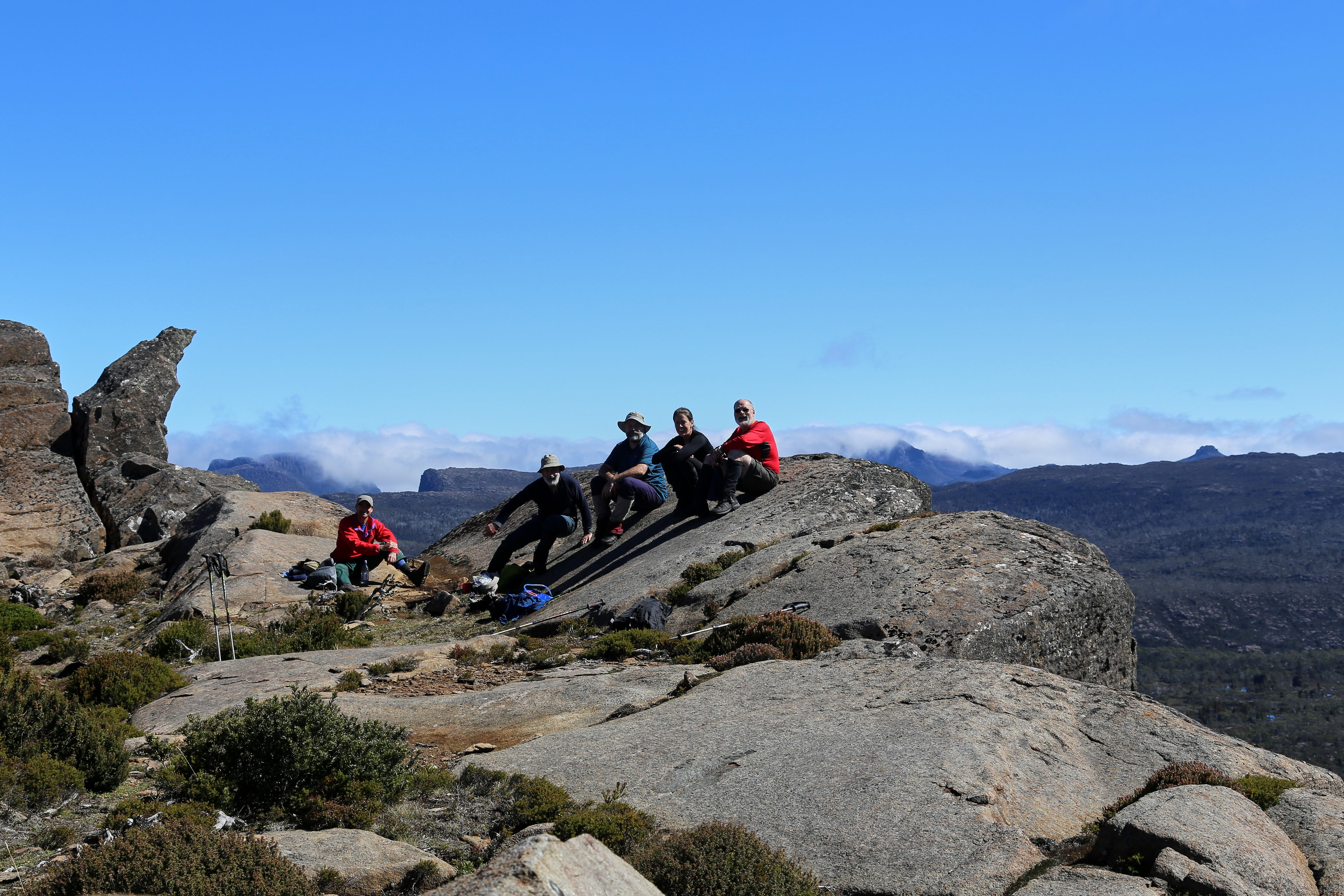


[Summit Views from Mount Rogoona]

Rogoona is essentially a small plateau whose summit is near the sheer dolerite cliffs on its north-western edge. So the views from the top are as vast as they are stunning. Steeply beneath and quite nearby is the tranquil Lake Myrtle. But your eye soon wanders west beyond the lake, over the nearby Cathedral Plateau, to the highest mountains of Tasmania, from Mt Pelion East to Mt Ossa and numerous others further south. 


Not once, but twice I’ve had that view ‘interrupted’ by a wedge-tailed eagle flying over. I’ve written in more detail here Eagle, but suffice it to say that being buzzed and eye-balled by the largest raptor in Australia is one of the greatest privileges of being in remote Tasmania. 


[Close encounter with the Rogoona Eagle]

After you’ve had that kind of mind-bending, time-stretching summit visit, there are few better places to sit and contemplate it than by the shores of Lake Myrtle. I’ve written about one particular experience here Myrtle 1, here Myrtle 2, and here Myrtle 3.


3) If the preceding ‘happy places’ would be easy to locate, the third is deliberately vague. Un-named Lakes and Pencil Pine Groves is a category of smultronställe that invites you to do your own explorations; make your own discoveries. And there could be few better places to wander in search of lakes and pencil pine groves than the Central Plateau. 


I once started the eye-watering job of trying to count the number of lakes just on the 1:25 000 Ada map. I gave up after counting 350 in one typical 10 sq km strip. Given there were 19 such strips still to count, it’d be fair to estimate between 5 000 and 7 000 lakes on the Ada map alone.


[So many lakes! A small part of the Central Plateau]


Obviously the number of lakes alone makes searching the plateau for sweet spots a lifelong task. But once the search begins, it becomes more subtle than you’d think. Lakes mean water, and many lakes mean a lot of water. That in turn means often waterlogged ground, and camping in such places isn’t much fun – not to mention the impacts it can have on that environment. In my Central Plateau wanderings I’ve seen many spots that looked great from a distance, but turned out to be unsuitably sodden once you got there and looked for tent spots. 


Happy Place searchers also have to consider another weather factor apart from precipitation, and that’s wind. The often fierce winds here further narrow your camping options. What may be a perfect site on a calm night can turn perilous when the wind gets up. Shelter is paramount, which is why pencil pines are often your friend. But there are complications here too. Many pencil pine groves are so dense that there’s no room for tents. And if there is room, the ground is often covered in dense, soggy sphagnum and/or gnarled tree roots. 


[Boots off and relaxing at a secret campsite]

 So … have I found some ‘Goldilocks Zone’ campsites on the Central Plateau? Of course I have. And I’ve spent some of my most blissful days and nights between a lake and some pencil pines. Am I going to share their locations here? Sorry, I’m not. What I can say is that if you haven’t searched for your own version, then you have a baffling, frustrating, but ultimately sublime quest ahead of you. If you have found such sites - or you recognise some of the ones pictured - I’d suggest you share that information sparingly. Let others have the thrill of the quest. Some places just shouldn’t be on Instagram.


[Does wild camping come any better than this?]

Tuesday, 2 August 2022

Happy Places 1: Smultronställe

In the (relatively shallow) depths of a Tasmanian winter, I find myself daydreaming of other places and other seasons. Take Sweden in summer as an example. Why Sweden for goodness sake? (you may ask.) Haven’t you watched enough Scandi noir to know Sweden is a place of constant snow, rain and grey weather, all bundled up in a flat and dreary landscape?

My simple answer is this. Before you judge it, spend one week of summer in Sweden. That is unless you object to VERY long, mild days, beautiful forests, meadows full of wildflowers, and stunningly intricate waterscapes of lakes and sea. And that’s not to mention the Swedes themselves, who in summer throw off their Scandi gloom, and become all frisky and fun-loving.


Take, for instance, one of their linguistic delights: the Swedish word smultronställe. It literally translates “place of wild strawberries”, but is most often used metaphorically to mean a semi-secret favourite place; a place that makes you happy. English phrases like “sweet spot” or “happy place” feel linguistically pale in comparison. If you've eaten wild strawberries, you'd surely agree. Smultronställe is a word forged from dark winters, scarce sun, and the utter delight at the sweet return of light and flavour. 


So it’s not unusual in Sweden to be asked for your smultronställe. What is your special place in the outdoors? It’s a question that resonates very much with me in relation to bushwalking in Tasmania. I’m often asked, especially by those who are not bushwalkers, or by people from other parts of Australia or the world, what my favourite bushwalking spots are. My plan for what remains of winter is to write about some of these in a series of blog posts; to share a bit of my daydreaming about places I'd rather be. However I should warn – and it’s probably in the spirit of smultronställe – that my posts might be a little geographically vague. If places are semi-secret, maybe it’s best that people discover their sweetness for themselves.


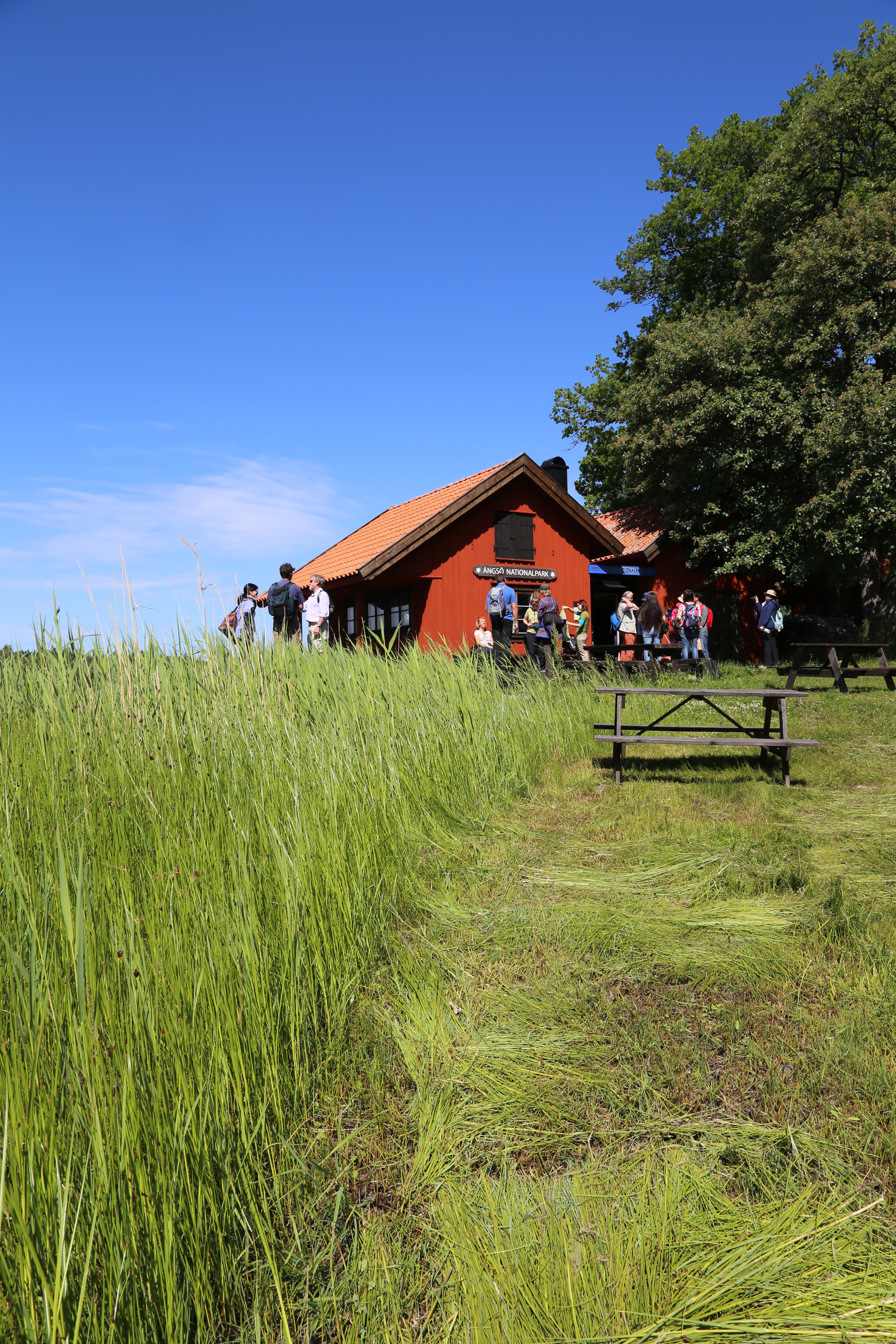
But before I start on my Tasmanian smultronställe, it’s only fair that I mention at least one favourite Swedish place. And that is Ängsö National Park, on the eastern coast of Sweden, about an hour’s drive north-east of Stockholm. I’ll let these images be a little taster of this beautiful place, and a reminder of all that was sweet – and accessible – before the pandemic. Let’s hope that such places will be within safe reach again in the future.


[Scenes from Ängsö National Park, Sweden]

Tuesday, 3 August 2021

Little Lives: Part 2 - The Nattai Wilderness

“Shorty” the campervan was next due to take us to Sydney. Lynne had spent a lot of time and effort getting ready for a reunion there. It had already been postponed twice due to the virus, so we were hoping this would be third time lucky. But, with just a few days up our sleeve, the Coronavirus outbreak in the city was growing. And so we cautiously waited before committing to enter greater metropolitan Sydney. 


For a couple of days we holed up in a Lithgow caravan park, and listened to news of the growing COVID outbreak in Sydney. Perched there on the heights of Lithgow, we felt like Frodo and Sam on the Emyn Muil, waiting to enter Mordor. Our daughter Sally caught onto this and messaged us using Boromir’s words: “One does not simply walk into Mordor!”


[Shorty hides out near Lithgow]


We didn’t, and neither did we drive there. Instead we turned tail and sadly retreated from “Mordor” to the rather more friendly town of Mudgee. While there, apart from a bit of wine tasting and bike riding, we learned that the NSW premier had put Greater Sydney into lockdown. Had we gone there, we’d have been there still (as of early August, and counting!)


* * *


Chastened, we re-jigged our plans – again. We’d organised to catchup with my brother after Sydney, when he’d be back from his own virus-dodging trip. So we firmed up that plan, and a few days later arrived at his place in the NSW Southern Highlands. He lives outside, though not a great distance from, greater metropolitan Sydney. It’s strange to run such a filter over every destination, but we had become very used to it. My brother, a retired doctor, is well practiced at it staying Covid-safe too. So once at his place, we hatched a plot to go literally far from the madding crowd: a day walk into the Nattai Wilderness.


[Ian and Lynne start our Nattai walk]


Tasmania has a way of turning we Tasmanians into wilderness snobs. Partly it’s the fact that we live on a substantially wild, mountainous island thrust into the southern seas, away from the fray of mainland Australia, and beyond the easy reach of over-development (though that threat is growing). And partly it’s that around 20% of our island, nearly 1.6 million hectares, is designated as World Heritage Wilderness. 


It’s a vast wilderness I will never encompass, no matter how long I live. But I have taken great pleasure in showing many people, including my brother Ian, just some of the wonders of Tasmania’s wilderness. Now it was his turn to show us one of the hidden gems of his area, specifically the Nattai Wilderness. 

[... let the wilderness begin]


When I've flown into Sydney I have sometimes looked down on a deeply incised wild area and wondered: is that the Nattai Wilderness? Back in the 1970s, when I lived and studied in NSW, I’d camped and bushwalked on the fringe of the area. But I had never knowingly been into what in 1991 became the Nattai National Park. Parts of the park, including where we would walk, were later officially designated as wilderness. Of course for millennia, the Dharawal and Gundangarra Aboriginal peoples called this home rather than wilderness. Our day walk would take us past sandstone overhangs that would have been used as shelter for thousands of years. The country still feels old and remote, despite being relatively close to a large city.


For Lynne and I the sandstone felt very familiar, since we were both brought up on sandstone country. Ian led us first along a fire trail, and then onto a narrower walking track. He was lamenting that we were seeing this country so soon after a massive wild fire. And he was apologetic that the wildflowers weren’t really out yet. Yet somehow we found more than enough to slow us down, oohing over a late-blooming flannel flower here; ahhing over a banksia there. 

[A selection of winter wildflowers in the Nattai]


The country felt similar to the Blue Mountains, and I knew that our track would inevitably lead us to a lookout, although lookdown would be more fitting name. Because, just as in the Blue Mountains, this is more gorge country than mountain country. We reached the edge of the plateau, and could feel the air expand around us before we saw the first bit of gorge beneath us. Ian suggested we push on to the lookout proper, maybe 5 minutes further on. 


[Worth the wait: Ahearn Lookout]


It was worth it. Ahearn Lookout is a grandstand to some vast, wild country. The Lion King wouldn’t have looked out of place posing here, if you accepted replacing savannah plains with vast and steep forested slopes. At the bottom of this defile was the Nattai River, here and there flashing reflections towards us. And beyond that we could make out further gorges, including that of the distant Wollondilly River.

[Looking south down the Nattai Gorge]

We perched on the edge of this vastness, 1 million hectares of wild country stretching all the way to Kanangra Walls, the Blue Mountains, the Wollemi, the Colo, and beyond. In such a place our quiet consumption of a humble sandwich and a coffee somehow felt like a feast. I was never great with equations, but here I could work out that place + movement, over time equalled deep satisfaction. And especially when that place was a wilderness. That's when a day can feel like another little life.


[Special thanks to my brother Ian for introducing us to the Nattai Wilderness.]

[The perfect spot to feast on wilderness]

Friday, 16 April 2021

Central Plateau Variations: Part 3


[Who else has walked here?]

It’s rare to walk the Earth and not be following in the footsteps of others. At our first campsite, we’d sat relaxed and content – when the weather allowed – and imagined the Palawa, Tasmania’s Aboriginal people, doing much the same over tens of thousands of years. The shelter, the water, the hunting, the clear views, would all have made this a wonderful summer place. What stories, songs and dances must they have shared here, and passed on for countless generations?


[A place of contentment]

For the Palawa, European invasion stopped all that, whether though disease, forced eviction, or deliberate killings. Others would now eye off this high country for their own purposes, and they did so quickly. In the 1830s, when G. A. Robinson (the so-called protector of Aboriginals), travelled through the Central Plateau to round up any remaining Aboriginals, he noted that “wild cattle was seen grazing … and several young calves appeared among them”. 

So this “empty” Central Plateau became a favoured place on which to summer livestock. It’s estimated that between 1860 and 1920, up to 350,000 sheep and 6,000 cattle were summered up here annually. This is tranhumance on a grander scale than I’d ever imagined. Gradually cattle became more highly favoured than sheep, and by the late 1870s, settlers from the Mersey Valley and surrounding districts had acquired cattle grazing leases on the plateau. They built tracks such as Higgs Track, Warners Track and Dixons Track so they could drive stock up to the high country each summer.

But as we were discovering first hand, the “warmer” months on the plateau can still be harsh, making navigation difficult. Around 1913 a farmer from Meander named Charles Ritter, who had leases in the Walls of Jerusalem area, thought to make a safer all-weather drove route from the top of Higgs Track/Ironstone Hut area to the Walls. It was probably completed by 1918, and became known as Ritters Track. While it was called a track, I had long wondered whether it was ever more than a series of large rock cairns that could be followed even in rough weather. On our fourth day, we were hoping to find out for ourselves.

[An old sketch map by Keith Lancaster, showing Ritters Track]

The night had been exceedingly windy, and none of us had slept much. Jim wasn't feeling great after a poor sleep punctuated by some unwelcome toilet trips in the dark. We’d already decided to adapt our schedule, allowing for another night here at Pencil Pine Tarn, and a short wander today. That meant Jim could stay back and “keep our camp secure”, which he generously volunteered to do. The rest of us would pack lunch and a day pack, and go in search of Ritters Track.

Three years earlier we’d half-heartedly looked for some cairns between here and Long Tarns. That time we’d only had some rough, third-hand notes, and our explorations hadn’t allowed us to say with any certainty that the cairns we found were part of Ritters Track. This time, we had not one but two lots of GPS data indicating the supposed locations of Ritter’s cairns. The only thing against us was the weather, which remained showery and ferociously windy: in short exactly the kind of weather Ritter hoped his track would deal with.


[Tim contemplates the route]

Tim and Larry, our two GPS-bearers, lead the way, at first taking us almost east, seemingly back to where we’d come from. I expressed my surprise, but Tim assured me we’d soon swing south. And once we’d picked up a cairn, we’d start heading more south-west. 

Before long one of our navigators signalled us to join him. According to his GPS, we were within 20 metres of one of the cairns. But what were we looking for? A pile of rocks in a landscape made of rocks? And rocks that have been glaciated, ice-shattered, and scattered about willy-nilly over aeons? The five of us wandered about, a little clueless, until someone finally had their eureka moment. 

[Surely a Ritters Track cairn?]

We hurried over towards an obviously human creation: four or five rocks piled high atop a large boulder, forming a rough and wonky pyramid. If the cairn’s size wasn’t the clincher, the mop of long, grey/green lichen on the rocks was. This indicated it was no recent or random cairn, but one put here deliberately, and many decades ago.

[Tim and Larry spy out the next cairn]

The next couple of hours saw us slowly following our navigational nerds from cairn to cairn. Sometimes the next cairn was visible from the current one, but at other times we were glad to have the GPS data. This was not the sort of “track” that, once found, you could easily follow. Apparently Ritter didn’t choose a straight-line route towards the Walls of Jerusalem (which today was clear to see ahead of us). Rather he kept to higher, less boggy ground, winding around the plateau on ground over which cattle could more easily move.

[A clear view towards the Walls of Jerusalem]

Another matter sometimes confused us. We found multiple other cairns dotted across the landscape. Some we considered Ritteresque: good copies, but not originals. Others were mere wannabes: poor imitations that lacked size or age, the creation perhaps of bushwalkers or anglers. Our rule of thumb was that a true Ritter cairn would be substantial, vaguely pyramidal, made with care, and bearded with lichen. We came to admire the labour that Charles Ritter, presumably with the help of his fellow drovers, had put into building the many dozens of cairns. The heavy rocks would have taken some effort to move, and the conditions for doing that work would seldom have been ideal.

[Libby inspects another genuine Ritter cairn]

As we walked, we imagined driving cattle through this terrain. How different it would have been to walk or ride here accompanied by the sound of hoofs and mooing; the steam from their breath; the swish of their tails; the slop of the slush beneath their hard hoofs; the smell of dung and drover alike. We could admire, celebrate even, the hard labour of these cattlemen, without wishing that this was still happening. Clearly driving and grazing cattle between here and the central Walls – where the best grazing was found – made a mess, and altered the landscape hugely. The unsustainability of the practice, both environmentally and economically, led to grazing being prohibited above the 3000ft contour (914m) in 1973. 

[Tim and Merran at our lunch stop]

While it had been fascinating to follow the footsteps of Ritter, after lunch it was time to complete our off-track loop back to the campsite. We were beginning to wonder how another grey-bearded fixture was doing. We found Jim relaxing in the sun, which had finally made a welcome return. As Tim placed his small solar panel in the same patch of sun as Jim, I remarked that we now had two solar collectors. Then, over a relaxing afternoon tea, we swapped stories of our day. Jim noticed that a couple of us were red in the face, and when we conjectured that a combination of windburn and sunburn might be to blame, he was all the gladder for his rest day.

[Two solar collectors hard at work]

When the shade from the pines started overtaking us, we followed the sun up the hill. It was good to gain a little altitude, to change our perspective, and to feel a windless sun after 48 hours of gales. Eventually we wandered back down to the camp, and we were soon off to our tents. How good it felt to be in that now quiet space, without wind tearing my every thought away.

[A calm Pencil Pine Tarn]

In that calm state, I began to ponder on our walk, and to think about the footsteps we had followed to this point. Whether it was those of the Palawa, those of the cattlemen, or those of the pioneer bushwalkers, the ones who were here before us are now gone. Without feeling at all morbid, I apprehended afresh my own impermanence. None of us – grey-bearded or not – will hang around even as long as Ritter’s cairns. Sooner or later each of us will follow in the footsteps of those who are gone. 

It was in a time of pandemic, nearly 400 years ago, that poet John Donne reflected so powerfully on this. 

No man is an island, 

entire of itself, 

every man is a piece of the continent, 

a part of the main; … 

any man's death diminishes me, 

because I am involved in mankind,  

And therefore never send to know for whom the bell tolls; 

It tolls for thee. 

Friday, 9 April 2021

Central Plateau Variations: Part 2

[Once more into the Central Plateau]
"I live my life in widening circles 
that reach out across the world.
I may not complete this last one

but I will give myself to it."

- Rainer Maria Rilke

Over time our walks across the roof of Tasmania have developed a sense that, like Rilke, we are travelling in ever widening circles. It’s a place that invites you to walk to the horizon, just to find out what’s beyond. If, on our last walk, we’d only half-heartedly looked for traces of Ritters Track, this time we planned to give ourselves fully to the search, this time with GPS-assistance.

But Rilke’s metaphor begs another question. When do you know that your latest “widening circle” is to be your last? Or to put it into our context, how do you know that you’re on your last big bushwalk? I wasn’t aware of it at the time, but thoughts like this were going through Jim’s mind as the six of us slowly roused ourselves from our tents the next morning.

It had been a rough night. Strong winds and squally showers had disturbed the sleep of most of us, and I was only woozily awake when I heard Jim’s voice outside my tent. “Cap’n, cap’n, you awake?”* Without waiting for an answer he went on. “I have a cunning plan. You seen the weather?”

I unzipped the tent and poked my head out to find that we’d been enveloped in cloud, our long views replaced by a close grey murk. The wind was shaking the pencil pines, and Jim was in his rain jacket. Welcome to the Central Plateau! As for Jim’s cunning plan, he was suggesting a retreat. We could head back to Tim and Merran’s place, and base ourselves in the warm, dry comfort of their cottage, and do day walks from there.

[Gaultheria berries thriving in harsh conditions]
Certainly I’d seen more encouraging walking weather, but Jim’s response to it seemed disproportionate. If we followed the original plan, and walked to our next sheltered campsite, we only had to brave these conditions for 3 hours or so. I questioned Jim a little more, and found out that he was also feeling “a bit off”. Considering he has a chronic health issue that means he often lives with a degree of nausea and/or dizziness, this didn’t sound like a walk ending scenario.

It didn’t take long for the rest of us to convince Jim that we should stick with our original plan. He toyed with the idea of walking back to the car solo, and coming to pick us up at the end of the trip, but in the end he went with the majority. As if to reinforce our decision, a few patches of blue appeared between squalls. We slowly packed up, and walked off into strongly gusting winds, but only intermittent showers. As we got into a rhythm, I was pleased to hear Jim having a good, loud catch-up conversation with Tim. Perhaps his mood would improve, and he’d be his normal life-of-the-party self. 

["Gimme Shelter" - any rock will do]

Meanwhile the weather continued to challenge us. For a time our off-track route took us into the sheltering lee of higher ground. But for much of the walk the wind was so strong it threatened to blow us off our feet. I find this kind of feral weather, its sheer ferocity, strangely exhilarating. It’s a reminder that, for all our ingenuity, we’re not in control here. Still, being blown over was NOT the kind of uplifting experience we would have wished on Jim in his current state. As we took a break, I photographed Jim against the background of our morning’s route. “Jim’s last walk” he muttered into his beard.

[Jim's last walk? Not a happy camper.]

Having reached the pass leading into the next valley, we turned west and found a sheltered lunch spot among our friends the pencil pines. As we ate, we even had some warm sunshine, and the day looked suddenly benign. It didn’t last, of course, as we soon had to reenter the maelstrom. 

[Lunch among the pines - pic courtesy of Larry]

The constant wind was energy sapping in the extreme, and everyone was relieved to finally see our pine-dotted tarn up ahead. We’d sheltered there from a strong wind 3 years ago, and it looked as though history would repeat itself this year.

We soon sussed out our tent spots. We were a little surprised that even here, deep in a substantial pine glade, the wind still managed to shake our tents. It was also cold by now, and we quickly decided that an early dinner and bed time made a lot of sense. As we cooked Jim still seemed lethargic, not wanting to bother getting out his cooking gear. Instead he asked around for any spare boiling water, scoring a hot cup-a-soup from me, and a bit of hot dinner from someone else. We were all finished and ready for bed by 5:30.

[Almost ready for bed: Pencil Pine Tarn]

All night the wind roared, the pines giving it a piercingly strident voice. At one stage I looked – in vain – for ear plugs in my first aid kit. It wouldn’t be snores from my fellow campers that would keep me awake tonight.

        
* Back in the mists of time some of our regular walking group had taken to addressing each other as “Captain”, usually in a growly, pirate-inspired voice.


Sunday, 4 April 2021

Central Plateau Variations: Part 1


[A bleak and windy day on Tasmania's Central Plateau]

When it comes to bushwalks, there’s often a degree of cat herding. Dates, walkers, venues, vehicles and variations are all part of the mix. By the time those are settled, the weather for the walk can sometimes fall into the “like it or lump it” category. Certainly it would on this occasion.

Our planned March walk would see six of us back in familiar territory, walking from Lake MacKenzie across Tasmania’s Central Plateau, into the Walls of Jerusalem. Most of us had done it 3 years earlier (see here), and loved the country so much that we welcomed the chance to return. One variation this time would be a more earnest search for the elusive Ritters Track. Another variation would be our arrival times. We’d be wandering in like Texas Rangers. (If that doesn’t ring a bell, treat yourself by checking out the first 45 seconds of this incredibly cheesy clip https://youtu.be/r2F4K7nbcgs) 


[Three set off from Lake MacKenzie]

Libby was the first “Texas Ranger”, having chosen to walk in a few days early, keen for some solo time, as well as to try out a new tent. Jim, Larry and I would come in next, and meet Libby at our Blue Peaks campsite. Tim and Merran would join us there a day and a half later.

One very neat variation was that Libby, Tim and Merran had already done a car shuffle for us, which would save Jim, Larry and me from having to leave a car at the Walls of Jerusalem carpark, and double back in another car to Lake MacKenzie to start our walk. So the three of us got going relatively early in cool, windy and sometimes showery weather. The weather was such that stopping was unpleasant, so we made good time and surprised Libby out of her tent mid afternoon.


[Seeding mountain rocket bring colour to an overcast day]

She had tales of strong winds, sleet and even snow. She grinned as she explained she’d secretly been hoping for some snow. Nonetheless she had possum-wide eyes as she told us about the strong winds she’d had to deal with. (Her One Planet Goondie 1 had stood up to it perfectly.) By now the afternoon was a little calmer, and the two of us with Helinox chairs settled in for a comfortable cuppa, while the other two feigned indifference.

On that count we carried a secret with us. Libby was, for now, sitting in a Helinox Chair Zero borrowed from Tim and Merran. But those two late comers would be bringing in a brand new one. It was one that we’d all shared in purchasing for Libby as a Covid-delayed wedding gift. This, of course, was to be a surprise to her. So it was hilarious when, after dinner, as we stacked the two "undressed" chairs in bushes out of the wind, spontaneous comments about the chairs exhibiting mating behaviour began to come out. How long, we idly wondered, was the gestation period of a chair? Perhaps the next morning would be a little too early for the appearance of any offspring. But later in the day: who was to know?


[The Helinox chairs getting "acquainted"]

Other excitements were to occupy us most of the next day. Neither Jim nor Libby had been to see the enormous cushion plant “colony” that Larry and a few of us had stumbled upon some years back. The weather more or less cooperated, and we set off towards that wonderfully small eminence, Little Throne. While we were winding our way around the end of one of the lakes, I was startled to find a tiger snake stretched out on some rocks over which I’d just jumped. It seemed little interested in moving, and we took our time to gawk at and photograph this beautifully marked creature. 


[A tiger snake sunning itself]

A little while later, from the top of Little Throne, we were able to message Jim’s wife with a picture of the tiger. She, being a notorious snake-phobic, sent suitably shrieky messages back, and we all chuckled at Jim’s tease. But not long afterwards I noticed Jim was not his usual jovial self. This became more apparent when he suggested that we might make this our turn-around point. We other three, all keen to see the enormous cushion plants, outvoted him. So he shrugged and reluctantly came with us.


[Atop Little Throne]

I had a reasonable idea where we would find the cushion plants. However, not for the last time on this trip, I was glad to be walking with a navigational nerd. Larry had marked the spot on his GPS, and this saved us from wandering around too much before finding it. I’m not sure if it was the bleakish weather, or Jim’s bleakish mood, but there was not quite the excitement I’d expected in the presence of this botanical wonder. Still, we lingered and photographed at length what is still the largest cushion plant “forest” I have ever seen.


[Part of the enormous cushion plant "forest"]


[There are often many species in a cushion plant community]

Although the rain held off, the weather was becoming cloudier and cooler. So we wasted no time in getting back to our campsite, this time taking the more direct route through the lake-dotted lower country. We had calculated that Tim and Merran wouldn’t be with us until around 7pm, and in this weather that looked like being well after our bedtime. We’d all eaten dinner by 5, so it looked like some of us might have to rug up and wait around for our friends’ arrival. Then, just after Jim disappeared into his tent, we were surprised to see Tim and Merran coming over the rise and into our campsite.

They’d managed to leave much earlier than expected, and had made good time in trying conditions. We gave them a bit of time to put up their tent, but before they’d finished cooking their dinner, the rest of us started ahemmming loudly. Tim, taking the hint, reached into his pack, and Merran handed over the gift chair to Libby. “They’ve had a baby” I called out, and we all laughed at the way our jokes had fitted so well with the timing of the gift. Libby was completely ‘rapt, not least because she wouldn’t now have to settle for a damp log for a seat.


[Libby: a happy camper in her new chair]

And so we were all together at last. Tomorrow, we hoped, we’d all venture further into the Central Plateau. We knew, after all, that a Texas Ranger’s “work is never through”.