Monday 29 December 2014

Father to the Man

Has he been caught unawares, or is he posing? It wouldn’t be the first time he’d struck a posture for the camera. Perhaps I’m being harsh. After all he’s not yet familiar with these ancient Gondwanan forests. And that look – he is gazing up with a mix of deep contemplation and awe – is a fitting response to the total sensory embrace of a Tasmanian rainforest.


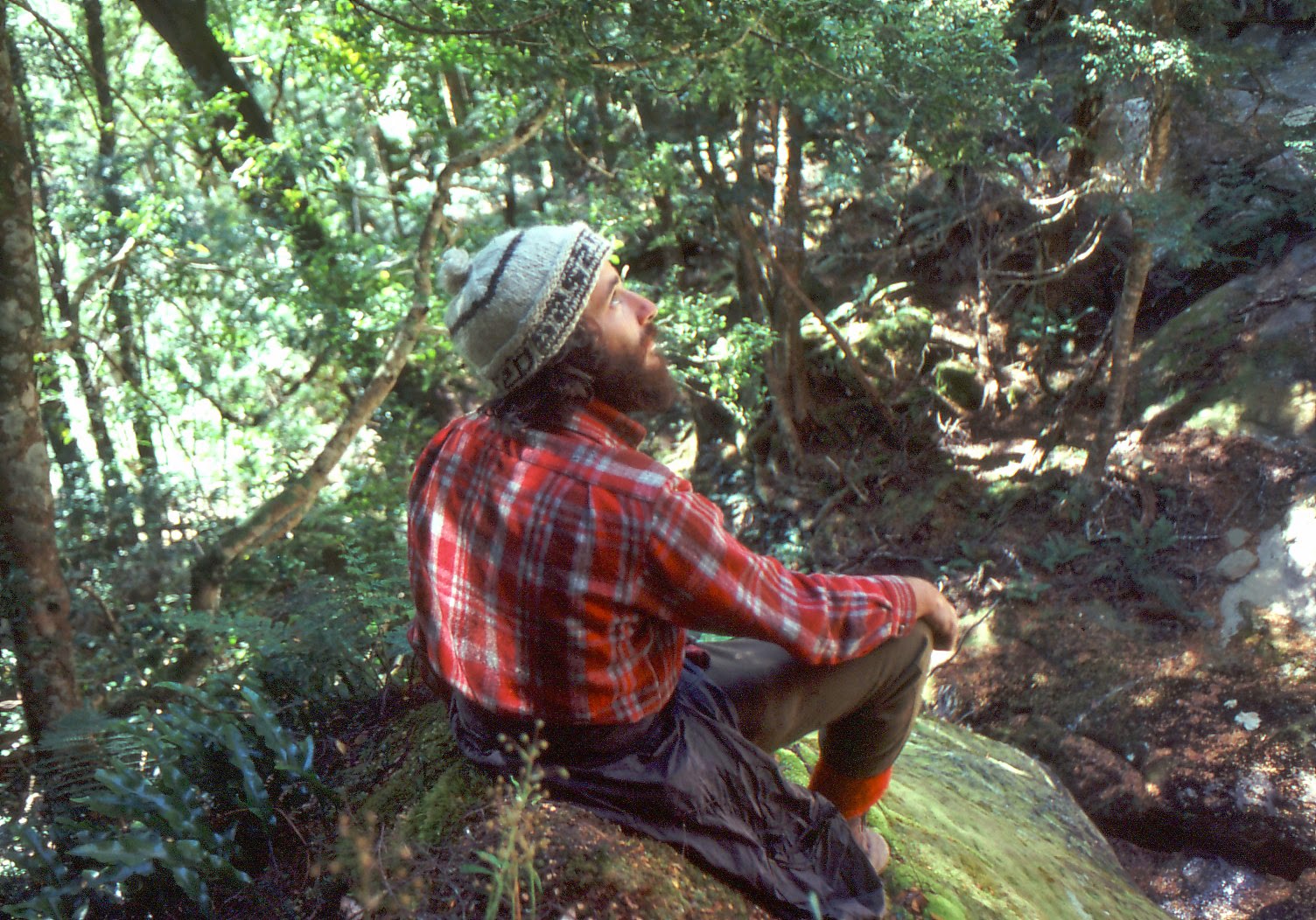
[In a Meander Forest, 1982: photo by KM] 
All these years later he still feels it. I know because he is me. A 28 year old me, a me flying free of the gravity of now. But  still me.

It’s 1982 and a different world. He has no internet and no computer (they’re for mathematical types, and he’s not one of those). His television is of the smallish, black and white kind, like his sheep dog.

He loves his wife and his wee daughter. He doesn’t yet know he’ll have two more children, and that they’ll go on to have children of their own. Being a grandfather is vastly far from his mind, even if it will be as unexpectedly full of marvels as stepping into that forest. No, right now he is freely swimming in the green timelessness of that Meander forest.

How to respond to that 28 year old me? Do I frown and judge; do I condescend; or do I just smile and leave him to his thoughts? If I’m tempted to pick on him, I might start with his naïve beliefs. A Christian AND a conservationist? Isn’t that two lost causes in one unlikely combination? I could suggest he’s a fan of Saint Jude, the patron saint of such things, but his theology doesn’t yet have that bent.


[The grandeur of growing things: inside a West Coast rainforest] 
It might be easier to stick with superficialities. For instance could I resist sniggering at his “hippy” looks; his long hair and Cat Stevens beard? And what’s with the hand-knitted beanie and hand-made, checked woollen shirt? Is it solidarity with the poor? Or is he inventing the “bogan” look before its time? Sure there might be an economic imperative too. I see hints of penny pinching in his army surplus trousers and cheap japara/oilskin rain jacket. But trousers tucked inside red socks? Really?!

While this is flitting through my mind, I realise I may have it all wrong. If, as Gerard Manley Hopkins had it, “the child is father to the man”, the same surely holds for the young man and the older man. That inverts the whole situation for the present me. If anyone is going to be “fatherly” towards the other, then it is the younger me who should be having words with the older me.

If he speaks to me of forests and other wild things in Tasmania, I will speak of my ongoing love and struggle. Struggle against that which would diminish the wild; or belittle it as a minor issue. If he speaks of my faith or of my relationships, the same two words will come up again: love and struggle.


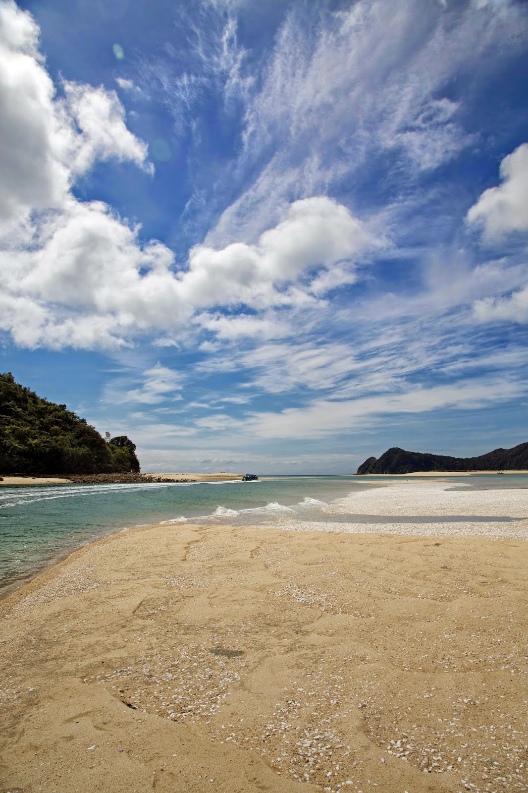
[Love's a beach: Lake Rhona, Tasmania] 
Because these things are hard, and they matter. The “stuff” that so often dominates the now – houses, cars, clothes and gadgets – will fade away. But the grandeur of growing things; of abiding love; of a questing spirit, things of which any Creator could be justly proud, these will remain.

Getting away from the pull of the present must be good for you. Certainly the younger me has passed on a few pearls, and has more to teach me yet. Still, I might pass on tucking my trousers into red socks.


Sunday 21 December 2014

Abel Tasman Coast Track 4: A Short Walk, A Long Road


Sometimes, on some walks, you’re glad to be getting near the end. Sure signs of this include constant thoughts of showers, soft beds, fresh food and  clean clothes. And of just not walking for a good long while.


[Pleasant walking on the final day] 
Our final day on the Abel Tasman Coast Track isn’t one of those days. The weather is fine, we are feeling fit, and the walking is interesting. We have the bonus of a walking companion in young New Zealander Brad. He is sociable, as Kiwis invariably seem to be. Is it the result of living in an isolated place at the end of the earth? If so it works well for Tasmanians too. We find plenty to chat about as we meander above the nearby coast.


[Looking towards Adele and Fisherman Islands] 

We’ve now drawn level with Adele Island, which we’d paused alongside on our first day’s water taxi ride. That day we’d seen sea birds galore, and were also thrilled to see New Zealand fur seals on the shore. The island is a focus of environmental restoration, with the biggest job being to bring back the dawn chorus. The Abel Tasman Birdsong Trust, Project Janszoon, DoC and various private donors have combined to trap and poison introduced predators such as rats, possums and stoats. Adele Island has been a pilot for a larger project which has seen 70% of the Abel Tasman National Park covered by the trapping program.


[New Zealand fur seals on Adele Island] 
We come across one of the newer humane traps. The traps are powered by compressed C02 gas. The possum version is activated when a possum bites on a lure. The rat/stoat version requires the animal to move aside a leaf to investigate a lure. Either way the animal activates a steel piston, powered by C02 gas, which strikes the skull of the inquisitive animal and kills it instantly. Once the animal has been struck, it drops to the ground, leaving the trap set for the next pest.


[A CO2-activated pest trap] 
Even though this method of pest eradication is much less labour-intensive than the older tunnel traps, there is still a huge commitment required to simply keep pest numbers down. Complete control is but a dream, and the the incredibly beautiful dawn chorus of native birds like tui, tieke, korimako, kakariki and kaka, is heard in relatively few localities.

English botanist Joseph Banks, while in this region aboard Captain James Cook’s Endeavour in 1770, wrote this about the local birds.

‘This morn I was awakd by the singing of the birds ashore from whence we are distant not a quarter of a mile, the numbers of them were certainly very great … Their voices were certainly the most melodious wild musick I have ever heard, almost imitating small bells but with the most tuneable silver sound imaginable.’


Even Cook, not one to wax lyrical, was moved to describe the korimako (bellbird) as sounding ‘like small bells exquisitely tuned’.


[An epiphyte colonising a trackside rock wall] 
As if predatory mammals were not enough of a threat to New Zealand’s native species, pest plants have a significant impact here too. As we walk towards our finishing point, we see signs of wilding pine infestations. These are any of ten different introduced conifers that have gone wild in New Zealand. A significant effort in this park has seen many of the infestations poisoned. For the moment they are evidenced by ugly brown stands of dead trees on the steep green forested slopes of the hinterland. In the longer term the dead pines will be – and already are being – replaced by native bush, much to the advantage of the bird species.


[A local newspaper story on wilding pine] 

By late lunchtime we have reeled in the small settlement of Marahau. We cross the final few bridges across the tidal flats, and walk into the café that marks the start/end of the track. There Brad joins us for a celebratory hot lunch and cool drink. We raise a glass to a great walk on this Great Walk.  

Sunday 14 December 2014

Abel Tasman Coast Track 3: Win Some, Lose Some

What a difference sun and warmth make! An afternoon of exposure to sun and a wood heater lifts our spirits and dries our gear. I hope it's doing the same to my camera. We share a pleasant night in Bark Bay Hut with three others, a young Malaysian man and a Spanish couple. In the morning they walk north to Awaroa, while we are going south to The Anchorage.


[Coastal Glimpses, Sandfly Bay: photo Lynne Grant] 

By now we’ve settled into the Abel Tasman pattern. You stay at a seaside hut, walk uphill in the morning, undulate a bit throughout the day, sneak a few views of the ever-varying coastline, pass through forests that change from wet and deep green to dry and straggly, before dropping down to the next coastal hut. None of the days is long.

But variations to the pattern are part of this walk’s charm. Today, towards the end of one of the undulations, we glimpse our destination in the distance. The Anchorage is at the far end of a convoluted embayment that we can only reach by crossing Torrent Bay.


[Above Torrent Bay, with The Anchorage in far left background]
Our first surprise is the settlement around the bay. Private land has been excised from the park, and more than a dozen “baches” are nestled into the forest around the bay. Quite a few are noticeably grander than the traditional weekend bach. There’s an exclusive lodge here too, made all the more desirable no doubt by being accessible only by boat. There are no roads anywhere near this beautifully tranquil bay.

We sticky-beak at a few houses, dream fleeting sea-change dreams, before finding the tidal flat we have to cross. We’ve aimed for low tide, to avoid the long detour we’d otherwise have to take. It’s a small moment of triumph when we see that we’ve almost exactly hit low tide. We hope this might mean we can walk right across dry-booted. This looks possible for the first couple of hundred metres, but then we reach a stream. It’s the Torrent River, one of the “torrents” after which the bay was named. At low tide it is a small sinuous creature winding a slow and shiny path across the flats. It’s only calf deep and a few metres wide, so we take off our boots, don crocs and wade across.


[Wading across Torrent River & tidal flats: photo Lynne Grant]
At the far end we climb over a short bushy isthmus then drop down to the beach that leads to Anchorage Hut. The beach is steeply sloped, golden-sanded, and busy. We’ve heard a few references to “The Anchorage Hilton”, built large because of the popularity of this beautiful bay. Opened just a year ago, it certainly is impressively spacious and comfortable. But it is still a hut, with the usual shared dining and bunk rooms and other typical DoC hut facilities.


[Anchorage Hut, aka the "Anchorage Hilton"]
Solar powered lights are probably the main novelty, unless you count the wryly humorous hut warden. Bill (not his real name) entertains the fifteen or so in the hut with droll Kiwi-style stories, variously tricking the naïve; bating the Aussies (us!); and generally teasing everyone else.

He helps to create a convivial atmosphere, and we’re soon exchanging stories with Danes, Poms, Swedes and Germans; the United Nations of hikers that typically peoples these Great Walks Huts. Happily my camera has started working again, so I snap a group shot before getting into a fun teasing chat with “Bill”.


 [Inside Anchorage Hut]

Australians and New Zealanders have a sibling affection that is strongly tinged with sibling rivalry. We exchange professional stories (I too work for a national park agency) and good-humouredly try to catch each other out. But eventually he pulls out his trump card. In the just completed rugby test New Zealand’s All Blacks have beaten Australia’s Wallabies by 29 to 28. That’s enough to shut me up. Lynne and I slink off to our bunk room, which we’re sharing with Brad. He happens to be the only New Zealander walker we meet on the track. We’re thankful he’s a non-gloating one!

Sunday 7 December 2014

Abel Tasman Coast Track 2: Weatherproofed?

During the night there is a pattering, pittering, scratching scatter of sound. I hear it only vaguely as I drowsily toss and turn on the bunk, but I know well enough what it is. It’s raining.

The sound of rain on a tin roof is supposed to be soothing. Not this morning. We were hoping to avoid anything but light showers. We're in New Zealand for three weeks, and with cycling, tramping and everyday gear to cart around with us, we’ve chosen to carry lightweight, basic waterproofs. It’s October, we reason; high spring. What could possibly go wrong?


[Climbing into the gloom above Awaroa] 

We prepare slowly, giving the rain a chance to scoot by and leave us with clear skies. It intensifies. Our hut mates pull on their full gore-tex gear, smile, shrug and walk off into the gloom. We tidy up a little more methodically than usual, then come up with a plan. We’ll don our gear and wander around the expansive bay until we find Awaroa Lodge. A hot coffee will brighten up our day, and the delay might even brighten the weather.

The jacket I’m depending on is a light and breathable “2.5 layer” job, whatever that means. By the time we find the Lodge – about 45 minutes later – I’m soaked. I’m not sure if it’s the 0.5 of missing layer, but it leaks. And wet is wet. Lynne’s jacket – a cheap-and-nasty single layer thing – is even worse. As we arrive at the lodge, our former hut mates are leaving. The lure of coffee and cake has tempted them in too.

The Lodge is palatial, quiet. More importantly, it’s warm and dry. Feeling we must look like Visigoth marauders, we sheepishly take off our dripping gear before heading up to the bar. They smile welcomingly and take our orders as though we’re royalty. Five minutes later we’re sitting in leather lounges and tucking into large coffees and a slab of carrot cake.

To say it's all downhill from there would not strictly be true. After the lodge it is steeply uphill. But yes, the weather deteriorates further, and our level of wetness with it. We pause above Awaroa and take a few photos. I have stowed my camera in my pack, thinking to keep it out of the wet. But after reaching the top, I decide I’m being overly cautious. The camera is a high-end one, and it's supposed to be “weather sealed”, so I figure it should be fine in this light rain. Besides, I want to take some “real conditions” photos in the rain, and not just fine weather ones.


[It's wet! Looking back to Awaroa: photo c/- Lynne Grant] 
So I carry the camera in its neoprene cover, and put a plastic bag over that, just in case. As we slush through the sodden track, I pause to take a few “here-we-are-in-the-wet” photos. Suddenly the camera makes a horrible noise – a kind of shuddering, repeated clicking – and refuses to take any more photos. I try to dry it off with a cloth, and try another shot, but it is not going to work. I put it back in my pack, exchanging “what-have-I-done?” looks with Lynne.

We keep climbing towards Tonga Saddle. The Department of Conservation (DoC) has been doing work on the track and it is very muddy. The rain persists, and my anxieties about the camera swirl about under my ineffectual rainhood. We follow the roaring Richardson Stream down to Onetahuti. It is probably a beautiful beach, but rain and wind make it look as bleak as I feel.


[More rain at Onetahuti: photo c/- Lynne Grant] 
Knowing how the potential ruin of a great camera is affecting me, Lynne tries the jollying along approach. She points out the beautiful coastal glimpses, takes special interest in the disused Tonga Quarry, even grumps about the confusing times on some of DoC's signs. All of these are my default positions, but today I just want to finish walking and try to dry out my camera.


[Sunshine and smoke welcome us to Bark Bay Hut: photo c/- Lynne Grant]  
The swirl of smoke coming from the Bark Bay Hut is a welcome sign. So too is the blue sky that has beaten back the clouds. There’s only one other walker inside the hut, a young Malaysian, and he’s making full use of the fire he’s got going. He quickly moves some of his gear aside to allow us room for our sodden kit. Crucially there’s some drying warmth for my camera too. I take out the battery and card, put a silicon sachet in the battery well, and leave it to dry, fingers crossed.


[The beautiful estuary at Bark Bay: photo c/- Lynne Grant]  
After changing into dry clothes, and despite my worries, I can’t help but enjoy the beauty of Bark Bay. It is yet another stunning estuarine beach, shining afresh after the recent soaking rain. It is surrounded by thick coastal forest, and there are birds in profusion, variously calling, flying, wading and strutting. Lynne takes her camera out on the beach, making a special effort to take photos that I might have taken. Not for the first time I’m thankful for such a wonderful friend and partner.


[Happy to be here: Bark Bay] 

Sunday 30 November 2014

Abel Tasman Coast Track 1: Time and Tide


It is a promising sign when a walk begins with an “I think we’ve died and gone to heaven!” moment. Especially when things haven’t actually gone according to plan.


[Our water taxi leaves us in "heaven" at Awaroa Inlet] 

We were supposed to start our walk on New Zealand’s Abel Tasman Coast Track at an inlet called Totaranui. But we soon learned that in these parts you have to take seriously the saying “time and tide wait for no man”.

Just before boarding our water taxi at Marahau in the south of the Abel Tasman National Park, for our trip to Totaranui in the north, we learned a crucial piece of information about tides. To walk from Totaranui south to Awaroa, you need to cross the Awaroa Inlet. We knew that. The hut is on the southern side of the inlet, and you can only cross it two hours either side of low tide. We knew that too.

What we hadn’t pieced together was how the actual tide times for that day would affect our potential crossing times. That particular conjunction of time and tide meant a crossing at 10 o’clock in the evening. That was an option we quickly ruled out. But our water taxi skipper had a typically breezy Kiwi solution. He would show us Totaranui – allowing us a 10 minute stop and look around – before taking us back to the southern side of Awaroa Inlet.


[Departing the water taxi at Totaranui] 

And that’s where, as the burr of the boat’s engine receded and we looked around, we started to think of heaven. Instead of a long afternoon’s walk and a dangerous swim/wade, we had the rest of the day to settle into both the hut and the tranquility.

We had read that Awaroa was one of the few places on this bit of coast on which Maori people had a permanent pre-European settlement. Around the well-watered flats they could plant crops of kumara to supplement the rich marine and forest resources of the area.


[Reeds on the flats at Awaroa Inlet] 

Dutch explorer Abel Tasman landed near here in 1642, shortly after his “discovery” of the island he named Van Diemen’s Land. Eventually both that Australian island (in 1856) and this national park (in 1942) would bear his name, as would the sea between Australia and New Zealand.

We were joined in the hut by three young trampers from Christchurch, all I.T. workers taking a few days off to recharge their batteries. The DoC hut ranger was the only other person we saw at the hut. This was a little unexpected, given that this is supposed to be New Zealand’s most popular “Great Walk”. Perhaps mid-October was early in the season; or did the locals know something in the weather forecast that we didn’t?


[The DoC hut at Awaroa] 

From the hut ranger we learned that there was a lodge about 40 minutes walk away, and that you could buy "proper" coffee and even a meal there. We long ago learned not to be surprised by what’s on offer on New Zealand walks. And not being at all averse to luxuries on a walk, we decided to see for ourselves.

After maybe 15 or 20 minutes we came to a building with a couple of ambiguous signs, none of which indicated it was the lodge. It certainly didn’t look open for business, but I wandered up for a look anyway. As I peered in a window, a man came out to chat. He was an electrical contractor doing a bit of work. He assured me that it was the lodge, but that no-one was around. There wouldn’t be any coffee, at least not from that source. Too early in the season again, perhaps?

We explored the picturesque inlet for a while, taking time to watch a pair of variable oystercatchers (Haematopus unicoloras they strutted in unison along the strand. Their Maori name is torea-pango, and they're also known in New Zealand as red bills. We found them remarkably like Australia’s sooty oystercatchers, except for the variability in their plumage (which isn't always black) and their pink rather than red legs. Also our “sooties" frequent rocky shores, whereas these appeared happy on sandy shores.


[A pair of variable Oystercatchers at Awaroa]
While it wasn’t anything like a long walk with a full pack, our small expedition in the tangy sea air was enough to work up an appetite. Back at the hut we broke out the cheese, biscuits and wine (refer to my mention of “luxuries” above), before getting on with dinner (only a freeze-dried, I'm afraid, but washed down with a little more wine). Our Christchurch hut mates had gone off to make a fire pit on the beach, but with clouds threatening and the wind getting up, we decided against joining them. Frankly, whether we'd earned it or not, we were more than happy to head for our bunks for an early night.


Sunday 23 November 2014

Off The Rails: The Otago Central Rail Trail After Hours

Need I say it’s not about the bike? A bike is a means of conveyance, albeit a particularly convivial one for open air travel. But nor is it all about the trail. That is just a path along which to travel; a ribbon draped – cunningly at times – across a landscape.

Yet to say it’s about the landscape is simplistic too; misleading even. Central Otago’s landscape is vast and powerful, filled with such grand wonders as snowy mountains and sinuous, willow-fringed rivers. At the same time it also manages to be intimate, with all those tiny tail-wiggling lambs, for instance. They’re a hint that Otago is rich with the stories of human endeavour and what people have done and continue to do within the landscape. It's the sum of all these that somehow invites you in; makes you want to look more closely.

So at the end of each day’s ride – and let’s be honest, most were only half day rides – we always found something more to see; to do; to uncover. In fact on day one, even before we set bottom on bike, the tone was set by the breakfast stories of our host, John, at Dunstan House in Clyde. As we sat there in our strangely coloured cycling gear, feeling anxious and ill at ease about the challenges ahead, his stories made us feel kin to an array of weird and wonderful characters who had spent time in these parts.


[Ophir's Post Office] 

Many of the stories we heard and saw would have gold at their heart. An example came after day one’s ride. Downing our bikes at Omakau, we set off to explore Ophir, an extraordinarily intact former gold mining town. Its buildings and bridge were indicative of those richer origins. Its ossification was due to the demise of gold, as well as it being by-passed by the railway in 1904. That side-lined status might have been reinforced by it also being by-passed by the rail trail. But all that neglect has had a benign effect. Few 150 year-old towns are as well-preserved as Ophir, and now it’s an attraction in its own right.


[The historic stone bridge at Ophir]

At Oturehua, the end of our second day’s ride, we were met by Sam, a local farmer turned guide. He took us in his people mover to more side-stories with a gilt edge. St Bathans and Cambrian were both founded during the gold rush of the 1860s. In St Bathans the evidence of that could clearly seen in the Blue Lake, a vast hole created by gold diggers and now filled with water. We paused for a drink at another watering hole, the marvellous Vulcan Hotel: a pub that could tell a few tales.


[The Blue Lake at St Bathans] 


[The Vulcan Hotel, St Bathans] 

The history at Cambrian, a little further down the already seldom-trod path, was partly delivered first-hand, when Sam introduced us to Bob. This lucid and pleasantly eccentric character was very keen to show our party his domain, which includes the Cambrian Common Forest. 


[Bob entertains guest at his Cambrian property] 


[Part of the Cambrian Common Forest] 

Bob began planting a forest/garden there in the year 2000, and already its thousands of trees and other plants have become hugely impressive. The town’s larger past – there are now only a dozen or less residents – was evident in the old school house and the remains of many other buildings.


[Inside the old Cambrian School] 

Our own eccentricities were challenged at the end of the next day, when we were taken from Ranfurly to Naseby for an afternoon of curling. I confessed to my brother that this ancient Scottish game, a kind of lawn bowls on ice, sounded as appealing to me as synchronised swimming. An hour later I was totally repentant, and by the end of our session I was begging for more time to perfect my technique.


[The boys practise their curling at the Naseby Indoor Rink] 

I’ll spare you the details of what’s involved in the game, but suffice to say it is a “must do” if ever you get the chance. I’ll add just one note, and that is that the game is competitive, and that sibling rivalry lives on in my family! Fortunately we contrived an honourable draw, rescuing dinner that night from any incivility. 

Our final night, at the Otago Central Hotel in Hyde, proved another highlight. Our host Ngaire not only cooked a three course meal for us, but gave us a spirited recital of her party piece, a poem called The Rail Trail Tale. Without giving too much away, I can tell you it involved cyclists, a car key and a long drop toilet. At the end of four days riding, and on a day which saw our support car break down, I can report that laughter was a good medicine.

At first it may seem odd to end a post called “Off the Rails” by boarding a train, but our final act on the Otago Central Rail Trail was to join the Taieri Gorge Railway at Middlemarch. And rather than odd, it seemed fitting to travel via the mode of transport that led to this trail ever happening in the first place. If we ogled at the view partly from a cyclist’s viewpoint, dreaming of how spectacular it would be to ride that final section down to Dunedin, we were more than happy to be travelling under someone else’s steam.


[A happy conclusion: aboard the Taieri Railway] 


Sunday 16 November 2014

Otago Central Rail Trail: Part 5

Breakfast on our final day. It’s early, and we’ve not slept well. We wander in like Brown’s cows, each grazing at different times from the good spread laid out for us. But we do have one thing in common: we’re all anxious to know if the support car will start.

The plan is for my sister and sister-in-law to leave early, drive to Dunedin, then catch the Taieri Gorge train back up to meet us at Middlemarch; the end of our trail. The timing is tight, hence our anxiety about the car.

If our ploy is to start the car using fuss and worry, it works. Without any hesitation the little beast sputters into life, and we wave Jude and Di off on their windy way to Dunedin.


[Ready to roll out of Hyde] 
The rest of us then relax a little, taking our time to fit in a little more breakfast, before packing our gear and settling up with the host. Then it’s one final time into the saddle for the 27km ride to Middlemarch. According to some it will be one of the less interesting day’s ride. For us it’s one to savour, so we take our time at the start of the gradual downhill run.

Before the landscape opens out onto the Strath Taieri valley, we have some hills to wind through. Just out of Hyde the Rock and Pillar Range, which will accompany us all day, bends close by the trail. Largely treeless and studded with quartz-rich schist tors, this characterful range was a skifield for Dunedin in cooler times. Latterly it has been part of “Middle Earth”, being used in various scenes in Peter Jackson’s fantasy films.


[The trail nears the Rock & Pillar Range]
The land closer to the trail holds other stories, and today we want to mark the site of one particularly sad tale. It takes place in 1943. While World War Two drags on, a crowded passenger train is bringing 113 passengers from Cromwell to Dunedin on the Otago Central line. It enters these hills at a reckless speed, and in a tight cutting it derails disastrously. 21 people die and 46 others are injured.


[Pausing at the rail disaster site near Hyde]
We find the exact spot, which is marked by an interpretation panel, and pause to reflect on this terrible event. For the locals the disaster was made worse by the fact that the government seemed to quickly forget the event. Perhaps its own decisions, which led to staff shortages and overwork on the railways, in turn contributed to the crash. Whatever the reason, it wasn’t until 1991 that a public memorial to those who died was erected at a roadside reserve near the crash site. We clamber over a stile to look at the pyramidal memorial, which includes a plaque with the names of the dead.


[Moody clouds over the Hyde memorial]
The weather has been overcast, and a dark cloud hangs above us. To our right the Rock and Pillar Range takes on the look of an elevated graveyard. As we push on the weather improves and the range starts to hang back a little, now taking on a bluer, more benign appearance.

Just after the tiny station of Rock and Pillar, the trail flattens out and makes a straight run – the longest of the whole trip - towards Middlemarch. We’ve never been good at predicting the exact line of the trail. Time and again we’ve been surprised, astounded even, by the skill of the rail engineers in picking a line through this rumpled terrain. But here there is no skill needed. A bullet straight line takes us the final 6.3km into the small town of Middlemarch.

In planning our day we’d hoped for a cool, overcast morning, but with sun and blue sky to welcome us into Middlemarch. That’s exactly how it pans out, so much so that we’re more than warm by the time we reach the trail end marker.


[The boys at trail's end]
But Lynne and I remember the delights of the Kissing Gate Café from previous visits. With an hour before the Taieri Gorge train is due, we indulge in both cool drinks and deep coffees in the shady grounds of the café. We stretch, chat, smile and relax, then make our way back to the train station. Our full celebration begins when the “support crew” arrives on the train. In a buoyant mood we return our bikes and collect our gear from shebikeshebikes, the fantastic folk we booked our trip through.

Then there’s just time to down our lunch before all six of us hop aboard the Taieri Gorge Railway for the trip into Dunedin. That’s where the idea for our trip had its genesis 8 years ago, so it’s apt that we should end our journey in that lovely southern city.


[... and then it's all aboard the Taieri Gorge Railway]