Thursday 30 December 2021

Walking the February Plains 3: Smurfing

If yesterday’s discoveries were unplanned, today’s will be deliberate - as long as we’re successful. From the cattle droving days of the mid 19th century, we’re skipping forward more than a century to the final days of the marsupial skin trade. And we’re looking for what’s probably the final hut Basil Steers built. He is often considered the last of the high country snarers in Tasmania. 


The hut we’re hunting was built relatively recently, during our own bushwalking days, in 1985. It’s sometimes known as ‘Basil Steers No. 3’, but is universally nick-named ‘Smurf Hut’. Its construction was partly a protest against the government’s 1984 ban on snaring as a method of taking animals. Given that provenance, Basil built the hut in a hard-to-find location, towards one edge of the Februaries. (Honouring that intention, I will not reveal its exact location here.)


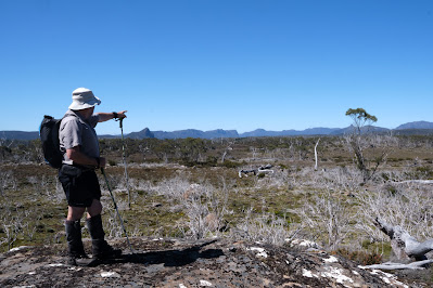
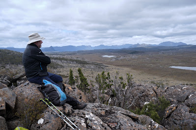
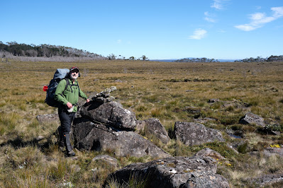
[Tim points the way, with Overland Track mountains ahead]
We set off quite early. The sky is predominantly blue, and the day promises to be warm. We by-pass Lake How, heading more or less south towards another lake. I naively assume it’s Lake Steers, which isn’t too far from our destination. It’s looking like a cruisy day. But not for the last time today Tim has to disabuse me of my belief. He points to some far-distant wooded hills, and tells me we’re headed towards them. We by-pass the unnamed lake, but still have to traverse some boggy ground getting across February Creek and its shallow valley.


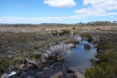
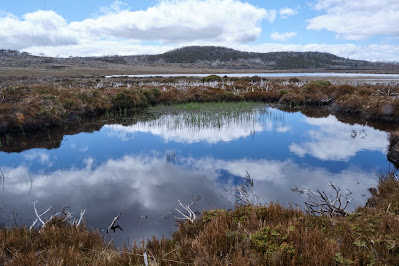
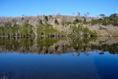
[February Creek, with Mt Pillinger on the horizon]

Bit by bit we close in on those distant hills. Naggingly persistent feet manage this feat surprisingly well, although often at a cost. For an hour or more we’re high-stepping over knee high grasses and sedges. It’s not difficult walking, but it’s wearing. I’m encouraged when I finally see on Tim’s device that we’re closing in on the red dot marking the hut’s location. All the way I’ve been reassured by the fact that Tim has been to Smurf Hut before – hence the red dot. 


What I don’t realise until we enter some gnarly scrub is that Tim has never come to the hut from the northern Februaries. Rather he’s previously approached it from the Arm River/Wurragarra Creek direction. When you’re in bauera, tea tree and scoparia scrub, being told you’re “maybe 200m from the hut” isn’t as comforting as it may sound. After some sweat-inducing wading through said scrub, Tim concedes that we are too far west. We need to back-track. However we’re unable to stomach a complete retreat, so we choose a “tactical withdrawal", going diagonally uphill. 


We finally come out of the scrub into a pencil pine forest. This is promising, as Basil Steers and many other trappers/snarers preferred to use pines like these for building huts. Eventually we descend into the dim green of a myrtle rainforest, an even better sign, as Tim’s memory is that Smurf Hut is hidden deep in such a forest. And so it proves, as we eventually clamber down a small cliff, scramble over a series of mossy logs, and find the humble timber hut.


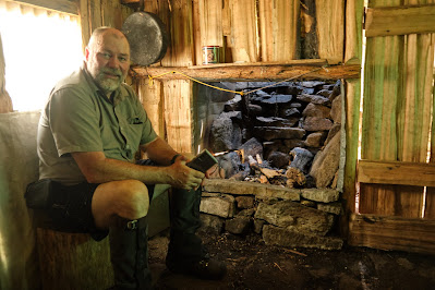
[Smurf Hut, with Tim outside]

Its name has always piqued my curiosity, but as we stoop to enter the hut, it explains itself. Everything about the hut is diminutive: the doorway; the size of the logs stored in the entryway; the height of the ceiling; the three wee bunks. It would be perfect for smurfs*. Indeed Tim and I agree it would be ideal for our friend Jim. Not only does he love a hut, especially one with a fire, but he is also – how shall we put this – a vertically-challenged man. The four foot long bunks would be perfect for him.


[Tim inside the diminutive hut]

We lunch outside the hut, soothed after our exertions by the cool quiet of the forest. After lunch I wander around the hut’s exterior. According to the late historian, Simon Cubit, the hut was never used as a skin shed, and certainly the walls show none of the signs of skins having been nailed there for drying or tanning.


We’ve learned lessons from our outward journey, and set off for our home lake via a less scrubby route. Although it’s still a long haul, all of it off-track, I’m pleasantly surprised to get back by mid-afternoon. While Tim soaks his hot feet in the lake I just sit back and enjoy being becalmed. Had we actually been sailing, it would have been a quiet afternoon. 


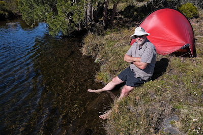
[Tim cools his feet]

There’s just the occasional puff of wind, and the lake is still enough to reveal one further secret. On the far side we can see the tell-tale ripples of a platypus at work. Occasionally it surfaces, bill, nose and eyes briefly visible before it dives again. I am in awe of these amazing creatures, not least because they’re one of only two egg laying mammals in the world (along with echidnas). I’m also astonished how they’ve managed to occupy this small lake that’s far distant from any other reliable body of water. I once watched a platypus toddle over land, and concluded it was unlikely to set any land speed records. Yet here they are, as they are in so many isolated lakes, tarns and creeks in Tasmania.


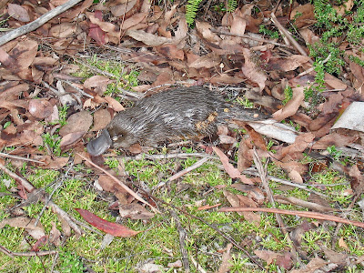
[A platypus walking overland]

After dinner I dig out some of my writing and read it aloud to Tim. On this walk, and earlier by phone, we’d been discussing some of my lock-down work about ‘the spirit of bushwalking’. It’s good to read it, albeit to an audience of one. It’s even better to discuss some of the knotty issues with someone who shares my perspective on walking and spirituality. Tim offers some helpful suggestions, and we toss around ideas, agreeing that there will be on-going discussions. I feel encouraged to keep working on it. Being detached from the everyday seems yet again to clear the mind.


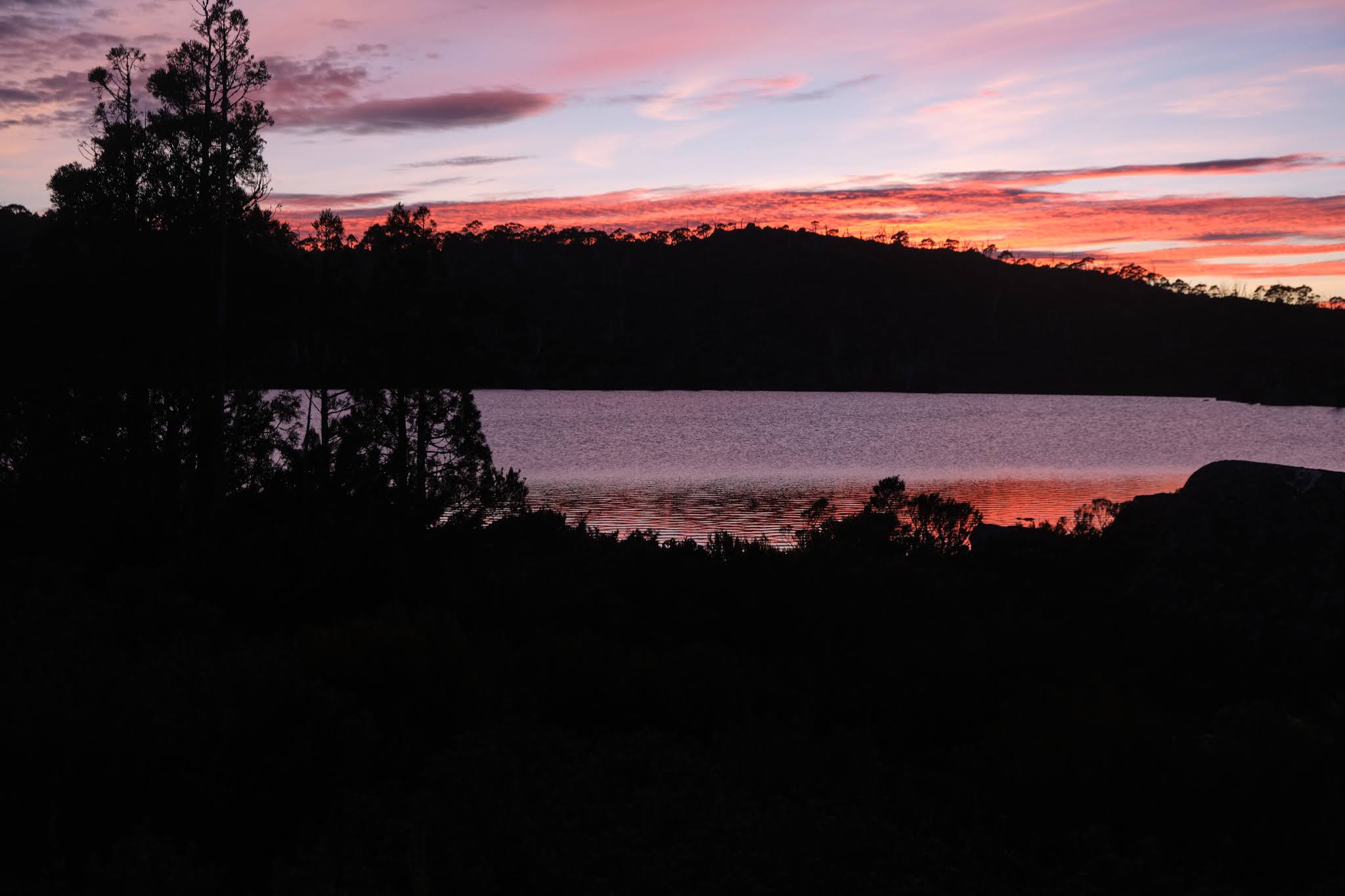
Gradually the blue day morphs into a dark jewel of an evening, and our honest day’s walk helps sleep to come swiftly. When the light of our final day leaks into our campsite, it reveals a mirror-flat lake, enticing us out for an early start. We have one more item on our agenda: to pick up the trail of cairns from day 2, and see if we can follow the old February Plains Stock Route out.


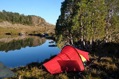
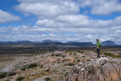
[It's perfectly calm on our departure day]

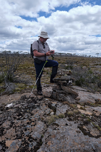
After all our years walking together, I should be aware that Tim’s journeys of discovery are rarely short-cuts. But as I’ve also been bitten by the exploration bug, the two of us happily fan out and scan for cairns. We walk far further west than we would otherwise need to, but are rewarded by the discovery of a series of cairns heading north. We follow these to Sardine Creek, near which we find some remnants of droving days. We feel sure that we have indeed been on the old February Plains Stock Route. 


[Another cairn on the February Plains Stock Route]


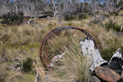
[Old fencing wire, possibly from the cattle droving days]
But now it’s time to leave off being explorers and head out for a substantial – meaning not dehydrated – lunchtime meal. We cut down valley to pick up the old (locked) road that comes down the west side of the Februaries, close to Basil Steers Huts 1 and 2. We’ve been off track for nearly four days, so it’s strange to be moving fast on a solid surface. By the time we get back to the car, our feet are hot. But soon we’re driving off, and Tim announces a supreme idea. When he gets phone reception, he pulls over to ring his wife Merran. Without him even prompting, she graciously offers to make home-made hamburgers back at their place. Any aches and pains are so quickly eclipsed, that Tim and I do a happy little smurf dance before driving home. 


[A Smurf-blue sky bids us farewell]

For those who don’t know, smurfs are fictional creatures from the mind of Belgian comic writer “Peyo”. Small, blue and human-like, they live in mushroom-shaped houses in the forest. 

Thursday 16 December 2021

Walking the February Plains 2: Discovery

We’re lulled to sleep by a frog symphony. Urged on by their own inscrutable drives, they variously bleat, creak and croak through the night to an audience that wouldn’t normally include us. But we’re here, and what a privilege it is to have these calls dampen the din of our normal lives.


The morning breaks fine, with a cloud cover that harbours no threats. We have a slow brew and breakfast, chatting easily about many things before eventually turning to the topic of “where to now?” South is the general answer, with maybe a visit to Lake How and a wander to a high point a little west of there.


Tim eyes the peaks of the Overland Track

We take a meandering route to the lake, heading first to “the grandstand”. We’ve visited this high point before, and been stunned by the views. Again it doesn’t disappoint. We can clearly see almost every mountain of the Overland Track, from Cradle to Olympus. To the south-east are the high points of the Walls of Jerusalem, and north and east many more mountains, including Tim’s home peak of Mount Roland.


Reflections in a pool beside Lake How

Within an hour we’re standing by the shallow shores of Lake How. As pleasant as it is, we’re glad we didn’t tried to camp here. It’s a shallow scoop in a soggy, grassy plain, unprotected by bush or trees. We have a scroggin break and discuss our onward route. I’m pretty much in Tim’s hands, having not been this far before. We decide to climb a nearby hill and the ridge beyond it, to reach the probable high point of the Februaries, to the west of the lake.


Towards the Overland Track from the Februaries' high point

When we get there we again find exhilarating views. The deep valley of the Forth River lies between us and the Overland Track. Our equivalent latitude is well south of Barn Bluff, which we can see clearly. We stop for a very early lunch, and reminisce about walks we’ve done in these nearby mountains. For Tim it’s a significant anniversary: three years since a cardiac arrest on the side of Mount Roland almost ended his life. As we look at Barn Bluff we recall him having, in hindsight, what was probably a warning episode. When we were climbing the steep bluff, Tim was straggling behind when he would normally be leading. At the time he put it down to having given blood the day before we left. Now, by-pass and other surgery behind him, Tim is back to his best, and I’m grateful to be the one straggling behind.


We decide today will be a short day, and amble downslope, thinking we’ll loop back to our home lake for an early finish. But as we cross the shallow valley above Lake How, we make an odd discovery. On the valley flanks, on no obvious route, is a large rock cairn. We puzzle over it, wondering if it’s random, or linked to others. As we walk out of the valley we find another and then, a little further on, two more.


I’ve thought for some time about Frédéric Gros’ theory: that walking through such landscapes detaches us from daily trivia. I’ve certainly experienced the truth of that, but I’ve also pondered what happens to us after we’re detached.  Gros hints at us then becoming attached to that which matters. We’ve experienced some of that at our lakeside camp, and elsewhere on this walk. But I think the freed up mind is also now open to uncovering – or discovering – things which have been hidden from us by our cluttered minds.


One of the probable Stock Route cairns
So here we are, uncluttered by the thought of having to follow a track – there are virtually no walking tracks in the Februaries – and we discover a track! Actually it’s a route, as there’s no clear ground sign of people or animals walking this way. But Tim’s straight onto a theory. We may have discovered an old stock route: perhaps the February Plains Stock Route. If we’re right this route, pioneered by the Field family, dates from the mid 1800s. It was used to drive cattle from the Borradaile Plain through the February Plains to the Pelion Plains. Tim thinks he has seen one or two of these cairns on a previous trip, but we are now finding a continuous series of them.


Tim logs another possible cairn

We dutifully stop at each one, and Tim enters their GPS coordinates into his device. We photograph some too, noting that they’re far less elaborate, and less covered with lichen, than the cairns we followed on Ritters Track, east of the Walls of Jerusalem, last year. You can read more here: Ritters Track


This kind of discovery becomes quite addictive, and we describe a wider arc than we otherwise might have as we walk on to “just one more” cairn. Eventually we cut back to our home lake, but with the idea that we may try to resume the cairn search on our last day. However when we get back to our tents, Tim’s explorer blood is still bubbling. Given it seems to be a day of discovery, he’s all for trying to find signs of another 19th century track, that of E.G. Innes. This is thought to be on the eastern edge of the Februaries, perhaps a few hundred metres from our lake. By now I’ve taken my boots off, so I only follow part of the way, and soon bow out to photograph the nearby flora. Given their subtle beauty, that will be discovery enough for me. 


Rubus gunnianus (Tasmanian alpine raspberry)

Tuesday 14 December 2021

Walking the February Plains 1: Detachment

Being in the presence of what absolutely endures detaches us from that ephemeral news for which we are usually agog.

         – Frédéric Gros (‘A Philosophy of Walking’)

Of all the reasons we hoist a pack and walk into the wild, getting detached from our usual lives is close to a universal. When the walking starts, so does the slow shedding of the skin of our bustle. Before this walk both Tim and I had been burdened in different ways. In Tim’s case some difficult issues in his work as a consultant wanted to slip into his pack. In my case the ups and downs of a writer’s life had me doubting the direction my work was going. It was time to detach! 


Where we'd rather be

So preoccupied have we been that it’s only at the last minute that we choose the February Plains as our destination. It’s not the glamour choice for walkers in search of lofty peaks. It not only lacks those, it’s also deficient in such other drawcards as lakes and forests. And over the years this sub-alpine upland, rarely higher than 1150m, has been grazed, mined, burned and otherwise given grief. Especially hard were the wildfires of 2016, which have left swathes of its slow-growing bush stark and grey, adding to its scarred and weather-worn visage. 


Ready for off!

For all that, we know the Februaries have a way of wheedling their way into your heart. So we’re smiling as we slip on our packs and set off into what is still, a sign soon reminds us, part of the Tasmanian Wilderness World Heritage Area. It’s my third trip here, while Tim has lost count of his many visits to what is almost part of his back yard. 


A lunch stop at Basil Steers #2

While the detachment has begun, I soon find it’s not possible to leave behind my relative lack of walking fitness. The amount of ascent is low, but I’m still puffing more than I should. I’m glad when we reach one of the snarer’s huts built by Basil Steers and family in 1974. We’ve been here before and, after signing the log book, we enjoy a leisurely lunch in its well cared-for vicinity. We marvel afresh at how fortunate the hut was to survive 2016’s fires. Its forest surrounds are still blackened. 

Wildflowers are one beneficiary of the fires. Shortly after leaving the hut we come across carpets of ground-hugging Hibbertia procumbens, their bright flowers extravagantly strewn across our way like precious confetti. There’s no actual track. We just wind our way around bogs and scrubbier sections, sometimes high-stepping over thicker bush. Once we’ve got our rhythm, we settle into stories of past trips here, including Tim’s encounter with a giant tiger snake that chased him off its territory. I spy one of the hills we climbed last trip, recalling who was with us and what we’d talked about. I express my relief that we’re not climbing it again today with a full pack. 


A carpet of Hibbertia in bloom

A couple of hours after lunch we reach a familiar though unnamed lake, its shore dotted with pencil pines. We’ve discussed the possibility of looking for a campsite further on. But picking up on my mood, Tim is happy to make this small lake our base. He and his family know it well enough to have given it their own name, Lake Nycteris, after a character in one of their favourite George MacDonald fairy tales. They haven’t camped here though, so we spend the next half hour circumnavigating the lake in search of the ideal campsite. 


A burned pencil pine beside the lake

The 2016 bushfire has come very close, burning part of a nearby myrtle beech forest, and taking out a couple of pencil pines in the sphagnum bog by the shore. In the end we find a site just large enough for my one-person tent and Tim’s tent/tarp set up. It’s by the lake shore, next to the outlet stream, and beside a small copse of pencil pines. It’s perfect, or nearly so. As soft as it makes us sound, it’s only when we’re sitting in our Helinox Chair Zero chairs with a hot brew in hand that we really feel settled. We’re in total agreement that these little camp chairs are worth their 500g in weight! 


Our set-up beside the lake

Settled perhaps, but not yet fully detached, we keep chatting about the work matters that have added weight to our packs. And we talk real estate, comparing local development issues that threaten to change the feel of our respective local areas. But eventually these matters slide into the background. 


The wider scene, with Clumner Bluff behind

Here, by this quiet lake, tucked under its forested hill, with views stretching down valley and across to a distant Clumner Bluff, with a hundred frogs calling from the water, a few shy wallabies eyeing us quietly, and a sky only scantily clouded, we find the other side of the equation. Now we’re beginning to attach ourselves to what truly matters. This is real real estate.

Tuesday 3 August 2021

Little Lives: Part 2 - The Nattai Wilderness

“Shorty” the campervan was next due to take us to Sydney. Lynne had spent a lot of time and effort getting ready for a reunion there. It had already been postponed twice due to the virus, so we were hoping this would be third time lucky. But, with just a few days up our sleeve, the Coronavirus outbreak in the city was growing. And so we cautiously waited before committing to enter greater metropolitan Sydney. 


For a couple of days we holed up in a Lithgow caravan park, and listened to news of the growing COVID outbreak in Sydney. Perched there on the heights of Lithgow, we felt like Frodo and Sam on the Emyn Muil, waiting to enter Mordor. Our daughter Sally caught onto this and messaged us using Boromir’s words: “One does not simply walk into Mordor!


[Shorty hides out near Lithgow]


We didn’t, and neither did we drive there. Instead we turned tail and sadly retreated from “Mordor” to the rather more friendly town of Mudgee. While there, apart from a bit of wine tasting and bike riding, we learned that the NSW premier had put Greater Sydney into lockdown. Had we gone there, we’d have been there still (as of early August, and counting!)


* * *


Chastened, we re-jigged our plans – again. We’d organised to catchup with my brother after Sydney, when he’d be back from his own virus-dodging trip. So we firmed up that plan, and a few days later arrived at his place in the NSW Southern Highlands. He lives outside, though not a great distance from, greater metropolitan Sydney. It’s strange to run such a filter over every destination, but we had become very used to it. My brother, a retired doctor, is well practiced at it staying Covid-safe too. So once at his place, we hatched a plot to go literally far from the madding crowd: a day walk into the Nattai Wilderness.


[Ian and Lynne start our Nattai walk]


Tasmania has a way of turning we Tasmanians into wilderness snobs. Partly it’s the fact that we live on a substantially wild, mountainous island thrust into the southern seas, away from the fray of mainland Australia, and beyond the easy reach of over-development (though that threat is growing). And partly it’s that around 20% of our island, nearly 1.6 million hectares, is designated as World Heritage Wilderness. 


It’s a vast wilderness I will never encompass, no matter how long I live. But I have taken great pleasure in showing many people, including my brother Ian, just some of the wonders of Tasmania’s wilderness. Now it was his turn to show us one of the hidden gems of his area, specifically the Nattai Wilderness. 

[... let the wilderness begin]


When I've flown into Sydney I have sometimes looked down on a deeply incised wild area and wondered: is that the Nattai Wilderness? Back in the 1970s, when I lived and studied in NSW, I’d camped and bushwalked on the fringe of the area. But I had never knowingly been into what in 1991 became the Nattai National Park. Parts of the park, including where we would walk, were later officially designated as wilderness. Of course for millennia, the Dharawal and Gundangarra Aboriginal peoples called this home rather than wilderness. Our day walk would take us past sandstone overhangs that would have been used as shelter for thousands of years. The country still feels old and remote, despite being relatively close to a large city.


For Lynne and I the sandstone felt very familiar, since we were both brought up on sandstone country. Ian led us first along a fire trail, and then onto a narrower walking track. He was lamenting that we were seeing this country so soon after a massive wild fire. And he was apologetic that the wildflowers weren’t really out yet. Yet somehow we found more than enough to slow us down, oohing over a late-blooming flannel flower here; ahhing over a banksia there. 

[A selection of winter wildflowers in the Nattai]


The country felt similar to the Blue Mountains, and I knew that our track would inevitably lead us to a lookout, although lookdown would be more fitting name. Because, just as in the Blue Mountains, this is more gorge country than mountain country. We reached the edge of the plateau, and could feel the air expand around us before we saw the first bit of gorge beneath us. Ian suggested we push on to the lookout proper, maybe 5 minutes further on. 


[Worth the wait: Ahearn Lookout]


It was worth it. Ahearn Lookout is a grandstand to some vast, wild country. The Lion King wouldn’t have looked out of place posing here, if you accepted replacing savannah plains with vast and steep forested slopes. At the bottom of this defile was the Nattai River, here and there flashing reflections towards us. And beyond that we could make out further gorges, including that of the distant Wollondilly River.

[Looking south down the Nattai Gorge]

We perched on the edge of this vastness, 1 million hectares of wild country stretching all the way to Kanangra Walls, the Blue Mountains, the Wollemi, the Colo, and beyond. In such a place our quiet consumption of a humble sandwich and a coffee somehow felt like a feast. I was never great with equations, but here I could work out that place + movement, over time equalled deep satisfaction. And especially when that place was a wilderness. That's when a day can feel like another little life.


[Special thanks to my brother Ian for introducing us to the Nattai Wilderness.]

[The perfect spot to feast on wilderness]

Monday 26 July 2021

Little Lives: Part 1 - Tumbarumba

My argument went like this. “Shorty”, our VW campervan, our tinyhouse on wheels and additional access to adventure in these covid-constrained times, would allow us to effectively move house whenever we fancied. Want a house by the sea? We just drive to the coast and make it our short-term home. Or a cabin in the mountains? Simply drive into the hills and stay awhile. There we could experience “little lives”, snippets of “what-if” life, in places we’d always wanted to be.


["Shorty" has a practice run]

I thought it sounded good, but Lynne wasn’t so convinced. She’d always thought we’d move by the beach after retirement, and my “little lives” idea sounded like a fob off. (I guess we’ll be having that “move to the coast” discussion for a while yet.) In the meantime we agreed that some adventures in “Shorty” were overdue. We had acquired a short wheelbase VW Transporter van, and had it converted into a campervan by the good folk at Achtung Camper in Geelong, Victoria. Being the SWB version, we nick-named it “Shorty”, and so far the name has stuck.


[Sheep near Tumba living contented little lives]

After a series of shakedown trips within Tasmania, we felt ready to venture to the “big island”, mainland Australia, via the Spirit of Tasmania ferry. A reunion in Sydney with people we shared our youth with some 45 years ago was the impetus. Around that event we planned some cycling, some walking, some beach bumming, and some family visits. But Sydney, in late June: let that sink in! 


Right from the start we sensed this would be a different trip in terms of forward planning. Melbourne was in partial COVID lockdown when we arrived, but we were permitted to transit Victoria, stopping only for food, fuel and toilet breaks. So our plan for a leisurely trip to some Goulburn Valley wineries, and a few days sipping, riding and living the “little life” dream of being winemakers, went west. Actually it went north, as we made a bee-line for the NSW border. We didn’t stop until we got to Tumbarumba.  


[Yep - Tumbarumba]
 

Of all the border towns on offer, why Tumbarumba? Well, to be fair the Riverina Highlands are lovely, and they do have vineyards. But the main attraction for us was a new 21km rail trail from Tumbarumba to Rosewood (or “from nowhere to nowhere” as someone unkindly put it). Tumbarumba’s beauty is on the subtle side. It nestles in some pretty hills, though calling them “highlands” would be a stretch. Its fame is somewhat meagre too, although a 1959 vernacular poem by John O’Grady has made it memorable for some. Its famous line is about a bloke who is “up at Tumba-bloody-rumba shootin' kanga-bloody-roos.”


[Pretty wooded hills near Tumbarumba]


[Low hills with vine-covered slopes]


The local roos would certainly have needed their winter coats, as overnight the temperature plunged to minus 4. I was glad Lynne had made sure our doona had been given a feather reinforcement a few weeks before the trip. The only other incumbents in the wee caravan park found their water had frozen overnight. 


[Ready for the ride: Tumbarumba to Rosewood]


The temperature didn’t encourage an early start, but the sun soon enticed us up the hill to the start of the cycle trail. We’ve been on plenty of cycle trails in Australia and New Zealand, but this would be the first time we’ve ridden one that is sealed the whole way, in this case in bitumen. There are reassuring hints that this was once a rail line, with old-style station names, the remains of old platforms, plenty of cuttings, and various bits of rail paraphernalia. Crucially, as with most rail trails, the incline is quite merciful. Trains are generally not able to climb a slope of more than 2 degrees. So while the vibe is retro, the surface and the infrastructure (think bridges, fences, crossings, toilets, sign posts, interpretive panels) are all shiny new. 


[The rail trail is paved and smooth all the way]


Lynne was still recovering from a cold, and we were both short on riding practice. More than that, we’d had a rushed and stressful trip across Victoria, after a sleepless night on the ferry. Sometimes you go for a walk or a ride not so much because you really want to, but more because you know you need the brain re-set that being out in the fresh air gives you. And so we rolled down the smooth track through hilly open woodland, before breaking out into wide, gently rolling hills dotted with eucalypts, sheep and cattle. It was quietly, gently exhilarating, the perfect way to ease us back into the present. Our coffee stop at a little wayside seat added some needed caffeine into the mix, and also some humour. While we had a thermos of hot coffee in our packs, we’d forgotten cups. All we had was a urine specimen container that we use to carry milk or condiments. So we took turns to sip micro-brews from our little yellow container, in between giggles.


[Lynne pours a "specimen" cup of coffee!]


[We found a ewe and lamb warming themselves on the track]

Our minds soon turned to the future. If we went all the way to Rosewood, we would then have to ride all the way back. The total trip would be close to 45km, rather more than we had planned. But I was quietly confident we could do it, especially given we were riding our e-bikes. We’d learned that Rosewood had a café, encouragingly called “Gone Barmy”. With the offer of another coffee there, this time from an actual cup, I convinced Lynne we could do the full return trip.


[We got there - and rested at Rosewood Station.]


And so we did, the return ride being just as delightful as the outward journey. Even the feared uphill to the Tumbarumba station proved a toothless tiger, and we were soon back with “Shorty” ready for a shower and rest before heading to the pub for a well-earned dinner. Our little life in Tumbarumba had been short but surprisingly sweet.

Friday 21 May 2021

Central Plateau Variations: Part 5

It was the light that woke me. Not just the slow leak of dawn light, but something far stronger. I emerged from the tent to a veil of high cirrus cloud that radiated a rich, warm pink. Blissful weather one day, stunning sunrise the next? Not business as usual for the Central Plateau then! 


[Sunrise at Lake Tyre]


By the time I’d fetched my camera, golds and reds were joining the display, lighting up the lower clouds. The whole was then reflected back at us off the lake. As the others emerged, we wandered in wonder around the shores of Lake Tyre taking photos, or just soaking up the beauty. If we thought we were in for another beautiful day, we’d forgotten the highlands’ capacity for tricks. I’d left my tent up while we ate breakfast, hoping the rising sun would dry it a little. But as we sipped our tea, a thick mist rolled in, hiding the sun and dampening hopes of carrying out dry tents. 


[The mist rolls in: Photo by Jim Wilson]


[Larry packs up in the mist: Photo by Jim Wilson]


Reluctantly, with raincoats at the ready, we packed up soggy gear in the clammy chill. As we left the camp site the mist was thinning, the day’s air beginning to mix. But above us Mount Jerusalem, which had been roiled in thick cloud, now sent that cloud rolling down towards us, like a stern angel driving us out of the garden.


[Cloud follows us down Zion Vale: Photo by Larry Hamilton]


Our Plan A for the trip was well out of kilter by now. Instead of spending a night at Tiger Lake as originally planned, we would now bypass it and walk out to the Walls of Jerusalem carpark in one go. Tim and Merran had done this on our last walk together here, when they had to leave a day early to get back for appointments. They assured us it wasn’t difficult, though given their walking prowess, one or two of us may have taken that with a grain of salt.


[Tim leads us towards Officers Marsh]


Still, if there’s one thing that motivates bushwalkers in the transition to the finish of a trip, it’s the craving for cold drinks and hot food at walk’s end. There are unspoken rules: it has to be something you can’t get in the bush, and it has to be prepared by someone else. Grease and beer are perennial favourite ingredients, but as we walked we considered a plethora of other post-walk possibilities.


We’d left early again. There was ground and time to make up if we were going to get to lunch in time. Fortunately, whether it was because we were walking downhill, or walking towards that promised lunch, or just because we were headed for home, Jim was the most sprightly he’d been all walk. He said he still felt crook, but he was determined to get the job done.


I noticed other transitions too. Descending towards Zion Vale, we first had to cross Officers Marsh, a buttongrass-fringed boggy area. We picked our way across it, keeping to less boggy higher parts where possible. The land felt fat with water, holding onto the plentiful rainfall not only in its many pools, but also in its deep and spongy peat soils. Wallaby scats and pads, and a wombat burrow in some higher ground confirmed it was also good grazing land. 


[Wombat burrow, Officers Marsh]


As we descended, the land grew leaner, the steeper gradient aiding faster water flow and impeding peat development. Now in places the water cut down to bedrock. The flowing water was finding its voice, chattering and chuckling among the stream-bed rocks, while calling currawongs and chittering honeyeaters sang their harmonies.


It wasn’t all downhill, of course. The highlands reserve the right to put an uphill in your way, just to keep you honest. So at the end of Golden Vale, after the junction of the Fish River and Wild Dog Creek, there was a short but steady climb towards George Howes Lake. Knowing this was coming, and feeling the warmth of the day finally asserting itself, we sat on a grassy bank for a break. It was a place a few of us had stopped before. In fact, Libby reminded us, it was almost exactly 8 years ago that she’d first met us in the Walls, joining us for a day walk past here to Tiger Lake. These days we don’t feel our walking group is complete if “Possum” (Libby’s nom de randonee) isn’t with us.


On the uphill section the sun and our physical effort squeezed the day’s first perspiration from us. After the turnoff to Tiger Lake our route once again trended downhill. And now the valley was tightening even more, squeezed between the uplands of the Walls to the south, and the outliers of Clumner Bluff to the north. To avoid a steep, bluffy descent, we left the river side and took a diagonal route through scrubby bush and forest towards the main Walls track. 


[About to leave the valley]


Eventually we met that track at Trappers Hut. And here we met the first other walkers we’d seen all trip, another surprising transition. For them the hut marked the end of their major ascent for the morning. For us it was the start of the highway home: a fully-formed track, easy to follow if mildly steep. It was tempting to just put our heads down and will the carpark to come. But for a change we were now meeting, and exchanging pleasantries with, other walkers. I’m sure our words for those nearing the top – an “almost there” or a “the worst is over” – were welcome. As we got further down, it was better to stick to “where are you from?” or “what are your plans?” Sometimes the brutal truth (“You’re looking stuffed. Sorry to tell you you’re not even half-way”) is best avoided.


Such “games”, if that’s the right word, eased us to the end of the track. Even so it seemed to take longer than I expected, even though I’ve walked this track 15-20 times. It didn’t help that I’d almost run out of water as I trudged into the very full carpark. A warm mouthful from the bottom of my Camelbak didn’t quite satisfy.


Once we’d loaded the cars and made it down to Earthwater Café near Mole Creek, all that was forgotten. We’d made it in time for a cooked lunch, and there were plenty of good choices in both food and drink. To spare other diners our malodorous presence, we sat outside at a long table set beneath some large deciduous trees. If this was a compromise, it’s one I’d choose every (fine) day. 


[Happy campers at Earthwater Cafe]


For most of us it had been a great walk, with some neat variations on our last walk on the Plateau. The fierce, wet winds that blew for 48 hours or more now seemed a distant memory. More prominent was the honour we felt to have found and followed substantial parts of Ritters Track at last. Larry and Tim were especially happy about that. Their judicious use of the sometimes dodgy GPS data was superb. And if Jim’s illness had partly spoiled the walk for him, we had to applaud his guts (pun intended) in making it to the end. Besides, with a beer in hand and fish and chips on the way, he looked as happy as, well, Larry – and everyone else.