Showing posts with label Mt Olympus. Show all posts

Thursday, 16 December 2021

Walking the February Plains 2: Discovery

We’re lulled to sleep by a frog symphony. Urged on by their own inscrutable drives, they variously bleat, creak and croak through the night to an audience that wouldn’t normally include us. But we’re here, and what a privilege it is to have these calls dampen the din of our normal lives.


The morning breaks fine, with a cloud cover that harbours no threats. We have a slow brew and breakfast, chatting easily about many things before eventually turning to the topic of “where to now?” South is the general answer, with maybe a visit to Lake How and a wander to a high point a little west of there.
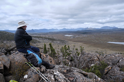


Tim eyes the peaks of the Overland Track

We take a meandering route to the lake, heading first to “the grandstand”. We’ve visited this high point before, and been stunned by the views. Again it doesn’t disappoint. We can clearly see almost every mountain of the Overland Track, from Cradle to Olympus. To the south-east are the high points of the Walls of Jerusalem, and north and east many more mountains, including Tim’s home peak of Mount Roland.
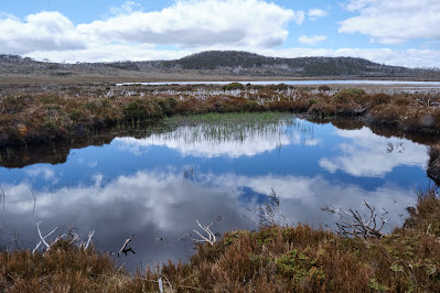


Reflections in a pool beside Lake How

Within an hour we’re standing by the shallow shores of Lake How. As pleasant as it is, we’re glad we didn’t tried to camp here. It’s a shallow scoop in a soggy, grassy plain, unprotected by bush or trees. We have a scroggin break and discuss our onward route. I’m pretty much in Tim’s hands, having not been this far before. We decide to climb a nearby hill and the ridge beyond it, to reach the probable high point of the Februaries, to the west of the lake.
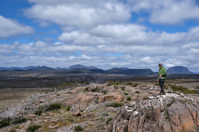


Towards the Overland Track from the Februaries' high point

When we get there we again find exhilarating views. The deep valley of the Forth River lies between us and the Overland Track. Our equivalent latitude is well south of Barn Bluff, which we can see clearly. We stop for a very early lunch, and reminisce about walks we’ve done in these nearby mountains. For Tim it’s a significant anniversary: three years since a cardiac arrest on the side of Mount Roland almost ended his life. As we look at Barn Bluff we recall him having, in hindsight, what was probably a warning episode. When we were climbing the steep bluff, Tim was straggling behind when he would normally be leading. At the time he put it down to having given blood the day before we left. Now, by-pass and other surgery behind him, Tim is back to his best, and I’m grateful to be the one straggling behind.


We decide today will be a short day, and amble downslope, thinking we’ll loop back to our home lake for an early finish. But as we cross the shallow valley above Lake How, we make an odd discovery. On the valley flanks, on no obvious route, is a large rock cairn. We puzzle over it, wondering if it’s random, or linked to others. As we walk out of the valley we find another and then, a little further on, two more.


I’ve thought for some time about Frédéric Gros’ theory: that walking through such landscapes detaches us from daily trivia. I’ve certainly experienced the truth of that, but I’ve also pondered what happens to us after we’re detached.  Gros hints at us then becoming attached to that which matters. We’ve experienced some of that at our lakeside camp, and elsewhere on this walk. But I think the freed up mind is also now open to uncovering – or discovering – things which have been hidden from us by our cluttered minds.
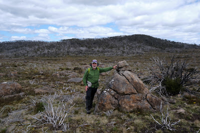


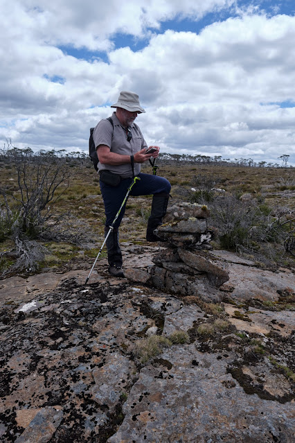
One of the probable Stock Route cairns
So here we are, uncluttered by the thought of having to follow a track – there are virtually no walking tracks in the Februaries – and we discover a track! Actually it’s a route, as there’s no clear ground sign of people or animals walking this way. But Tim’s straight onto a theory. We may have discovered an old stock route: perhaps the February Plains Stock Route. If we’re right this route, pioneered by the Field family, dates from the mid 1800s. It was used to drive cattle from the Borradaile Plain through the February Plains to the Pelion Plains. Tim thinks he has seen one or two of these cairns on a previous trip, but we are now finding a continuous series of them.


Tim logs another possible cairn

We dutifully stop at each one, and Tim enters their GPS coordinates into his device. We photograph some too, noting that they’re far less elaborate, and less covered with lichen, than the cairns we followed on Ritters Track, east of the Walls of Jerusalem, last year. You can read more here: Ritters Track


This kind of discovery becomes quite addictive, and we describe a wider arc than we otherwise might have as we walk on to “just one more” cairn. Eventually we cut back to our home lake, but with the idea that we may try to resume the cairn search on our last day. However when we get back to our tents, Tim’s explorer blood is still bubbling. Given it seems to be a day of discovery, he’s all for trying to find signs of another 19th century track, that of E.G. Innes. This is thought to be on the eastern edge of the Februaries, perhaps a few hundred metres from our lake. By now I’ve taken my boots off, so I only follow part of the way, and soon bow out to photograph the nearby flora. Given their subtle beauty, that will be discovery enough for me. 


Rubus gunnianus (Tasmanian alpine raspberry)

Sunday, 3 March 2013

These are the Days


A Mount Olympus Walk: Part 3

“These are the days that make the moments feel like years.”– (Ross Hamilton of Wolfstone)


[Lake Oenone from "Paris Ridge", Mt Olympus] 

Best laid plans. We would be up early, before the march flies, to tackle the steepest part of the climb before the hottest part of the day.

It is a still and clear morning. Tick. We have slept well and feel refreshed. Tick. I pull back the tent flap and there is the mountain, high, clear and beckoning above our home lake. Tick. However one member of our party feels very comfortable remaining horizontal inside the tent. Cross.

So it is not a lightning fast start to our summit day. And we do not beat the heat up the rocky, steep, tree-less and east-facing slope. C’est la vie! At least we are only carrying day packs. Our backs rejoice in that, and our steps feel light as we ease our way up slope, carefully avoiding a fagus mini-forest. It glows a vivid green, contrasting with the demure green of pencil pines. That contrast will be starker in a few months, when the fagus colours up.

The ridge we’ve started climbing looks morainal. Either side of it glacial ice would have moved during the long ice ages that shaped this whole landscape. On our side of the ridge Lake Oenone fills the resulting hollow. On the other side, still out of our view, lies its twin, Lake Helen.

In Greek myth Oenone was a beautiful nymph, secretly married to Paris, the Prince of Troy. Paris, like us, had abandoned Oenone to go to a lonely mountain top. After many intrigues he ended up in Troy where he courted the fair Helen, only to die from a poison arrow wound.

Hopeful of a better end to our story, we continue to ascend “Paris Ridge” towards our own lonely mountain top. On our right the beautiful Lake Helen soon comes into view, scintillating in the mid-morning sunlight, while on our left Lake Oenone recedes slowly. Tim takes some time to photograph the lake, given it bears the same name as his wife. In this heat, I’m more than happy to pause for a water break.


[On the bouldery ascent, Mt Olympus] 
We’ve been off track for two days now, but this ridge is the only obvious route towards the true summit of Mt Olympus. There are clear signs of footfall everywhere, and we have no difficulty reaching the rocky base of the final climb. Here large dolerite boulders lie about like playthings of the gods.

Soon we are leaping and scrambling a little, getting our arms involved as well as our legs. We are earning our altitude gain. As we stop to draw breath we debate the “right” way to the top. If there is such a way, we seem to be close to it. Just near the top of what we hope to be the final climbing gully, we find some pink tape. If we’ve gone the wrong way, we’re not the only ones.

We break out on top in clear and perfect sunshine, sweating and breathless, but elated. Of course it’s not the final top, but reaching that will be easy. We stop, drink, and look around. The views are stunning. Here on the eastern side of the escarpment we look over leeawulena/Lake St Clair to the Traveller Range, and down on Mt Ida. To the north we see Narcissus Bay and beyond that the route of the Overland Track, which winds around the bluffs and peaks of the Du Cane Range, past Cathedral Mountain, and more than 60km onwards to the just-visible Cradle Mountain.


[Summit views from Mt Olympus] 

As we wander towards the humble, lightly-cairned summit of Olympus, we start to also see the mountains to the west and south. Far and near there’s Frenchmans Cap, the West Coast ranges; the Eldon Range and Mt Rufus. Tim and I were on top of Rufus a couple of summers ago, that time with our wives. Even alone on a mountaintop, you carry others with you.

Olympus is no peaky mountain, rather a remarkably flat and quite massive plateau. As we stand scanning the rumpled horizon, it’s as though we’re on the bridge of a giant ship sailing through mountainous seas. So many of the peaks I can see and name have stories for me, three decade’s worth and more. I feel a profound joy in having had their company for so long.

This northern part of the mountain has long, shallow tiers. They are lightly clothed in low, dense vegetation of the sort that can resist heavy snow and scouring winds, as well as high heat and burning sun. One of the most successful communities seems to be the cushion plants. 


[Cushion plant: between a rock and a wet place]

Despite their name they are not soft to the touch, although they have wonderfully rounded edges. Between these mounds there are shallow pools of water. We linger beside one of particular beauty and enjoy lunch.


[Close-up of cushion plant flowering] 

Of course there are march flies in this ointment, and it is almost unbearably hot. But this is one of those mountain days you hope for and work for. These are the days that make late starts, sweaty climbs and muscle aches seem trivial. This is why we walk. 


Wednesday, 27 February 2013

Visions in the Dark

A Mount Olympus Walk: Part 2


[The sun sets on Mt Olympus' south summit] 

Horizontal is good, very good. So too is being out of range of the flying blood-suckers. We lie in the tent reprising our day, trying to focus on the good things. Our muscles are loudly shouting the other side of the equation.


But we’re Aussies being positive: what better to do than dig deep into the book of cliches? “How’s the serenity?”, “You know you’re alive”, “How often do you get weather like this?”, “No-pain-no-gain”, “We may never pass this way again”, and so on. But mostly we just rejoice in being still and comfortable.

Before long the talk shifts to what we’re missing on this trip. Naturally we start with our respective spouses, and soon follow with our walking mate Jim. But we very quickly agree how glad we are that none of them has just gone through what we have.

More pragmatically we think to add scrub gloves and a length of rope to our “missing” list. On the ascent from Echo Point, as expected, we had come across a few cliff lines. These bands of horizontal sedimentary rock long pre-existed the dark dolerite that caps so much of this part of Tasmania. During the Jurassic era magma had forced its way up through the existing rock, cooling to form a vast dolerite layer on top of the earlier bands. The Lake St Clair glacier had subsequently gouged the valley that formed the lake, crudely cutting through this layer cake of rock.


[Tim surveys one of our "jungle" cliffs]  

What that geology meant in practical terms was that we had to negotiate a few near-vertical sections of sedimentary rock. And without any rope to help us haul our packs. Oops! We’d read that sidling a few hundred metres either side of these barriers would usually yield an easier climb. That sounded great on paper, but when you’re as hot and tired as we already were, sidling seemed a poor option. Especially when there’s was a bit of pink tape at the top of your nasty looking 10 metre “cliff” as good as telling you “this way.”

After a slightly desperate pause, our inventive substitute for rope was to use a trekking pole. I extended one pole fully and inverted it so that Tim could hook its hand loop through a clip on the pack. A couple of hernia-threatening heaves from me (above) and Tim (below) finally saw us – and our packs – on top of our first cliff.

But all that is behind us now. Ahead of us, in the morning, is a 200 metre scramble from our lake up a ridge and onto the Olympus plateau. “How hard could it be?” Tim asks, not caring to hear an answer quite yet.


[Looking towards the north summit of Olympus] 

One thing that isn’t hard is falling asleep. We’re soon purring beneath our tent’s nylon dome while the mosquitoes vent their frustration and fury on its mesh. But then something wakes us around 2:30 am. Just perhaps one us has been snoring, although men of our age might also blame their bladders. I prefer to think it’s the universe calling, because when I decide I may as well go outside for a pee, my jaw drops.

The sky is extravagantly spattered with stars. From one horizon to the other, in every direction, there are stars in the kind of profusion that only a child, or a Vincent van Gogh, might imagine. My gasps bring Tim out, and for a time we just stand there, oblivious to the mosquitoes, taking in that everynight wonder that most of us never see, thinking the night sky simply black.

My late mother-in-law painted a sky like this in her piece called “Cosmos”. Our fortunate guests can see it above the spare bed. It too is extravagant, child-like, wonderful. I’m sorry I never asked her where and when she had seen this brilliantly black vision.


["Cosmos" by Joan Goldsworthy] 
Eventually we fall asleep again, knowing that the clear night sky will soon yield to a clear hot day: our summit day.