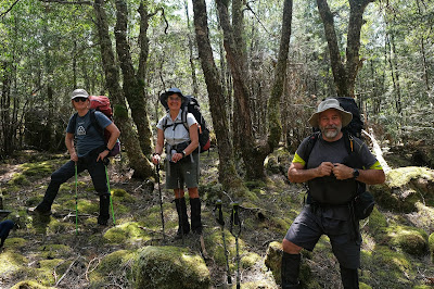
Tuesday 28 April 2020

A Long-Awaited Reunion: Part 2


[Mt Oakleigh from New Pelion Hut] 
After a long and tiring day of bushwalking, thoughts like “I’ll sleep like a log”, or “I’ll definitely sleep late tomorrow” come easily to mind. Reality usually has other ideas, especially in huts, where there are always snorers, and usually the rustling, clattering and chattering of the early-to-depart brigade. But this morning we join in the noise. We have to get our breakfast done early-ish, because we have a morning tea appointment!

Tim D and Merran’s son Justin, who works for an Overland Track guiding company, is joining us for morning tea. The even better news is that he’s bringing some muffins to share. This quickly gets everyone’s attention, and especially Libby’s. She’s renowned in our company as a muffin-fancier, and – according to some – a muffin thief.


[Libby showing earlier form at muffin-fancying] 
It’s a sumptuous morning tea, and we all hoe in even though we’ve just had brekky. We then get chatting with Justin about his work, and are soon discussing the pros and cons of Overland Track commercial trips. The knowledge and cooking of the guides, and the comfort of soft beds and showers, certainly have appeal. Of course the trips are expensive too, and we conclude that they’re not primarily aimed at experienced walkers like us. That said, Jim is quite taken with the thought of an upgrade from the public hut. So he spruiks his abilities as a raconteur, saying he’s willing to offer his services to groups in exchange for bed and board. Justin rubs his beard mock-thoughtfully, and assures Jim he’ll give the idea deep thought. The rest of us laugh heartily before thanking Justin again as he heads back to work.

And now we feel the need to “walk off the smackerels” (as Winnie-the-Pooh would have put it). So we decide to have a leg stretch on the track towards Pelion Gap. Brita passes, as she has her eye on a recently vacated tent site, and wants to get the tent set up before the site is claimed by others. I’m not sure how much the snoring has to do with her relocation decision, but I ask her to try and keep a spot free for our tent too.


[Climbing towards Pelion Gap] 
We walk into a beautiful patch of myrtle beech forest just 10-15 minutes up the track. After yesterday’s knee pain, Lynne is wary of even this amount of walking. And soon she’s wincing with the pain of walking. She’s upset too at the possible implications for the rest of the walk. So on the way back down we discuss plans for the day. Lynne lets us know her day will be spent resting her knee at New Pelion. The rest of us are thinking about Mount Oakleigh, and possibly beyond.

Back at the hut, we fill Brita in on the options. It turns out she’s happy with a slow wander through the forest towards Oakleigh. Jim and I have talked up the splendour of the forest, and are happy to guide her. Merran, Libby and the two Tims have more ambitious plans. They’re wanting to go up to the Oakleigh plateau, turn east, and head off track in search of Tarn of Islands. Tim D has it all sussed on his GPS, although he adds that it’ll be a long day, with a number of “known unknowns”. Jim and I look at each other knowingly, and wish them well.

They leave as soon as lunch is packed. The rest of us go more slowly. I set up our tent next to where Brita and the others have put theirs. Half an hour later, Brita, Jim and I are finally ready. We wave Lynne farewell and head north towards Mt Oakleigh. It’s a very familiar walk across buttongrass plains, with expansive views of mountains in almost every direction. The weather is blue-skied and mild, and it’s wonderful being out among friends, both human and geographical.


[Walking towards Oakleigh, with Pelion West in background] 
Brita is soon learning that there are different styles of walking within our group. Some emphasise the journey over the destination; while for others the destination is the main thing. If that destination is a hut, or a mountain – preferably one with a mobile signal – then Jim can put on a surprising turn of speed. Brita, it turns out, is a journey person. I am too, so we trail behind Jim, taking time to stop, look, enjoy and photograph the wonderfully rich, tall rainforest.


[Forest on the ascent of Mt Oakleigh] 

[A Senecio daisy in the Oakleigh Forest] 
After a final steep and sweaty climb, we finally catch up with Jim on a dolerite outcrop atop the Oakleigh plateau. He’s already posted something on Facebook about being a “lonely little petunia” up there. We burst his loneliness bubble and join him for lunch. The day has warmed up, and the deep blue sky is daubed with just a few decorative clouds. Although Oakleigh is a minor Overland Track peak in terms of altitude (just 1286m), the views from it are stunning. As we eat lunch our eyes are drawn across the Pelion Plains to the highest mountains of The Reserve: the broad-backed bulk of Mt Ossa (1617m); the nipple-like top of Mt Pelion East (1461m); the loaf-like Mt Pelion West (1560m); the sharp-edged Du Cane Range (1500m+), and many more besides.


[Brita and Jim on Mt Oakleigh] 
I sit back, enjoying warm sun, a wafting breeze, good conversation, and all of this!  It’s fair to say destinations can be pretty good too. We look out east towards where our friends have gone in search of a more adventurous destination. To the south, down Pelion way, there’s a metaphorical cloud for me. I’m fretting about Lynne’s knee. I’m sorry too that she’s missing this summit, but glad that we have been here together before, and in good weather. Brita and I chat about the knee issue, and she says she might have a few things she can try that might help Lynne.

After lunch, our route back down keeps knees front of mind. At times it’s a steep, knee-crunching trial. I’m glad of trekking poles to act as shock absorbers, gladder still of the beauty of the forest here. At one point I think of Sagrada Familia, the phenomenal Barcelona church designed by Antoni Gaudi. He said he was inspired by forests in his design of the vast arching ceiling and its exquisite sun-lit high windows. He convinced me, such that I was brought to tears by that interior.


[In the rainforest on the side of Oakleigh] 
The colours and textures that inspired Gaudi are here too. There are the mossy greens and speckled browns of the forest floor; the near luminous lichens and green, orange and yellow mosses gently smothering every trunk and branch; the deep leaf greens that fade and grade together towards a vast, vaulting canopy beyond which are only hints of bright blue. Brita is loving this too, confessing she is particularly a fan of lichen.


[Lichen and moss, Oakleigh Forest] 
Once we’re back at the hut we catch up with Lynne, and soon afterwards Brita puts her osteopath hat on. After an examination of Lynne’s knee, she suggests that the main issue might not be the knee, but a tight hamstring. Brita offers to work on it. Half an hour later – after hard work for one, and some pain for the other – they both walk onto the verandah, where Jim and I are socialising. Both women are smiling, and Lynne says she feels six inches taller. The knee is definitely improved, and there’s some hope that any ongoing issues can be handled via stretches and walking techniques. In short there’s a fair chance that Lynne will be able to walk out, rather than becoming a permanent fixture at the hut.

It’s been a day of appointments, and we have one more before we’re done. Our friend Libby recently married her man, Colin. But with him being Canadian, they’d snuck out of the country to get hitched in Canada over Christmas. As you do! Since we weren’t able to be part of that great occasion, we have planned a surprise party on the helipad to celebrate with Libby. The only snag is that she – and the other three – haven’t come back from their Tarn of Islands adventure yet.

It’s well after 6pm before we see the straggling group coming up the track. They look the worse for wear, and have tales of scratchy scrub to tell, as well as raves about what they’ve seen. TimO has had the extra adventure of being geographically embarrassed for a while. But apart from scratches and sunburn, they’re in good spirits.   
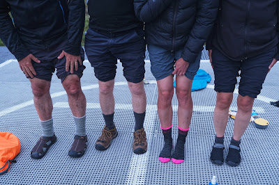

[Comparing scrub scratches after Tarn of Islands trip] 
Once they’re ready we carry our party gear down to the helipad for the celebration. We’ve each got special food to share, as well as a few small gifts. After the first round of cheese and dips, it’s time for “the speeches”. Actually, as Libby doesn’t much like being the centre of attention (and probably won’t like this part of the blog) they’re more a few brief words of appreciation for our friend, and lots of well-wishing for her future with Colin.
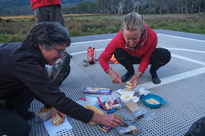

[Merran and Brita prepare the Feast] 

[Speech time at the Helipad Celebration] 
There are lighter moments as well, chief of which is Jim presenting each of us with some spare toilet paper. We’re unsure what we are supposed to make of this, until we discover that each square has a black and white portrait of Donald Trump on it. 
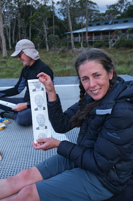

[Libby displays Jim's special gift] 
After some juvenile guffawing, we eat and drink a bit more, and watch the sun casting its last light across the plains and onto Oakleigh. It’s been a long day, and most of us are glad to head tent-ward. Once back at the tent, I greatly enjoy getting horizontal again. And I’m grateful that the noisiest neighbours here are the calling currawongs. As those sounds settle me towards sleep, I almost catch myself saying that I’ll sleep like a log.

Friday 17 April 2020

A Long-Awaited Reunion: Part 1

Walks can take a little time to organise. Who’s coming? Where are we going, and when? And then there’s transport, food, tents, weather, contingencies. The list tends to go on. But for eleven years? That does seem excessive! Strange but true, this walk had its genesis back in 2009. Five of us – Tim O, Jim, Mick, Lynne and me – were on an extended tramping trip in New Zealand. 


[In the Beginning: (L to R) Mick, Peter, Lynne, TimO and Jim, 2009] 
That trip went down in legend as the start of the “pirate captain/cabin boy” nonsense that we’ve maintained to this day. While that’s another story, its relevance for the February 2020 walk was that in March 2009, we met an Austrian backpacker named Brita. At the time we were walking the Routeburn Track. While Brita was much younger than all of us, we got on very well. Importantly she was quite tolerant of our pirate accents and general silliness while walking … or resting, or cooking, or eating!


[1st Meeting, Routeburn Track 2009. L to R: Jim, Brita and Ranger John] 
This was in the early days of Facebook, and that plus email enabled us to keep in touch. Our on-going contacts confirmed that Brita was a keen traveller, and an adventurous soul. So we weren’t surprised when, having qualified as an osteopath in 2018, she decided to work in New Zealand. For a European that felt like just next door to Tasmania, and she expressed interest in “popping over”. So for the next year or so, Jim sold Brita the concept of a reunion walk in Tassie with us. We’d be able to offer free accommodation, sight-seeing and socialising on a grand scale. I’m not entirely sure Jim didn’t also promise steak knives.

Skip forward to February 2020. Most of our original 2009 group could make the reunion walk, although Mick had followed his heart to Darwin, and couldn’t join us. But our group did expand to include our regular walking friends Libby, Tim D and Merran. The question then became: where would we be taking Brita? She was keen to walk the Overland Track, having succumbed to illness on a previous attempt. Most of us had done that trip multiple times, and thought we should go somewhere a little more adventurous.

Two years earlier we’d had a brilliant off-track adventure, walking from Lake Mackenzie through the Blue Peaks and overland to the Walls of Jerusalem. (You can read more here, then here, and finally here.) A variation on that walk firmed as the early favourite before logistic issues, the need for some early departures, and Jim’s fondness for huts led to a rethink. And given that the trip was Jim’s baby more than anyone else’s, we caved in to his suggestion. And that was that we walk in to Pelion Hut (bending towards Brita’s Overland Track wish, and Jim’s love of a hut), via a new-to-us side track (bending towards Tim D’s adventurous navigator impulse, and Tim O’s love of new routes), and base ourselves in the heart of the highest part of Tasmania, with many mountains to climb, and some beautiful ancient forests to "bathe" in (a plus for everyone).


[... And beautiful mossy forest] 
You’ll see now that we do try to accommodate as many preferences as we can. But you’ll also guess that there can be a certain amount of cat-herding involved. Once the miaowing had died down, we met for a very early departure one Friday in early February. The plan was to meet our northern-based friends, Tim D and Merran, at the turn-off to the Arm River Track. This provides a well accepted way into the middle of the Overland Track at the Pelion Plains. But we weren’t going via the Arm River. Instead Tim had found another way into the same destination, which he assured us was less steep and probably easier. (According to Jim “he lied!”, but more of that later.) Certainly it’s fair to say we were innocent as lambs as we drove up the long dirt road to the start of our walk.


[At the start of our 2020 walk to Pelion] 
The weather was warm and sunny, and the march flies had found us well before we’d slapped on sunscreen and laced up our boots. We snapped the obligatory departure photo, and hoisted our too-heavy packs. We were keen to leave the march flies behind, although soon enough that keenness receded as the climbing began. We’d started at the edge of an old logging coupe, which soon graded into forest. Our ascent was a steep, diagonal sidle, following a route rather than a clear track. Regularly we were clambering over fallen logs and up mossy banks, which was energy sapping work. As some of us hadn’t eaten lunch, we signalled to the front walkers to look out for a good shady spot near water. We soon regretted being too prescriptive, as Lynne and I were already sore and sorry after only an hour of ascent.


[Will this do for a lunch stop?]
Half an hour later the perfectionists up front finally stopped. To their credit their choice of lunch stop was excellent. In the cool, mossy shade of a beautiful myrtle beech forest we drank and ate and rested. As we chatted with Brita we learned a bit more about the mysteries of osteopathy, and also heard her confession that she hadn’t done overnight full-pack style walking for some years. In short, she wasn’t finding the going much easier than we were.


[Will Tim fall in the mud?] 
The good news for all was that we weren’t too far from the top of the main climb. After lunch the track duly levelled out, and the optimist in me started to feel we were over the worst. I was wrong, of course. We still had to get to the junction with the Arm River Track. And that was well short of half way to Pelion. What made this realisation harder was that Lynne was limping, struggling with knee pain.


[Lynne and Tim O in forest before Lake Ayr] 
The two of us adjusted our speed, as did Tim O, out of sympathy rather than his own need. We walked slowly, rested frequently, and kept hydrated. Lynne also practised stretches that Brita had suggested, and they seemed to help a little. So the afternoon wore on, the miles went slowly by. It remained very warm but the sky had grown hazy with smoke from the horrific Victorian bushfires. 


["I die here!" Lynne rests near Lake Ayr] 
The route now trended downhill through forest towards Lake Ayr. We rested in sight of the lake, a milestone that made us feel we were in the Pelion neighbourhood at least. An hour later we finally plodded into Pelion Hut. It was after 7pm, and we’d been walking for more than 6 hours. 


[Nearly at Pelion, with Mt Pelion West behind] 
To our surprise the fastest of our party had been at the hut for only half an hour. Everyone had found the going tough, particularly because of the hot weather and the very early start. Our hut champion, Jim, had managed to sequester a few bunks for us in the hut. We had planned to put up tents nearby, and leave the hut bunks for Overland Track walkers (who had paid for the walk). Jim’s argument that we too were fee paying park pass holders held some sway. But sheer tiredness was an even more powerful argument to leave the tent in the pack.

And so, after a quick meal, and a slower cup of wine, Lynne and I joined Jim and Brita in one of Pelion Hut’s bunkrooms. “Tim D. lied, you know” said Jim as we settled into our sleeping bags. “That was a lot worse than I remember the Arm River Track being.” Tim D and the others were safely ensconced in tents, so there was no comeback from them. And, despite our experiences of the day, Lynne and I were more inclined to invoke a pilgrim saying we’d learned: “It is what it is.” Although on this occasion, I’d have been glad to say “It was what it was”, and hope that the return journey would be another story altogether.

Monday 13 April 2020

The West Coast Wilderness Trail: Day 4

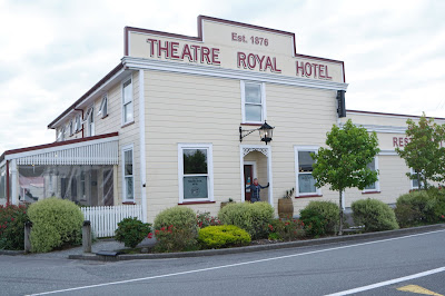
Kumara’s goldrush might have ended in the late 19th century, but on our last night Kumara’s Theatre Royal Hotel was still channeling that vibe. The Wildfood Festival was in full swing, and the hotel’s bar and dining room were heaving. Lynne and I were invited to share a table with some other Aussie cyclists and, getting into the wildfood theme, we ordered the venison. (It was a good choice!)


[Once used for digging gold] 
As we set off in the morning we found more reminders of the goldrush days. Some old mining relics had been set on fence posts along the trail. A short while later we crossed a large suspension bridge over the aptly named Chasm. Beyond the chasm was the rushing blue of the Taramakau River, which we would have to cross on our way to the finish at Greymouth.


[View from Chasm to Taramakau River] 
And now we followed the Greymouth Kumara Tramway, benefitting again from the work of the old miners. Horse drawn trams once carried gold ore along this route to the port in Greymouth. It made for a pleasant gradient, initially through a beautiful patch of dark podocarp forest. To me one of the surprises of the West Coast Wilderness Trail had been the amount of native forest we’d encountered. In so many other parts of New Zealand it is cleared, gone forever.


[Riding a forested section of the Greymouth Kumara Tramway] 
Too soon we broke out of forest and rode into bright sunshine. The trail ran now through farmland – and parallel to the state highway – and we had to farewell the forest for good. We knew we’d soon need to cross both the highway and the river, so we were pleasantly surprised to find a new looping underpass, purpose-built to avoid a potentially dangerous road crossing. The trail then immediately swung onto the bridge across the wide, braided Taramakau.


[Sea wrack on the beach south of Greymouth] 
Our route was flattening out as it ran north along the wild coastline. Occasionally we glimpsed long stretches of shingle beach, storm wrack littering the high tide line. The intense rainfall in the mountains to the east can wash vast amounts of sediment down these rivers and into the Tasman Sea. And with it comes a huge volume of shattered timber from the forests, so much that rivers and beaches here are scoured for useable craft wood. Although we were reeling Greymouth in bit by bit, Lynne and I weren’t ready to finish. So we stretched both time and our legs on the beach, inspecting some of the storm wrack for ourselves. It was staggering to see the size of some tree trunks that had made the journey from hill to river to sea.


[Somehow this tree washed all the way down to this beach] 
It was a Saturday, and the west coast was busy about its weekend business. The salty air mixed with the tang of freshly mown grass as we rode through the increasingly built-up area. The trail itself was busier too, with a mix of day riders and full-trail cyclists. We recognised plenty of the latter, including a group from the North Island. We saw that a pedal had come off one of their bikes, rendering it almost impossible to ride. Ingeniously they’d rigged up a tow-rope, so the rider on the stricken bike could be towed by another bike the final few kilometres into Greymouth, all the while steering and braking as required.

Greymouth looked close now, the cranes and warehouses of the port in plain view. But looks can be deceptive. The trail markers pointed us up the seaward side of the port, only to take us to a dead-end at the southern breakwater. Puzzled, we followed the now-sparse signs nearly 180 degrees back, and then via a strangely convoluted route through the port to the landward side of town. If it had been a hard day’s ride, we might have been bothered by this seeming detour. But today, at the end of 4 great days of riding, it felt like a lap of honour.

As we finally rode up Mawhera Quay, alongside the Grey River, and into the town proper, a quick look around told us we’d finished. All that was left to do was to exchange congratulatory hugs, and find our way to Monteith’s Brewery for the traditional end-of-ride group lunch. And how would we get the 1.5km to the brewery? We’d ride, of course. What’s an extra 1500m between friends.


[The end! photo by Lynne Grant] 
Post Script. The coronavirus “clouds” that had been forming during our trip (early March, 2020), became much more like an imminent storm in the days that followed. We ended up cutting short our New Zealand trip, and flying home to Tasmania while we still could. We hadn’t been back long when we heard the sad and sobering news that New Zealand’s first Covid-19 related death had occurred in Greymouth. The world had changed!

Friday 3 April 2020

The West Coast Wilderness Trail: Day 3

On a clear, blue-skied morning, we travelled east up the road from Hokitika towards the high hills – for the third time. This toing and froing was necessary to get us from Scenic Waterways back to Cowboy Paradise, where we would’ve been staying, had we booked earlier.

We’d had a superb night at Scenic Waterways, so this geographical hiccup had worked out fine. Our bikes appeared to have had a quieter night, and were still leaning where we’d left them on the hitching rail outside the Cowboy Paradise saloon. Without ceremony we donned our helmets, hopped onto our saddles, and cycled off.


[Ready to leave Cowboy Paradise] 
Whenever we’re told “it’s all downhill from here”, we’ve learned to take it with a grain of salt. Someone had said it about today’s ride, but our scepticism proved justified. Certainly we did start with a small descent through rich, dark rainforest. In places tall, thick-trunked rimu overtowered everything. But after we’d crossed the long suspension bridge over the deep, dark slot that held McPherson Creek, we began a steep, winding, leg-burning climb. A couple of times I had to shift down to “granny gear” and pedal furiously. At least the forest held its composure.


[Podocarp Rainforest] 
We’d also been briefed about a couple of fords that we’d meet this morning. Following rain these stream crossings are sometimes impassable, but after the fine weather we’d been having, the worst the fords could do was dampen our shoes as we slooshed across. We continued climbing across a high terrace. We learned later that we were riding along the line of the Great Alpine Fault, a vast zone of collision between the Pacific and Indo-Australian tectonic plates. It’s strange that you can sometimes be in the company of something dramatic; something literally earth shattering; something that’s even visible from space, and yet remain completely unaware of it. Given that the fault’s last major rupture occurred over 300 years ago, we probably didn’t have a lot to worry about. Still, ignorance is bliss.

Less blissful was the continuous uphill gradient, now on a gravel road rather than a narrow track. With hard work and persistence we finally reached Kawhaka Pass, at 317m the highest point of the whole trail. There we caught our breath alongside a handful of other cyclists also pausing at the top. We realised we were seeing a lot more cyclists this morning; many heading in the opposite direction, some with panniers and full overnight touring gear. We learned that these were participants in the biennial Tour Aotearoa Brevet event. This involves cyclists – most of them New Zealanders – riding the entire north-south length of their country over no more than 30 days. To keep from overcrowding, they had been leaving in waves of 100 from the middle of February until early March, and we were now meeting a few ripples from those waves.


[We're all smiles at the top!] 
We chatted with two North Island women who were on the tour. They told us they were expecting their husbands, who’d started riding a week after them, to join them sometime today. We took a photo for them, congratulated them on their guts, and wished them well. As they pedalled off we suddenly felt wimpy comparing our 4 day, 135km tour with their 30 day, 3000km marathon. On the long, steep descent from Kawhaka Pass, we marvelled afresh at the stamina of anyone riding up this climb with fully-laden bikes. What for us was an exhilarating whoosh through sun-dappled forest, would for them have been the struggle of Sisyphus. Before we reached the bottom, we’d passed several cyclists on their way up. Even as they were basting in their own sweat, most still managed a cheerful wave or a “G’day”. You’ve gotta love the Kiwis!


[Enjoying the downhill run] 
One of the other delights of being in remoter parts of New Zealand is the capacity of the locals to surprise you. One such was the hot tea on offer – for a small sum – at the campsite known as Trappers Rest. The host wasn’t at home, but a large tent was set up in a broad clearing next to our cycle trail. Around this was a scattering of camp chairs, and a sign offering camping (with hot shower) and, crucially, hot tea. Atop the almost extinguished fire sat a small urn with just a skerrick of hot water left in it. Not to be denied a cuppa, Lynne refilled the urn and we refreshed the fire. The wait gave us a good excuse to sit a while, and catch up with some of the cyclists we now knew by name.


[Tea break at Trappers Rest]
Our tea downed, we continued onto what we expected would be a straightforward, mostly downhill section. At one point the track met some flood damage, and jagged unexpectedly left to a makeshift bridge across a stream. But confusingly there was also a clear track straight ahead, going sharply up a steep hill. Lynne was in front of me here, and on seeing this, she had accelerated hard to get up the hill. She’d missed a small “private property” sign, so I called out, whistled, and eventually shouted, before she finally heard me. I signalled her back down, pointing to the rather cryptic orange trail marker and the bridge we had to cross.

Once across we stopped to talk to three cyclists we’d met earlier. They were looking quite puzzled, and asked us if we’d seen Cathy, the fourth of their party. We hadn’t, but we conjectured that she might have done the same thing as Lynne, and then kept going. (We later learned that was the case, and that she’d only rejoined her group nearly two hours later via a very convoluted route.) At the time we said we’d keep an eye out for her, and rode off along the track beside a water race.


[Cycling beside the water race] 
The going was now becoming flatter and more open. But we were also growing wearier. I’d been telling myself whenever we came to an uphill section, that my legs were my engine. I simply had to change down a gear or two, and push hard to keep up with Lynne on her e-bike. Perhaps I’d been too convincing, and had been pushing a little hard, because now my legs burned on every slight uphill. When we got to a wide wetland our trail followed a boardwalk. I welcomed the chance to stop and refuel. We even had a chocolate bar.


[Looking across Lake Kapitea to the Southern Alps] 
We were now down in lowland country, though the views across the hydro-electric reservoir, Lake Kapitea, showed us that the Alps were not that far behind us. Eventually, after nearly 35km of riding, we arrived into the town of Kumara, where we would spend the night in the ambiguously named Theatre Royal Hotel. Gladly we didn’t have to put on any performance to get a drink at the bar. After a day that was anything but “all downhill”, we were very glad of that.


[Time for a beer: our hotel in Kumara]