Thursday 11 August 2022

Happy Places 2: Tasmania’s Central Plateau

The Central Plateau has been dubbed ‘the roof of Tasmania’, and ‘the land of a thousand lakes’; which is about as nuanced as calling Australia the ‘wide brown land’. There’s so much more to this wild and high part of our island state. 


It owes a great deal of its identity to dolerite, and to a massive sub-surface upwelling of that igneous rock during the Jurassic age. Almost equally its identity has since been shaped by the ice sheet that covered the surface during a number of glacial phases. That covering was more ‘doona’ than ‘sheet’, as it measured hundreds of metres thick in some parts. As that huge amount of ice, at least 6000 sq km in area, slowly jostled and crunched across the plateau, it carved out lakes – many more than a thousand – and left sharp peaks and dramatic clefts. 


[A special spot on Tasmania's Central Plateau]

 While much of that ice-age drama is over, the Central Plateau remains a vast area of largely wild high country. It’s roughly bounded by Great Lake to the east, the Great Western Tiers to the north, and the Walls of Jerusalem to the west. To the south the boundary is more vague, but perhaps the Lyell Highway marks a convenient edge. As this post is about my ‘happy places’, it’s probably okay to leave the big picture fuzzy, and focus in on the subject at hand. 


So … where on this cold, high, wet and wild plateau are my happy places? I’m particularly thinking of smultronställe, a Swedish word that evokes that sweet, semi-secret favourite place; somewhere that – particularly during these cold months – makes me smile just thinking about it.


[A sweet end to a lakeside night]

 During more than 40 years of walking in Tasmania, I’ve been privileged to walk across the plateau numerous times, from every direction. I’ve written about some earlier walks here Walking With Ada and here No Lack of Lakes  All that plateau wandering makes choosing particular smultronställe as difficult as naming my favourite child. But if I had to pick just three Central Plateau ‘happy places’, they would be (in no particular order):


1.     The Walls of Jerusalem

2.     Mount Rogoona

3.     Un-named Lakes and Pencil Pine Groves


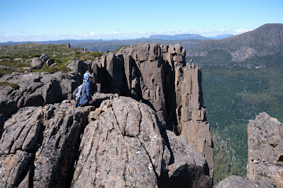
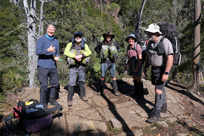
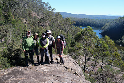
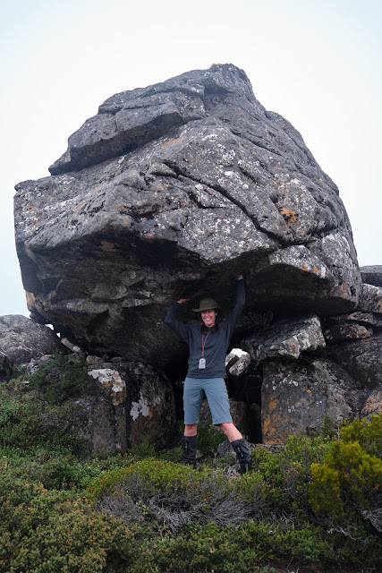
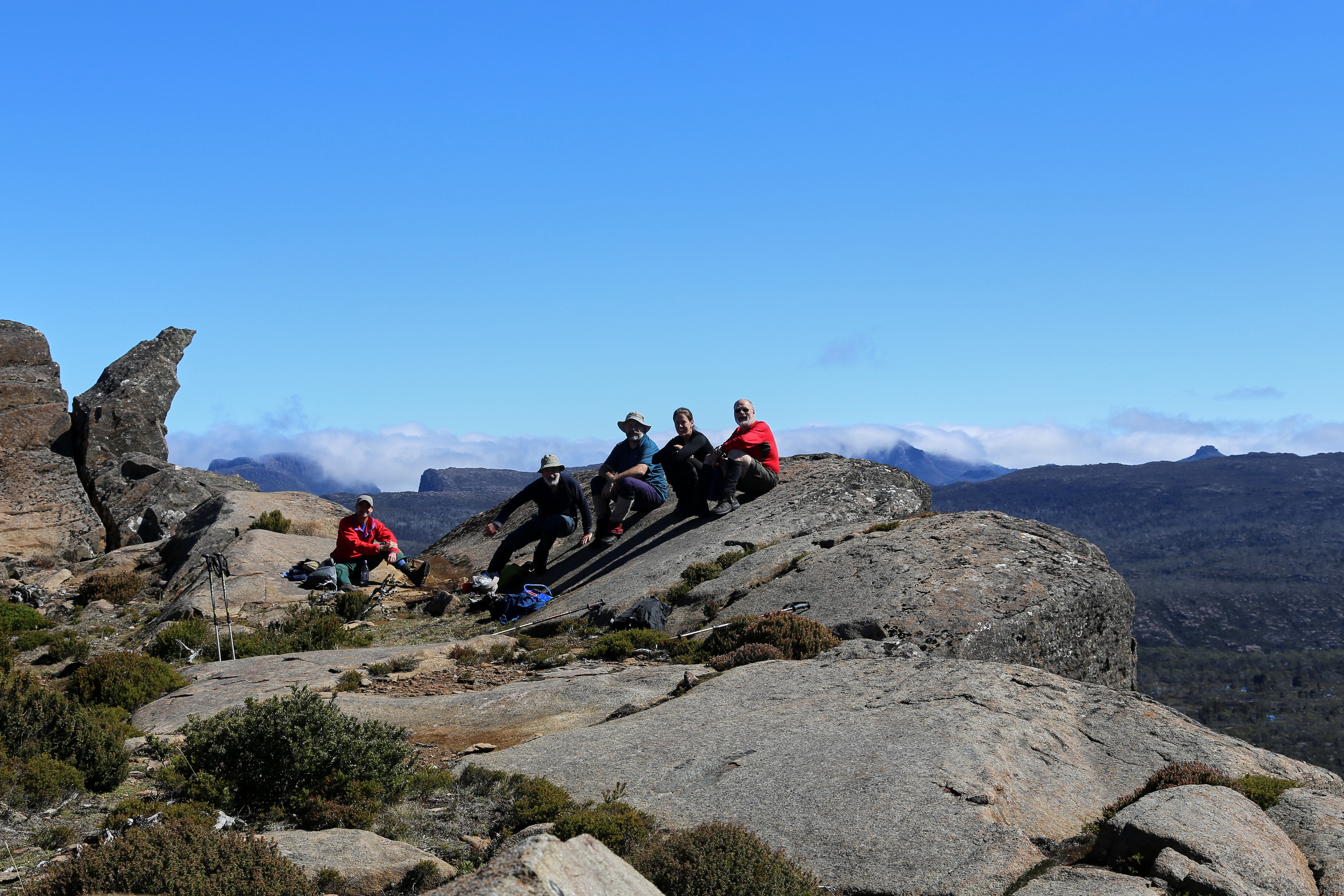
1) Certainly this choice needs some narrowing down, as The Walls of Jerusalem National Park covers 518 square km! Scattered across this mountain-fringed park are some wonderful campsites, both formal and informal; on-track and off-track. And I could have selected any of those. But because mountains are such a feature of The Walls, I’ve chosen Solomons Throne as my Walls of Jerusalem ‘happy place’. 


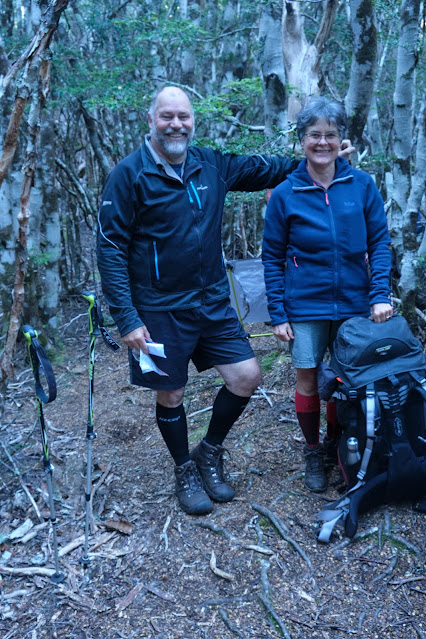
[Friends share special times on Solomons Throne]

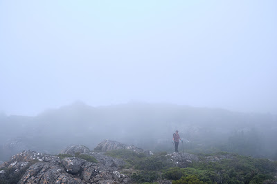
The peak is not the highest in the park, nor is it the most difficult to ascend. What make it sit so sweetly in my memory is a combination of my experiences here, and the superb vistas from the top. I’ve been up there in thick snow, and relished views outward towards a snow-bound Overland Track, and inward to the nearby pine-fringed lakes and vales. I’ve been there with family, introducing them to the wonders of our wilds. I’ve been there with friends (many times); with first-time walkers; and with international visitors who thought Australia didn’t have mountains. While I will certainly tire during the steep climb up a rocky chute to the peak, I will never tire of sitting on the Throne.


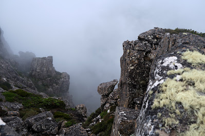
[Looking towards the Overland Track from Solomons Throne ... click to enlarge]


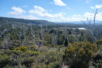
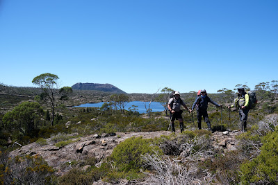
2) The upper Mersey River roughly marks one edge of the Central Plateau. The Mersey Forest Rd also gives good access to one of the sweetest spots on the western side of the plateau: Mount Rogoona. I first heard about this mountain during the 1980s. A group I walked with had been planning a trip there, but a major fire burned out much of the track and surrounding areas, so we walked elsewhere. It wasn’t until nearly 20 years later that I finally reached that peak.


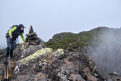
[Mount Rogoona from Lake Myrtle]

And what a peak! It sits, sphinx-like, above the waters of Lake Myrtle, its knobby summit giving way to dolerite cliffs that are like a younger, smaller sibling of the Organ Pipes of kunanyi/Mt Wellington. For most visits to Rogoona, Lake Myrtle is the most convenient camping spot. However direct access to the peak is not easy from the lake. I found this out – in reverse – when a few of us decided to return from the summit direct to the lake. I would not recommend it! Rather the track between Lake Myrtle and Lake Meston leads to an easier slant-wise route to the mountain.


[Summit Views from Mount Rogoona]

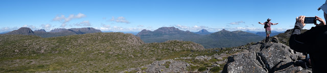
Rogoona is essentially a small plateau whose summit is near the sheer dolerite cliffs on its north-western edge. So the views from the top are as vast as they are stunning. Steeply beneath and quite nearby is the tranquil Lake Myrtle. But your eye soon wanders west beyond the lake, over the nearby Cathedral Plateau, to the highest mountains of Tasmania, from Mt Pelion East to Mt Ossa and numerous others further south. 


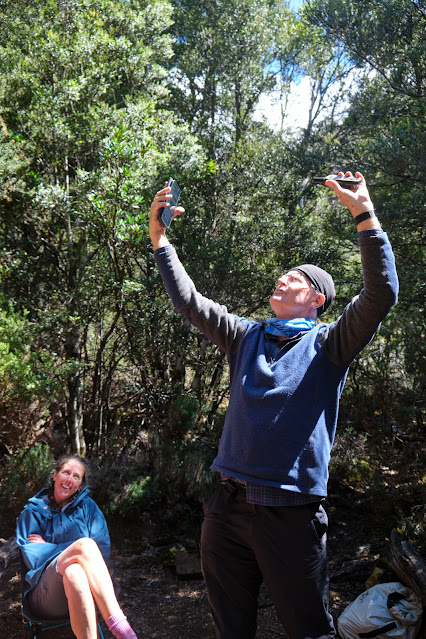
Not once, but twice I’ve had that view ‘interrupted’ by a wedge-tailed eagle flying over. I’ve written in more detail here Eagle, but suffice it to say that being buzzed and eye-balled by the largest raptor in Australia is one of the greatest privileges of being in remote Tasmania. 


[Close encounter with the Rogoona Eagle]

After you’ve had that kind of mind-bending, time-stretching summit visit, there are few better places to sit and contemplate it than by the shores of Lake Myrtle. I’ve written about one particular experience here Myrtle 1, here Myrtle 2, and here Myrtle 3.


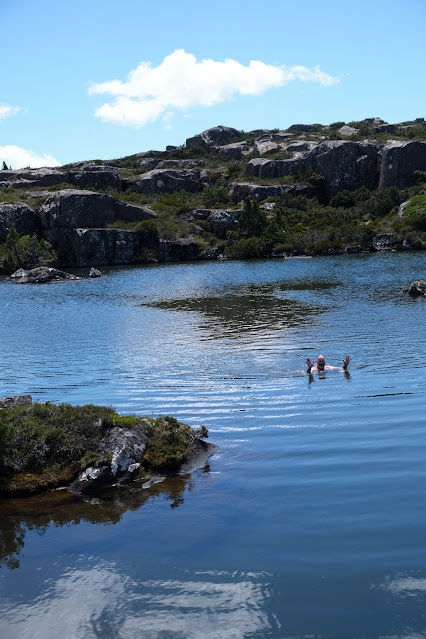
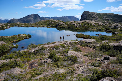
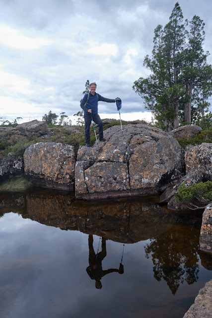
3) If the preceding ‘happy places’ would be easy to locate, the third is deliberately vague. Un-named Lakes and Pencil Pine Groves is a category of smultronställe that invites you to do your own explorations; make your own discoveries. And there could be few better places to wander in search of lakes and pencil pine groves than the Central Plateau. 


I once started the eye-watering job of trying to count the number of lakes just on the 1:25 000 Ada map. I gave up after counting 350 in one typical 10 sq km strip. Given there were 19 such strips still to count, it’d be fair to estimate between 5 000 and 7 000 lakes on the Ada map alone.


[So many lakes! A small part of the Central Plateau]


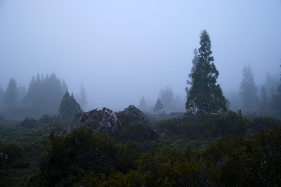
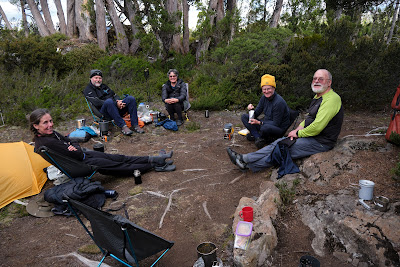
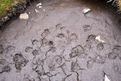
Obviously the number of lakes alone makes searching the plateau for sweet spots a lifelong task. But once the search begins, it becomes more subtle than you’d think. Lakes mean water, and many lakes mean a lot of water. That in turn means often waterlogged ground, and camping in such places isn’t much fun – not to mention the impacts it can have on that environment. In my Central Plateau wanderings I’ve seen many spots that looked great from a distance, but turned out to be unsuitably sodden once you got there and looked for tent spots. 


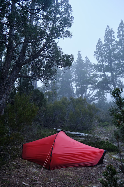
Happy Place searchers also have to consider another weather factor apart from precipitation, and that’s wind. The often fierce winds here further narrow your camping options. What may be a perfect site on a calm night can turn perilous when the wind gets up. Shelter is paramount, which is why pencil pines are often your friend. But there are complications here too. Many pencil pine groves are so dense that there’s no room for tents. And if there is room, the ground is often covered in dense, soggy sphagnum and/or gnarled tree roots. 


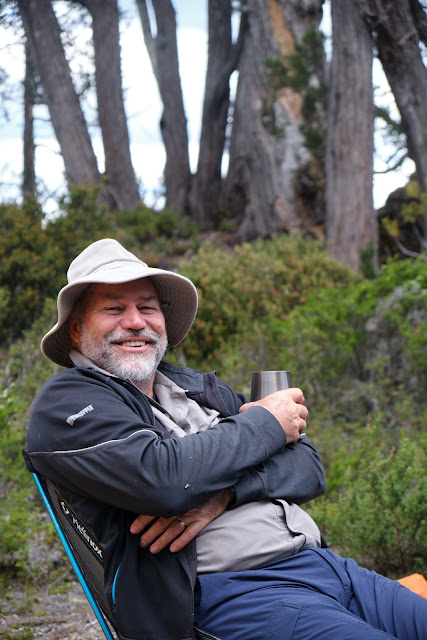
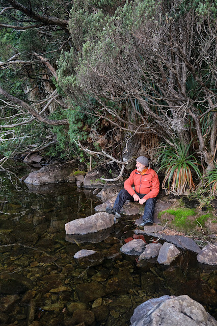
[Boots off and relaxing at a secret campsite]

 So … have I found some ‘Goldilocks Zone’ campsites on the Central Plateau? Of course I have. And I’ve spent some of my most blissful days and nights between a lake and some pencil pines. Am I going to share their locations here? Sorry, I’m not. What I can say is that if you haven’t searched for your own version, then you have a baffling, frustrating, but ultimately sublime quest ahead of you. If you have found such sites - or you recognise some of the ones pictured - I’d suggest you share that information sparingly. Let others have the thrill of the quest. Some places just shouldn’t be on Instagram.


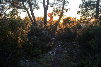
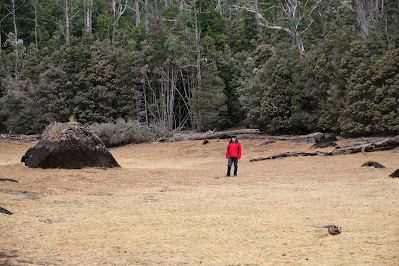
[Does wild camping come any better than this?]

Tuesday 2 August 2022

Happy Places 1: Smultronställe

In the (relatively shallow) depths of a Tasmanian winter, I find myself daydreaming of other places and other seasons. Take Sweden in summer as an example. Why Sweden for goodness sake? (you may ask.) Haven’t you watched enough Scandi noir to know Sweden is a place of constant snow, rain and grey weather, all bundled up in a flat and dreary landscape?

My simple answer is this. Before you judge it, spend one week of summer in Sweden. That is unless you object to VERY long, mild days, beautiful forests, meadows full of wildflowers, and stunningly intricate waterscapes of lakes and sea. And that’s not to mention the Swedes themselves, who in summer throw off their Scandi gloom, and become all frisky and fun-loving.


Take, for instance, one of their linguistic delights: the Swedish word smultronställe. It literally translates “place of wild strawberries”, but is most often used metaphorically to mean a semi-secret favourite place; a place that makes you happy. English phrases like “sweet spot” or “happy place” feel linguistically pale in comparison. If you've eaten wild strawberries, you'd surely agree. Smultronställe is a word forged from dark winters, scarce sun, and the utter delight at the sweet return of light and flavour. 


So it’s not unusual in Sweden to be asked for your smultronställe. What is your special place in the outdoors? It’s a question that resonates very much with me in relation to bushwalking in Tasmania. I’m often asked, especially by those who are not bushwalkers, or by people from other parts of Australia or the world, what my favourite bushwalking spots are. My plan for what remains of winter is to write about some of these in a series of blog posts; to share a bit of my daydreaming about places I'd rather be. However I should warn – and it’s probably in the spirit of smultronställe – that my posts might be a little geographically vague. If places are semi-secret, maybe it’s best that people discover their sweetness for themselves.


But before I start on my Tasmanian smultronställe, it’s only fair that I mention at least one favourite Swedish place. And that is Ängsö National Park, on the eastern coast of Sweden, about an hour’s drive north-east of Stockholm. I’ll let these images be a little taster of this beautiful place, and a reminder of all that was sweet – and accessible – before the pandemic. Let’s hope that such places will be within safe reach again in the future.


[Scenes from Ängsö National Park, Sweden]

Wednesday 9 March 2022

Cathedral Plateau 3: Highs and Lows

The bright early evening leaked its light slowly. It was that time of day when the world holds its breath, and anything seems possible. And sure enough Tim D went full Shackleton on us, trying to talk TimO into climbing all the way up to the plateau’s edge to watch the sunset. 


[Ernest Shackleton's supposed newspaper ad. for his Antarctic expedition]

TimO is always up for a challenge, but he was also a very tired boy. I stepped in, taking on the (mock) role of his coach/manager – dreadful Michael Caine accent and all – insisting that ‘my boy ‘ere’ would need more than ‘some dubious promise of a flash of sun, followed by an uncertain return, fully in the dark’. Surprisingly TimO followed his manager’s advice, settling instead for Tim D’s tamer challenge: a game of Yaniv. It was a card game TimO knew nothing about, so he clearly still needed his ‘manager’ (who also knew nothing about the game; didn’t want to try it; and would retire to his tent mid-game). To cut a long story short, TimO lost the game gloriously – and noisily – despite his manager shouting from his tent such timeless encouragement as: ‘Go hard son’ … ‘Give it 110%’ and ‘Go up the guts!’. Yet even after the heavy loss, TimO had to admit it beat a stumbling return through scoparia in the dark!


[A Misty Morning at Tent tarn] 

The morning was quieter, a soft, dwindling mist dampening sound and tent alike. We had a less ambitious day planned, with the ascent of Cathedral Mountain itself the first agenda item. This was even via a marked route, with rock cairns making it hard to miss. This beaten-path look was new to those of us who’d been here many times before. My guess would be that it was down to Cathedral’s status as an ‘Abel’, a label that somehow makes one mountain a more desirable goal than a perfectly beautiful nearby one that doesn’t qualify for that designation.


[Jim ascends from Tent Tarn]

Before we’d ascended far it became clear that Jim wouldn’t be going any further than the first summit. He was again struggling with dizziness and a lack of energy. Today that wouldn’t be a problem, as he could station himself on Cathedral and return to camp safely whenever he liked. So while the rest of us walked beyond the peak, down to the plateau’s edge, he luxuriated in a patch of sun that also had mobile reception. Only a hut would have improved how well this suited him. 


[A Panorama from the Plateau's Edge]

The sky had cleared as expected, and by the time we reached the cliff line, the day was a stunner. The views were even better, with every Overland Track mountain from Olympus in the south, to Cradle in the north, clearly visible. We could even make out a distant Frenchmans Cap. These are views that never pall, and we feasted on them for a long time before deciding that a swim in one of the rim pools further along the edge would make a great day even better.


[Looking towards Mt Ossa and the Pelions]


[TimO at the Edge of Cathedral Plateau]

We were spoiled for choice, walking past several lovely looking pools – none of them named – before finding one that had an accessible island and a rock shelf from which we could swim before lunch. I’ve swum in the highlands of Tasmania many times, and it’s rare for the water to be either warm or inviting. Today it was both, and we all plunged in, the Tims choosing to do laps. TimO, despite his delicate Irish complexion, even spread himself on a rock for a micro-sunbake. And from high above we noticed Jim still up on Cathedral, occasionally waving, and (we would learn later) taking distant paparazzi-style pictures of us. 


[Tim D swims in the unnamed pool]

We finished our pool-side stop with a relaxed lunch, and all agreed this had been a rare and sublime episode in an already wonderful day. What could top this, we wondered, as we wandered slowly past a few more pools and then down a ridge towards our home tarn? What happened towards the end of that return didn’t exactly top the rest of the day. But it certainly added an exclamation mark to it!


[What could beat this rim pool scene on Cathedral?]

Our descent was off-track, and mostly through light scrub. This sometimes required us to pick the path of least resistance, so we’d spread out a little by the time we were closing in on Tent Tarn. Tim D, Libby and I had chosen a line down one side of a small scrubby creek, while TimO and Merran were on the other side. Tim D suddenly stopped, and called out “Ooh, a big one!” We knew he was referring to a tiger snake, so Libby and I stopped to see what we should do next. 


Tim D cautiously walked to the far side of the bush into which the snake had disappeared. Completely without warning the 5 foot long snake darted out of the bush at full speed, straight towards Libby and me. I let out a sharp expletive and rushed to escape in the opposite direction. Instead I stumbled over my trekking pole, falling heavily on my arm. What?! On the ground with a tiger snake just metres away from me?! In complete panic I struggled back to my feet, only to fall again, expecting the snake to be right there where I’d fallen. My heart racing, I eventually scrambled back to my feet to find Libby still standing where I’d last seen her, and Tim D coming cautiously towards us.


Apparently the snake, spooked by Tim’s footsteps, had turned to escape from him only to hear/see another walker (me) crashing to the ground in front of it. The snake had then slipped straight by Libby’s boots as she stood still, “like a rock, like a tree”, as she later told us. Fortunately for me, my attempted escape had been both noisy and diagonal, and the snake had made for the scrub elsewhere. We all stood there for some time, adrenaline pulsing through our bodies, before quietly and cautiously resuming our walk back to camp. We had quite a story to tell!


[My bruised upper arm - photos by Jim Wilson]


[Snake Bite? No, but enough for Jim to beat up a story.]  

What really happened here? I’ve replayed the incident in my mind many times. I am not fearful of snakes. I admire them, and have a healthy respect for them. I would see a couple of snakes every summer when I’m out bush, and have never had an ‘adverse’ encounter with one. But all I can say is that, given this situation 100 times over – a snake coming full pelt, straight at me from 2-3 metres away – I would react exactly the same. Why? Because my reaction to the threat was involuntary, involving my sypathetic nervous system. This is often given the shorthand of “fight, flight or freeze”. Obviously my reaction, “flight”, might not have been wise. All I can say is that it was completely instinctive.


But why was Libby’s reaction so different? She explained to us that she heard the voice of her grandfather, who had experience in handling snakes. If one threatens you, he’d advised her, “be a rock, be a tree”. This sounds like a conscious choice, rather than a “freeze” response, as mentioned above. I can only say I’m astonished by her reaction, which was both wise and effective. In my own case, I’d have to say that my conscious mind was not in play in my own initial response. 


As we told the others our story back at the campsite, we again showed our different emotional reactions to the adrenaline that was still coursing through our systems. I gabbled out loud, retelling the story over and over, while Libby had a quieter emotional moment. Over dinner we continued to reflect on a day of amazing highs and literal lows (for me at least), before Tim D brought out some port to settle us for the evening. 


[Another Misty Start at Tent Tarn]

The next morning, our last, saw us up very early. Our plan was for most of us to walk all the way out in time for a latish lunch at the Mole Creek pub. Libby was staying one more night, taking advantage of the great weather and the chance of a bit of solitude. It was misty again, and our tents were wet. But with no time to dry them, we simply bundled them away. In theory last day packs are lighter, but ours were wetter and lumpier. Finesse isn’t always a priority when you need to get walking by 7am.


[Tim and Merran's Tent Fly shaken in the sunrise] 

As we waved Libby farewell, the mist was already lifting, and the views we soon had over Chalice Lake were a sparkling delight. The (theoretically) lighter packs and the gently downhill track made everything feel easier. That was until the very steep descent to the Grail Falls campsite, and the similarly steep ascent out of that valley. Steeply down became the theme thereafter. And if anyone thinks that’s always good news, they haven’t tried a rapid descent at this gradient, with a full pack and ageing knees. 


[Farewell to Chalice Lake]

It was an enormous relief to finally break out at the carpark. It was hot, and we were exhausted and thirsty. But if we felt a little sorry for ourselves, we were sorrier for the two walkers we met at the carpark. They were about to walk in the way we’d just walked out. It was just after 1pm, and they had their sights set on reaching Tent Tarn that afternoon. We wished them well, before getting changed into street clothes and driving out to Mole Creek.


Alas our vision of a luxurious hot counter meal and a cold beer was dashed. We arrived just 10 minutes after the kitchen had closed. There was nothing for it but to enjoy that cold beer with a pie from the bain-marie. Somehow though, after five days of bushwalking food, that managed to seem enough of a feast. I certainly wouldn't count it as a low, not when compared with falling down in the path of terrified/irate snake! 

Monday 28 February 2022

Cathedral Plateau 2: Higher Thoughts

Q: When is a blue sky not blue? A: When you’re deep in the shade of a forested valley, head down, scrambling to get ready while most others are impatient to leave. The first time I lifted my eyes that morning was when Tim D informed us it was sunny, and would soon be warm. And sure enough, above the thickly tangled myrtle branches, I found that the sky was indeed blue.


[Are You Ready Yet?] 

The climb out of the Chapter Lake/Grail Falls valley onto the Cathedral Plateau was hardly less steep than if we’d clambered up the falls themselves, though at least we weren’t contending with falling water. It was a full body work out: hands, arms, legs, lungs, heart and mind all toiling to haul us, full packs and all, onto the plateau. But the exertions were over soon enough, and we took a welcome breather on the rock shelf above the falls enjoying the commanding view over Chapter Lake. And yes, it was sunny and warm.


[Above Grail Falls and Chapter Lake]

We still had some work to do, pushing through, up and around the persistent rocky scrub beside Moses Creek. Beyond that we got our first glimpses of a glittering Chalice Lake, a sign we’d arrived on the Cathedral Plateau proper. Perhaps my brain was overheated from the climb, but as I surveyed this many-armed lake, I imagined it as some vast aquatic creature, its tentacles reaching out to harvest the water from higher ground surrounding it. 


We paused for a water and scroggin near the end of the lake, recalling that we’d once camped here. Back then it was a necessary compromise camp site; today its soggy, open, unshaded nature held little appeal. Besides it was only 11am, and the pencil pine forests of Tent Tarn were calling. 


[Above Chalice Lake, Mt Rogoona in background]

After a little more climbing we arrived at that much smaller and shallower lake. Before choosing our tent sites, a few of us wandered around the perimeter of the lake, seeing if there was a better camping place. Half an hour later we returned to our original place among the pencil pines, convinced that after all this was the perfect place to base ourselves for the next few days and nights.


By the time we’d set up our tents and gathered water, it was still early in the afternoon. But few of us had the appetite for anything more strenuous than a local wander. Some tried out reflection photography around the shores of the tarn; others washed the sweat of the day from their bodies. 


[TimO reflected in Tent Tarn]

And then it was time to relax, have a brew, and ponder some interesting questions together. Why, for instance, were the pencil pines here so prolific? And why were so few of them burned in comparison with nearby places like The Walls of Jerusalem and the Central Plateau? It occurred to me that this cliff-guarded plateau had probably never seen cattle or other hard hooved animals, and therefore the kind of human-initiated burning that historically went with that activity. Certainly we couldn’t think of any accessible way to bring stock up here, making it a kind of land-that-time-forgot. After a good social time over dinner, we dispersed to our tents for an early night. 


[Relaxing at Tent Tarn]

We woke to find a thick mist smothering the plateau. We judged that it would burn off soon enough, so we carried on with our plan to climb Bishop Peak, one of the prominent peaks on the plateau’s western edge. As our route was off-track, the mist wasn’t going to hide any track markers. Besides we had confidence in Tim D’s navigation skills. Before we reached the edge we paused at a strange rock formation, which Tim’s device said was Bishops Mitre. The somewhat curved pyramidal rock looked more like a troll’s head than a bishop’s ceremonial hat, but who were we to criticize an explorer’s fevered imaginings? We paused for the obligatory silly photos before pushing on to the 1378m Bishop Peak. 


[Merran in the Mist near Bishop Peak]
[Libby obliges at Bishops Mitre]

Our hoped-for lift hadn’t arrived, so the views were misty, mystical even, as swirling cloud hit the plateau’s edge, obscuring the abyssal 800m plunge to the Mersey River which flowed between us and the Overland Track. Not to be put off we meandered north-east, a little back from the edge, towards a small tarn. From there we aimed for Curate Bluff. Appropriately less grand than the Bishop, and 100m lower in altitude, it still promised a grand view, especially as the clouds were now beginning to thin.


[Jim peers into the misty void from Bishop Peak]
[Evidence of a wombat dance party near the unnamed tarn?]

But first we had to wade through some scoparia, never much fun. That done, we scrambled to the top and were rewarded with broad views over the whole range of mountains along the Overland Track. Somewhere north of Pelion I knew my son Stuart was out running as a “sweeper” in the Cradle Mountain Run, a trail running event that sees its leading runners complete the whole 80km Overland Track in less than 8 hours. Stuart’s job was to escort tardy or injured runners back from New Pelion Hut to an early exit via the Arm River.


Closer to home, I soon realized I’d be performing a similar role. Tim D planned to continue on to Vicar Bluff and then Dean Bluff, and had given us an estimate that would have seen us back at Tent Tarn quite late. Jim, already low on energy, wasn’t as keen as the others to do that, so I agreed to join him in returning to home base. For a while the two of us watched as the others receded to ant-like proportions on their scrubby meander towards the distant goal. And then we turned and did our own bit of off-track wandering, up, along, and then steeply down to Tent Tarn.


[The water supply replenished]

By the time we’d pushed our way through the scratchy scrub that eventually gave way to our campsite, we were hot and sweaty. Water collection and a wash were the first order of business, followed by a welcome sit down and a brew. We’d only been sitting for a hour or so when we were surprised to hear coo-eees from the slopes above us. We could just make out Libby waving both arms from a far rock clearing. We were amazed they’d made such good time, although we (rightly) estimated they’d still take another half an hour to get down.


It seems Tim D had overestimated how long the return trudge to Deans Bluff would take. Regardless the four returnees all agreed on two things. Firstly that the views from the bluff had been stunning; and secondly that they were knackered. Merran demonstrated this by having a quiet snooze in her Helinox chair shortly afterwards. 


[Tim D in relaxation mode at Tent Tarn]

While she dreamed, I brought up with the others something I’d long wondered about Tent Tarn. Why, in a place where almost every name has an ecclesiastical connotation, had this tarn ended up with such a plain-Jane name? Was it simply a pragmatic name: this is a tarn where tents can be put up with some shelter? That made some sense, but I put forward a slightly more theological thought. 


The Old Testament tells us that prior to the temple being built in Jerusalem, the Israelites carried a portable tent known as the tabernacle. This symbolised the presence of God, and provided a place of meeting and worship. Was it possible some Bible savvy place-namer had slipped in this obscure reference as a kind of curve-ball name to (almost) go along with the more obvious church-based names? The others were doubtful about that. If that was their intention, why not name it Tabernacle Tarn? Even then, Tim D pointed out, that would make it an Old Testament name, when all the others – Cathedral, Bishop, Dean, Spires, Chalice, Chapter, Cloister, Grail etc – were New Testament or mediaeval names.


I had to concede that he had a point. After a bit more banter we all eventually retired to our tents. But my mind wasn’t done for the day. It began spiralling beyond nomenclature to higher thoughts. A cathedral, I guess, was supposed to be major centre of worship, a place to inspire both awe and worshipful devotion. 


[Awe seems an appropriate response to scenes like this at Bishop Peak]

But before Cathedrals, before even churches or temples, there had been that simple tent. And as I settled into my own modern version of one, I realised that grand architecture wasn’t necessary for us to experience awe, or to be worshipful. Here, in this sublime place, surrounded by favourite trees, and favourite people, awe and worship seemed a natural response.

Wednesday 16 February 2022

Cathedral Plateau: Part 1

As you traverse Tasmania’s Overland Track, a walk so renowned for mountains, few peaks are as constant and commanding as Cathedral Mountain. Throughout the middle days of the walk the 1400m mountain variously lurks, looms and towers to the eastern side of the track, its 800m buttresses as much gothic fortress as cathedral. Yet despite this prominence, Cathedral is one mountain that Overland Track walkers never summit. It’s not that it’s all that difficult to climb, but if you were trying it from the Overland Track, any stage Irishman would tell you “I wouldn’t be startin’ from here!


[Cathedral Mountain from the Overland Track, near Kia Ora]

Rather than a single peak to be “bagged”, Cathedral is actually a substantial plateau, and one to be savoured. It’s almost unique in the highlands of Tasmania, being a virtual mountain/island, with steep access on all sides. (Only the Ben Lomond plateau compares.) Like some vast dolerite cake, albeit one that’s collapsed towards its eastern edge, Cathedral's cliffs guard it against casual tasters.


With this in mind, a group of us planned to spend five days exploring the plateau, coming at it from the more accessible north-eastern route. Once that was settled, organising it should have been easy, but for one word: pandemic. In the lead up to the February walk Covid hovered over the party, eventually hitting one of our group. Fortunately Libby’s case was mild, and her recovery swift enough for her to join us on the walk, though not without a warning us that she might be slow. That suited the rest of us, who already ceded her about as many years in age as we did kilograms in weight. 


Most of us had been to Cathedral before, though not in ideal conditions. There’s more of that story starting here But crucially TimO had never been there, and his strong inclination to always explore new places made this a must-do. Another plus was the large high pressure system that looked like floating over us for most of the walk, promising perfect plateau wandering weather.


The four of us from the south first spent a relaxing night at Tim D and Merran’s cottage in Sheffield, getting fuelled up on Tim’s famous homemade pizzas. The next morning we started out fresh and early, as there was no disguising that we had some hard work ahead of us. The walk starts at around 600m altitude, and our first camp, at Grail Falls, is around 1000m. At least the weather was cool, with a solid cloud cover yielding occasional drizzle. We hoped this was just the tail of a cold front, and that it would soon give way to that promised high.


[Jim, Tim and Libby ascend through myrtle forest]

The walk started in a scrubby, weed-infested former logging coupe. Jim added some ‘colour’ by sharing an ear-worm with us. It was an old Marty Robbins song, but the only words he knew were part of the chorus: “cool, clear water.” Even that he managed to misquote, adding a jovial note to our climb. Soon we were walking through more pleasant sclerophyll forest, the drizzle persisting, but not enough for rainjackets. As we gained altitude the colours changed from the grey green of eucalypts to the deep green of myrtle rainforest. Our lunch stop was supposed to be at a small tarn we’d visited before. But if we’d been hoping to top up our water, we were in for a disappointment. The ‘tarn’, empty of water, was instead a large grassy bowl. Still, this “disappearing tarn” was a welcome stop after the steepish climb.


[Jim confirms the tarn is dry]

Following the break it was a pleasant surprise to soon find ourselves descending towards Chapter Lake and Grail Falls. We’d have been even more delighted had the route been a little less knee-jarring. “Just think, we’ve gotta come back up this!” Jim moaned, and we all filed that away in the “worry about that later” box.


Once we’d set up tents in the stunted myrtles near Grail Falls, TimO started grappling with Tim D’s inReach satellite phone. As Tim and Merran D. would be coming in late, after their work day, they’d suggested we use their sat. phone to send a message about where we’d stopped for the night. We had dobbed TimO in for that job, though using it proved easier said than done. The rest of us had a little mirth at TimO’s expense as he tried to work out the cryptic menu system. “You had ONE JOB Tim!” we called out encouragingly as he fruitlessly pointed the device towards the heavens. 


[TimO tries to get the satellite phone to connect]

The next surprise was our consensus that a little tent-bound nap would go down well. This seemed fair enough for Libby, who was only just back into exercising after Covid. For the rest of us, our justification was that there was no point in eating dinner too early, as Tim and Merran were probably coming in late (though, as we reminded TimO, he hadn’t had any inReach confirmation of this). Also the drizzle was now verging on rain. On the personal level, I realised that for the last few weeks I’d had background anxiety in organising this trip, especially in relation to Covid. But now my whole being was beginning to relax into this wonderfully peaceful place. 


Next thing I knew an hour had passed, and Jim was calling us out of our tents for pre-dinner nibbles.  Despite our best intentions, pre-dinner soon became dinner, and we would have been ready for bed by 6:30 if we hadn’t decided to explore the nearby lake and falls. We had never seen the falls this dry, with only a small flow tumbling over the precipice. On our last visit the falls were thundering, making conversation difficult.


[Libby at the base of Grail Falls]


[On the shores of Chapter Lake]

After our wander we started a ‘book’ on when we reckoned the other two would arrive, chivvying TimO from time to time to see if he’d got a reply to his inReach message yet. He kept muttering in the negative, and gradually, one by one, our guessed times passed. Eventually, around 8:30, we decided we may as well give up and go to our tents. We’d let them rouse us when they got here, if that transpired.


[Tim and Merran arrive early the next morning]

As it turned out, that ‘rousing’ didn’t happen until just after 7 the next morning, when Tim and Merran walked into camp before we’d even got up. Their story tumbled out over breakfast. The short of it was that they’d been delayed, and had decided to camp part way in rather than trying to get up here in the dark. We were glad to have the six of us together, without too much drama, ready to walk up to the plateau proper. And as for their reply to TimO’s inReach message, it had apparently gone astray. It seemed it was through no fault of TimO – though that didn’t stop us gently ribbing him about it for the next day or two.