Tuesday 22 April 2014

From City to Summit 1: Planning a Pilgrimage

It’s raining at home. Where the mountain should be there’s a ragged cloud, a dishevelled doona pulled up around a chilly summit. Perversely, it has me thinking about walking. Mountains always do that, even when they’re trying to sleep.


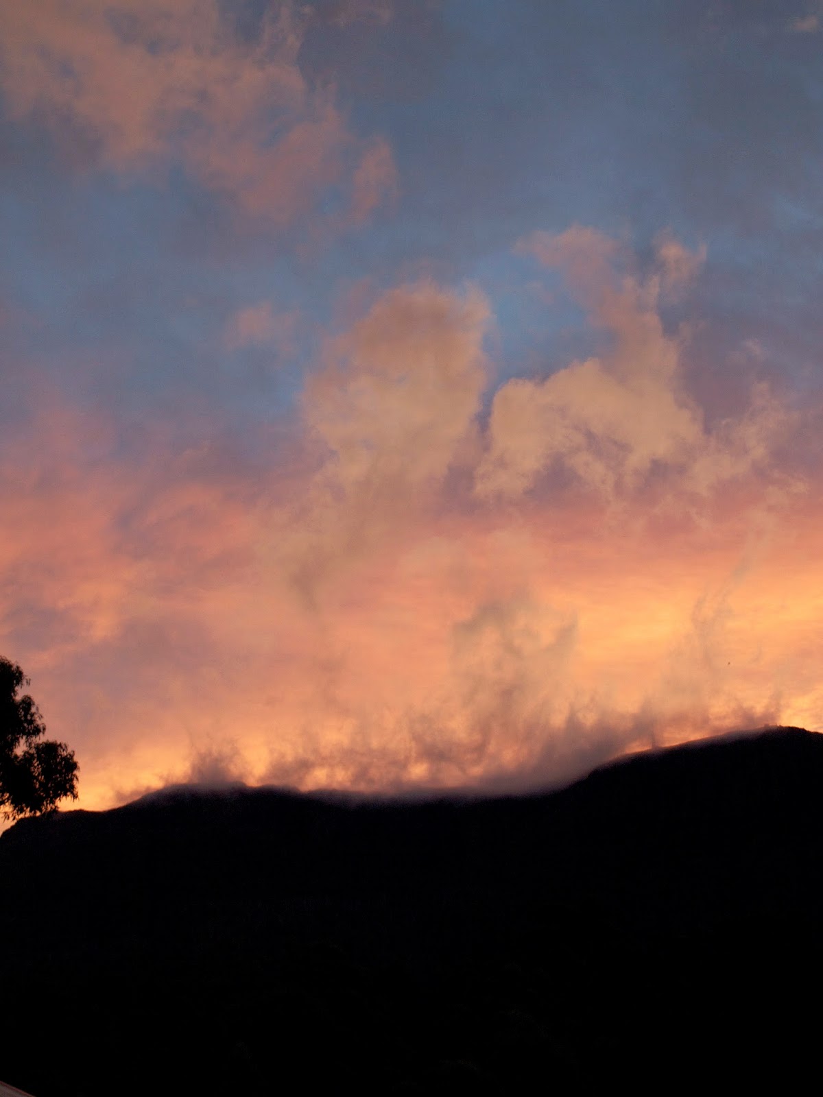
[Sunset over the Mountain] 
But today I’m also thinking about history, and Hobart’s history in particular, because kunanyi/Mt Wellington plays a big part in that. After a short-lived and fraught experiment on the eastern shore of the Derwent River, Hobart was founded in 1804 on the opposite shore, near its current town centre. Water reliability was the principal reason for that early move. And that in turn was encouraged by the regularity of the rain – and sometimes snow – that fall on the flanks of the mountain.


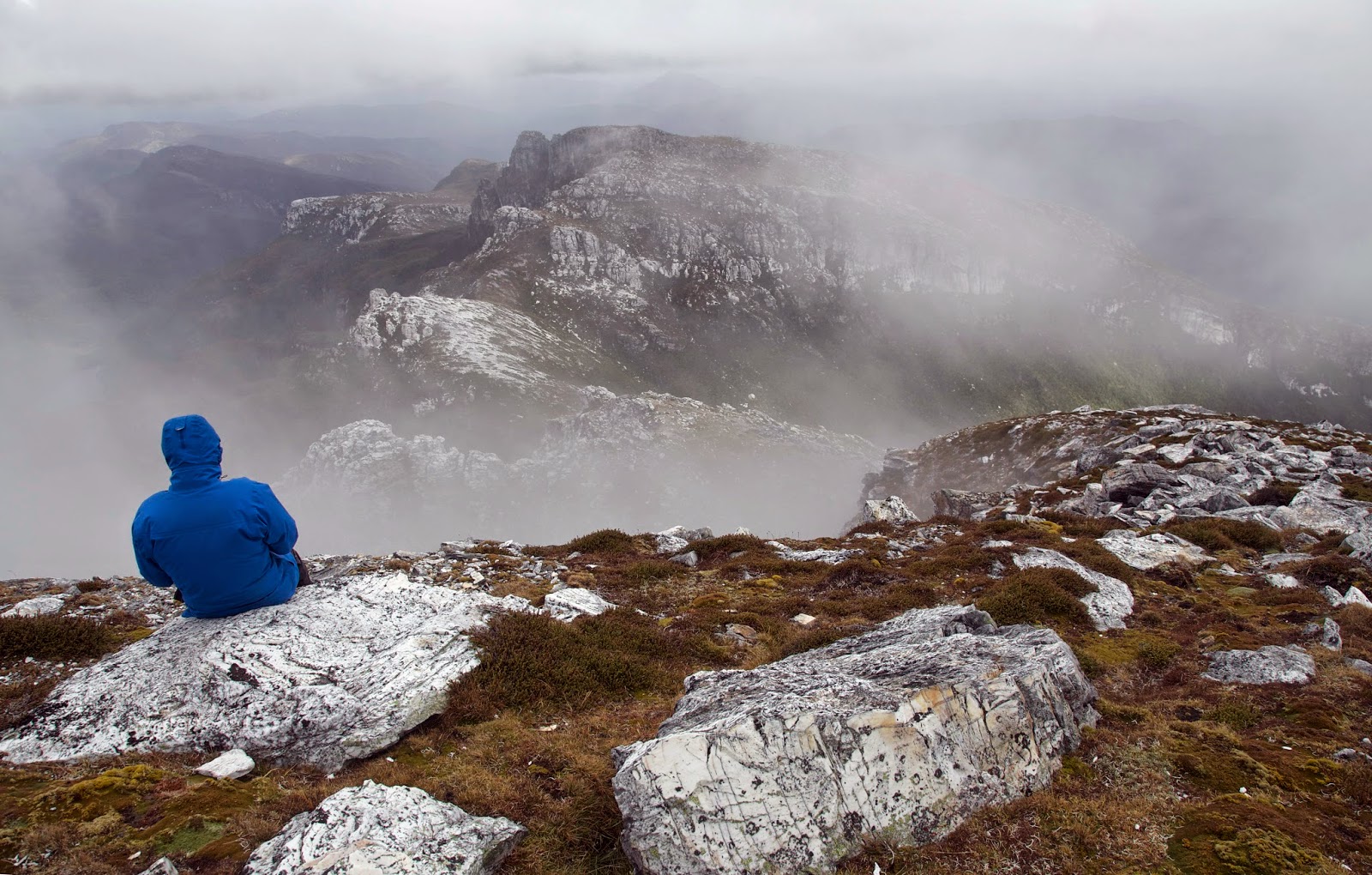
[Wild and well-watered: the top of kunanyi/Mt Wellington] 

A good proportion of what falls there ends up in the Hobart Rivulet. At less than 10km it is too short to be called a river. Still it proved a reliable and constant source of fresh water for the port of Hobartown. In my 28 years living alongside it I have never known it to stop flowing.


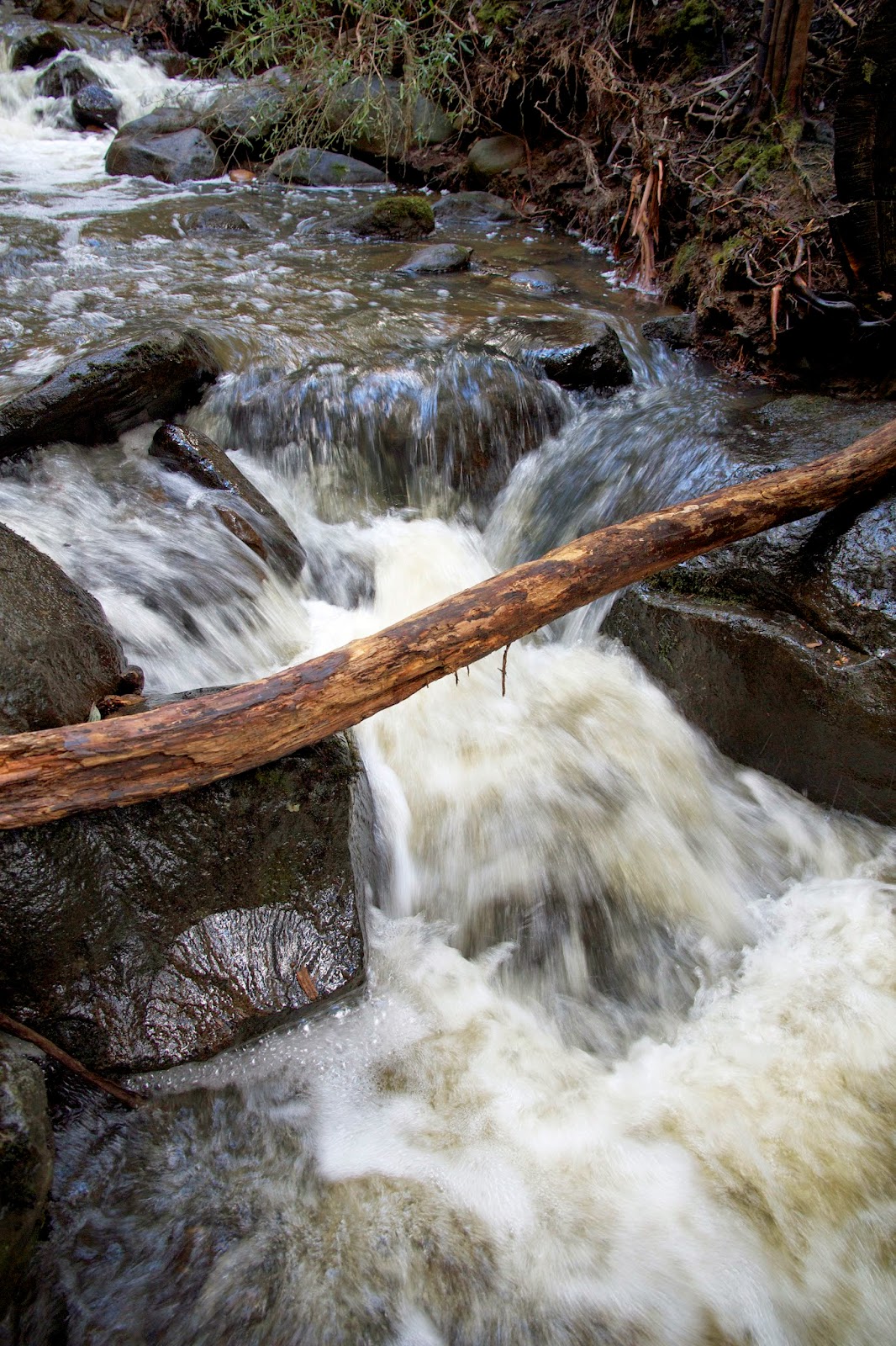
[Hobart Rivulet in its untamed state]
‘Though its lower reaches are now piped and tunnelled, and outflows from stormwater drains, factories and the city’s tip mingle with mountain-fresh water, the Rivulet’s upper waters are still used in Hobart’s renowned Cascade beverages. “Out of the wilderness” its beer advertisements once spruiked. We locals smiled at the exaggeration, yet were still proud of our city’s proximity to relatively wild places. How many other capital cities have ready access to such wildness?

Most work days I walk down that valley, close by the rivulet, “out of the wilderness” and into the city. Truth be told, I often yearn to be going the other way, towards the wild. So one day I decide to do just that. I will start from the comforts of a favourite 
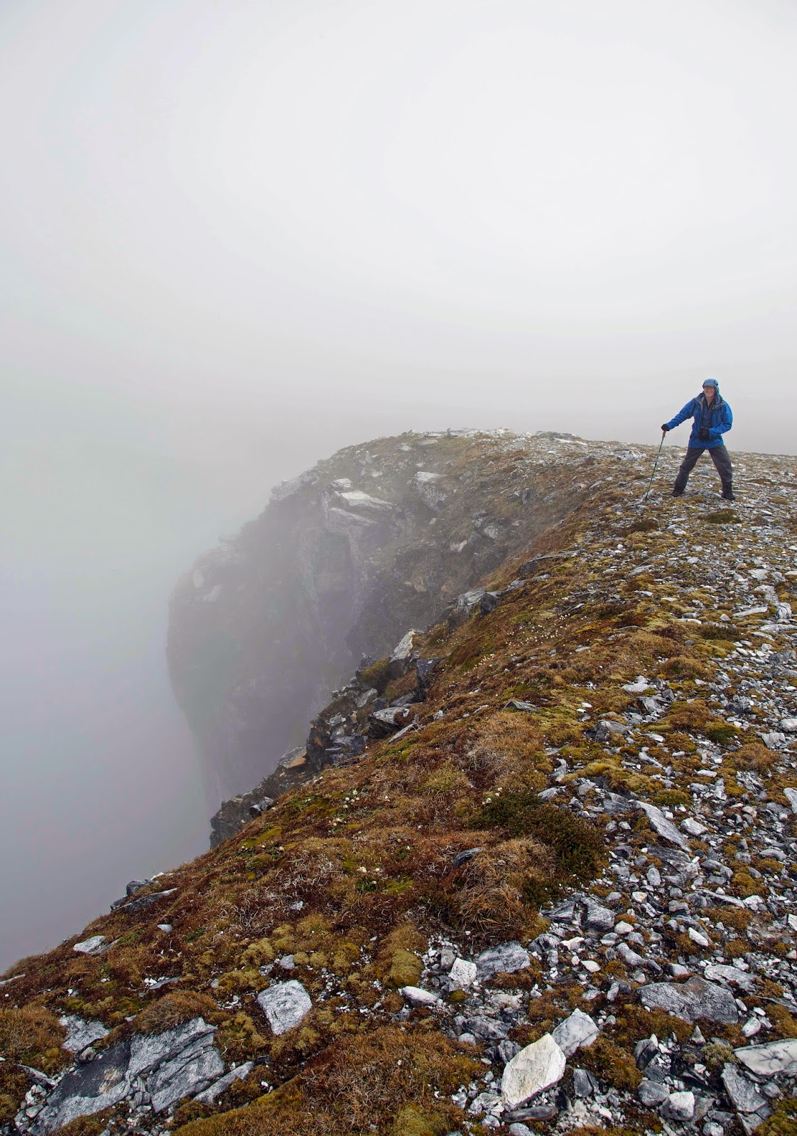
Hobart café, and walk upstream to kunanyi’s windswept 1271m summit.


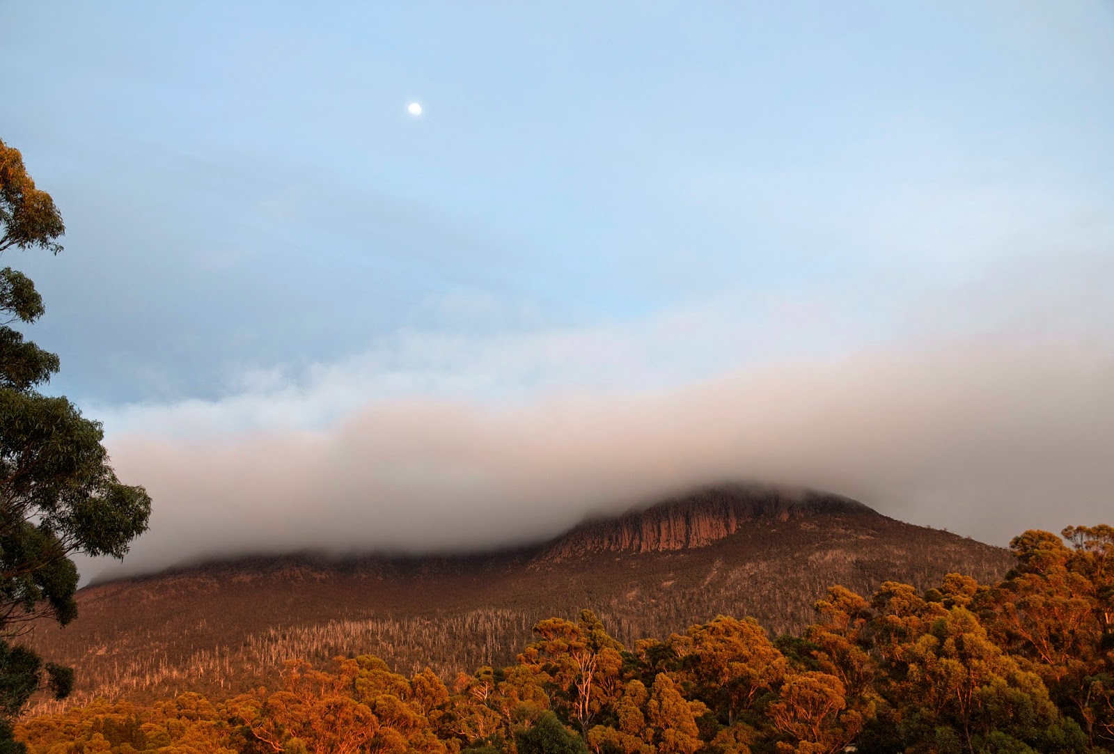
[Sunrise and moonset over kunanyi/Mt Wellington] 
While it’s hardly an expedition – there are tracks all the way, and it’ll be done in a day – it does require that I gain more than 1200m in altitude. So there will be sweat and effort required. But the more I plan, the more I come to see how much of that effort will be mental. Because the walk will involve transecting a slice of Hobart’s natural and social story, I will need to be alert not only to what IS, but also to what WAS. That makes it a symbolic journey: a kind of local pilgrimage to places with significant stories, human and non-human, past and present.

I want this to be a series not because it is a long walk, but more because it promises to be an involved walk. It won't be just an A to B bushwalk. Perhaps no bushwalk ever should be.


Sunday 13 April 2014

Frenchmans Cap 4: Horses Headed for Home


[Summit glimpses, Frenchmans Cap] 
Whoever said it’s tough at the top seems to have forgotten what it’s like getting there in the first place. It may have been windy, cold and cloudy, and there might have been rain forecast, but it was NOT tough at the top of Frenchmans Cap. Just how often do you get to be in such a place?

Tim and I put on everything we’d summited with, and settled in to share the sheer, wild joy of being there. Clouds whooshed around us: wispy and thin one minute, revealing wedges of the wider world; darker and dense the next, all but engulfing us.

Memories stirred for me as we explored the broad summit. 31 years ago I’d been part of a large group that had come here. Clouds had featured then too. That time they had also cleared a little, giving us a clear blue sky above and some deliciously warm sunshine. But the clouds beneath had remained resolutely in place, giving us no views of our surroundings.


[Summit day 1983. Ray Spedding is on the right, bending down] 

I was startled to remember that back then we had not only come all the way here from Lake Vera, but had gone back there the same day. I would have been tempted to blame such an epic day on the folly of youth. But I know that our 1983 walk was led by a 60-something year old Ray Spedding. An early bushwalking mentor of mine, Ray continued to do hard walks for many years after the Frenchmans trip. He even summited Federation Peak in his 70s, and lived into his 90s. As if today’s summit hadn’t been inspiration enough!

After maybe an hour soaking up the summit, we realised the clouds were not giving up. If anything they’d been reinforced, and as we scrambled down towards North Col it began to rain lightly. It was time to get back to Tahune’s snug little coal stove.

Along with our mate Nick, we found a young Austrian and a South Australian sharing the hut. The Austrian had come up from Lake Vera in what sounded like an incredibly short time. He was quite wet, and his gear was torn – courtesy of two weeks in Tassie’s south-west – but he looked strong and fit.


[Nick and Tim and lifting weather near Pine Knob] 
Next morning the Austrian left early, and bounded up the steep track towards North Col in apparent haste. We were up early too. By unspoken agreement we were considering going all the way out today. Eventually we spoke about it, and agreed on a rough timetable for getting back to the highway before dark. We’d need to get to Vera Hut for lunch, and leave there shortly after.

Once you start thinking about home on a long walk, your mind shifts a gear – and your body follows. You are horses headed for home. Sections of track that had seemed arduous and slow on the journey in are now straightforward. We strode up from Tahune, advanced quickly through Artichoke Valley, stopping only for scroggin at a cave beneath Nicoles Needle. We were soon at Barron Pass, ready for the steep descent to Lake Vera.


[A section of rainforest between Lake Vera and Barron Pass] 

If there is a more intricately beautiful bit of forest on this walk than the one between the pass and Vera, then I haven’t seen it. We marvelled at it afresh, amazed at Philp and co., the people who first found a route up through this steep, scrub-filled forest. We revelled too in not having to gasp for breath. ‘Though there are walkers who say they prefer ascending to descending, I’m not one of them. Only the knee jarring that can accompany a descent like this makes it remotely close to difficult. That’s one of the reasons I use trekking poles, to make me into a quasi-quadruped.

Towards the bottom of the slope the Austrian walker caught up with us. He had summited – in thick cloud – and was now on his (hasty) way back to Lake Vera. Just for fun I tried to keep pace with him once he’d passed us. For maybe five minutes I kept him within sight, helped by the fact that he occasionally paused – very briefly – to photograph forest scenes. But soon the fast-forward Austrian was lost to sight and sound.

We caught him later at Lake Vera, where he was going to stay the night. He’d stripped off his torn merino top, and was lying lizard-like in the sun which was now asserting itself, even on the mountain tops. It turned out that his haste to get here may have cost him the chance to do his sunbaking on the summit. But then hindsight is a fine thing.


[And now it fines up: Tim shows where we've been] 

For us it was clear there would be just enough time to get to the highway before dark. After a quick lunch we hoisted packs again, and set off on what would become a route-march towards the lower lands.

Ten and a half hours after leaving Tahune – in failing light – we staggered past the information booth and into the carpark. At times I had got close to falling asleep on my feet. To say I was exhausted would be an understatement. Likewise with saying I was elated. At the youthful age of 60 I’d completed a hard walk; had got to the summit; had done a 20+km last day, and all without any part of me feeling as though it was about to fall off. Could it be that the spirit of Ray Spedding lives on?

Sunday 6 April 2014

Frenchmans Cap 3: From the Ridiculous to the Sublime


[Tim avoids the void, Frenchmans Cap] 

“Timing is everything.”
“Summit windows are small.”
“Short sentences sound hardcore.”

The truth about our Frenchmans Cap summit day is that we basically leave when we’re ready to – probably a bit later, in fact. And the truth about Tim and I is that our reputation has little to do with being hardcore, and lot to do with supreme PFA-ing*.

Three Victorian walkers who’ve shared the hut with us have left more than an hour before us. But their window is small; they plan to be back at Lake Vera Hut for the night. We’ll have another night at Tahune Hut, so our window could be re-opened the following day, if we really wanted it to.

It’s in this somewhat blasé mood that we check out the weather and gradually get our gear together. It’s cool and overcast, but the clouds that have hovered between our lake and the rock walls above seem to be lifting. There can be advantages in being slow coaches.

From Tahune it’s pretty much straight uphill towards North Col. 31 years ago we had come here from Lake Vera, rushed past Tahune and clambered directly up to the col. That track is now closed high up towards the col to allow the eroded gully to recover. Instead the track slices diagonally left, missing the col itself, before sidling further left across the steep walls for a few hundred metres.


[A panorama of the track from Tahune towards North Col] 

Just before it does a hairpin back in the direction we’ve come from, we meet the Victorian trio coming down. They’ve summited okay, but the clouds have only parted briefly for them.They’re still in high spirits though, and we promise we’ll send them some photos from the soon-to-be-clear summit. Everyone laughs in a “yeah, right” kind of way, and we go our separate ways.

Shortly afterwards Nick decides he might leave the hairy bits to us. As it’s got steeper he’s become more cautious and has begun to doubt his comfort on the really steep bits. He leaves us at the hairpin and heads down. Tim and I cinch our day packs tight and turn towards the top.

It’s not long before we reach parts that make Nick’s decision look wise. We come to a track junction with signs pointing straight ahead to the Irenabyss Track (via the col), and back behind us to Tahune. And the summit track? The sign just points up. Rather than walk, it seems we’ll need to climb or at least scramble straight up a steep quartzite wall. 

We switch to Russian accents. Part of our strategy for coping with difficulties is to use a variety of appallingly inept accents. Irish works well for comfortable strolling; uppercrust English seems good for gradual downhills; but there’s nothing like Russian for those steep uphill pinches. Ah the games we play, just to take our minds from the labours of hard walking!

Although there are several of them, the actual steep bits never last long. But with intermittent drizzle wetting the rocks, we take our time. Every now and then the clouds part a little; the sky brightens momentarily; and we wonder whether our window is coming. If timing is everything, dumb luck has a big say too.


[Tim negotiates a steep bit on Frenchmans Cap] 
After several “faux plateaux” – our term for false summits – the track turns a corner, the incline lessens, and a little white-brick-road meanders up to a remarkably broad and level summit. The memories from 31 years ago surge back as I see the summit cairn; the familiar blasted rocks; the swiftly shifting clouds; and the feeling of being high without actually seeing the evidence for it.

Yes, I’ve summited Frenchmans again, in the cloud again. Yet far from feeling it’s “strike two”, I actually feel quite euphoric. Tim does too. We settle down in the summit cairn-cum-shelter, grab a handful of scroggin and swig some water. And then? We sing of course: a rousing Russian rendition of the Carpenters’ “Top of the World”, which we video for posterity – and for our fellow PFA-er Jim, who took so long getting ready that he didn’t actually make this walk at all.


[Tim and I on top of the world, Frenchmans Cap] 
That formality over, we look up and suddenly realise that that the clouds have parted. We immediately revert to Irish, castigating ourselves for the “eejits” that we are for fiddling while the clouds lift. We rush over towards the edge of the summit to see what we can see. Huge cliffs drop 400m or more from here to the still unseen depths. But what can be seen – through gaps in the cloud – is the stately summit of Clytemnestra, and other peaks further off to the south-west.

The Romantic poets coined the word sublime for just this sort of view. It goes far beyond being merely pretty; it surpasses beauty even. For me it hovers somewhere between “beyond words” and “evoking deep feelings of simultaneous insignificance and significance”.


[A sublime moment: Clytemnestra from Frenchmans Cap] 


_______________________________________________


* P.F.A. is an acronym for a slightly crude Aussie phrase that refers to dithering, delaying, or taking a long time to do anything. (P = P*ss; F = F*rt; A = Around.)