Showing posts with label The Walls of Jerusalem. Show all posts

Thursday, 28 November 2024

A Loopy Walk on the Plateau 3

Day 3: A Trip to Cairns

“All journeys have secret destinations of which the traveller is unaware.” – Martin Buber


What a difference blue sky and time on a summit can make! We descended from Turrana Bluff gradually, happily; delighting in the lack of full packs and the wide vistas all around us. We were back at our campsite around 11am, and quickly finished packing before setting off for destination not-quite-known. In theory we should find Ritter’s Track by mid-afternoon. A few years before, a little east of Pencil Pine Tarn, we had located some of the cairns that marked Ritter’s Track. That time we’d followed them south and west towards the Walls of Jerusalem. This time our plan was to go the other way. We would pass east of Lakes Lexie and Gwendy in search of some of the northern markers of Ritter’s Track. We were now thinking of the walk as Ritter 2.0.


[Tim D finds water and shelter]

The day had become warm, the sun strong. Full-pack, off-track walking, with its attendant high leg-lifting, is thirsty work. By lunchtime we were in need of both water and shade, and found them in the delightful shade of some pencil pines beside a small pool. If we’d been told two days ago that we’d be sweating, putting on sunscreen, and hiding in the shade from fierce sun, we’d have shaken our heads in disbelief. Welcome to November in the high country: freezing one day, burning the next!
 
Over lunch our GPS geeks, Tim D and Larry, began comparing data on the whereabouts of the nearest Ritter cairn. We were supposed to be walking directly towards one, but we knew we weren’t guaranteed to find it. Ritter’s Track is not like a conventional bushwalking track: mostly easy to follow, with markers and an obvious ground trail. Rather, at least from our previous experience, it’s a vague route, marked by sometimes hard-to-find rock cairns, and with little or no ground trail. After all, it was created over 100 years ago to drive cattle towards grazing grounds in the Walls of Jerusalem area, and it‘s been many decades since it’s been used for that.


[Looking down towards Lake Lexie]

We crested a scrubby high point overlooking Lake Lexie, a lake we’d wandered past on previous trips. We did so again, making for some low rocky hills, beyond which lay Lake Gwendy. After that, Larry told us, we should be getting close to a Ritter cairn. By now some of us were growing weary, and even low hills felt like hard work. The prospect of finding a cairn was less thrilling than that of finding a good campsite. We plodded on, eventually dropping down through scrub towards a small open lake. A few of us were ready to stop, but this looked like a campsite only for the desperate. After a brief discussion we walked on.


[TimO at Lake Lexie, with the "low hill" behind]

We clambered over another rise and found a larger, unnamed lake. Larry said we were only a few hundred metres from a cairn, but in this sort of country that can be half an hour’s work. We compromised by continuing up the eastern shore of the large lake vaguely close to the direction of a cairn. By now most of us were only interested in finding a campsite, at least for today. 


[Our eventual campsite: a hidden gem]

We'd been spread out searching for a while before Libby walked upslope from the large lake, and called back that she’d located a promising possibility. It proved to be more than that! She’d found a lovely small lake, fringed by pencil pines, and with a group of ducks bobbing near the far shore. What bliss! We each managed to find a spot for our tent, and settled in “tired but happy”, as the cliched school composition had it.


[Libby celebrates a card game win]

Indeed we were happy enough, and the weather was fine enough, that we sat around playing cards after dinner. As we finished our games, a waxing moon rose into the clear evening sky, a change of the guard signalling bedtime. With this wonderful campsite it seems we’d landed on our feet. That said we'd be even happier once we were off them and in our tents.

Wednesday, 4 January 2023

Wandering the Little Fisher 1: Hot and Bothered

I should know by now that when it comes to bushwalking in Tasmania, “meticulous planning” is an oxymoron. I could bore you with all the plans; the variations on plans; the emails; the reply emails – or lack of them – and the “okay, how’s this?” follow-up emails. But let’s just say that busy-ness, weather, Covid, and human frailty all had their mitts on this walk. And yet …


[Starting Off in 32 Degree Heat, Fisher Bluff behind]


On a late December afternoon four walkers step out of an air conditioned car to be mugged by the heat of an old forestry coupe. Ahead of us stands a wall of mountains, familiar mountains. Their names, Fisher Bluff, Clumner Bluff, Turrana Bluff, Mersey Crag all speak of their verticality. Thankfully our first afternoon isn’t going to involve too much climbing. And that’s just as well, as our thermometer tells us it’s 32 degrees C. That’s great for swimming, but brutal for bushwalking with a full pack.


While the mountains are familiar, this view of them is less so. We’re walking up the Little Fisher River, a deep valley carved out of the Great Western Tiers. Officially we’re walking into the Walls of Jerusalem National Park, though well east of the better known tracks and mountains.


Pack on and sweat rising, the familiar call of black currawongs lightens my hot and bothered mood. I’m thankful too for the shade of the old forestry track we’re taking towards the tiers. We pause for a drink and a rest, and Tim D and I remember driving up here long ago, when this track was still open to vehicles. The road has been blocked off for years. More recently some huge weather events have eroded it so badly that not even the boldest of four wheel drivers would consider trying it.


[Erosion and repairs on the Little Fisher Track]


Our plan A for the first day had been to climb out of the valley and find a camp somewhere on the plateau near Long Tarns. In a concession to the heat, our tardiness, and the forward forecast, we’ve come up with a much more modest ambition. The Little Fisher is generally steep sided, but Tim has heard there may be camping near the river a couple of hours upstream of the start. His source has also told him that there’s an old cattlemen’s hut site in the same vicinity. Tim is keen to find and investigate the site. Two birds with one stone sounds like good energy conservation in this heat.


Even so, by the time we leave the track and clomp our way through a soggy sphagnum-filled area in search of a campsite, I’m exhausted. Thankfully it doesn’t take long. At the edge of some rainforest, where two minor creeks feed into the river, we find a very pleasant site. It’s both shady and well-watered, and we’re surprised to find no evidence of previous camping. We drink deeply, rest for a moment, then suss out space for three tents: Tim and Merran’s, Ken’s, and mine. 


[Camping in the forest, by the water: Ahhh!!]


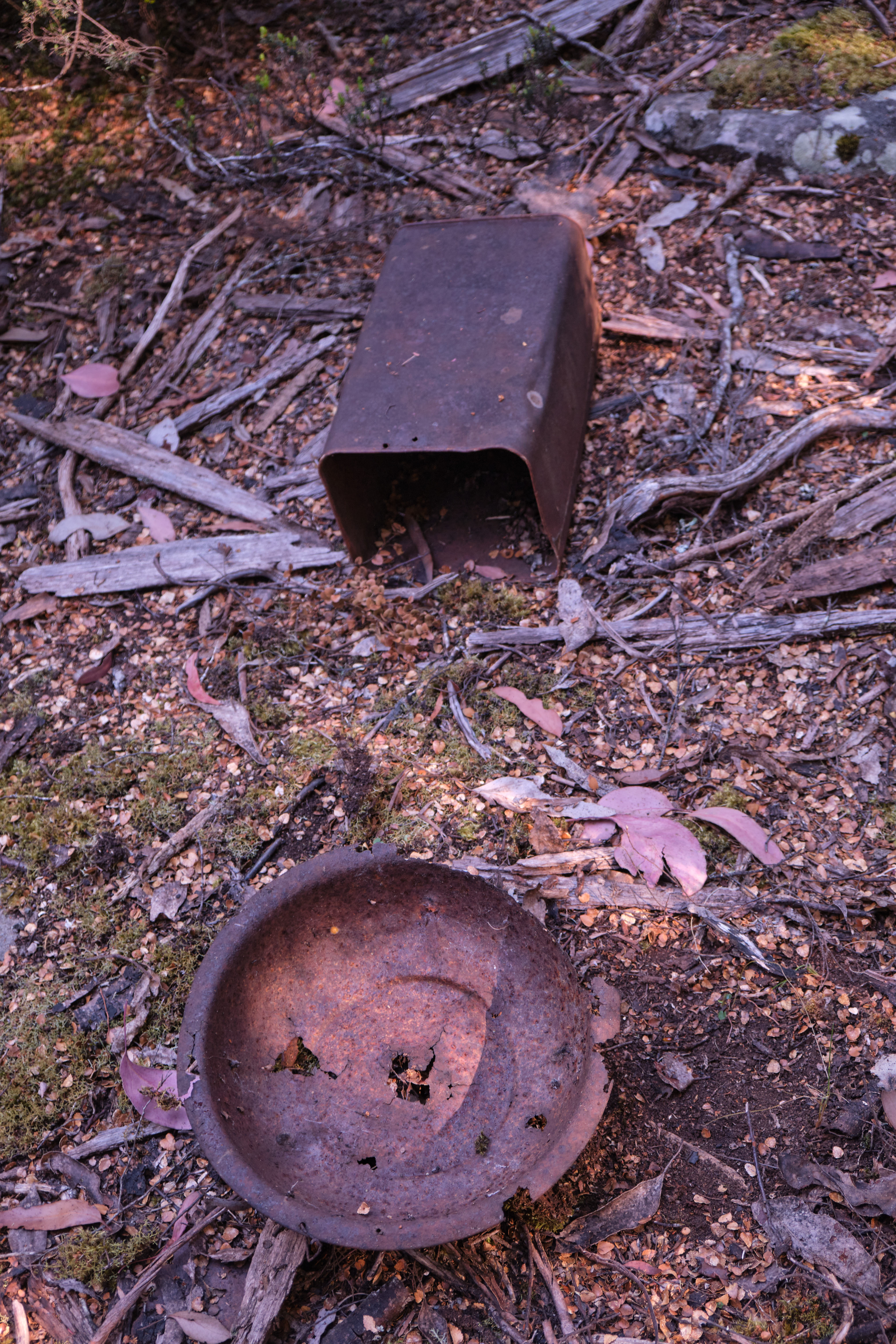
When we’re satisfied with our setup, we prepare to go in search of the hut site. Tim’s informant hasn’t set our expectations too high. This won’t even be a ruined hut, just the hint of where a rough hut once stood. A GPS dot on a device is one thing; finding a site in quite thick regrowth is another. We spread out, and call to each other when we see anything that might be part of a site. Suddenly anything linear looks like a foundation or a fallen bit of a timber wall. Half an hour into our search Tim finally finds something more definitive. He calls us over to see some artefacts, a few glass bottles, a rusting billy and plate, and a bit of chain. A little away from the site we find some celery-top pine stumps. The builders seem to have cut more than they used, as some pine logs are still lying unused, partly preserved by their rot-resistant resin. 


[Artefacts at the old hut site]


Without doing any formal analysis, we guess to site to be at least 100 years old. Certainly in the late 19th century the area was regularly visited by cattlemen, who drove their stock up to summer on the pastures at this and higher altitudes. Between loggers, trappers and drovers, the area was well known and used. Yet now the forest, well-watered in this high rainfall area, is taking over again.


[Ken and Tim at the hut site]


The hut site, sensibly, is elevated above the river valley. But as a large pool in the river is within about 100 metres of it, we detour that way on our return. The day is still very warm, and we’re sweat-soaked from our exertions. It would seem rude not to have a swim, so we do. 


[The Swimming Hole: You Can Keep Your Hat On.]


The water is VERY bracing, but still an almost perfect way to end our hot day. Only a good meal and conversation back at the camp could improve on that. It does.


[Merran and Tim: Happy Campers]

Thursday, 11 August 2022

Happy Places 2: Tasmania’s Central Plateau

The Central Plateau has been dubbed ‘the roof of Tasmania’, and ‘the land of a thousand lakes’; which is about as nuanced as calling Australia the ‘wide brown land’. There’s so much more to this wild and high part of our island state. 


It owes a great deal of its identity to dolerite, and to a massive sub-surface upwelling of that igneous rock during the Jurassic age. Almost equally its identity has since been shaped by the ice sheet that covered the surface during a number of glacial phases. That covering was more ‘doona’ than ‘sheet’, as it measured hundreds of metres thick in some parts. As that huge amount of ice, at least 6000 sq km in area, slowly jostled and crunched across the plateau, it carved out lakes – many more than a thousand – and left sharp peaks and dramatic clefts. 


[A special spot on Tasmania's Central Plateau]

 While much of that ice-age drama is over, the Central Plateau remains a vast area of largely wild high country. It’s roughly bounded by Great Lake to the east, the Great Western Tiers to the north, and the Walls of Jerusalem to the west. To the south the boundary is more vague, but perhaps the Lyell Highway marks a convenient edge. As this post is about my ‘happy places’, it’s probably okay to leave the big picture fuzzy, and focus in on the subject at hand. 


So … where on this cold, high, wet and wild plateau are my happy places? I’m particularly thinking of smultronställe, a Swedish word that evokes that sweet, semi-secret favourite place; somewhere that – particularly during these cold months – makes me smile just thinking about it.


[A sweet end to a lakeside night]

 During more than 40 years of walking in Tasmania, I’ve been privileged to walk across the plateau numerous times, from every direction. I’ve written about some earlier walks here Walking With Ada and here No Lack of Lakes  All that plateau wandering makes choosing particular smultronställe as difficult as naming my favourite child. But if I had to pick just three Central Plateau ‘happy places’, they would be (in no particular order):


1.     The Walls of Jerusalem

2.     Mount Rogoona

3.     Un-named Lakes and Pencil Pine Groves


1) Certainly this choice needs some narrowing down, as The Walls of Jerusalem National Park covers 518 square km! Scattered across this mountain-fringed park are some wonderful campsites, both formal and informal; on-track and off-track. And I could have selected any of those. But because mountains are such a feature of The Walls, I’ve chosen Solomons Throne as my Walls of Jerusalem ‘happy place’. 


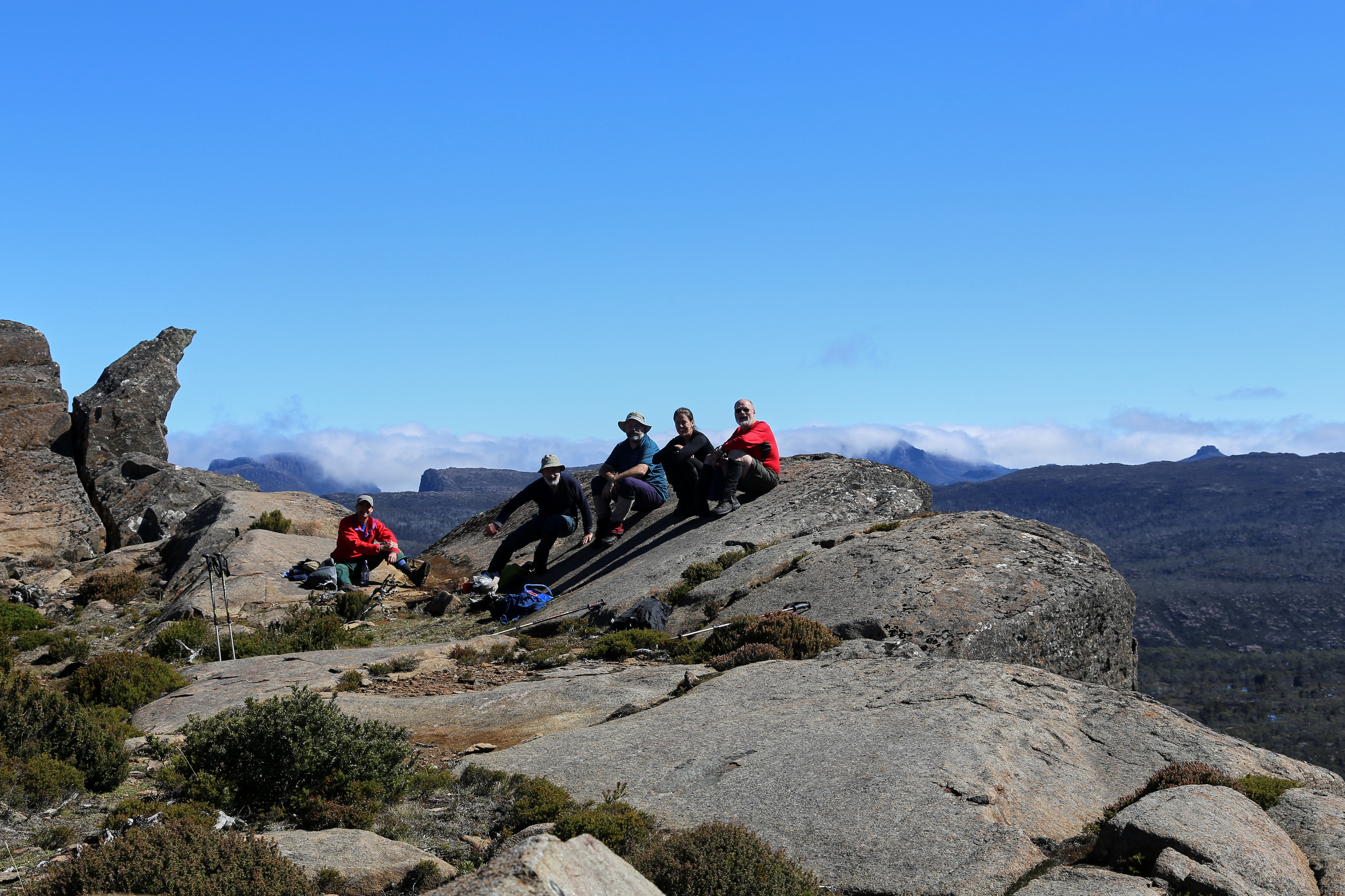
[Friends share special times on Solomons Throne]

The peak is not the highest in the park, nor is it the most difficult to ascend. What make it sit so sweetly in my memory is a combination of my experiences here, and the superb vistas from the top. I’ve been up there in thick snow, and relished views outward towards a snow-bound Overland Track, and inward to the nearby pine-fringed lakes and vales. I’ve been there with family, introducing them to the wonders of our wilds. I’ve been there with friends (many times); with first-time walkers; and with international visitors who thought Australia didn’t have mountains. While I will certainly tire during the steep climb up a rocky chute to the peak, I will never tire of sitting on the Throne.


[Looking towards the Overland Track from Solomons Throne ... click to enlarge]


2) The upper Mersey River roughly marks one edge of the Central Plateau. The Mersey Forest Rd also gives good access to one of the sweetest spots on the western side of the plateau: Mount Rogoona. I first heard about this mountain during the 1980s. A group I walked with had been planning a trip there, but a major fire burned out much of the track and surrounding areas, so we walked elsewhere. It wasn’t until nearly 20 years later that I finally reached that peak.


[Mount Rogoona from Lake Myrtle]

And what a peak! It sits, sphinx-like, above the waters of Lake Myrtle, its knobby summit giving way to dolerite cliffs that are like a younger, smaller sibling of the Organ Pipes of kunanyi/Mt Wellington. For most visits to Rogoona, Lake Myrtle is the most convenient camping spot. However direct access to the peak is not easy from the lake. I found this out – in reverse – when a few of us decided to return from the summit direct to the lake. I would not recommend it! Rather the track between Lake Myrtle and Lake Meston leads to an easier slant-wise route to the mountain.


[Summit Views from Mount Rogoona]

Rogoona is essentially a small plateau whose summit is near the sheer dolerite cliffs on its north-western edge. So the views from the top are as vast as they are stunning. Steeply beneath and quite nearby is the tranquil Lake Myrtle. But your eye soon wanders west beyond the lake, over the nearby Cathedral Plateau, to the highest mountains of Tasmania, from Mt Pelion East to Mt Ossa and numerous others further south. 


Not once, but twice I’ve had that view ‘interrupted’ by a wedge-tailed eagle flying over. I’ve written in more detail here Eagle, but suffice it to say that being buzzed and eye-balled by the largest raptor in Australia is one of the greatest privileges of being in remote Tasmania. 


[Close encounter with the Rogoona Eagle]

After you’ve had that kind of mind-bending, time-stretching summit visit, there are few better places to sit and contemplate it than by the shores of Lake Myrtle. I’ve written about one particular experience here Myrtle 1, here Myrtle 2, and here Myrtle 3.


3) If the preceding ‘happy places’ would be easy to locate, the third is deliberately vague. Un-named Lakes and Pencil Pine Groves is a category of smultronställe that invites you to do your own explorations; make your own discoveries. And there could be few better places to wander in search of lakes and pencil pine groves than the Central Plateau. 


I once started the eye-watering job of trying to count the number of lakes just on the 1:25 000 Ada map. I gave up after counting 350 in one typical 10 sq km strip. Given there were 19 such strips still to count, it’d be fair to estimate between 5 000 and 7 000 lakes on the Ada map alone.


[So many lakes! A small part of the Central Plateau]


Obviously the number of lakes alone makes searching the plateau for sweet spots a lifelong task. But once the search begins, it becomes more subtle than you’d think. Lakes mean water, and many lakes mean a lot of water. That in turn means often waterlogged ground, and camping in such places isn’t much fun – not to mention the impacts it can have on that environment. In my Central Plateau wanderings I’ve seen many spots that looked great from a distance, but turned out to be unsuitably sodden once you got there and looked for tent spots. 


Happy Place searchers also have to consider another weather factor apart from precipitation, and that’s wind. The often fierce winds here further narrow your camping options. What may be a perfect site on a calm night can turn perilous when the wind gets up. Shelter is paramount, which is why pencil pines are often your friend. But there are complications here too. Many pencil pine groves are so dense that there’s no room for tents. And if there is room, the ground is often covered in dense, soggy sphagnum and/or gnarled tree roots. 


[Boots off and relaxing at a secret campsite]

 So … have I found some ‘Goldilocks Zone’ campsites on the Central Plateau? Of course I have. And I’ve spent some of my most blissful days and nights between a lake and some pencil pines. Am I going to share their locations here? Sorry, I’m not. What I can say is that if you haven’t searched for your own version, then you have a baffling, frustrating, but ultimately sublime quest ahead of you. If you have found such sites - or you recognise some of the ones pictured - I’d suggest you share that information sparingly. Let others have the thrill of the quest. Some places just shouldn’t be on Instagram.


[Does wild camping come any better than this?]