Showing posts with label Fisher Bluff. Show all posts

Wednesday, 11 January 2023

Wandering the Little Fisher 3: Surprises

One thing has surprised me this entire walk. Tim D brings it into the open when we’re at Rinadena Falls. Knowing I’d walked up this valley long ago, and had reached Long Tarns on the plateau, presumably via the falls, he asks: So do you remember the falls now?

There’s no doubt Rinadena is memorable. And yet I have to tell him I don’t have a single memory of being here. Of course that previous walk was nearly 40 years ago, and memory’s net is both flimsy and fickle. Nevertheless I find it strange that either (a) we by-passed the falls, or (b) I’ve simply forgotten them. After returning home, I dig out some old photos from that walk. I can’t find any of Rinadena Falls, but there’s one – included here – that has a young me walking in the kind of forest we’d walked through to get to the falls on our current trip. The puzzle remains unsolved.


[Me on the Little Fisher Track, 1983]


Tim has one more surprise in store. At the end of our second day, we agreed we’d probably achieved most of what we wanted to from this walk. We’d found a great off-track campsite; located an abandoned hut site; and visited the legendary Rinadena Falls. Yes, we hadn’t gone up to the plateau as originally planned. But we were happy to forego that, given it would mean going back over yesterday’s walk WITH a full pack, AND into unfavourable weather. 


So I’ve gone to bed on the understanding that we’ll have a lazy morning, a slow pack up, and then we’ll walk out. But when I get to breakfast, Tim smiles and starts talking about a potential change of plans. It sounds ominous! He explains that Merran is feeling slothful after not joining us in our falls walk yesterday. So they suggest that before leaving we first have a bit of a “wander”. That’s a Tim word I’ve come to treat with some suspicion over the years, so my ears prick up. The “wander” will be up through trackless rainforest straight behind our camp, and towards the nearest high point. It’s an outlier of the Central Plateau that’s appropriately called Deception Point. What could possibly go wrong?


[Onward and Upward through rainforest]


With daypacks on, and a promise that we’ll be back before lunch, we “wander” up, steeply up, through what I must admit is delightful forest. But did I say it was steep?! Upward we toil, gaining some 450 metres in altitude in around 90 minutes. That altitude gain is marked by considerable huffing on our part; plus a gradual stunting of the trees, and a marked increase in the thickness of the scrub. We finally reach rock, some of Tasmania’s ever-familiar dolerite. After a bit of scrambling and route finding, we break out onto a promontory beneath Deception Point.


[Our high point beneath Deception Point]


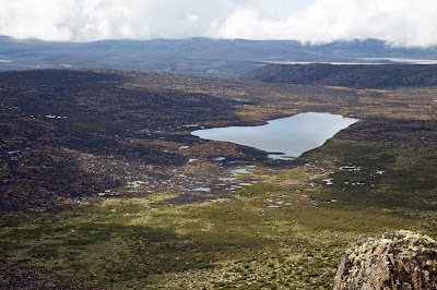
Reading both his watch and the mood, Tim suggests this rock shelf, rather than the actual summit, might be enough for our morning wander. We enjoy a scroggin and drink break, and the chance to gain an overview of the country we’ve traversed – or planned to traverse – on this walk. Beneath us we see the clearings at the edge of which we’ve camped. And we make out the line of the Little Fisher Track, marked by a band of shorter, greyish regrowth. I realise that 40 years ago we’d have driven a long way up that track in a 4WD, before undertaking the much shorter walk up to the plateau. No wonder my memories are a little hazy.


[Looking down on the Little Fisher valley]


Straight across the valley from our perch is Fisher Bluff, with its sharp drop-offs and abundant scree slopes. Further south-east are Turrana Bluff and Mersey Crag. I’ve been to these high points before, though not usually up the Little Fisher valley. It’s like running into old friends out of their usual context. We sit around for a while enjoying the elevation, and the memories of past walks. 
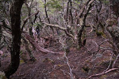


[Spot the three walkers on our scrubby descent]


But what goes up must come down. Our knees don’t thank us for the relentlessness of the stumbling, sliding walk back to camp. But we arrive there remarkably close to the time Tim had said we would. (There’s a first time for everything.)


[Back at our campsite]


One advantage of a late pack-up in warm weather is a dry tent. One disadvantage of a late departure, especially after a steep “wander”, is weariness. But by now we’re ready to leave, so we simply put our heads down and keep walking. Of course there’s one more nasty surprise. On the way in, concentrating as we were on getting going, and surviving the heat, we hadn’t noticed that the first 2km leading to the bridge over the Little Fisher River were downhill. And that means that the final 2km of our return walk are uphill. And since we’re now heading almost west, we’re also walking straight into the hot afternoon sun. 


In my fevered mind I become Manuel from Fawlty Towers, muttering I no complain! Perhaps Ken, who is trudging along beside me, might tell it differently. But what happens on the walk, stays on the walk!
Wednesday, 4 January 2023

Wandering the Little Fisher 1: Hot and Bothered

I should know by now that when it comes to bushwalking in Tasmania, “meticulous planning” is an oxymoron. I could bore you with all the plans; the variations on plans; the emails; the reply emails – or lack of them – and the “okay, how’s this?” follow-up emails. But let’s just say that busy-ness, weather, Covid, and human frailty all had their mitts on this walk. And yet …


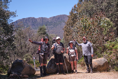
[Starting Off in 32 Degree Heat, Fisher Bluff behind]


On a late December afternoon four walkers step out of an air conditioned car to be mugged by the heat of an old forestry coupe. Ahead of us stands a wall of mountains, familiar mountains. Their names, Fisher Bluff, Clumner Bluff, Turrana Bluff, Mersey Crag all speak of their verticality. Thankfully our first afternoon isn’t going to involve too much climbing. And that’s just as well, as our thermometer tells us it’s 32 degrees C. That’s great for swimming, but brutal for bushwalking with a full pack.


While the mountains are familiar, this view of them is less so. We’re walking up the Little Fisher River, a deep valley carved out of the Great Western Tiers. Officially we’re walking into the Walls of Jerusalem National Park, though well east of the better known tracks and mountains.


Pack on and sweat rising, the familiar call of black currawongs lightens my hot and bothered mood. I’m thankful too for the shade of the old forestry track we’re taking towards the tiers. We pause for a drink and a rest, and Tim D and I remember driving up here long ago, when this track was still open to vehicles. The road has been blocked off for years. More recently some huge weather events have eroded it so badly that not even the boldest of four wheel drivers would consider trying it.


[Erosion and repairs on the Little Fisher Track]


Our plan A for the first day had been to climb out of the valley and find a camp somewhere on the plateau near Long Tarns. In a concession to the heat, our tardiness, and the forward forecast, we’ve come up with a much more modest ambition. The Little Fisher is generally steep sided, but Tim has heard there may be camping near the river a couple of hours upstream of the start. His source has also told him that there’s an old cattlemen’s hut site in the same vicinity. Tim is keen to find and investigate the site. Two birds with one stone sounds like good energy conservation in this heat.


Even so, by the time we leave the track and clomp our way through a soggy sphagnum-filled area in search of a campsite, I’m exhausted. Thankfully it doesn’t take long. At the edge of some rainforest, where two minor creeks feed into the river, we find a very pleasant site. It’s both shady and well-watered, and we’re surprised to find no evidence of previous camping. We drink deeply, rest for a moment, then suss out space for three tents: Tim and Merran’s, Ken’s, and mine. 


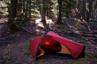
[Camping in the forest, by the water: Ahhh!!]


When we’re satisfied with our setup, we prepare to go in search of the hut site. Tim’s informant hasn’t set our expectations too high. This won’t even be a ruined hut, just the hint of where a rough hut once stood. A GPS dot on a device is one thing; finding a site in quite thick regrowth is another. We spread out, and call to each other when we see anything that might be part of a site. Suddenly anything linear looks like a foundation or a fallen bit of a timber wall. Half an hour into our search Tim finally finds something more definitive. He calls us over to see some artefacts, a few glass bottles, a rusting billy and plate, and a bit of chain. A little away from the site we find some celery-top pine stumps. The builders seem to have cut more than they used, as some pine logs are still lying unused, partly preserved by their rot-resistant resin. 


[Artefacts at the old hut site]


Without doing any formal analysis, we guess to site to be at least 100 years old. Certainly in the late 19th century the area was regularly visited by cattlemen, who drove their stock up to summer on the pastures at this and higher altitudes. Between loggers, trappers and drovers, the area was well known and used. Yet now the forest, well-watered in this high rainfall area, is taking over again.


[Ken and Tim at the hut site]


The hut site, sensibly, is elevated above the river valley. But as a large pool in the river is within about 100 metres of it, we detour that way on our return. The day is still very warm, and we’re sweat-soaked from our exertions. It would seem rude not to have a swim, so we do. 


[The Swimming Hole: You Can Keep Your Hat On.]


The water is VERY bracing, but still an almost perfect way to end our hot day. Only a good meal and conversation back at the camp could improve on that. It does.


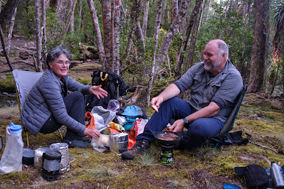
[Merran and Tim: Happy Campers]

Saturday, 9 April 2016

Return to Blue Peaks 3: Bluffed

I have a great affection for printed maps. I pore over them in the lead up to a walk. To me they’re a bridge between imagination and place; between mind and foot. And on the walk itself paper maps and a compass are my chief navigation tools. Strange then, and probably significant, that on this Blue Peaks walk not one member of our party is carrying a paper map.

Between us we have at least five devices with digital maps and/or a built-in GPS. And we have backup batteries so our devices don’t become useless lumps of plastic and metal. Of course I can hear voices warning how this could go astray. But ironically, on this occasion it’s actually the lack of paper maps that keeps us on track.


[Jim asks "Where Are We?"] 
What follows then is the tale of two 21st century moments, two literal turning points, that illustrate how bushwalking is changing.

* * *

The first moment comes as our party, walking off-track in search of Fisher Bluff, starts to wander like the Israelites of old. Or less grandly perhaps, like Brown’s cows. Mick and TimO are heading south of our rough bearing; the rest of us are strung out along a more northern route. Somewhere over the humps and bumps ahead is Fisher Bluff. But in this plateau country one high point looks much like the next. So which one is it?


[Mick and Tim take their own bearing towards Fisher Bluff] 
If we’d been looking at a conventional flat map, we’d probably have convinced ourselves that the northern eminence is Fisher Bluff. We just need to keep climbing. That’s when Mick’s digital map, with its GPS dot indicating where we are, puts us in our place - literally. It shows us we have to go further south. We do so, some of us contritely. Eventually, high atop a southerly bluff, we see a good old-fashioned trig point – that commonplace of highest points – and our digital hunch is confirmed.

We skirt a large linear forest of pencil pines, blessing its health and unburned state, and trudge towards the trig. It’s uphill of course, but we don’t need any form of map to tell us that.

Fisher Bluff, being one of the western most mountains of the Central Plateau, has broad views south to the Walls of Jerusalem and south-west to the highest mountains of the Overland Track. We also have close-up views of the nearby Mersey valley, one of the epicentres of the recent fires. It’s a brutalised mess of burned and blackened forest.


[Central Plateau fire damage around Last Lagoon] 
Nearer still we can see where the fire has broken out onto the higher plateau. The area around Last Lagoon has been hit hard. We see what we guess to be dead cushion plants and incinerated peat. If there’s any compensation, it’s that the fire got no further into this part of the plateau.

Our second 21st century navigational moment comes the following day. An old Irish folk song has it that “going to a wedding is the making of another”. It’s the same with mountains. From Fisher Bluff we’ve looked out on Turrana Bluff, Turrana Heights and one or two other reachable mountaintops.

Our agenda is set, and in the morning we make a surprisingly early start (for us). We progress quickly towards Turrana Heights which, being the nearest, is our first target. We're fairly sure of where we’re going. After all we’ve spied this mountaintop, shapely and prominent, from both Little Throne and Fisher Bluff. But as we’re climbing towards it, passing a nearby high “lump”, Mick pulls us up again. His digital map tells him the lump is actually Turrana Heights. We each consult our own digital oracle, and come to the same conclusion. We’re heading for the wrong high point. The mountain we’re aiming at has no name.


[Getting closer to the unnamed peak] 
We decide we’re with Shakespeare (“What's in a name? That which we call a rose by any other name would smell as sweet.”) and keep heading towards the more “fragrant” top. The nameless mountain’s flanks, sloping slabs of dolerite, are steep and challenging, but when we get there the summit offers more than enough compensation.


[Libby and lakes from atop the unnamed peak] 
We settle on top, feeling like royalty on a high throne, lords of all we survey. Below and all around us are thousands of lakes, both near and far. And dozens of mountain tops, from the nearby Walls to the far distant peaks of the south and west, stand out like familiar faces in a loyal throng.   


[Looking towards the Walls of Jerusalem from the unnamed peak] 
Two other things are remarkable to us. The first is that this sweet mountain isn’t honoured with a name, at least not on any map we possess. And the second is that it is still morning! We will have time to visit the “lump” – Turrana Heights – for lunch.

After a long and relaxing visit, basking in bright sun beneath benignly blue heavens, it’s decision time again. Is Turrana Bluff within our reach? Opinions vary from “definitely not/no way” to “we could give it a crack!” Rather than split into two groups along these lines, we delay the decision and wander down from the heights in a vaguely bluff-ward direction.

Eventually the sheer distance involved in getting to the Bluff, let alone getting all the way back to our camp, dissuades even the keen from going there. When clouds start to build and rain threatens, that looks a wise decision. We still split into two groups, the one keen to explore the high rim of the plateau, the other wanting to make a bee-line for camp.


[Libby photographing cushion plant, with pineapple grass in the foreground] 
In the end the “low roaders” are back at camp less than an hour before the “high roaders”. And we’re both there before the rain, which is kind enough to hold off until after dinner.


[As close as we get to Turrana Bluff] 
The wind is another matter. It strengthens all evening, and makes for an unpleasant night. I’ve been trying out my lightweight gear, including a tent with a mesh inner, and a summer weight sleeping bag. For three out of four nights this has worked well. But in the cold windy weather that hits us on the final night, I become a cold and unhappy camper.

Early the next morning shouted, wind-muffled conversations tell me I wasn’t the only one. We decide to break camp and make a run for it, without even having breakfast. Our brilliant run of weather and the magnificent time we’ve had together, have come to a brisk end. Sitting around in this biting wind is an ugly option.

With heads down and the wind still tearing at us, we quickly retrace our steps back to Lake MacKenzie. There’s not a lot of talk, so I can’t be sure. But the chances are we’re all thinking about that big cooked breakfast we’ll have once we’re out. And we don’t need a map to show us where either.