Showing posts with label Overland Track. Show all posts

Monday, 26 May 2025

The Not-So-Plain Plains: Part 4

I’ll start with a confession. I am not the speediest of bushwalkers, not only in terms of actual walking pace, but also in terms of how quickly I pack up and get ready to depart. My walking companions refer to this as PFAing (short for the old Aussie slang: Piss Farting Around). It’s the ability to take a long time to get not much done. It’s an under-appreciated skill, and normally I’m accompanied by others who can match me in this (you know who you are!) 


[Waiting for me on a previous walk]

But on this walk, I am the PFAer nonpareil. So, knowing we have an early departure planned for our last day, I choose to play a different game. It goes something like this.

Move 1. Wake up excessively early. Yes, it’s not even 6am; it’s cold and dark, and the forest is dripping. But the rain has stopped. Up you get!

Move 2. Push aside any guilt you feel about ruining the quiet. You can’t wriggle out of a sleeping bag, deflate a sleeping mat, and stuff all your bits and pieces into bags without making an unreasonable amount of noisy rustling.

Move 3.  Go to the kitchen area, and find that water has pooled on the tarp roof. Further ruin the peace by splooshingthe water onto the ground. That’ll be sure to rouse the others from their tents!

Move 4. Forget about normal breakfast. A muesli bar will keep you going. No muesli bar? Never mind, a Snickers Bar or two is the breakfast of champions. And they’re just great with cold water.

Move 5. As the others amble into the kitchen area, greet them cheerfully, then stand up in an obvious way and go off to finish your packing.

Move 6. While the others have whatever they’re having for breakfast (don’t look; don’t envy!) go off into the forest for your toilet time.

Move 7. Your packing done, it’s time to buckle on your pack, lean nonchalantly against a tree, whistling and waiting. Better still, offer to help the others get ready. They probably won’t accept your offer, but you’ll have made your point.


In truth I may not have played the game this perfectly on our last morning. But – wonders will never cease – I am actually ready to leave with the others! 


That said, if I think that was the hard part, I am soon proven wrong. Tim has a plan, an untested one. Knowing how difficult our scrubby ascent onto the Februaries had been, he’s studied the maps, and thinks a direct descent towards the Wurragarra Creek can’t be worse. 


[Let the scrub bashing begin!]

We’re soon struggling through chest high scoparia and tea tree, and our trust in Tim is faltering. On our way in it had taken us around 90 minutes to get through the scrub. And that was uphill. Surely this couldn’t be worse? The answer to that may seem subjective, but sheer arithmetic must come into it. Yes it’s downhill, but we take over 100 minutes of rough, wet scrub bashing to reach the Wurragarra. I complicate matters by attempting an “alternative” crossing of the creek. When I finally crawl out of the scrub and join the others on the far bank, they’ve been waiting 15 minutes. That’s PFAing of which I’m not proud! I‘ve torn my trousers, have scrub debris down my neck, in my pockets, and through my beard and hair. If this morning’s walk is a game, I doubt even 0.5% of bushwalkers would buy it!


[A blaze on a creek-side pine - click to enlarge]

Tim is still upbeat, and assures us we’re almost out to the Arm River Track. Before that he stops to show us a very old and elaborate blaze on a pencil pine beside the creek. He tells us it’s older than those made by trappers and hunters, but relates to what was once called the Mole Creek Track. The blaze was probably cut in the late 1890s to mark a creek crossing point. It’s likely it was the work of surveyor E.G. Innes and/or his team as they surveyed potential railway routes.


[The scrub thinning, Mt Pillinger behind]


[Walking towards Mt Pillinger through coral fern]

By now the scrub has thinned out. Straggly, strangling shrubs give way to carpets of coral fern. It’s low, tough, deep green and makes for easy walking. We swish through the fern percussively, and soon reach the Arm River Track. It feels like a highway after our days of off-track walking, and we are glad of the fast and easy walking. 


[On the Arm River Track at last]

Merran and Libby lead off, and Tim and I bring up the rear. As the women pass a commercial walking group coming up the track, they nod and say hello, but don’t stop for a chat. However they’re sure we will. Not only does Tim love a good chat, but he and Merran’s son works for that walking company. And sure enough, as soon as we meet them we’re conversing with the head guide, whose boss is Tim and Merran’s son. We ask how their clients are coping with this “non-Overland Track” section of the Overland Track; a temporary change brought about by the loss of their second night hut in the February 2025 bushfires. He tells us that some walkers are fine with it, but others find the Arm River Track quite arduous.


[In rainforest on the Arm River Track - photo by Tim]

We wave them off, secretly glad to be going the opposite way. We’re soon delighting in the changing surrounds: now deep rainforest, now open heath. And then we hit the switch-backs, which start to feel never-ending. The constant downhill thumping takes its toll on the soles of our feet. Mine feel hot and on the edge of blistering. But there’s only one way to get this job done. “Soldier on” is a phrase literally made for this kind of persistent plodding. And it gets us there, back to the car in which we’re soon speeding back to Sheffield. There a café lunch together rounds off another great wilderness walk. We are feeling the privilege of being among the “0.5%” of walkers who’ve been where we’ve just been.


[What a privilege to walk in such places!]


Tuesday, 13 May 2025

The Not-So-Plain Plains: Part 2

It’s blissful being horizontal at last, snug in my sleeping bag. The quiet of the forest is a balm, and as sleep hovers at my door, I turn over in my bag. Suddenly my body is gripped by a series of excruciating cramps. Everywhere from groin to toe spasms, and I can barely keep from screaming. As I writhe about, swallowing my squeals, I think desperately of crawling the 50 metres to Tim and Merran’s tent to seek medical advice! 

Today’s steep, scrubby, off-track walking has caught up with me. Despite taking magnesium – a good prophylactic against cramps – my 70+ year old body is letting me know there’s still a price to pay. I sit up, pull the toes of one leg towards me, and get some relief. When I do the same with the other leg, the cramping worsens. I try relaxing, stretching, sipping water, sitting up, lying down again, breathing slowly: any and everything. But for the next several minutes nothing gives me much relief. Eventually the cramp storm passes, and I lie breathless and uneasy on my left side, not daring to turn over. I just wait, hope and pray for sleep to come.


And eventually I do sleep, if a bit fitfully. In the morning I manage to crawl out of the tent and walk to breakfast with relative dignity. As we sip our cuppas and exchange tales of our night, I learn that sleep has eluded others too. Tiredness is no guarantee of sleep. I share my cramping episode, hoping to persuade Tim to keep our ambitions for today’s walk “realistic”. He seems solicitous … but I’ve seen that look before. He has plans, and the best I can hope for is that I won’t be left too far behind.


[Mt Pelion East peaks out behind Tarn of Islands]

Day packs filled, our first order of business is to visit the nearby Tarn of Islands. Merran has struggled to remember its name, and we amplify the confusion by playing with its name. First it's “Lagoon of Rocks”, then “Lake of Hills”, and finally the supremely silly “Pond of Thousand Island Dressing”. The tarn rebukes our folly by being both comely and large. It not only allows glimpses of some of the mountains of the Overland Track, it also (naturally) contains several miniature islands, some topped with small pencil pines. Even its small details are fetching. 


[Small details on the shore of the tarn]

If Tim’s agenda for the day is full, it is also flexible. He first dangles before us the opportunity to visit what he calls “my forest”. He describes a small forest that he’s camped in which has all three species of Athrotaxis pines adjacent to one another. We’re intrigued enough to consent, and we’re soon walking off in its direction. But on the way there’s an unplanned surprise. I catch sight of what I suppose to be a golden, sphagnum-covered rock, maybe 100m away. But as I look more closely, the rock moves! We all stop to watch. Is it a wallaby hunched over grazing? We’ve seen golden wallabies in the highlands before. When it moves to where we have a clearer view, we can see it’s a large golden wombat.


[The large golden wombat]

The day is fine and clear, though there’s a good breeze blowing across the low scrub. Fortunately it’s coming from the wombat towards us, so the animal hasn’t heard or smelled us. For some minutes s/he wombles slowly in our direction, grazing and picking at bits of grass among the coral fern. We watch entranced, photographing, videoing and exchanging quiet expressions of awe. None of us has seen a wombat as blonde as this. Were it a lion, we would undoubtedly describe it as golden. It moves within a few metres of us before I inadvertently knock my camera against its case. The small sound startles the wombat, and it gallops away from us. It’s hard to believe that a 30kg barrel-shaped, low-slung quadruped would be capable of such speed, but they have been clocked at over 40km/h; only a little slower than Usain Bolt! Our quiet bubble burst, we laugh and babble about this amazing sighting.


[Inside Tim's forest]

And now Tim must feel that “his” forest can only be a let-down. It isn’t. Although it’s younger and much smaller that our “home” forest, it is instantly appealing. For a start it has that rare combination of all three pine species – pencil pine, King Billy pine, and laxifolia (a hybrid of the other two) – immediately adjacent to each other. It also has some impressive “Grandma” myrtles, very old Nothofagus cunninghamii that reach high into the forest canopy. They also beautifully exhibit what is known as canopy shyness. Such trees, often of the same species, leave a continuous gap or channel between each other’s outermost leaves. It reminds me of that almost electric shyness I felt when I first wanted to hold a girl’s hand. 


[Canopy shyness in myrtle trees - photo by Libby]

The reasons for this botanical shyness are probably multiple, including to reduce mechanical pruning of each other when wind moves the branches, and to limit the spread of leaf eating invertebrates. But trees are as mysterious as they are remarkable, and the more we study them, the more questions we have.


It’s now lunchtime, and we find another reason Tim is so fond of this forest. At its grassy edge we sit in the sun, sheltered from the keen breeze, and look out over the plains. The humps and bumps of the foregeround are covered in scoparia, sphagnum and dozens of other hardy, low-growing plant species. We know the weather is not always as benign as it is today. In the distance, in the lee of small hills, we see pockets of gum trees and pencil pines. Tim spreads his arms towards the wide horizon, and assures us he’s never seen another soul out here. We tease back: “Not even one of the 0.5%?”


After lunch we continue our slow wander back, though Tim being our leader, there’s a diversion first. He takes us further west to where he had earlier found what he thought was the original boundary marker of the Cradle Mountain-Lake St Clair National Park. We find a large rock cairn on a knoll overlooking the Forth River valley, some 600m below us. We pause and salute those who surveyed and ultimately protected this wild country.


[Tim and the boundary marker]

[Lake Rosa]

And then we actually start walking homeward, first via Lake Rosa, a shallow lake dotted with water lillies, then down a long, wide valley through knee-high scrub to the unnamed lake we’d paused at on our outward journey. Ultimately we complete a nearly 12km long figure 8, and return to our forest camp early in the afternoon. It has been a marvellous day of off-track walking, but I’m not ashamed to say that the lure of an afternoon nap soon takes me tentward.

Thursday, 24 April 2025

The Not-So-Plain Plains: Part 1

How do I describe this place? I could try starting with the sound, or the seeming lack of it. Not that the forest is silent. Even in the dead of night there’s a faint thrum. Is it my own blood pulsing, or is it water softly whispering down the slope? The hoarse squeal of a squabbling possum briefly pierces the profound quiet. And when a strong wind arrives, the trees tut and shoosh at the interruption.


[One of the enormous pencil pines in the forest]

Might it be easier to talk about the light? Again I struggle. Even in the daytime the light is so low that an old light meter would scarcely register it. Yet it’s a darkness with shades and flecks, some murky, some hinting at an emerald shimmer. Just occasionally a beam of sunlight struggles through the foliage, only to retreat like a messenger at the wrong address. 


Then there’s what I can feel with hands, feet and face. My tent is pitched so close to a moss and lichen-draped tree trunk, that when I clamber out I can’t help but brush its damp softness. I can almost taste forest, unless it’s just its deep, damp-duff, pine-inflected scent.  


[Our forest campsite]

All of this might give the impression that I’m experiencing sensory overload. But no, it’s just how it is in a pencil pine forest, the type of forest we might all know and love, were we not so otherwise attuned. The type of forest that is becoming rarer as the decades pass, as heat, drought, neglect and fire take their toll. A fear of that might add to my deeply felt response to the forest. But whatever the rational explanation, this forest is simply one of the most soul-filling places I’ll ever visit.


[Starting on the Arm River Track]

But I should take us back to the start of the day, because places like this are inevitably hard won. And just getting here usually has its own story. I’d previously much enjoyed my two or three trips to the northern part of the February Plains, each time with Tim D. But for all its charms, the area shows many signs of human use and abuse, including intense fires, over-grazing and deforestation. In leading this walk, Tim must have decided it’s time we saw some less impacted parts of the Februaries.


We start on the Arm River Track, a formerly quiet track that has slowly become a much frequented short-cut to the centre of the Overland Track at the Pelion Plains. Most recently it’s also become the third day of some commercial trips on the Overland Track, following the loss to wildfire of a (private) hut and some trackwork in February 2025.


[Overland Track mountains, incl Pelion East and Ossa, from the Februaries]

There’s no disguising the uphill trend. We’re soon sweating our way up the long section of switch-backs that take up steeply up towards Lake Price, and our first mountain. Mt Pillinger is something of an outlier; not quite an Overland Track mountain, nor part of the nearby Cathedral Plateau. We cross the bridge over the Wurragarra Creek and pause for lunch in a grassy clearing off to the side of the track. 


[Mt Pillinger peeps out beside the Arm River Track]


[A pause near Lake Price]

Tim has been reassuring Libby that once we’ve left this busy-ish track, we will be heading off-track to the February Plains where, he says, “0.5% of walkers will ever go”. Libby, who’s very fond of remote and un-peopled wilderness, smiles and gives Tim a thumbs up. But as we’re eating lunch, a walker wanders up the Arm River Track. We give a friendly wave, and he comes off the track towards us, presumably just to say a quick hello. 


[Lunch near the Arm River Track]

We soon ask him where he’s headed, and are suitably shocked – and some of us amused – when he says “The February Plains”. We quickly explain why we’ve broken into sudden laughter. We share a bit of information on possible routes, and Ned (not his real name) walks off up-valley towards some formidable looking scrub. Before we’ve packed up from lunch he’s back, having found no way through the tangled bush. He asks if he can join us as we try to find our way up to the plateau. Shortly afterwards Ned must be wondering whether it’s the blind leading the blind, as our own “route” is very rough, steep and scrubby. We push uphill through scarcely yielding scrub for about 90 minutes before the slope finally eases, and the scrub becomes relatively thin. 


[... and the scrub finally yields]

We’ve been on our feet for more than 5 hours, nearly all of it uphill, some of it in gnarly scrub. Keen to find a campsite doesn’t fully express it! As we dump our packs to do a search, Ned says he'll keep walking. He’s wanting to camp as close to Mount Oakleigh as he can. Tim looks over the map with him before we wave “Mr. 0.5%” farewell, and start our own search in the vicinity of a nearby lake, one of the few in this area with a name. 


[Tim and Ned check the map]

After close to an hour, we eventually choose a large, thick pencil pine forest. There is a sunnier, more exposed lake-side camp nearby, but as we’re expecting strong winds in a day or two, we’ve chosen to have a protected campsite for all three nights. And protected it is, as well as hinting at being the above-mentioned soul-filling place. We’ll find that out later, but for now our order of business is simple: stop, set up camp, eat, sleep.


[Sunset and moonrise near our camp]

Thursday, 11 August 2022

Happy Places 2: Tasmania’s Central Plateau

The Central Plateau has been dubbed ‘the roof of Tasmania’, and ‘the land of a thousand lakes’; which is about as nuanced as calling Australia the ‘wide brown land’. There’s so much more to this wild and high part of our island state. 


It owes a great deal of its identity to dolerite, and to a massive sub-surface upwelling of that igneous rock during the Jurassic age. Almost equally its identity has since been shaped by the ice sheet that covered the surface during a number of glacial phases. That covering was more ‘doona’ than ‘sheet’, as it measured hundreds of metres thick in some parts. As that huge amount of ice, at least 6000 sq km in area, slowly jostled and crunched across the plateau, it carved out lakes – many more than a thousand – and left sharp peaks and dramatic clefts. 


[A special spot on Tasmania's Central Plateau]

 While much of that ice-age drama is over, the Central Plateau remains a vast area of largely wild high country. It’s roughly bounded by Great Lake to the east, the Great Western Tiers to the north, and the Walls of Jerusalem to the west. To the south the boundary is more vague, but perhaps the Lyell Highway marks a convenient edge. As this post is about my ‘happy places’, it’s probably okay to leave the big picture fuzzy, and focus in on the subject at hand. 


So … where on this cold, high, wet and wild plateau are my happy places? I’m particularly thinking of smultronställe, a Swedish word that evokes that sweet, semi-secret favourite place; somewhere that – particularly during these cold months – makes me smile just thinking about it.


[A sweet end to a lakeside night]

 During more than 40 years of walking in Tasmania, I’ve been privileged to walk across the plateau numerous times, from every direction. I’ve written about some earlier walks here Walking With Ada and here No Lack of Lakes  All that plateau wandering makes choosing particular smultronställe as difficult as naming my favourite child. But if I had to pick just three Central Plateau ‘happy places’, they would be (in no particular order):


1.     The Walls of Jerusalem

2.     Mount Rogoona

3.     Un-named Lakes and Pencil Pine Groves


1) Certainly this choice needs some narrowing down, as The Walls of Jerusalem National Park covers 518 square km! Scattered across this mountain-fringed park are some wonderful campsites, both formal and informal; on-track and off-track. And I could have selected any of those. But because mountains are such a feature of The Walls, I’ve chosen Solomons Throne as my Walls of Jerusalem ‘happy place’. 


[Friends share special times on Solomons Throne]

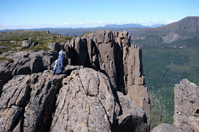
The peak is not the highest in the park, nor is it the most difficult to ascend. What make it sit so sweetly in my memory is a combination of my experiences here, and the superb vistas from the top. I’ve been up there in thick snow, and relished views outward towards a snow-bound Overland Track, and inward to the nearby pine-fringed lakes and vales. I’ve been there with family, introducing them to the wonders of our wilds. I’ve been there with friends (many times); with first-time walkers; and with international visitors who thought Australia didn’t have mountains. While I will certainly tire during the steep climb up a rocky chute to the peak, I will never tire of sitting on the Throne.


[Looking towards the Overland Track from Solomons Throne ... click to enlarge]


2) The upper Mersey River roughly marks one edge of the Central Plateau. The Mersey Forest Rd also gives good access to one of the sweetest spots on the western side of the plateau: Mount Rogoona. I first heard about this mountain during the 1980s. A group I walked with had been planning a trip there, but a major fire burned out much of the track and surrounding areas, so we walked elsewhere. It wasn’t until nearly 20 years later that I finally reached that peak.


[Mount Rogoona from Lake Myrtle]

And what a peak! It sits, sphinx-like, above the waters of Lake Myrtle, its knobby summit giving way to dolerite cliffs that are like a younger, smaller sibling of the Organ Pipes of kunanyi/Mt Wellington. For most visits to Rogoona, Lake Myrtle is the most convenient camping spot. However direct access to the peak is not easy from the lake. I found this out – in reverse – when a few of us decided to return from the summit direct to the lake. I would not recommend it! Rather the track between Lake Myrtle and Lake Meston leads to an easier slant-wise route to the mountain.


[Summit Views from Mount Rogoona]

Rogoona is essentially a small plateau whose summit is near the sheer dolerite cliffs on its north-western edge. So the views from the top are as vast as they are stunning. Steeply beneath and quite nearby is the tranquil Lake Myrtle. But your eye soon wanders west beyond the lake, over the nearby Cathedral Plateau, to the highest mountains of Tasmania, from Mt Pelion East to Mt Ossa and numerous others further south. 


Not once, but twice I’ve had that view ‘interrupted’ by a wedge-tailed eagle flying over. I’ve written in more detail here Eagle, but suffice it to say that being buzzed and eye-balled by the largest raptor in Australia is one of the greatest privileges of being in remote Tasmania. 


[Close encounter with the Rogoona Eagle]

After you’ve had that kind of mind-bending, time-stretching summit visit, there are few better places to sit and contemplate it than by the shores of Lake Myrtle. I’ve written about one particular experience here Myrtle 1, here Myrtle 2, and here Myrtle 3.


3) If the preceding ‘happy places’ would be easy to locate, the third is deliberately vague. Un-named Lakes and Pencil Pine Groves is a category of smultronställe that invites you to do your own explorations; make your own discoveries. And there could be few better places to wander in search of lakes and pencil pine groves than the Central Plateau. 


I once started the eye-watering job of trying to count the number of lakes just on the 1:25 000 Ada map. I gave up after counting 350 in one typical 10 sq km strip. Given there were 19 such strips still to count, it’d be fair to estimate between 5 000 and 7 000 lakes on the Ada map alone.


[So many lakes! A small part of the Central Plateau]


Obviously the number of lakes alone makes searching the plateau for sweet spots a lifelong task. But once the search begins, it becomes more subtle than you’d think. Lakes mean water, and many lakes mean a lot of water. That in turn means often waterlogged ground, and camping in such places isn’t much fun – not to mention the impacts it can have on that environment. In my Central Plateau wanderings I’ve seen many spots that looked great from a distance, but turned out to be unsuitably sodden once you got there and looked for tent spots. 


Happy Place searchers also have to consider another weather factor apart from precipitation, and that’s wind. The often fierce winds here further narrow your camping options. What may be a perfect site on a calm night can turn perilous when the wind gets up. Shelter is paramount, which is why pencil pines are often your friend. But there are complications here too. Many pencil pine groves are so dense that there’s no room for tents. And if there is room, the ground is often covered in dense, soggy sphagnum and/or gnarled tree roots. 


[Boots off and relaxing at a secret campsite]

 So … have I found some ‘Goldilocks Zone’ campsites on the Central Plateau? Of course I have. And I’ve spent some of my most blissful days and nights between a lake and some pencil pines. Am I going to share their locations here? Sorry, I’m not. What I can say is that if you haven’t searched for your own version, then you have a baffling, frustrating, but ultimately sublime quest ahead of you. If you have found such sites - or you recognise some of the ones pictured - I’d suggest you share that information sparingly. Let others have the thrill of the quest. Some places just shouldn’t be on Instagram.


[Does wild camping come any better than this?]

Wednesday, 9 March 2022

Cathedral Plateau 3: Highs and Lows

The bright early evening leaked its light slowly. It was that time of day when the world holds its breath, and anything seems possible. And sure enough Tim D went full Shackleton on us, trying to talk TimO into climbing all the way up to the plateau’s edge to watch the sunset. 


[Ernest Shackleton's supposed newspaper ad. for his Antarctic expedition]

TimO is always up for a challenge, but he was also a very tired boy. I stepped in, taking on the (mock) role of his coach/manager – dreadful Michael Caine accent and all – insisting that ‘my boy ‘ere’ would need more than ‘some dubious promise of a flash of sun, followed by an uncertain return, fully in the dark’. Surprisingly TimO followed his manager’s advice, settling instead for Tim D’s tamer challenge: a game of Yaniv. It was a card game TimO knew nothing about, so he clearly still needed his ‘manager’ (who also knew nothing about the game; didn’t want to try it; and would retire to his tent mid-game). To cut a long story short, TimO lost the game gloriously – and noisily – despite his manager shouting from his tent such timeless encouragement as: ‘Go hard son’ … ‘Give it 110%’ and ‘Go up the guts!’. Yet even after the heavy loss, TimO had to admit it beat a stumbling return through scoparia in the dark!


[A Misty Morning at Tent tarn] 

The morning was quieter, a soft, dwindling mist dampening sound and tent alike. We had a less ambitious day planned, with the ascent of Cathedral Mountain itself the first agenda item. This was even via a marked route, with rock cairns making it hard to miss. This beaten-path look was new to those of us who’d been here many times before. My guess would be that it was down to Cathedral’s status as an ‘Abel’, a label that somehow makes one mountain a more desirable goal than a perfectly beautiful nearby one that doesn’t qualify for that designation.


[Jim ascends from Tent Tarn]

Before we’d ascended far it became clear that Jim wouldn’t be going any further than the first summit. He was again struggling with dizziness and a lack of energy. Today that wouldn’t be a problem, as he could station himself on Cathedral and return to camp safely whenever he liked. So while the rest of us walked beyond the peak, down to the plateau’s edge, he luxuriated in a patch of sun that also had mobile reception. Only a hut would have improved how well this suited him. 


[A Panorama from the Plateau's Edge]

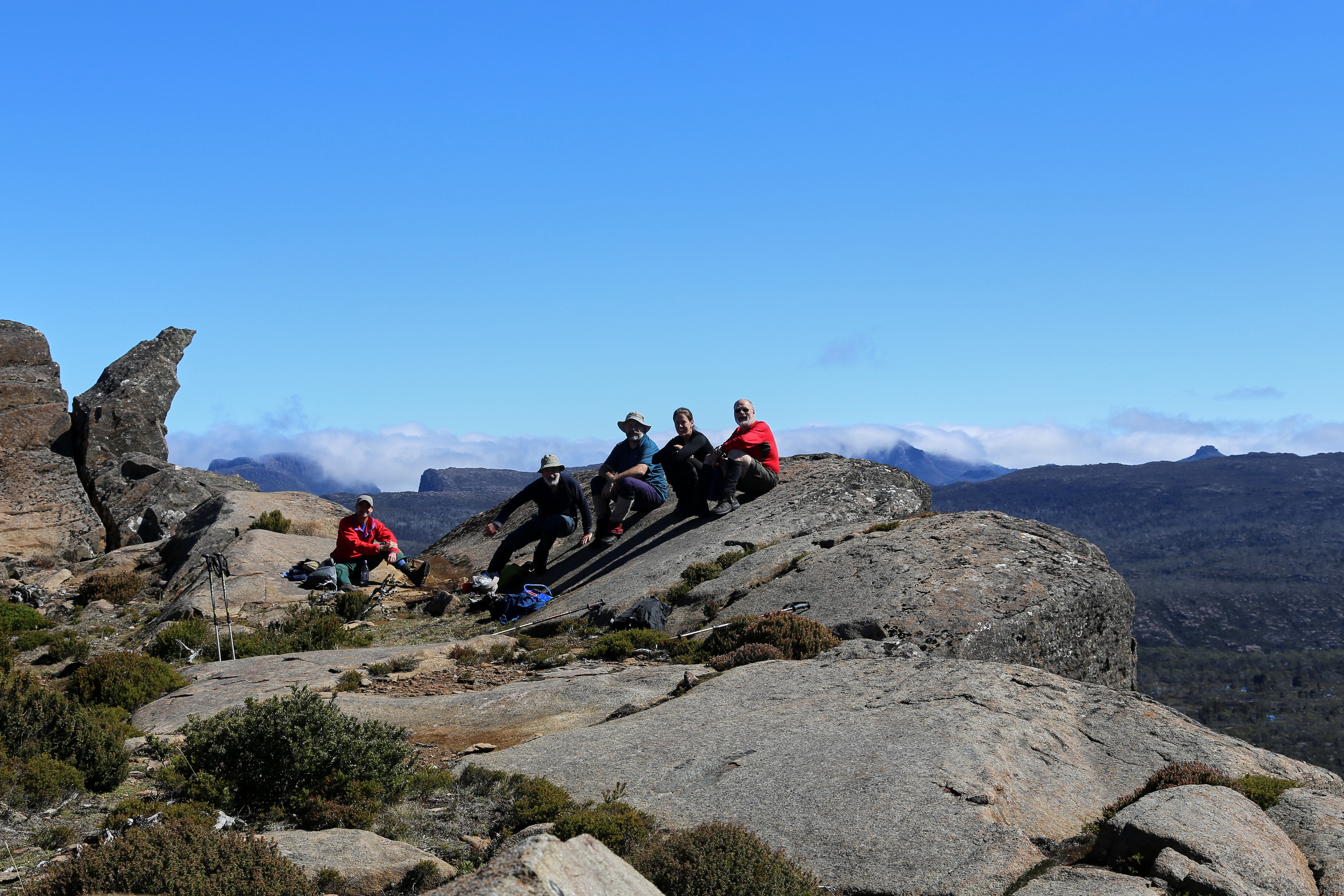
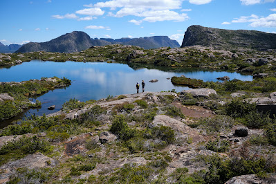
The sky had cleared as expected, and by the time we reached the cliff line, the day was a stunner. The views were even better, with every Overland Track mountain from Olympus in the south, to Cradle in the north, clearly visible. We could even make out a distant Frenchmans Cap. These are views that never pall, and we feasted on them for a long time before deciding that a swim in one of the rim pools further along the edge would make a great day even better.


[Looking towards Mt Ossa and the Pelions]


[TimO at the Edge of Cathedral Plateau]

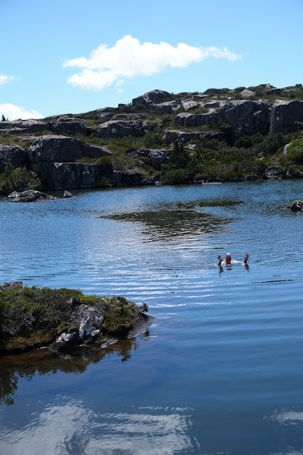
We were spoiled for choice, walking past several lovely looking pools – none of them named – before finding one that had an accessible island and a rock shelf from which we could swim before lunch. I’ve swum in the highlands of Tasmania many times, and it’s rare for the water to be either warm or inviting. Today it was both, and we all plunged in, the Tims choosing to do laps. TimO, despite his delicate Irish complexion, even spread himself on a rock for a micro-sunbake. And from high above we noticed Jim still up on Cathedral, occasionally waving, and (we would learn later) taking distant paparazzi-style pictures of us. 


[Tim D swims in the unnamed pool]

We finished our pool-side stop with a relaxed lunch, and all agreed this had been a rare and sublime episode in an already wonderful day. What could top this, we wondered, as we wandered slowly past a few more pools and then down a ridge towards our home tarn? What happened towards the end of that return didn’t exactly top the rest of the day. But it certainly added an exclamation mark to it!


[What could beat this rim pool scene on Cathedral?]

Our descent was off-track, and mostly through light scrub. This sometimes required us to pick the path of least resistance, so we’d spread out a little by the time we were closing in on Tent Tarn. Tim D, Libby and I had chosen a line down one side of a small scrubby creek, while TimO and Merran were on the other side. Tim D suddenly stopped, and called out “Ooh, a big one!” We knew he was referring to a tiger snake, so Libby and I stopped to see what we should do next. 


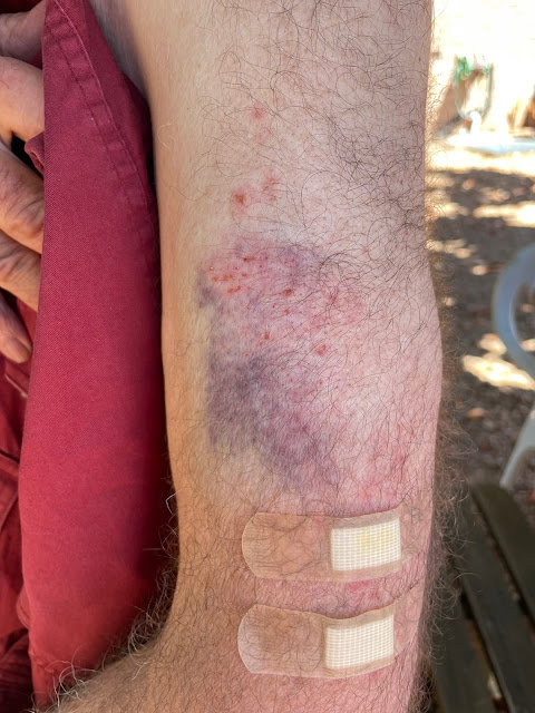
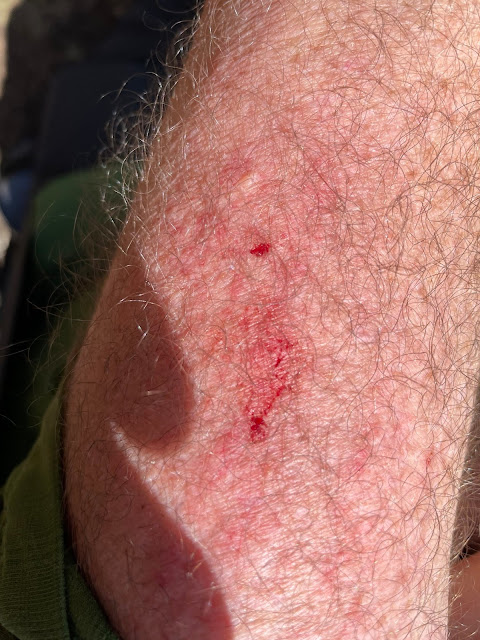
Tim D cautiously walked to the far side of the bush into which the snake had disappeared. Completely without warning the 5 foot long snake darted out of the bush at full speed, straight towards Libby and me. I let out a sharp expletive and rushed to escape in the opposite direction. Instead I stumbled over my trekking pole, falling heavily on my arm. What?! On the ground with a tiger snake just metres away from me?! In complete panic I struggled back to my feet, only to fall again, expecting the snake to be right there where I’d fallen. My heart racing, I eventually scrambled back to my feet to find Libby still standing where I’d last seen her, and Tim D coming cautiously towards us.


Apparently the snake, spooked by Tim’s footsteps, had turned to escape from him only to hear/see another walker (me) crashing to the ground in front of it. The snake had then slipped straight by Libby’s boots as she stood still, “like a rock, like a tree”, as she later told us. Fortunately for me, my attempted escape had been both noisy and diagonal, and the snake had made for the scrub elsewhere. We all stood there for some time, adrenaline pulsing through our bodies, before quietly and cautiously resuming our walk back to camp. We had quite a story to tell!


[My bruised upper arm - photos by Jim Wilson]


[Snake Bite? No, but enough for Jim to beat up a story.]  

What really happened here? I’ve replayed the incident in my mind many times. I am not fearful of snakes. I admire them, and have a healthy respect for them. I would see a couple of snakes every summer when I’m out bush, and have never had an ‘adverse’ encounter with one. But all I can say is that, given this situation 100 times over – a snake coming full pelt, straight at me from 2-3 metres away – I would react exactly the same. Why? Because my reaction to the threat was involuntary, involving my sypathetic nervous system. This is often given the shorthand of “fight, flight or freeze”. Obviously my reaction, “flight”, might not have been wise. All I can say is that it was completely instinctive.


But why was Libby’s reaction so different? She explained to us that she heard the voice of her grandfather, who had experience in handling snakes. If one threatens you, he’d advised her, “be a rock, be a tree”. This sounds like a conscious choice, rather than a “freeze” response, as mentioned above. I can only say I’m astonished by her reaction, which was both wise and effective. In my own case, I’d have to say that my conscious mind was not in play in my own initial response. 


As we told the others our story back at the campsite, we again showed our different emotional reactions to the adrenaline that was still coursing through our systems. I gabbled out loud, retelling the story over and over, while Libby had a quieter emotional moment. Over dinner we continued to reflect on a day of amazing highs and literal lows (for me at least), before Tim D brought out some port to settle us for the evening. 


[Another Misty Start at Tent Tarn]

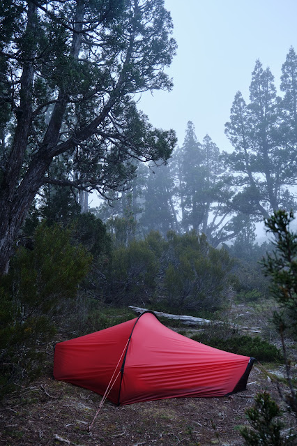
The next morning, our last, saw us up very early. Our plan was for most of us to walk all the way out in time for a latish lunch at the Mole Creek pub. Libby was staying one more night, taking advantage of the great weather and the chance of a bit of solitude. It was misty again, and our tents were wet. But with no time to dry them, we simply bundled them away. In theory last day packs are lighter, but ours were wetter and lumpier. Finesse isn’t always a priority when you need to get walking by 7am.


[Tim and Merran's Tent Fly shaken in the sunrise] 

As we waved Libby farewell, the mist was already lifting, and the views we soon had over Chalice Lake were a sparkling delight. The (theoretically) lighter packs and the gently downhill track made everything feel easier. That was until the very steep descent to the Grail Falls campsite, and the similarly steep ascent out of that valley. Steeply down became the theme thereafter. And if anyone thinks that’s always good news, they haven’t tried a rapid descent at this gradient, with a full pack and ageing knees. 


[Farewell to Chalice Lake]

It was an enormous relief to finally break out at the carpark. It was hot, and we were exhausted and thirsty. But if we felt a little sorry for ourselves, we were sorrier for the two walkers we met at the carpark. They were about to walk in the way we’d just walked out. It was just after 1pm, and they had their sights set on reaching Tent Tarn that afternoon. We wished them well, before getting changed into street clothes and driving out to Mole Creek.


Alas our vision of a luxurious hot counter meal and a cold beer was dashed. We arrived just 10 minutes after the kitchen had closed. There was nothing for it but to enjoy that cold beer with a pie from the bain-marie. Somehow though, after five days of bushwalking food, that managed to seem enough of a feast. I certainly wouldn't count it as a low, not when compared with falling down in the path of terrified/irate snake!