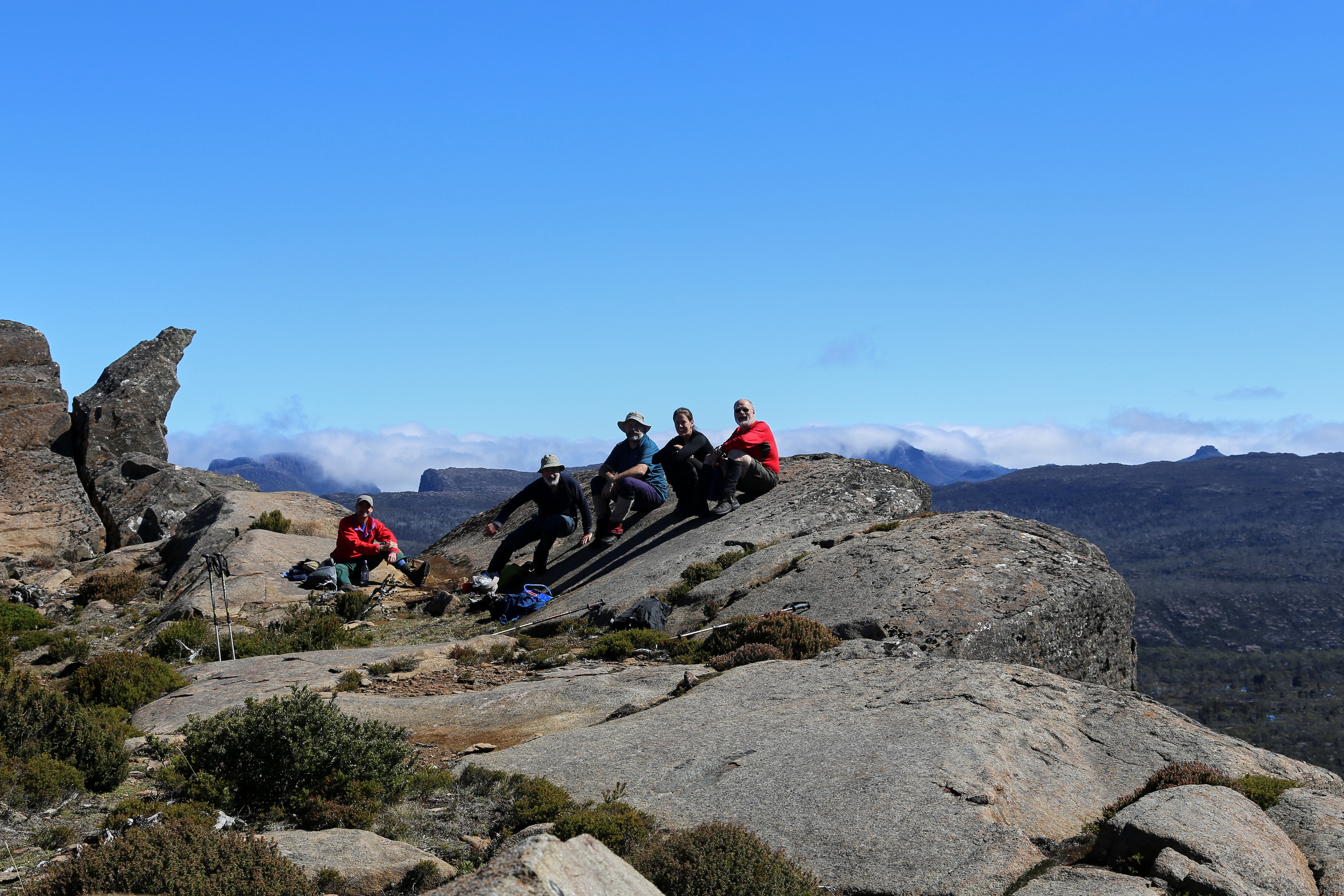
Jim's Last Walk? |
Jim ready to start |
It's all uphill |
Moss, ferns and fungi |
Colourful trackside fungi |
Dwarfed by a giant survivor |
The Hut At Last! |
Expert log splitter at work! |
![]() |
Enjoying the glow, but keeping puffers on. |
Nature is home, even if we live in cities. I'm a Tasmanian-based writer who loves learning and writing about the natural world, from the smallest bugs to the broadest landscapes. That passion led me to co-found the Wildcare Tasmania Nature Writing Prize, and to write the book "Habitat Garden". I also write a quarterly column, "The Patch", for 40 South magazine. © All material in this blog copyright Peter Grant (unless otherwise stated)
Jim's Last Walk? |
Jim ready to start |
It's all uphill |
Moss, ferns and fungi |
Colourful trackside fungi |
Dwarfed by a giant survivor |
The Hut At Last! |
Expert log splitter at work! |
![]() |
Enjoying the glow, but keeping puffers on. |
Past tears are present strength
– George MacDonald
We left our campsite a little after 10am and continued down Harry Lees Lake – actually a long, two-part lake – for a bit over a kilometre. There was no track, but the going was delightfully open along the lakeside, if a little scrubby once we climbed out of the valley. Again we didn’t know exactly where we were going. But Tim D and Libby, along with Merran (who missed this walk due to work obligations) had come this way before. They were sure we’d find plenty of lakeside camps in the country between Turrana Bluff and Turrana Heights.
![]() |
[Clambering around the end of Harry Lees Lake] |
First we had to sidle around some lumpy, rocky country, passing some good stands of young pencil pines. Just before we dropped down into a shallow valley, we were visited by a wedge-tailed eagle. It circled us inquisitively for a while before apparently concluding we were neither threat nor food. The wind continued to be strong, and showers were still blowing through occasionally.
Once we were in the valley, we stopped for lunch near a rock shelter. There Tim D told us the story of what happened last time he, Merran and Libby had come this way. They’d been walking towards the head of the Little Fisher valley, and had come down a steep, rocky slope just above where we were now sitting. A slight miss-step by Tim had led to a tumble downslope. Unfortunately one leg had been caught behind the other, and as he fell Tim’s full weight came down on the front leg, which crashed onto a rock. He coolly described the crack he heard as his fibula snapped.
![]() |
[Pencil pine groves punctuated the walk] |
After lunch we climbed steeply and slowly out of the valley, and up towards a shoulder of Turrana Bluff. The last part of the climb was through waterlogged tufty grass, with ample evidence of the wombats and wallabies that helped to keep the grass cropped. It was beautiful walking, though the slope was unrelenting. When we finally crested the rise, there were mutterings about going on to the summit of Turrana Bluff, which was only a kilometre or so away. I gruffly demurred, mainly because I’d found the ascent thus far hard enough without adding a further 200m climb to it. I also pointed out that I’d been there before – albeit decades ago – so I felt no “peak bagger” pull. That might not have been fair to Tim D, who had more reason than most of us to reach that particular summit. But for the time being we decided to leave the climb till later, and instead used our dwindling energy looking for a camp-able lake among the dozens we could now see below us.
![]() |
[Our camp beside a tarn near Turrana Bluff] |
We dropped down through light scrub and the occasional scoparia thicket, and scouted around a few pools, tarns and small lakes sniffing out a suitable spot. We eventually settled on a small tarn around which we could just fit five tents. The forecast had promised the winds would abate, so we weren’t too fussed about any perceived lack of shelter.
That faith in the forecast came back to haunt us. Our tents were shaken all night, the strong winds and rain having come back with a vengeance. It seems no-one slept well, and there could have been much grumbling over breakfast, had the promised fine weather not finally made an appearance. Instead, by 9 am it was a revitalised team that packed day packs, and strode up the hill towards Turrana Bluff. Tim D in particular had a date with the bluff he'd so dramatically missed out on last time. With blue skies and a gently wafting breeze, we could not have chosen a better day for a side trip to the top of this impressive 1454m mountain.
![]() | ||
[Summit selfie, Turrana Bluff]
|
Beneath us we looked down on the Little Fisher Valley, and beyond that to the Walls of Jerusalem. All around us were familiar mountains, some spattered with snow, as well as some of the many thousands of lakes and tarns that dot the wondrous Central Plateau. But nowhere to be seen was my grumpy, non-peak-bagging self. I was so glad to be up here. And you can bet Tim D was too.
![]() |
[Ready to leave, at last!] |
I usually reckon type 2 fun – something that’s difficult at the time, but which turns out to be rewarding – applies well to bushwalks. But just occasionally it applies to the lead up to a walk.
Organising the first bushwalk of summer with my usual walking mates was close to classic type 2 fun. That partly came down to our differing bushwalking styles and preferences. Some of us like to walk to wild places, far from the madding crowd. Some of us like a walk to be short and sweet, preferably with the comforts of a hut, and the prospect of meeting new walkers. Still others of us like the challenge of reaching a mountaintop, or finding our way through new, preferably trackless country.
Trying to juggle the various walk preferences; lock in the dates; settle on a venue; nail complex transport arrangements; deal with last minute changes; factor in the weather – all in the age of COVID – made the organisation of this walk more than a little fraught.
But then, miracle of miracles, as soon as we got to the start of the walk, the difficulties began to be eclipsed by the rewards, and the smiling began. In truth for two of us, the smiling had begun a day early. Knowing that on this walk we wouldn’t get to stay in a hut, Jim’s high-rank preference, he and I had gone up early and spent the night at the Great Lake Hotel: a very fancy "hut", by our standards.
Our four day jaunt was to begin not far from Great Lake. We would walk into the Central Plateau/Walls of Jerusalem area, starting from Ada Lagoon. We’d eyed off several potential lakeside camps, with Silver Lake our likely first destination. I’d walked there a few times, but not for many years. So in writing up the walk plan, I allowed six hours to get from Ada to Silver: a generous estimate, I thought.
![]() |
[Walking beside Ada Lagoon] |
We didn’t manage to start walking until after 12 noon, partly because of the tight preparation time available for the full-time workers in the group. But we kept smiling, and the weather gods smiled back at us. The forecast showers were nowhere to be seen. Instead they’d given way to a blue sky off-set by welcomingly fluffy clouds.
Compared to the more popular end of the Walls of Jerusalem, this walk has an unspectacular start. It’s flattish, largely treeless, and partially on an old fourwheel drive track. For us though, the lack of high peaks and deep forest was compensated for by the wide open vistas, the glittering of lakes near and far, and the stunning early summer wildflower displays. Golden pultenaea, creamy orites, red waratah were all on peak display, offset here and there by smaller, more cryptic caladenia and diuris orchids. And of course there was the company. We hadn’t all been together for many months, and there was a lot to catch up on.
![]() |
[Easy walking among summer wildflowers] |
But we had started late, and this was soon compounded by slower pace of some of us. Dare I name we retirees for this? Anyway we didn’t exactly set a cracking pace on the outward run. By the time we left the marked track and began the slow, scrubby descent towards Lake Antimony, fatigue was setting in. The intransigence of the scrub, with every second Hakea bush or banksia seemingly intent on grabbing us, exhausted us further.
![]() |
[Caladenia alpina orchids] |
Even the sight of Antimony Hut #5 did little to brighten the eyes of the hut-lovers. We gave the humble structure a perfunctory once-over, and left for the short trek over to Silver Lake. But first we had to cross the fast flowing Powena Creek. Wet feet and a less-than-desirable distance between the lead walkers and those at the tail end, didn’t improve matters.
![]() |
[Jim and TimO at Antimony Hut #5] |
Still, soon enough we saw the southernmost of the twin Silver Lakes, with a bright red tent already set up on its far shore. But by now the six of us had separated into two groups of three, and we’d lost visual contact with each other. It took an extra forty minutes for us to locate one another near the southern shore of south Silver Lake. The original plan had been to go to the northern shore of the north lake, where I knew there was plenty of space. But by now my generous six hour walk time estimate was proving regrettably accurate. So, just after 6 o’clock, we all agreed to simply get to a viable campsite and set up for the night.
The occupant of the red tent called out a welcome across the lake, and advised us as to where we might fit our tents. All that was left was for us to ford the Pine River and walk to the lakeside to find tent sites. Wet feet, fatigue and concern that we might crowd the solo walker were soon forgotten as Tim D showed us a goodly number of potential tent sites, all well distant from “Neighbour Dave”, as we dubbed the solo walker.
![]() |
[Durston and Hilleberg vie for attention at Silver Lake] |
Better still our neighbour was more than happy to have company. He even came over to help me set up my red tent. He’d recognised it as a variation on his own Hilleberg Akto tent (mine is the lighter weight Hilleberg Enan). I later visited his tent, and we shared fan boy enthusiasms over our well-made Swedish tents.
![]() |
[Relaxing at the tarp set up] |
Back at our site, Jim was having his own fanboy moment, showing off his new Durston X-Mid 1 tent, which we quickly dubbed "The Hut": another attempt to console Jim for the lack of huts on this walk. Tim D had set up the next best thing, an ample 4m X 3m tarp, and we were soon gathered around it enjoying the luxury of cheese, biscuits and wine before a late dinner. We were tired from our day’s exertion, but as we stretched out, mesmerised by the views across the lake to the Walls of Jerusalem, I think we remembered to be grateful.
The Central Plateau has been dubbed ‘the roof of Tasmania’, and ‘the land of a thousand lakes’; which is about as nuanced as calling Australia the ‘wide brown land’. There’s so much more to this wild and high part of our island state.
It owes a great deal of its identity to dolerite, and to a massive sub-surface upwelling of that igneous rock during the Jurassic age. Almost equally its identity has since been shaped by the ice sheet that covered the surface during a number of glacial phases. That covering was more ‘doona’ than ‘sheet’, as it measured hundreds of metres thick in some parts. As that huge amount of ice, at least 6000 sq km in area, slowly jostled and crunched across the plateau, it carved out lakes – many more than a thousand – and left sharp peaks and dramatic clefts.
![]() |
[A special spot on Tasmania's Central Plateau] |
While much of that ice-age drama is over, the Central Plateau remains a vast area of largely wild high country. It’s roughly bounded by Great Lake to the east, the Great Western Tiers to the north, and the Walls of Jerusalem to the west. To the south the boundary is more vague, but perhaps the Lyell Highway marks a convenient edge. As this post is about my ‘happy places’, it’s probably okay to leave the big picture fuzzy, and focus in on the subject at hand.
So … where on this cold, high, wet and wild plateau are my happy places? I’m particularly thinking of smultronställe, a Swedish word that evokes that sweet, semi-secret favourite place; somewhere that – particularly during these cold months – makes me smile just thinking about it.
![]() |
[A sweet end to a lakeside night] |
During more than 40 years of walking in Tasmania, I’ve been privileged to walk across the plateau numerous times, from every direction. I’ve written about some earlier walks here Walking With Ada and here No Lack of Lakes All that plateau wandering makes choosing particular smultronställe as difficult as naming my favourite child. But if I had to pick just three Central Plateau ‘happy places’, they would be (in no particular order):
1. The Walls of Jerusalem
2. Mount Rogoona
3. Un-named Lakes and Pencil Pine Groves
1) Certainly this choice needs some narrowing down, as The Walls of Jerusalem National Park covers 518 square km! Scattered across this mountain-fringed park are some wonderful campsites, both formal and informal; on-track and off-track. And I could have selected any of those. But because mountains are such a feature of The Walls, I’ve chosen Solomons Throne as my Walls of Jerusalem ‘happy place’.
![]() |
[Friends share special times on Solomons Throne] |
The peak is not the highest in the park, nor is it the most difficult to ascend. What make it sit so sweetly in my memory is a combination of my experiences here, and the superb vistas from the top. I’ve been up there in thick snow, and relished views outward towards a snow-bound Overland Track, and inward to the nearby pine-fringed lakes and vales. I’ve been there with family, introducing them to the wonders of our wilds. I’ve been there with friends (many times); with first-time walkers; and with international visitors who thought Australia didn’t have mountains. While I will certainly tire during the steep climb up a rocky chute to the peak, I will never tire of sitting on the Throne.
![]() |
[Looking towards the Overland Track from Solomons Throne ... click to enlarge] |
2) The upper Mersey River roughly marks one edge of the Central Plateau. The Mersey Forest Rd also gives good access to one of the sweetest spots on the western side of the plateau: Mount Rogoona. I first heard about this mountain during the 1980s. A group I walked with had been planning a trip there, but a major fire burned out much of the track and surrounding areas, so we walked elsewhere. It wasn’t until nearly 20 years later that I finally reached that peak.
![]() |
[Mount Rogoona from Lake Myrtle] |
And what a peak! It sits, sphinx-like, above the waters of Lake Myrtle, its knobby summit giving way to dolerite cliffs that are like a younger, smaller sibling of the Organ Pipes of kunanyi/Mt Wellington. For most visits to Rogoona, Lake Myrtle is the most convenient camping spot. However direct access to the peak is not easy from the lake. I found this out – in reverse – when a few of us decided to return from the summit direct to the lake. I would not recommend it! Rather the track between Lake Myrtle and Lake Meston leads to an easier slant-wise route to the mountain.
![]() |
[Summit Views from Mount Rogoona] |
Rogoona is essentially a small plateau whose summit is near the sheer dolerite cliffs on its north-western edge. So the views from the top are as vast as they are stunning. Steeply beneath and quite nearby is the tranquil Lake Myrtle. But your eye soon wanders west beyond the lake, over the nearby Cathedral Plateau, to the highest mountains of Tasmania, from Mt Pelion East to Mt Ossa and numerous others further south.
Not once, but twice I’ve had that view ‘interrupted’ by a wedge-tailed eagle flying over. I’ve written in more detail here Eagle, but suffice it to say that being buzzed and eye-balled by the largest raptor in Australia is one of the greatest privileges of being in remote Tasmania.
![]() |
[Close encounter with the Rogoona Eagle] |
After you’ve had that kind of mind-bending, time-stretching summit visit, there are few better places to sit and contemplate it than by the shores of Lake Myrtle. I’ve written about one particular experience here Myrtle 1, here Myrtle 2, and here Myrtle 3.
3) If the preceding ‘happy places’ would be easy to locate, the third is deliberately vague. Un-named Lakes and Pencil Pine Groves is a category of smultronställe that invites you to do your own explorations; make your own discoveries. And there could be few better places to wander in search of lakes and pencil pine groves than the Central Plateau.
I once started the eye-watering job of trying to count the number of lakes just on the 1:25 000 Ada map. I gave up after counting 350 in one typical 10 sq km strip. Given there were 19 such strips still to count, it’d be fair to estimate between 5 000 and 7 000 lakes on the Ada map alone.
![]() |
[So many lakes! A small part of the Central Plateau] |
Obviously the number of lakes alone makes searching the plateau for sweet spots a lifelong task. But once the search begins, it becomes more subtle than you’d think. Lakes mean water, and many lakes mean a lot of water. That in turn means often waterlogged ground, and camping in such places isn’t much fun – not to mention the impacts it can have on that environment. In my Central Plateau wanderings I’ve seen many spots that looked great from a distance, but turned out to be unsuitably sodden once you got there and looked for tent spots.
Happy Place searchers also have to consider another weather factor apart from precipitation, and that’s wind. The often fierce winds here further narrow your camping options. What may be a perfect site on a calm night can turn perilous when the wind gets up. Shelter is paramount, which is why pencil pines are often your friend. But there are complications here too. Many pencil pine groves are so dense that there’s no room for tents. And if there is room, the ground is often covered in dense, soggy sphagnum and/or gnarled tree roots.
![]() |
[Boots off and relaxing at a secret campsite] |
![]() |
[Does wild camping come any better than this?] |