Showing posts with label Tasmanian Wilderness World Heritage Area. Show all posts

Tuesday, 14 December 2021

Walking the February Plains 1: Detachment

Being in the presence of what absolutely endures detaches us from that ephemeral news for which we are usually agog.

         – Frédéric Gros (‘A Philosophy of Walking’)

Of all the reasons we hoist a pack and walk into the wild, getting detached from our usual lives is close to a universal. When the walking starts, so does the slow shedding of the skin of our bustle. Before this walk both Tim and I had been burdened in different ways. In Tim’s case some difficult issues in his work as a consultant wanted to slip into his pack. In my case the ups and downs of a writer’s life had me doubting the direction my work was going. It was time to detach! 


Where we'd rather be

So preoccupied have we been that it’s only at the last minute that we choose the February Plains as our destination. It’s not the glamour choice for walkers in search of lofty peaks. It not only lacks those, it’s also deficient in such other drawcards as lakes and forests. And over the years this sub-alpine upland, rarely higher than 1150m, has been grazed, mined, burned and otherwise given grief. Especially hard were the wildfires of 2016, which have left swathes of its slow-growing bush stark and grey, adding to its scarred and weather-worn visage. 


Ready for off!

For all that, we know the Februaries have a way of wheedling their way into your heart. So we’re smiling as we slip on our packs and set off into what is still, a sign soon reminds us, part of the Tasmanian Wilderness World Heritage Area. It’s my third trip here, while Tim has lost count of his many visits to what is almost part of his back yard. 


A lunch stop at Basil Steers #2

While the detachment has begun, I soon find it’s not possible to leave behind my relative lack of walking fitness. The amount of ascent is low, but I’m still puffing more than I should. I’m glad when we reach one of the snarer’s huts built by Basil Steers and family in 1974. We’ve been here before and, after signing the log book, we enjoy a leisurely lunch in its well cared-for vicinity. We marvel afresh at how fortunate the hut was to survive 2016’s fires. Its forest surrounds are still blackened. 

Wildflowers are one beneficiary of the fires. Shortly after leaving the hut we come across carpets of ground-hugging Hibbertia procumbens, their bright flowers extravagantly strewn across our way like precious confetti. There’s no actual track. We just wind our way around bogs and scrubbier sections, sometimes high-stepping over thicker bush. Once we’ve got our rhythm, we settle into stories of past trips here, including Tim’s encounter with a giant tiger snake that chased him off its territory. I spy one of the hills we climbed last trip, recalling who was with us and what we’d talked about. I express my relief that we’re not climbing it again today with a full pack. 


A carpet of Hibbertia in bloom

A couple of hours after lunch we reach a familiar though unnamed lake, its shore dotted with pencil pines. We’ve discussed the possibility of looking for a campsite further on. But picking up on my mood, Tim is happy to make this small lake our base. He and his family know it well enough to have given it their own name, Lake Nycteris, after a character in one of their favourite George MacDonald fairy tales. They haven’t camped here though, so we spend the next half hour circumnavigating the lake in search of the ideal campsite. 


A burned pencil pine beside the lake

The 2016 bushfire has come very close, burning part of a nearby myrtle beech forest, and taking out a couple of pencil pines in the sphagnum bog by the shore. In the end we find a site just large enough for my one-person tent and Tim’s tent/tarp set up. It’s by the lake shore, next to the outlet stream, and beside a small copse of pencil pines. It’s perfect, or nearly so. As soft as it makes us sound, it’s only when we’re sitting in our Helinox Chair Zero chairs with a hot brew in hand that we really feel settled. We’re in total agreement that these little camp chairs are worth their 500g in weight! 


Our set-up beside the lake

Settled perhaps, but not yet fully detached, we keep chatting about the work matters that have added weight to our packs. And we talk real estate, comparing local development issues that threaten to change the feel of our respective local areas. But eventually these matters slide into the background. 


The wider scene, with Clumner Bluff behind

Here, by this quiet lake, tucked under its forested hill, with views stretching down valley and across to a distant Clumner Bluff, with a hundred frogs calling from the water, a few shy wallabies eyeing us quietly, and a sky only scantily clouded, we find the other side of the equation. Now we’re beginning to attach ourselves to what truly matters. This is real real estate.

Tuesday, 19 February 2019

Narcissus and the Fire-Dragon


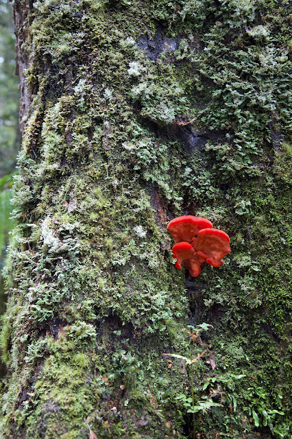
[Fungi and lichen on a sassafras trunk] 
Every trip has its backstory. They just don’t usually feel as earth-turning as this one. Normally it’s where to go; who can come; whether we’re fit enough; and who’s providing transport. This summer all that was deeply overshadowed, quite literally, by bushfires.

They began in late December 2018, when dry lightning strikes ignited several fires in the Tasmanian highlands. In what is starting to look like the new normal, thousands more lightning strikes occurred on January 16 and 29. I watched a simulation of the lightning storms as they crossed from north-west to south-east. It was as though a vast and merciless dragon was swooping and swerving across our island, breathing deadly fire, now to the left, now to the right. The fires started by the dry storms continued burning for weeks, along a vast front. By early February 2019, over 40 fires had burnt around 200,000 ha, almost 3% of Tasmania.

There’s a more personal slant to the story. By January 4 the Gell River fire in the central south-west had grown into a monster. As it roared down the Vale of Rasselas, a vast smoke plume spread westward, piling high into the sky behind kunanyi/Mt Wellington. An eerily murky pall settled over the city of Hobart for days. Nobody could breathe easy in any sense.


[Smoke 'erupts' behind kunanyi/Mt Wellington] 
All day long we had the radio on, listening for updates, wondering if the fires would reach Hobart. We hastily worked out our fire plan, with southern Tasmania’s disastrous 1967 fires firmly in mind. That calamity claimed 64 lives, injured around a thousand, and razed 1300 buildings. If fire struck here again our plan was simple: get out early. Twice we packed overnight bags and precious items. We photographed parts of the house interior, in case we’d need to remember what was replaceable. The irreplaceable would be just that.

If that wasn’t unsettling enough, we were deeply troubled that the fires were burning through the heart of Tasmania’s Wilderness World Heritage Area. They tore through wet highland forest and lapped up to the achingly beautiful Lake Rhona. All the while the weather stayed relentlessly hot and dry, the usually wet westerlies tight-buttoned and sober.

Fire sped east and south, igniting the ridges leading towards Mt Anne and its irreplaceable King Billy pine forests. They raged across buttongrass plains and up the slopes of the iconic Western Arthur Range. They menaced the majestic Gondwanan forest on the flanks of Mt Bobs, with half an eye on Federation Peak itself. They crawled across the Central Plateau near Great Lake, taking out some pencil pines, cushion plants and cider gums.


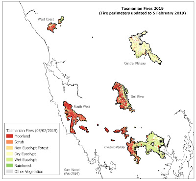
[A map of some of the 2019 fires, courtesy https://firecentre.org.au/] 

These are just some of the places I know personally. Hundreds of other precious wild places were burning at the same time, not to mention the forest and scrub fires that were threatening – and already destroying – homes and properties in the Huon Valley to the south-east. Up to 700 firefighting staff and hundreds more volunteers employed firebombers; helicopters; temporary irrigation systems; chemical fire retardants and just plain elbow grease to try and limit the damage.

It was in this context that I chatted with a couple of friends who are both senior fire managers. After talking about all that was being done to try and douse the fires, one simply added “Pray for rain!” I said I would, adding that if it helped I would even do a rain dance. (Not a pretty sight, we agreed!)

Gallows humour aside, I was deeply despondent, but also angry. It felt as though my heart country, those wild and wet places that are refuge for the wonderfully strange vegetation of old Gondwana, was under brutal assault. At the same time it seemed our political leaders were actively refusing to acknowledge that this – and the mass fish kill in the Murray-Darling; and the unprecedented bleaching of coral in the Barrier Reef; and the newly minted record hot/dry January all over Australia – resulted from climate change. And not the slow and incremental change we might have expected, but sharp and damaging change.

I did pray for rain, and I also planned to get out there – somewhere, anywhere – to feel the wilderness beneath my feet; the clear air in my lungs; and just perhaps to hear the whisper of Gondwana again.

With many of the usual tracks closed because of fire risk, we ummed and arred in the lead up days to our walk, trying to settle on somewhere we could still go. And then, of course, it began raining: beautiful, long, soaking wet rain. Where we live we had around 40mm overnight, with the promise of more to come. We could hardly complain, but the wet forecast further restricted our options. Be careful what you pray for!


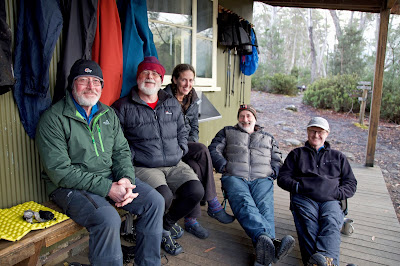
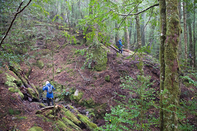
[Our group shelters on the Narcissus Hut verandah] 
So, on a wet and windy Saturday, five of us finally found ourselves on the ferry trip up leeawuleena/Lake St Clair. Our far-from-adventurous destination was Narcissus Hut, just a few hundred metres from the ferry jetty. It’s not exactly the heart of the wilderness, but as we lugged our packs from the jetty to the hut, it felt good to hear the currawongs call, and the dollops of rain on the roof, and the whoosh and scratch of wind in the trees.

Narcissus Hut is the poor relation of Overland Track Huts. Most who reach it are intent on going somewhere else: either home via the Lakeside Track or ferry, or up to Pine Valley Hut for more exploration of the national park. We – and plenty of freshly arriving Overland Track walkers – soon learned that the route to Pine Valley was shut. So quite a few walkers hastily re-arranged their plans; tried to change their ferry booking; or simply decided to stay a night or two at Narcissus Hut with us.


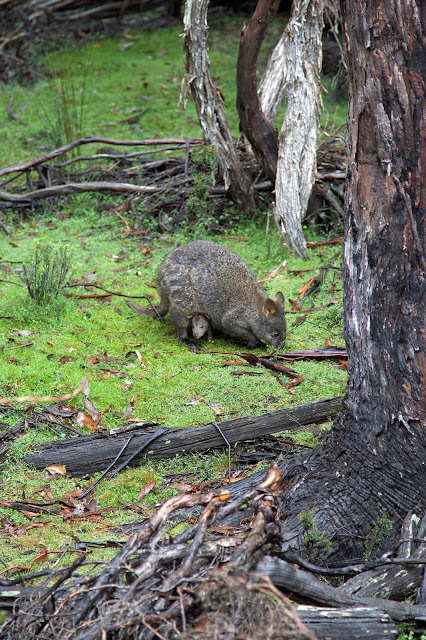
[Pademelon and mother near Narcissus] 
With the exception of Jim, who loves a hut, we’d set up tents on the nearby platforms. Still, it rained a lot, and Narcissus is a small hut. So with everyone cooking inside, we cooked and ate in shifts. It’s always interesting to hear what walkers have thought of their Overland Track trip, and we had a fine social time conversing with walkers from places as far away as Macau, Venezuela, Alaska, Taiwan, Canada and France. But it wasn’t quite the wilderness time we were hoping for.

So on Day 2, regardless of the wet forecast, we filled our day packs with all the necessary gear, donned our waterproofs, and headed off towards Byron Gap. Less than 10 minutes into the walk I could already feel the wildness doing me good. After 20 minutes on flat boarded track, we reached a track junction in wet forest, and turned towards the Gap. Starting from an altitude of around 700m, we knew we had a nearly 300m climb to reach there. But the narrow, winding track through tall forest beckoned.


[Ascending towards Byron Gap] 
I won’t say it was easy: it took over 2 hours to get to Byron Gap. But I must say it was sublime. No one in the group had been on the walk, and I’d talked it up with phrases like “brilliant rainforest” and “superbly uber-green, mossy and beautiful.” My apprehension at having over-sold the area quickly dissolved, and the sighs and soft words of appreciation told me it was working on the others too. Never mind that it was raining, it was a rainforest!! Better still it was a glad, green and growing one. And for now at least, it was safe from the fires that we prayed were being taught wet lessons from this stern and insistent rain.


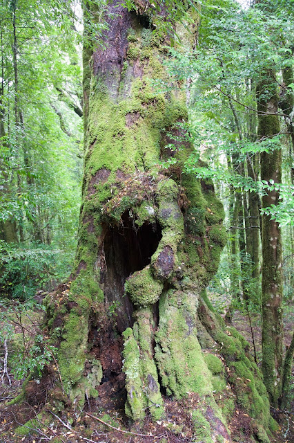
[An ancient giant in the rainforest near Byron Gap] 
I wonder sometimes whether my love for these Gondwanan forests verges on the mystical. The sassafras, myrtle beech, King Billy pine, celery-top pine, fern and leatherwood of these forests are plants with links back to the supercontinent of Gondwana. They’re kin to plants found in other former Gondwanan places like New Zealand’s South Island and Patagonia. They are also completely unlike anything I grew up with. Yet before I’d met them I used to draw forests just like these: with green mossy tree trunks, bright glossy leaves, ferns and a carpet of fallen leaves everywhere. And always there were waterfalls … and probably fairies too.


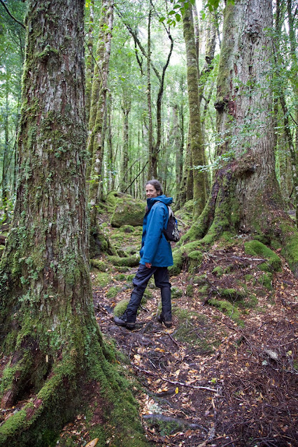
[Libby soaks in the green wonders of the rainforest] 
This childhood dream was dampened by sweat, rain and some blood-sucking reality by the time we stopped at the un-forested top of the Gap. After more than a month of heat, drought, and a lack of victims, a legion leeches warmly welcomed us to their world. Between showers and glimpses of nearby Mt Byron, we had a restless and rapid lunch. After plucking off as many leeches as we could find, we turned around and descended back to where we’d come from.

If tiredness and a slight itchy paranoia took some of the gloss from the wonders, it was still as marvellous descending through the forest as it had been going up. That green glow stayed with us back at the hut, and well beyond.


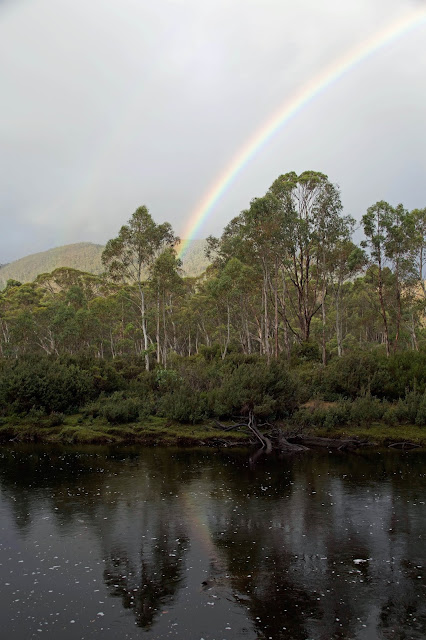
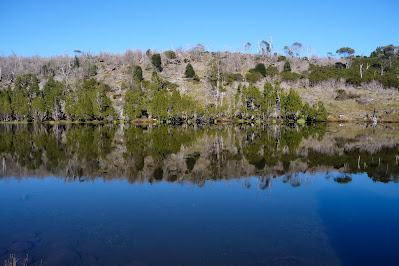
[Rainbow reflections from Narcissus Hut]
Narcissus and reflections: I suppose they go together. After a month under the dire spell of a this 2019 fire dragon, my mind wandered into the territory of myth. Perhaps I was hoping for a brave St George to slay this dragon. Instead, among our political leaders at least, I could find only a weak and witless Narcissus. 


[Narcissus prefers his own reflection to the beauty of Echo: artist Solomon J. Solomon] 
In the original myth a beautiful nymph named Echo fell in love with Narcissus. But he did not return her love. Instead he became so enamoured of his own reflection in a pool of water that he gazed at it day and night, eventually dying for lack of food and sleep. And Echo, broken-hearted, wandered into the mountains, where she pined away until only her melodious voice remained.

I know it’s not just our leaders who are focussed on themselves. So many of us are enchanted by how fine we look reflected in the glow of the things we’ve created. But it's not just about us. While we're busy admiring ourselves, and pretending we are masters of all, the world of nature, like Echo – and perhaps also Gondwana – retreats into the mountains and begins to fade away.

Thursday, 22 June 2017

Back to the Arthur Range 1: A is for …

I feel it deep in the pit of my stomach, although I’m not quite sure what to name it. I eventually decide it’s apprehension. Unlike Mick and Eden, the two other walkers in the party, I’ve previously been to the Western Arthur Range in Tasmania’s south-west wilderness. It might have been 35 years ago, but I know what to expect. I remember it as one of the hardest, most epic walks of my life: a rite of passage to an aspiring bushwalker.


[The old H-frame pack, as used in 1982] 
That 1982 trip was only my second proper expedition into the Tasmanian wilds. I was still in my 20s and had only rudimentary gear. I also had barely a clue as to how you prepare for such a walk. Into my old H-frame pack I threw whole potatoes, zucchinis, carrots and onions, plus fresh steak, some cans, and more clothes than I could possibly use. It’s a wonder I survived.

Youthful ignorance notwithstanding, I at least had the sense to be a little apprehensive before we left, especially when the serrated outline of the range reared up at us we neared Scotts Peak. I remember naively suggesting that the track must sidle around the peaks, rather than going over them. A tart “Nup … up and down the whole lot” quickly set the butterflies flapping.


[Surveying the Western Arthur Range from McKays Track] 
Afterwards my main responses to the trip were a peculiar mix of vertiginous joy, stunned awe and fear. We had walked through a landscape that shouldn’t exist in this “wide brown land”, on a route so steep that it hadn’t looked remotely passable.

But back to January 2017, and my renewed acquaintance with both the Arthur Range and my apprehension. The source of the latter is not just my time-eroded knowledge of what’s ahead, but also the nagging thought that my now 60+ year old body is not going to like this. Add a very ordinary looking weather forecast, and you’ll forgive a few butterflies.

We start promisingly. The weather is cool, the cloud patchy, and there’s a strong breeze. That’s better than par, this being the south-west. We make good progress, soon breaking out onto the white quartz of McKays Track. Our path meanders across the wide buttongrass plains that lead to Junction Creek, and the moraine by which we’ll access the range.


[Buttongrass and track near Junction Creek] 
All the way the Arthurs loom ever larger, and the amount of mud increases. By Junction Creek we’re lightly marinated in mud, but the creek is flowing swift and clear, and we clean off a little as we cross to the southern side. With plenty of daylight left, we find some good campsites and put up two tents and a tarp. Mick has chosen to combine a tarp with a bivvy bag as an experiment. As he fiddles with the setup, we offer helpful comments like “What could possibly go wrong?” But we do give him a hand with some of the guy lines, and eventually he looks set.

By morning the clouds have thickened, and they’ve flattened the top of the range. As we reach the toe of Moraine A, showers are scudding by. The track onto the range looks brutally steep, an off-white ribbon winding through tawny buttongrass pocked with quartzy outcrops and bands of scrub. As we climb, the showers come and go. We put on our rain jackets, climb, sweat, take off our jackets, stop, rest, moan a little, eat and drink a little, then repeat the process for the next couple of hours.

It’s plain hard work, ‘though there are some sweet moments. The piping and chipping of the honeyeaters, and the bright glow of the wildflowers that thrive in this harsh environment, are somehow encouraging. And although it’s a couple of weeks after Christmas, nobody has told the Christmas bells. Their beautiful scarlet and gold bells are continuing the festivities, and they too lift my thoughts beyond my aching body.


[Christmas bells and quartzite rock on Moraine A] 
We pause briefly beneath an inadequate rock overhang for a quick, wet lunch. Looking up, it appears we don’t have too far to go. But appearances do what they often do on a bushwalk, and by the time finally top out, we’re exhausted. We flop down in patchy sun on the flanks of Mt Hesperus to rest and drink. When Mick discovers we have a phone signal, it turns into a longer break. Our mobiles are quickly out and we’re checking in with home. I would normally see mobile calls as an intrusion on a wilderness experience, but this time it feels important to talk to Lynne. We’ve had a tough family time over Christmas. Our 12 year old granddaughter from Launceston has had a serious fall, and has broken bones in both her ankle and her jaw. She and her family have had to spend weeks with us in Hobart, with numerous hospital visits, some surgery, and a lot of anxiety.


[Wildflowers near Mt Hesperus]
My usual role in this sort of situation is to be positive, to look for solutions, to jolly everyone along. But a couple of days away from it all has helped me to realise that deep down I too have been anxious about my granddaughter. And I’ve added to that anxiety by taking on this physical challenge in the Arthurs. I get to say this to both Lynne and my daughter, and it feels good to better understand the source of those letter A feelings that have inhabited my stomach.


[Massed flowering of Tasmanian purplestar] 
Our calls complete, we don our packs and meander around and over Mt Hesperus. From there we angle steeply down through a burned-out area. The fires have been kind to some of the plants, and especially the Tasmanian purplestars, which are flowering more profusely than I’ve ever seen. We then sidle around Lake Fortuna, giving it more than one “could we camp there?” glance, before finally reaching the steep descent to beautiful Lake Cygnus. 


[Finally ... Lake Cygnus] 
By the time we get to the lake we’re exhausted again. I take small comfort from the fact that my 30 and 40 something-year-old companions are just as spent as me. Trying to set up tents when you’re in that state makes for comical scenes. After a certain amount of muted hysteria, we get our shelters up. Then it’s a quick meal and some vague chat about tomorrow. While apprehension and anxiety have both accompanied me today, I'm happy to add achievement to the lexicon. And then I succumb to the call of the sleeping bag.

Wednesday, 9 March 2016

Rufus Part 2: Crying in the Wilderness

The voice of one crying in the wilderness, Prepare ye the way of the Lord, make his paths straight.”
- Mark, Ch. 1 v. 3

There’s a notable contrast between the two pairs of walkers starting their third day of our Mt Rufus walk. For Tim and Georgianna, it’s to be an early start. Despite Tim’s avowed dislike of going where he has already been, he and George have seen Mt Hugel, and they are in its thrall. If that means going back up Mt Rufus on the way, then so be it.


[Gingerbread Hut and pandani] 
Jim and I, on the other hand, are more than happy to ascend the lovely Mt Rufus again, to linger on its summit and wander around its flanks. But we have no desire to go any further. It’s a hot day again, and Hugel from the Rufus side looks like a challenge for another time. The massive and steep jumble of dolerite boulders that litter its southern side, together with some thick scrub and no marked route, all make it a mountain for which I’d want to be psyched up.

With cries of “what could possibly go wrong?” the other two depart early. A few moments later I wonder if I’ve got an early answer to that question. Tim’s camera is still in the hut. I call out after him, and he’s close enough for a shouted exchange. The gist of it is that he’s happy to leave his camera behind, in the interests of travelling light.

Jim and I take our time, and don’t leave the hut for another hour or so. Our plans are modest. We’ll head to Rufus and see what we feel like. Most probably we’ll have a long lazy lunch on the summit; chat with the multinational crew of walkers we’ll find there; then slowly make our way back to the hut. The only other plan I have is to thoroughly investigate the sandstone/conglomerate bands that punctuate the sloping country between Joe Slatter and Gingerbread Huts.


[Erosion features in the sandstone/conglomerate band] 
While Tim and Georgianna don’t leave a trail of breadcrumbs, they do leave a little reward for us at Gingerbread Hut. Yes, more gingernut snaps! Reenergised we toddle – and sweat – our way to the summit again, and find it no less awesome than yesterday. Perhaps the weather is even clearer, and the views more stupendous. Could anyone ever tire of this?

Yesterday when we crossed the band of sandstone/conglomerate rock, we had paused beside the track at a particular rock we dubbed “The Font”. A large slab of sedimentary rock, it had a natural hand-basin-sized hollow in it. This was filled with delightfully cool water, and we’d taken turns to splash our faces. We’d talked about having a baptism in the wilderness, even if it was more of an Anglican style baptism than anything John the Baptist would have conducted.


[Jim prepares for a wash in The Font]
Today, as we divert off the track to more fully investigate the rock band, we discover many more “fonts” eroded into the softer rock. Some of them are nearly large enough for a full-immersion style baptism, and we do consider having an “unclad” dip. But somehow the idea of washing our sweaty sins into this beautifully wild water deters us. Instead we mosey around these fascinating formations, taking in their homely strangeness. In places there are substantial overhangs, well-suited to an emergency bivouac. And perhaps, I wonder, Aboriginal camping.


[At a rock shelter looking towards the King William Range] 
It’s about here that the 21st century rudely interjects. I’ve been experimenting with a GPS tracking app on my iPhone. It uses the phone’s GPS capability to track your walk, with the added “benefit” of a voice telling you how far you’ve gone, and at what pace, every kilometre. Lynne and I had used the app in our local bush, and we nicknamed the (American female) voice Barb, reckoning she had a sharpish, slightly naggy tone.

So I’m experimenting with Barb in the wilds for the first time, carrying my phone on my hip-belt. She’s voiced our progress from the top of Rufus for the first little while. But as we wander around the weird rock formations, I suddenly notice the lack of nagging. I feel my hip belt, and there’s no phone! I back-track for nearly an hour, try to walk all over our wildly meandering route around the rocks, but there’s no sign of the phone.

It’s strange enough to be in the wilderness, lamenting the absence of such an intrusive device. It’s stranger still to find yourself calling Tim and George on Jim’s phone, asking them to keep their eyes open on their way back from Hugel. Not very helpfully I tell them it's somewhere between the top of Rufus and the sandstone/conglomerate band. 

On our way back I’m castigating myself – with some encouragement from Jim – for being so careless. But I decide I don’t want this walk to be brought low for me by this (expensive) incident. Instead Jim and I lighten up a bit, imagining Barb out in the wilds, still nagging, but with no-one listening.

“Time: 3 hours, 17 minutes. Distance: Still only 2.3 kilOMetres. Pace: too darned slow! Hey Pete … where are you? Are you listening??”

Somehow the thought of Barb crying in the wilderness lifts my mood. So too does our sighting of a brilliantly-hued snow gum beside the track.


[A Tasmanian snowgum (Eucalyptus coccifera) ablaze with colour] 
By way of a postscript, I have to report there’s no happy ending for Barb. Tim and George, semi-triumphant from getting at least part of the way up Hugel, aren’t able to locate the phone. So I return home phoneless. A few weeks later a friend walking the same way also searches in vain. It seems Barb is condemned to be a voice crying in the wilderness for evermore: or at least until the battery runs out. Just don’t tell her I’ve now got a replacement phone.

Friday, 26 February 2016

Rufus Part 1: Repeat Offenders

 “Climb the mountains and get their good tidings.” – John Muir

Jim and I are on top of Mt Rufus, at the southern end of the Cradle Mt-Lake St Clair National Park. It’s one of those blissful, blue-skied, summer days where you feel you can see the whole of Tasmania; the kind of day that might have you asking “How often does it get this good?” Except that, had I asked that question, Jim would have replied “Well, there was yesterday.”


[Tim on Mt Rufus, with Mt Gell behind] 
So how is it that we’re summiting Rufus two days in a row, and in such amazing conditions? In part the answer is bushfires; and in part it’s drought, El Nino, and even climate change. All of those elements have combined to bring us twice to Mt Rufus.

I’ve already characterised this summer’s bushfires as catastrophic, at least for our rare highland species (see here) In that context it’s just a minor inconvenience that our group finds itself at Mt Rufus because fires have closed the track to our intended destination. As the days of our planned walk in the Central Plateau drew nearer, the weather remained hot, and Tasmania remained ablaze. Even our Plan B – a walk in the south-west – was scuttled by closed tracks.

It shows the riches of bushwalking in Tasmania when a place as beautiful as the 1416m Mt Rufus can be part of Plan C. Still, why summit twice? Heat comes into it again. Hot February weather isn’t conducive to steep and steamy adventuring, at least not for me. Instead we’ve chosen to base ourselves on the side of Mt Rufus, at the Joe Slatter Hut (more on that here), and do some tamer explorations of the nearby wilderness.

Yet it isn’t just about heat. The fires ravaging parts of our wilderness have taken my soul to a dark place. Good company and good conversation will help that, but so too will being slow and quiet in the presence of grand vistas and tall trees. But with wilderness it’s not just about size. I’m also here to seek out some of the smaller wonders, from delicate wildflowers to intricately eroded rock formations. And I especially want to see pencil pines, to pay my respects, to hear their tidings after this most dreadful of summers.


[Tim photographing Fairy's Apron flowers on the Gingerbread Track]
So Jim, Tim, Georgianna and I trundle up the Gingerbread Track and settle in to Joe Slatter Hut. The next day is fine and very warm, and we depart slowly, not keen to hurry into the heat. But we’re already hot and sweaty as we reach Gingerbread Hut, a bit more than half way up Mt Rufus. There Georgianna offers us themed refreshments: some gingernut snaps to scoff while we cool off inside the quaint little hut.


[Ginger biscuits at Gingerbread Hut [photo by Jim, courtesy of Georgianna]) 
Before long – although not without more sweat – we’re on top of Rufus. We’ve come up the route-less-travelled, but meet “traffic” as we join the main track near the summit. And why wouldn’t people have made the effort to climb up here from Cynthia Bay – the usual route – given the extraordinary scenes that the mountain-top affords on a day like this? To the west are Mt Gell and the Cheyne Range, and in the distance beyond that the distinctive dome of Frenchmans Cap. To the north, and closer, the crooked domes of Byron, Cuvier and Gould are the warm-up act for the craggy bulk of the Du Cane Range. And that in turn resolves into Mt Ossa and the Pelions, the roof of Tasmania.

Over lunch we share information and enthusiasm with the other walkers, some from as far away as France, Italy and Spain. They’ve all seen grander mountains at home, for sure, but nothing has prepared them for the palpable sense of wilderness here. From this summit we are not seeing the likes of roads, buildings, towns, powerlines and cable-cars, which seem to be the staple of European high places. The walkers’ faces show their appreciation of the wonder of this place.


[Looking towards the King William Range from the side of Mt Rufus] 
Meanwhile Tim and his cousin Georgianna are eyeing off our neighbouring mountain, Mt Hugel. It sits on the other side of an ancient cirque that once fed glacial ice down to leeawuleena/Lake St Clair, gouging out Forgotten Lake and Shadow Lake in the process. We’re too late for explorations in the Hugel direction today, but when Tim starts saying things like “How hard could it be?”, we know an idea has lodged firmly in his mind.


[Paper daisies on Mt Rufus] 
For now we’re all content descending in a slow, erratic and mainly off-track fashion. Below the Gingerbread Hut we find a well-watered clearing that would make a great camping spot, in fair weather at least. A small, sometimes underground creek meanders through the low bush, finding the occasional pool or mini-tarn to slow its way down the mountain.

The day has reached its hottest, and we pause to taste the creek water. If there is any beverage that can beat the pure cold water of a mountain creek, I’ve yet to taste it. From there were fan out to explore the scrub, and to wander slowly downwards. There are patches of scoparia, and a few marshy spots, but we avoid those, and head instead towards a small and lonely-looking stand of pencil pines. 


[A small stand of pencil pines near Mt Rufus] 
I push through the scented foliage into the thick shade of what I assume to be a young stand of trees. But in the centre I find a gnarled old tree, stooped, forked, but thick with growth. It must be several hundred years old. I breathe deeply, take in its good air, and grieve a while for its sibling pines that have gone forever in this summer’s fires.

And then we slowly make our way back to the hut, stopping for photographs, water and anything else that takes our fancy. Sometimes it’s good just to amble.


Thursday, 4 February 2016

A Tasmanian Catastrophe

Have you ever stepped into one of those pubs? I mean the dingy, seedy, noisy type of establishment, where most of the patrons love nothing better than a loud, aggressive argument, and a fist fight is just a misplaced word away? I feel as though I’ve been in one of those pubs for much of the last week.

It’s not been an actual pub of course, but the internet. And these days the web joins the pub and the media as one of the major courts of public opinion. The arguments and potential fisticuffs have been about the bushfires that are still burning in the wilder parts of Tasmania. I’ve been arguing that these fires are catastrophic, and require urgent action. But I've been met with a dismaying array of counter arguments and even indifference.


[Burned scene with cushion plants, near Lake Mackenzie, 2016. (Photo courtesy Rob Blakers)] 
  
Let’s start with some bare facts that should be beyond argument.
  • 2015 was one of the driest and warmest years on record in Tasmania
  • Spring 2015 was the driest ever recorded in Tasmania
  • On January 13, 2016, and again on January 27, thunderstorms crossed our island state
  • Lightning strikes not accompanied by significant rain (commonly known as dry lightning) ignited more than 70 fires
  • Most fires started in remote, uninhabited areas, including the Central Plateau, part of the Tasmanian Wilderness World Heritage Area (TWWHA), and the Tarkine region in the state’s far north-west
  • As of the time of writing, many thousands of hectares - some 2% of the Wilderness World Heritage Area - have been burned
  • As of the time of writing, no human lives have been lost, and no houses have burned down


[Recently burned pine, Central Plateau (Photo courtesy Rob Blakers)]
For what follows, I want to concentrate on the fires in the Central Plateau, and most particularly those burning in its rare high-altitude plant communities. I will start by looking at, and responding to, some of the dismaying, misleading or just plain wrong ideas about the fires in those alpine areas.

“Fire is a natural part of the Australian environment: always has been, always will be.”

It’s true that in many places across much of Australia, fire shapes our vegetation. But there are some very notable exceptions. Plant communities which have developed in the absence of fire include rainforests and the relict Gondwanan vegetation of Tasmania. That includes pencil pines, King Billy pines and deciduous beech, and the complex, waterlogged peat soil communities in which they thrive.

These plant communities, some of which date back 65 million years, are so special and so rare anywhere in the world, that they were one of the main reasons the Tasmanian wilderness was declared to be of World Heritage significance by UNESCO. But these plant communities are not at all fire-adapted. Pencil pines, for instance, regenerate via the shedding of cones, which occurs only every five or six years. They can also spread vegetatively via suckering. Neither method allows them to spread far from the parent tree, which is one reason we see them growing in stands. One hot, local fire will kill both the trees and their seeds, leading to local extinction.

Fire is NOT a natural part of the highest and wettest parts of the Tasmanian highlands. Fire ecologists tells us that natural fires have been either totally absent, or extremely rare, over much of this country for millions of years.


[No regrowth for this dead giant (Photo courtesy Rob Blakers)]
“These fires were caused by lightning, so they were totally natural. Surely this is what has always happened.”

While these fires were caused by lightning, this has not always happened in Tasmania. Dry lightning was once very rare, but is now happening with greater frequency. This was predicted to be one of the results of climate change, as warmer, longer dry periods, and more frequent extreme events (including thunderstorms in Tasmania) occur. Dry lightning fires have now been regularly recorded most years since 2003, and some consider this to be the “new normal”.

 “Surely Aboriginal people burned all of Tasmania over many thousands of years.”

Yes they did, but with two big provisos. Firstly their use of fire was usually small scale rather than landscape wide. And it occurred during the cooler months. Their so called “mosaic burns” promoted patches of regrowth, but left adjacent areas as unburned refuges for the mammals they were hunting. Secondly, waterlogged and peat areas, including pine stands, would have mostly been untouched by such fires, as they contained little grazing grass and didn’t burn well in the cooler seasons.


[A stand of healthy pencil pine, Central Plateau]
“It’s an El Nino year. We always get hot, dry weather in Tasmania during an El Nino pattern. This is no different.”

Actually it is different. While this is an El Nino summer, the extreme conditions in such years – including the occurrence of dry lightning – are becoming accentuated as a result of climate change. As Professor David Bowman of the University of Tasmania says, “We are in a new place. We just have to accept that we’ve crossed a threshold, I suspect. This is what climate change looks like.”

“Fire regenerates the bush. There have been big fires in the highlands before, and the bush recovers.”

Fire does not regenerate all species. As we saw above, pencil pines are killed outright by hot fires. Other species, and the peat soils on which they depend, are also killed by fire.


[Recovery? 50 years after a fire at Great Pine Tier: click to enlarge] 
As for the fires that previously ravaged the plateau, such as the deliberately lit fires of 1960-61, it’s very clear that the bush did not recover (see photo above). Thousands of dead pencil pines, and peat soils burned down to bedrock, stand as witness to their local extinction. Other species slowly take over, but the unique Gondwanan coniferous heathland is gone forever.

* * *

As I step out of “pub”, I realise that we’re never going to resolve this dispute through argument alone. If I had my way I would far prefer taking some of the “pub’s patrons” with me into these pine-dotted landscapes to experience them for themselves.

I’d want them to share the unique light, to breathe that strangely ancient air, to feel the timelessness of these ancient stands. I try to imagine them joining me just a month ago when, as a tired bushwalker looking for a safe place to put my tent, I took refuge in a stand of pencil pines close by a lake. Putting my tent up beside their stout trunks, I lay back on a bed of pine needles and watched as stars wheeled overhead, filtered through the foliage. If they’d been there they too might have known the comfort, shade and shelter, and the indefinable, muted peacefulness that these pines give.


[The comfort of pines: Central Plateau] 
And what if we’d been there together on the night of those storms, as vast clouds loomed and darkened, and lightning slashed from the sky, but rain refused to fall? Then in the growing dark, as flames from the lightning-lit fires became visible, would they have remained indifferent then? Or if they’d joined my friends Dan Broun and Rob Blakers, who walked through the charred landscapes to record this catastrophe just days after the fires started, what would their argument have been then? Having experienced these unique places, wouldn’t they have wanted to do anything to prevent this sort of catastrophe ever happening?

Any parent who loves a child, any person who loves another, will know how fiercely you want to protect what you love. It’s time more of us loved these ancient treasures before it’s too late. They’re in need of our protection now.

* * *

I would like to acknowledge the fire crews from many Tasmanian and interstate agencies, plus remote area fire fighters from as far away as New Zealand, who have been working incredibly hard to quell these fires. It is a very complex task in rugged terrain, with difficult access in sometimes extreme weather conditions. Low cloud and rain have sometimes made it difficult to get to the fires and to assess their condition, as this is mostly done via helicopter. It still remains to be seen whether they were given sufficient resources, at an early enough stage, to adequately deal with this catastrophe.