Showing posts with label bushfire. Show all posts

Sunday, 20 March 2016

Return to Blue Peaks 1: The Aftermath

Blue Peaks Track, Central Plateau, Tasmania: It’s an early Friday afternoon, early autumn. The weather is benign, so is the company. And yet there’s turmoil on the track. It’s a turmoil that matches the lead-up to this trip.

Bushwalking isn’t supposed to be like this. It’s usually a simplified, pared down existence. Challenges are defined, and everyday cares are excluded from the rucksack. It was this summer’s fires that changed all that.


[An ominous bushfire sunset, January 2016] 
In the weeks leading up to the trip the six of us have exchanged dozens of emails, made numerous phone calls. Plan A has been in, then out, then in again … possibly. We’ve discussed Plans B, C, D and more in detail. Our decision has depended entirely on whether the Mersey Forest Road would open again after a prolonged fire-caused closure.

The uncertainty has robbed us of anticipation, one of the pleasures of any trip. I’ve even been waking in the wee hours, my mind going through the options, struggling to match the preferences of our walking party to the potentially available routes.

It’s not until we’re half way up the Midland Highway on our first day that we make the final call. Rumour has it that the Mersey Forest Road will open tomorrow morning. It’s too late. We’re off to the Blue Peaks again. Tim O and I might have just been there in December, but the others haven’t, and the road is definitely open.

There’s one other definite. We’ll be walking into one of the recent fire zones. And it’s the aftermath of the Lake MacKenzie bushfires, just a few hundred metres up the track, that is the cause of more turmoil.


[The charred trunk of a pencil pine, Blue Peaks]  

As we climb the slope away from Lake MacKenzie, the bush is its usual muted, mottled green. Then, as we round a bend at the top of the slope, the ground is suddenly bare. The varied greens are replaced by basic black and brown, a 3D landscape now two dimensional.

We’ve been expecting a bleak scene, but not this assault on every sense. Of course it’s visually awful, with blackened, twisted, bare and broken bush, and barely anything still green and growing. Even the puddles created by recent, too-late rains seem singed, filled with sooty sludge and burned debris.

And the bush also smells like death. Beyond the burning of leaf and limb, there’s the whiff of scorched soil and of countless other incinerated living things. We even see leeches fire-frozen in the act of stretching.


[Burned and unburned: the chaos of bushfire] 
But it’s the sounds – or the lack of them – that haunt me the most. Although there’s a breeze, with no leaves to rustle the wind has no voice. Not one bird calls: not even a raven or other carrion chaser. We too are silent, walking slowly, taking ghoulish photographs, deep in our own thoughts.

I’ve studied fires for years, and have been in fire zones before. I know that much of this bush will slowly recover. It will just need time. Indeed in some places there are already a few tiny green shoots. But while there will be some healing here, it’s the things that will never recover that have me the most concerned.

And sure enough, around a corner we meet our first forever fatalities. Just two months back Tim and I had paused for photos at the track’s first prominent pencil pine. An old survivor, this scarred but living pine stood next to others that had succumbed to past fires. Perhaps its sodden home, among sphagnum and cushion plants, had offered it some protection.


[Before and after the fire: pencil pine and cushion plants, Blue Peaks] 
This time it hasn’t been so lucky. One large limb, ripped from its crown, lies ruined and brown beside it. Its one remaining limb has been singed, though for now it’s still green. Near its base, the normally plump green cushion plants are a sickly brown and yellow: deflated, defeated, doomed. So too are the desiccated sphagnum beds.

We walk on through this strange half-dead landscape. The chaos that is fire has left some patches entirely unburned. Parts of our track are a bizarrely green ribbon through brown, burned barrens. The waterlogged scoop of many footfalls has protected it. But the saddest sights for us are the fatally burned pencil pines. One large stand along a sodden, sphagnum-filled creek that would normally be its salvation, has been almost entirely cremated. We won’t see them here again.


[Before and after: pencil pines and sphagnum, Blue Peaks] 
Twenty minutes later we leave the burning zone. The air has started to feel refreshed, and we hear birds and even frogs again. The bush is now its familiar khaki mix, and we turn our focus to the hard work of walking. We hope we’ll soon reach the unburned refuge of our pencil pine-fringed campsite beneath the Blue Peaks.

Friday, 26 February 2016

Rufus Part 1: Repeat Offenders

 “Climb the mountains and get their good tidings.” – John Muir

Jim and I are on top of Mt Rufus, at the southern end of the Cradle Mt-Lake St Clair National Park. It’s one of those blissful, blue-skied, summer days where you feel you can see the whole of Tasmania; the kind of day that might have you asking “How often does it get this good?” Except that, had I asked that question, Jim would have replied “Well, there was yesterday.”


[Tim on Mt Rufus, with Mt Gell behind] 
So how is it that we’re summiting Rufus two days in a row, and in such amazing conditions? In part the answer is bushfires; and in part it’s drought, El Nino, and even climate change. All of those elements have combined to bring us twice to Mt Rufus.

I’ve already characterised this summer’s bushfires as catastrophic, at least for our rare highland species (see here) In that context it’s just a minor inconvenience that our group finds itself at Mt Rufus because fires have closed the track to our intended destination. As the days of our planned walk in the Central Plateau drew nearer, the weather remained hot, and Tasmania remained ablaze. Even our Plan B – a walk in the south-west – was scuttled by closed tracks.

It shows the riches of bushwalking in Tasmania when a place as beautiful as the 1416m Mt Rufus can be part of Plan C. Still, why summit twice? Heat comes into it again. Hot February weather isn’t conducive to steep and steamy adventuring, at least not for me. Instead we’ve chosen to base ourselves on the side of Mt Rufus, at the Joe Slatter Hut (more on that here), and do some tamer explorations of the nearby wilderness.

Yet it isn’t just about heat. The fires ravaging parts of our wilderness have taken my soul to a dark place. Good company and good conversation will help that, but so too will being slow and quiet in the presence of grand vistas and tall trees. But with wilderness it’s not just about size. I’m also here to seek out some of the smaller wonders, from delicate wildflowers to intricately eroded rock formations. And I especially want to see pencil pines, to pay my respects, to hear their tidings after this most dreadful of summers.


[Tim photographing Fairy's Apron flowers on the Gingerbread Track]
So Jim, Tim, Georgianna and I trundle up the Gingerbread Track and settle in to Joe Slatter Hut. The next day is fine and very warm, and we depart slowly, not keen to hurry into the heat. But we’re already hot and sweaty as we reach Gingerbread Hut, a bit more than half way up Mt Rufus. There Georgianna offers us themed refreshments: some gingernut snaps to scoff while we cool off inside the quaint little hut.


[Ginger biscuits at Gingerbread Hut [photo by Jim, courtesy of Georgianna]) 
Before long – although not without more sweat – we’re on top of Rufus. We’ve come up the route-less-travelled, but meet “traffic” as we join the main track near the summit. And why wouldn’t people have made the effort to climb up here from Cynthia Bay – the usual route – given the extraordinary scenes that the mountain-top affords on a day like this? To the west are Mt Gell and the Cheyne Range, and in the distance beyond that the distinctive dome of Frenchmans Cap. To the north, and closer, the crooked domes of Byron, Cuvier and Gould are the warm-up act for the craggy bulk of the Du Cane Range. And that in turn resolves into Mt Ossa and the Pelions, the roof of Tasmania.

Over lunch we share information and enthusiasm with the other walkers, some from as far away as France, Italy and Spain. They’ve all seen grander mountains at home, for sure, but nothing has prepared them for the palpable sense of wilderness here. From this summit we are not seeing the likes of roads, buildings, towns, powerlines and cable-cars, which seem to be the staple of European high places. The walkers’ faces show their appreciation of the wonder of this place.


[Looking towards the King William Range from the side of Mt Rufus] 
Meanwhile Tim and his cousin Georgianna are eyeing off our neighbouring mountain, Mt Hugel. It sits on the other side of an ancient cirque that once fed glacial ice down to leeawuleena/Lake St Clair, gouging out Forgotten Lake and Shadow Lake in the process. We’re too late for explorations in the Hugel direction today, but when Tim starts saying things like “How hard could it be?”, we know an idea has lodged firmly in his mind.


[Paper daisies on Mt Rufus] 
For now we’re all content descending in a slow, erratic and mainly off-track fashion. Below the Gingerbread Hut we find a well-watered clearing that would make a great camping spot, in fair weather at least. A small, sometimes underground creek meanders through the low bush, finding the occasional pool or mini-tarn to slow its way down the mountain.

The day has reached its hottest, and we pause to taste the creek water. If there is any beverage that can beat the pure cold water of a mountain creek, I’ve yet to taste it. From there were fan out to explore the scrub, and to wander slowly downwards. There are patches of scoparia, and a few marshy spots, but we avoid those, and head instead towards a small and lonely-looking stand of pencil pines. 


[A small stand of pencil pines near Mt Rufus] 
I push through the scented foliage into the thick shade of what I assume to be a young stand of trees. But in the centre I find a gnarled old tree, stooped, forked, but thick with growth. It must be several hundred years old. I breathe deeply, take in its good air, and grieve a while for its sibling pines that have gone forever in this summer’s fires.

And then we slowly make our way back to the hut, stopping for photographs, water and anything else that takes our fancy. Sometimes it’s good just to amble.


Sunday, 12 January 2014

Nights by a Highland Lake: Part 1


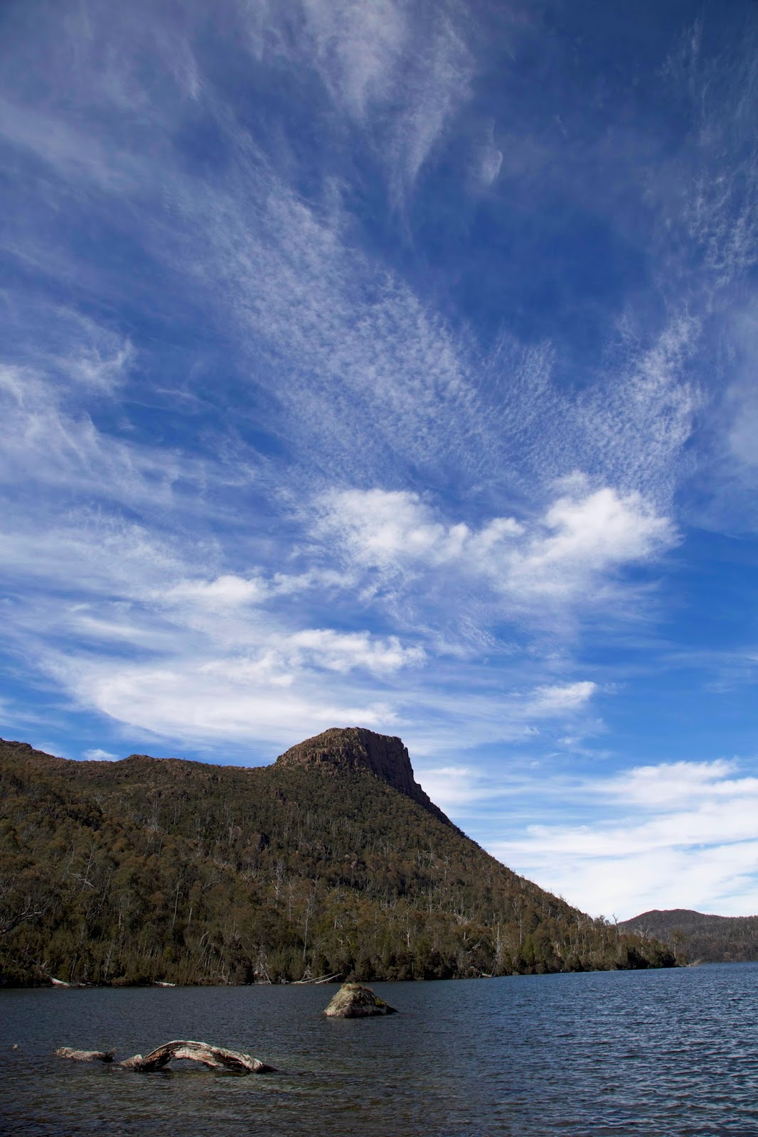
[Mt Rogoona above Lake Myrtle] 
Launceston,1982. I’m one of the leaders of a group planning an overnight bushwalk. Being newish to this part of the state, I’m listening more than talking. We discuss potential destinations, place names that seem ripe with promise, rich with story. Places I too will come to cherish, ‘though that’s in my future.

When the name Rogoona is mentioned, keen looks turn suddenly sad. “No … it’s been burned out. Tragic. No point going up there.” There’s a bit more discussion; some speculation about the fire’s cause; talk of pencil pine groves destroyed forever.


[A burned pencil pine grove near Lake Myrtle] 

It’s the era of the Franklin Dam dispute. Lake Pedder is not long drowned. Nuclear weapons seem to hover over us. We share the pervasive feeling that all that is precious can be threatened, even a mountain like Rogoona.

Fast forward three decades, and I’m headed for Mt Rogoona; my third trip in recent years. In the intervening years much has changed, much has not. We’ve raised three children, and are well into the wonderland of grandparenting. But I always said I’d catch Lynne up on some of what she missed in those years. This beautiful mountain above a glittering lake is high on that list.

One of the positive changes in that time has been weather forecasting. For all that we complain when they get it wrong, forecasters today are able to give us just that: a casting-ahead – even a week to ten days ahead – of likely weather conditions.

So for this trip our weather is looking as sorted as anything driven by a chaos engine can be. Unfortunately my memory is also chaotic. From my previous trips I recall “a little bit of uphill” getting to Lake Myrtle. Pedantically the map insists there are 457 metres of it, but my memory is still more of sidle than grunt. Of course after 5 minutes of sidle, it’s steep for the next hour. And then you’re still not there. Too late I remember that there is a series of false summits – faux plateaux – as we had dubbed them on my last trip.


[Contemplating "a bit of up"] 

Optimism and faulty memories are largely helpful allies in bushwalking. Otherwise we might never leave home. But as we break out of forest onto the buttongrass of Blizzard Plain, with Mt Rogoona in view at last, I resist expressing my “almost-there” thoughts. “Not-even-half-way-there” is actually more accurate. After some buttongrass bog there’s the little lake foretaste provided by Lake Bill. It’s a very pleasant mountain lake, but an ugly step-sister in comparison with Lake Myrtle. It’s only a few minutes off our route, but we’re too tired to drop in on the second-rate sibling.


[A distant Mt Rogoona, with glimpses of Lake Bill]  

Quietly cursing too much Christmas pudding and an unreasonably early start, we stagger on up the slope. We pass a wonderful array of wildflowers, gushing waterfalls, and glimpses of Rogoona without giving them the enthusiasm they deserve.

I’m concerned about our levels of exertion; concerned that I’ve built up the beauty of our Lake Myrtle destination to such an extent that Lynne will be disappointed. I worry too that there will be multiple tents there already, with the best spots taken.


We finally arrive, though only after a tricky last-minute creek crossing, and my optimism returns. The campsite is both beautiful and empty. We slump down on unreasonably soft lake-front grass in bright sunshine. Mt Rogoona sits lofty and sphinx-like above the shining waters. Lynne is beaming through her pain. I’m guessing that in a few days, perhaps weeks, her memory too will become as unreliable as mine.


[Lake Myrtle reflections] 

Sunday, 17 January 2010

Walking With Ada 2 - Great Pine Tears

[Photo: some of the dead pencil pines on Great Pine Tier, Tasmania]


[part 2 of reflections on a recent bushwalk]


In a country with a dearth of conifers, the Tasmanian highlands boast several species, most notably the two in the Athrotaxis genus: pencil pine and King Billy pine. These relicts of Gondwana have closer relatives in New Zealand and South America than they do in mainland Australia. Of the two only pencil pine will grow in virtually pure stands, especially in parts of the Walls of Jerusalem National Park.


To walk into a pencil pine stand is to change climate; change light levels; even to feel you have changed hemispheres. There is a cool, dimly-lit quiet, aided by the thick foliage and the soft carpet of needles. Time itself seems to take on a different quality, as though picking up on the pencil pines’ slow-growing, long-lived nature.


As gymnosperms, they mainly regenerate via the shedding of cones, although even this is an unusually unhurried affair, occurring only every five or six years. In peat they also appear to spread vegetatively via suckering. Neither method allows them to spread far from the parent tree. Given their slow growth – they average 40 years to reach just one metre, and can live to well over 1 000 years – they don’t appear to do anything hastily. I find it hard to resist ascribing entish characteristics to these lovely conifers.


Their tactic in the conditions they seem to find themselves in – a drying part of a dry continent – is to wait out bad times and take advantage of good times. That climatic good times may be in long-term decline is just one problem for them. Another issue since European take-over is the spread of herbivores such as rabbits, sheep and cattle. All of these find pencil pine seedlings more palatable than do our native species. In historic times this has created further pressure.


But one bad time factor far outweighs all others. Fire is the deadly enemy of the pencil pine. Having evolved in wet or even water-logged conditions, where fire is a rarity, pencil pines have few defences against bushfire. Recovery is via slow spread from surviving trees. In a drying, fire-prone future this is a high risk strategy.


This January a walk with the Ada map took me to Great Pine Tier, an upland only modestly higher than the surrounding plateau. But the tier distinguished itself, and was so named, because of the prodigious stands of pencil pine that historically stood there. That was until 1960. Between October of that year and February of the next, a series of catastrophic, deliberately-lit fires in the area burned through an estimated 1300 square kilometres of alpine vegetation. Geographically that took in much of Ada and many of the neighbouring map sheets. A significant proportion of the area incinerated contained pencil pine, deciduous beech (or fagus) and ancient peat.


Without knowing the full story of this fire, my friends and I were meandering between the myriad lakes around Great Pine Tier. But when we reached the epicentre of the fire we could hardly have mistaken that we were late witnesses to an ecological catastrophe. Half a century after the event the area still looks like a war zone. With gallows humour we remarked on how easy the walking was thanks to the fire. In truth we were aghast.


For miles around us we could see pencil pine stags, literally by the thousand. Their vertical persistence in death is owed to their tightly-packed, borer-resistant, resinous wood. Bleached white by the icy winds, they stand like a vast wartime graveyard, a ghostly reminder of the glory that once was.


In patches, particularly on the western rim of the tier, small stands of pine forest persist. Walking into one of these felt like walking through a door to another country. Everything was different, the contrast heightening the helpless and hopeless sense of what has been lost.

Beyond such patches, the slowly burgeoning new growth is dominated by other species. There is a changing of the guard, with fire tolerant eucalypts and other flowering plants now taking over. It’s fair to say that pencil pines have been made locally extinct as a result of that single fire event.


You would therefore think that such an event would be burned into the Tasmanian psyche, much as the Hobart area’s 1967 bushfires are. Yet most of us have no clue that this tragedy occurred. So I recall with a chill my recent discovery of a fresh fire ring butted up against a living pencil pine near the West Wall. Some cold or heedless walker has ignored that they were in an area where only fuel stoves are allowed.


If these last stands, and especially that around Dixons Kingdom, succumb to such stupidity, there may be generations of Australians who never have the chance to see the glory of these gracious old Gonwanan forests.