Sunday, 2 May 2021

Central Plateau Variations: Part 4

You can’t bargain with Tasmania’s highland weather. It’s pointless arguing that you’ve suffered so much tough weather that “tomorrow it shall be fine!” Still, hope springs eternal, and the signs were good. At the end of day 4 of our Central Highlands walk, the wind had dropped to a whisper. Indeed, for the first time on the trip we could hear the night-time snores from neighbouring tents.


[An optimistic spider web at Pencil Pine Tarn]

So we began day 5 with the same optimism as the spiders that shared the pencil pine grove with us. They’d been busy spinning webs, anxious, I imagine, to catch some food after a few days of wind famine. And now the sun shone on web and tent alike. The wind a mere memory, the sky brilliantly blue, the weather angels singing: it was a perfect day to retrace some of yesterday’s wander on Ritter’s Track, and go beyond into the Walls of Jerusalem.


[Tim looking towards the Walls of Jerusalem]


We got away uncharacteristically early – for us – thinking we had a long day ahead, especially with Jim still feeling unwell. We took our time, ambling through a landscape that was now blissfully benign, soft underfoot, dotted with pools and tarns rimmed with sphagnum and pencil pines. It’s a country that’s wonderful in any weather, but this day, after those that preceded it, was one to savour. Even if it were possible for the grand scene to overwhelm, the small things could still give their quieter joy. I kept noticing, for instance, scatters of tiny yellow berries and similarly small red berries. It was as if careless wee folk had upset their applecarts.


[Gaultheria tasmanica berries ... or are they wee apples?]


Out front our two “navigational nerds”, Tim and Larry, again steered us along Ritter’s Track via the now familiar cairns. Once we passed the point we’d reached at the end of yesterday’s reconnoitre, our leaders focussed on quickly finding the next few cairns. By now Jim had slipped to the back of the group, his tank already low on fuel. When a helicopter flew over, he looked up longingly, as if it might be possible to flag a lift. It didn’t help that every time he caught up with the group, the leaders would start off again. Hearing Jim’s mutterings, I decided I’d join him at the back. Two voices might have better luck moderating the enthusiasm at the front of the group.


[Merran takes in the blissful scene]


After a couple of hours we passed between the aptly-named Long Tarns and Lake Butters, neither of which we could see. But we did find a delightful smaller lake, and paused there for scroggin and water. On our last traverse of this country, we’d been further north. I remembered that getting across Richea Ridge, west of Long Tarns, had been rough and quite scrubby. We were hopeful that this time, being further south and “on” Ritter’s Track – if you could ever truly say that – we might find an easier route, perhaps avoiding Richea Ridge altogether. 


No such luck. The cairns were now as sporadic as they were dubious. There was nothing for it but to take a rough bearing west towards Lake Tyre. That took us up, over, around and through some rocky, scrubby bush. The fact that it was riddled with Richea scoparia strongly hinted to us that we hadn’t avoided Richea Ridge after all. 


[Yes, there was NO WIND!]


[Getting closer to Mt Jerusalem]


It was hot, sweaty work on this warm, sunny afternoon. We were glad when we finally began to descend towards the valley flanking Mount Jerusalem. We were tempted to stroll down the now clear valley towards Zion Gate. However we’d learned on our last trip that we had to stay one valley east. This necessitated a bothersome trudge up a bushy hill which earlier in the morning would have seemed nothing. We had some reward at the top in the form of a view of Lake Tyre’s south-eastern shore. The sting in the tail was that our preferred campsite was on the north-western shore, another few hundred metres away, and through some scrub.


[Tent set-up at Lake Tyre, with Mt Jerusalem behind]

Still, we reached the campsite by mid afternoon. We may have been hot and tired but, in the words of young Mr Grace, "
we’d all done very well". Once we’d put up our tents, drunk a litre of water, and settled into our Helinox chairs (if we had them!) our day 5 optimism started to look justified. Some rare days in the highlands go just as you hoped they might.

Friday, 16 April 2021

Central Plateau Variations: Part 3


[Who else has walked here?]

It’s rare to walk the Earth and not be following in the footsteps of others. At our first campsite, we’d sat relaxed and content – when the weather allowed – and imagined the Palawa, Tasmania’s Aboriginal people, doing much the same over tens of thousands of years. The shelter, the water, the hunting, the clear views, would all have made this a wonderful summer place. What stories, songs and dances must they have shared here, and passed on for countless generations?


[A place of contentment]

For the Palawa, European invasion stopped all that, whether though disease, forced eviction, or deliberate killings. Others would now eye off this high country for their own purposes, and they did so quickly. In the 1830s, when G. A. Robinson (the so-called protector of Aboriginals), travelled through the Central Plateau to round up any remaining Aboriginals, he noted that “wild cattle was seen grazing … and several young calves appeared among them”. 

So this “empty” Central Plateau became a favoured place on which to summer livestock. It’s estimated that between 1860 and 1920, up to 350,000 sheep and 6,000 cattle were summered up here annually. This is tranhumance on a grander scale than I’d ever imagined. Gradually cattle became more highly favoured than sheep, and by the late 1870s, settlers from the Mersey Valley and surrounding districts had acquired cattle grazing leases on the plateau. They built tracks such as Higgs Track, Warners Track and Dixons Track so they could drive stock up to the high country each summer.

But as we were discovering first hand, the “warmer” months on the plateau can still be harsh, making navigation difficult. Around 1913 a farmer from Meander named Charles Ritter, who had leases in the Walls of Jerusalem area, thought to make a safer all-weather drove route from the top of Higgs Track/Ironstone Hut area to the Walls. It was probably completed by 1918, and became known as Ritters Track. While it was called a track, I had long wondered whether it was ever more than a series of large rock cairns that could be followed even in rough weather. On our fourth day, we were hoping to find out for ourselves.
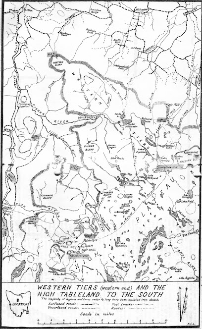
[An old sketch map by Keith Lancaster, showing Ritters Track]

The night had been exceedingly windy, and none of us had slept much. Jim wasn't feeling great after a poor sleep punctuated by some unwelcome toilet trips in the dark. We’d already decided to adapt our schedule, allowing for another night here at Pencil Pine Tarn, and a short wander today. That meant Jim could stay back and “keep our camp secure”, which he generously volunteered to do. The rest of us would pack lunch and a day pack, and go in search of Ritters Track.

Three years earlier we’d half-heartedly looked for some cairns between here and Long Tarns. That time we’d only had some rough, third-hand notes, and our explorations hadn’t allowed us to say with any certainty that the cairns we found were part of Ritters Track. This time, we had not one but two lots of GPS data indicating the supposed locations of Ritter’s cairns. The only thing against us was the weather, which remained showery and ferociously windy: in short exactly the kind of weather Ritter hoped his track would deal with.


[Tim contemplates the route]

Tim and Larry, our two GPS-bearers, lead the way, at first taking us almost east, seemingly back to where we’d come from. I expressed my surprise, but Tim assured me we’d soon swing south. And once we’d picked up a cairn, we’d start heading more south-west. 

Before long one of our navigators signalled us to join him. According to his GPS, we were within 20 metres of one of the cairns. But what were we looking for? A pile of rocks in a landscape made of rocks? And rocks that have been glaciated, ice-shattered, and scattered about willy-nilly over aeons? The five of us wandered about, a little clueless, until someone finally had their eureka moment. 
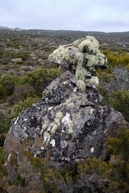
[Surely a Ritters Track cairn?]

We hurried over towards an obviously human creation: four or five rocks piled high atop a large boulder, forming a rough and wonky pyramid. If the cairn’s size wasn’t the clincher, the mop of long, grey/green lichen on the rocks was. This indicated it was no recent or random cairn, but one put here deliberately, and many decades ago.

[Tim and Larry spy out the next cairn]

The next couple of hours saw us slowly following our navigational nerds from cairn to cairn. Sometimes the next cairn was visible from the current one, but at other times we were glad to have the GPS data. This was not the sort of “track” that, once found, you could easily follow. Apparently Ritter didn’t choose a straight-line route towards the Walls of Jerusalem (which today was clear to see ahead of us). Rather he kept to higher, less boggy ground, winding around the plateau on ground over which cattle could more easily move.
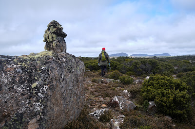
[A clear view towards the Walls of Jerusalem]

Another matter sometimes confused us. We found multiple other cairns dotted across the landscape. Some we considered Ritteresque: good copies, but not originals. Others were mere wannabes: poor imitations that lacked size or age, the creation perhaps of bushwalkers or anglers. Our rule of thumb was that a true Ritter cairn would be substantial, vaguely pyramidal, made with care, and bearded with lichen. We came to admire the labour that Charles Ritter, presumably with the help of his fellow drovers, had put into building the many dozens of cairns. The heavy rocks would have taken some effort to move, and the conditions for doing that work would seldom have been ideal.
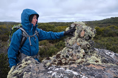
[Libby inspects another genuine Ritter cairn]

As we walked, we imagined driving cattle through this terrain. How different it would have been to walk or ride here accompanied by the sound of hoofs and mooing; the steam from their breath; the swish of their tails; the slop of the slush beneath their hard hoofs; the smell of dung and drover alike. We could admire, celebrate even, the hard labour of these cattlemen, without wishing that this was still happening. Clearly driving and grazing cattle between here and the central Walls – where the best grazing was found – made a mess, and altered the landscape hugely. The unsustainability of the practice, both environmentally and economically, led to grazing being prohibited above the 3000ft contour (914m) in 1973. 
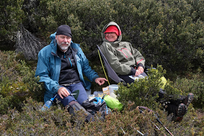
[Tim and Merran at our lunch stop]

While it had been fascinating to follow the footsteps of Ritter, after lunch it was time to complete our off-track loop back to the campsite. We were beginning to wonder how another grey-bearded fixture was doing. We found Jim relaxing in the sun, which had finally made a welcome return. As Tim placed his small solar panel in the same patch of sun as Jim, I remarked that we now had two solar collectors. Then, over a relaxing afternoon tea, we swapped stories of our day. Jim noticed that a couple of us were red in the face, and when we conjectured that a combination of windburn and sunburn might be to blame, he was all the gladder for his rest day.
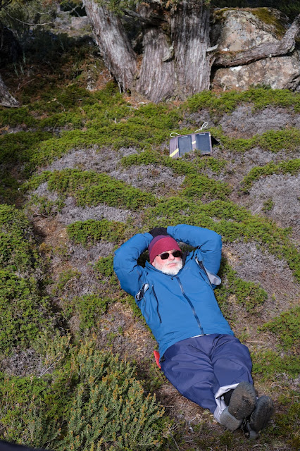
[Two solar collectors hard at work]

When the shade from the pines started overtaking us, we followed the sun up the hill. It was good to gain a little altitude, to change our perspective, and to feel a windless sun after 48 hours of gales. Eventually we wandered back down to the camp, and we were soon off to our tents. How good it felt to be in that now quiet space, without wind tearing my every thought away.
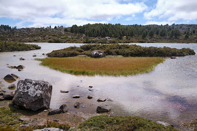
[A calm Pencil Pine Tarn]

In that calm state, I began to ponder on our walk, and to think about the footsteps we had followed to this point. Whether it was those of the Palawa, those of the cattlemen, or those of the pioneer bushwalkers, the ones who were here before us are now gone. Without feeling at all morbid, I apprehended afresh my own impermanence. None of us – grey-bearded or not – will hang around even as long as Ritter’s cairns. Sooner or later each of us will follow in the footsteps of those who are gone. 

It was in a time of pandemic, nearly 400 years ago, that poet John Donne reflected so powerfully on this. 

No man is an island, 

entire of itself, 

every man is a piece of the continent, 

a part of the main; … 

any man's death diminishes me, 

because I am involved in mankind,  

And therefore never send to know for whom the bell tolls; 

It tolls for thee. 

Friday, 9 April 2021

Central Plateau Variations: Part 2

[Once more into the Central Plateau]
"I live my life in widening circles 
that reach out across the world.
I may not complete this last one

but I will give myself to it."

- Rainer Maria Rilke

Over time our walks across the roof of Tasmania have developed a sense that, like Rilke, we are travelling in ever widening circles. It’s a place that invites you to walk to the horizon, just to find out what’s beyond. If, on our last walk, we’d only half-heartedly looked for traces of Ritters Track, this time we planned to give ourselves fully to the search, this time with GPS-assistance.

But Rilke’s metaphor begs another question. When do you know that your latest “widening circle” is to be your last? Or to put it into our context, how do you know that you’re on your last big bushwalk? I wasn’t aware of it at the time, but thoughts like this were going through Jim’s mind as the six of us slowly roused ourselves from our tents the next morning.

It had been a rough night. Strong winds and squally showers had disturbed the sleep of most of us, and I was only woozily awake when I heard Jim’s voice outside my tent. “Cap’n, cap’n, you awake?”* Without waiting for an answer he went on. “I have a cunning plan. You seen the weather?”

I unzipped the tent and poked my head out to find that we’d been enveloped in cloud, our long views replaced by a close grey murk. The wind was shaking the pencil pines, and Jim was in his rain jacket. Welcome to the Central Plateau! As for Jim’s cunning plan, he was suggesting a retreat. We could head back to Tim and Merran’s place, and base ourselves in the warm, dry comfort of their cottage, and do day walks from there.

[Gaultheria berries thriving in harsh conditions]
Certainly I’d seen more encouraging walking weather, but Jim’s response to it seemed disproportionate. If we followed the original plan, and walked to our next sheltered campsite, we only had to brave these conditions for 3 hours or so. I questioned Jim a little more, and found out that he was also feeling “a bit off”. Considering he has a chronic health issue that means he often lives with a degree of nausea and/or dizziness, this didn’t sound like a walk ending scenario.

It didn’t take long for the rest of us to convince Jim that we should stick with our original plan. He toyed with the idea of walking back to the car solo, and coming to pick us up at the end of the trip, but in the end he went with the majority. As if to reinforce our decision, a few patches of blue appeared between squalls. We slowly packed up, and walked off into strongly gusting winds, but only intermittent showers. As we got into a rhythm, I was pleased to hear Jim having a good, loud catch-up conversation with Tim. Perhaps his mood would improve, and he’d be his normal life-of-the-party self. 

["Gimme Shelter" - any rock will do]

Meanwhile the weather continued to challenge us. For a time our off-track route took us into the sheltering lee of higher ground. But for much of the walk the wind was so strong it threatened to blow us off our feet. I find this kind of feral weather, its sheer ferocity, strangely exhilarating. It’s a reminder that, for all our ingenuity, we’re not in control here. Still, being blown over was NOT the kind of uplifting experience we would have wished on Jim in his current state. As we took a break, I photographed Jim against the background of our morning’s route. “Jim’s last walk” he muttered into his beard.

[Jim's last walk? Not a happy camper.]

Having reached the pass leading into the next valley, we turned west and found a sheltered lunch spot among our friends the pencil pines. As we ate, we even had some warm sunshine, and the day looked suddenly benign. It didn’t last, of course, as we soon had to reenter the maelstrom. 

[Lunch among the pines - pic courtesy of Larry]

The constant wind was energy sapping in the extreme, and everyone was relieved to finally see our pine-dotted tarn up ahead. We’d sheltered there from a strong wind 3 years ago, and it looked as though history would repeat itself this year.

We soon sussed out our tent spots. We were a little surprised that even here, deep in a substantial pine glade, the wind still managed to shake our tents. It was also cold by now, and we quickly decided that an early dinner and bed time made a lot of sense. As we cooked Jim still seemed lethargic, not wanting to bother getting out his cooking gear. Instead he asked around for any spare boiling water, scoring a hot cup-a-soup from me, and a bit of hot dinner from someone else. We were all finished and ready for bed by 5:30.

[Almost ready for bed: Pencil Pine Tarn]

All night the wind roared, the pines giving it a piercingly strident voice. At one stage I looked – in vain – for ear plugs in my first aid kit. It wouldn’t be snores from my fellow campers that would keep me awake tonight.

        
* Back in the mists of time some of our regular walking group had taken to addressing each other as “Captain”, usually in a growly, pirate-inspired voice.