Showing posts with label scoparia. Show all posts

Thursday, 5 December 2024

A Loopy Walk on the Plateau 5

Day 5: Aches and Lakes 

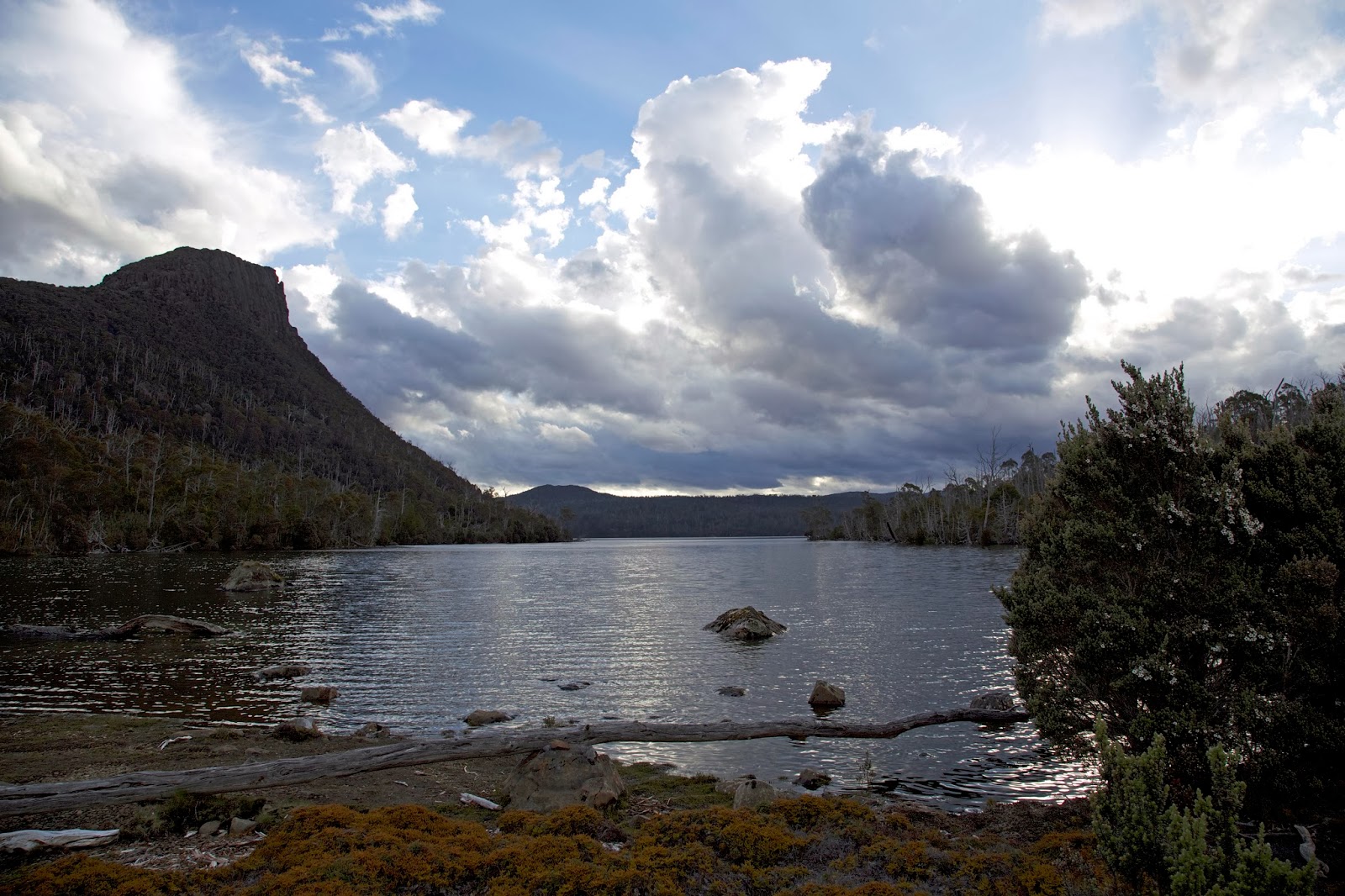
After a delightfully restful night, we were up early and full of beans for the easy day ahead of us. We’d planned a post-walk lunch at Mole Creek Pub, and we were all keen to get there. It was a simple walk past Lakes Nameless, Snake and Explorer, much of it on an actual named track, then on to the shore of Lake Mackenzie. After that it would be an easy walk around the lake shore back to the cars. A few of us had done most of the walk before, and had no memory of difficulties. Ah, but amnesia among bushwalkers … it’s as rife as it is perilous! 


[Farewell to Ironstone Hut ... click to enlarge]
Our first hint of difficulty came when Tim D disappeared into a scrubby hole while crossing a creek near the start of Snake Lake. He thrashed around for what seemed like minutes, only the writhing branches giving away his position. In the end he broke a walking pole while trying to extract himself. So much for being on a named track! Apparently we weren’t yet at the Explorer Creek Track, which maps – for good reason – show as intermittent. 


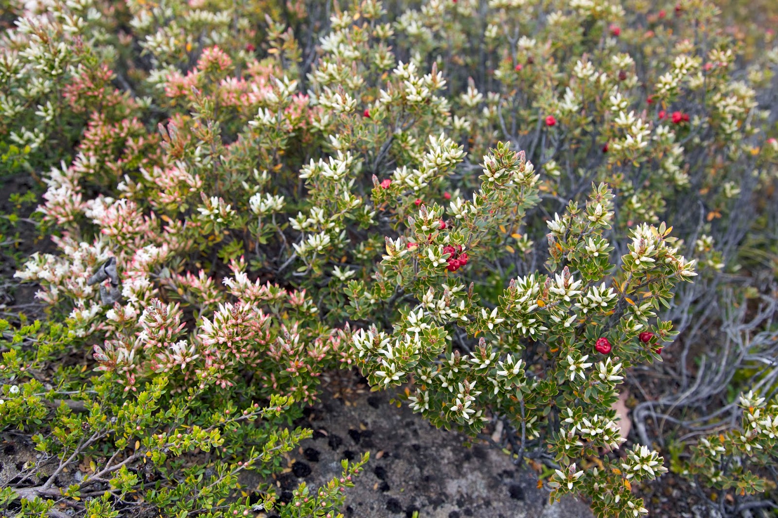
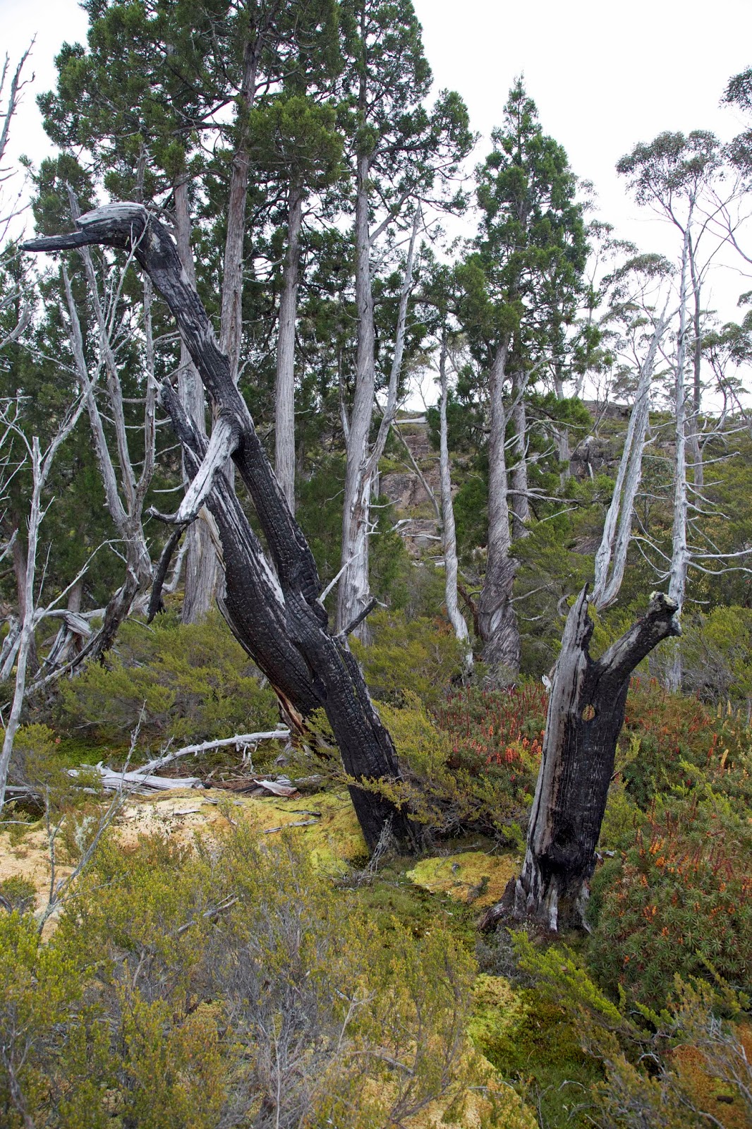
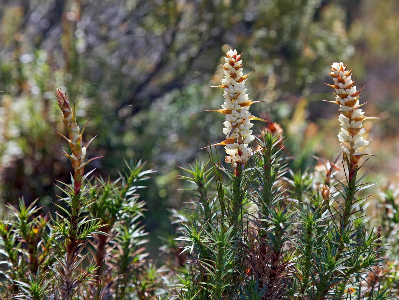
[Scoparia in bloom beside Explorer Lake]
It certainly wasn’t here on the eastern shore of Lake Explorer, which we were finding tediously scrubby and undulating. The scoparia might have been flowering handsomely, but progress through or around it was scratchy and difficult. When we did get a view we looked longingly at the western shore and wondered: might that have been an easier option? 


[A bit of respite: looking across Explorer Lake]
We finally scrambled around the end of Explorer, and were relieved to join a more defined track. It led us down Explorer Creek, past a waterfall, to the confluence of the creek with the Fisher River on the shores of Lake Mackenzie. 


[Larry returning from the Explorer Ck waterfall]
We crossed the rushing stream on somewhat precarious rocks, and arrived mostly dry-footed on the other side. It had taken us three and a half hours from hut to lake, more time than we’d expected to take for the whole walk back to the cars. Still, we were almost there now. We just had to walk the 2km or so around the shore. 


[Having a break after the Fisher River crossing]
The maps helpfully showed a track around the shore, except there wasn’t one. Or if there was it was underwater. Instead we began a steep, scrubby, slanted, rocky scramble around the lake. At times the way relented, and we merely had to rock-hop. But then we’d find another steep bluff that wouldn’t allow us to continue close to the shore. At these points we had to clamber steeply into rough bush, and battle our way parallel to the shore until we could drop down again. 


[Tim D on one of the "friendly" bits of the shoreline]
This exhausting cat and mouse game continued until, at last, we found what looked like a rough grader track. Surely now we’d simply follow this until it came out at the dam wall of Lake Mackenzie. No! Inexplicably the grader track suddenly stopped, and there was no obvious track ahead. Talk about a road to nowhere! I wasn’t alone in loudly expressing my dismay. If ever we needed the assistance of an eagle, it was now. Surely a wedgie would be able to see the way ahead. But lacking such avian assistance, we had no other choice than to bush-bash in the general direction of our cars. 

Eventually, scratched, sweaty and far from jolly, we struggled down to the lake again, and across it we saw the dam wall. It had taken us well over an hour and a half to travel less than 2km. And we weren’t even back yet! Worse still our lunch appointment at the pub was looking in peril. We’d previously learned the hard way that they closed the kitchen at 2pm, and it was about 1:15pm when we reached the cars. We hastily sent Tim D and Libby ahead as an advance party, in the hope that they’d be able to keep the kitchen open on the promise that 5 hungry bushwalkers were on their way. 

Larry, TimO and I left a little later. When we finally drove into mobile range it was nearly 2 o’clock, and we were still 10 minutes from Mole Creek. At this point the phone rang, and it was Tim D calling us from the pub. We’d have to give him our lunch orders NOW, as the chef was about to shut up shop. Hamburgers all round (vego for TimO) was the quick and easy answer. 

The timing was perfect. We arrived at the pub a little after 2pm, in time to grab a hard-earned drink. And as we joined the others under the shade of a big old magnolia tree in the garden, the meals started coming out. “Windy, rude and boisterous” our November wander may have been, with a real test on our “easy” final day. 


[Relaxing after lunch: selfie courtesy of Tim Dyer]
But as we sat, ate and drank together, our well-timed finish had us forgetting our pain and declaring it to have been a great walk. It might have been a case of early-onset amnesia, but who said hard days can’t sometimes have a happy ending?

Saturday, 2 May 2020

A Long-Awaited Reunion: Part 3

When I was young, some car owners opted to buy eye-catching two-tone cars. A rich uncle had a very fancy two-tone Ford Ranch Wagon, with fetching brown sides, and a custard coloured roof. Today confirms that our walking group has turned into a two-tone model.

This starts to become clear while we’re discussing our walking options. The forecast is good, and climbing Tasmania’s highest mountain, Mt Ossa, is high on some agendas. Yesterday’s more adventurous quartet has Ossa and maybe more in mind. I start thinking of them as the “brown” side.


[Small falls between Pelion Hut and Pelion Gap] 
On the “custard” side, Lynne has never ascended Ossa, and would have been keen. But … yesterday’s work on her knee wasn’t a miracle cure. She will still have to nurse it a little, and I plan to stick with her today. Jim was up Ossa with me in 2017, the most recent of many ascents we’ve made. On that occasion we had the best conditions we’re ever likely to see. During our descent we talked about whether we’d ever do it again. We weren't sure then, but when he’s asked if he’ll go today, Jim simply says “Nup”. The “custard” side is firming. Brita then declares that she’s not a summit person, and with Ossa not on her list today, the score becomes Brown 4, Custard 4.


[Our 2017 summit experience on Mt Ossa] 
So the Tims, Merran and Libby are going up to Pelion Gap, then on to the top of Tasmania. TimO adds that he’s never been up Mt Pelion East, and I see that “can I do two summits?” glint in his eye. Jim, Brita, Lynne and I reckon we’ll go as far as the Gap, and then see how we feel. Our two-tone group at least agrees to be back in time for pre-dinner nibbles and drinks together on the grass beside our tents.


[Buttongrass heads and coral fern] 
Part of Brita’s coaching of Lynne is that she could try shorter steps, not striding out too much. A corollary of that is that she should go at her own pace. So the brown team leaves us in their dust, as we custards climb towards Pelion Gap in a more leisurely fashion. One of the advantages for me is more time to photograph, which also means more time to really notice the intricacies of the forest and woodlands we’re walking through. Jim and Brita stay with us for a while, but eventually they firm up a plan to walk past the gap, and up to the side of Mount Doris.


[A small grove of Pandani near Pelion Hut] 


[Celmisia - alpine daisy] 
Lynne is walking a little more easily today, but there’s still some pain, and she stops every now and then to stretch her hamstring. Eventually we top out on Pelion Gap, just as Jim and Brita are about to depart from there for Mt. Doris. 


[L to R: Peter, Lynne and Jim at Pelion Gap]  
Jim is keen to show Brita what he calls “The Japanese Garden” on the side of Doris. It’s a relatively level section of an otherwise steep route. Bright green carpets of cushion plant are interspersed with other ground-hugging species, mini-thickets of scoparia, and slabs of lichen-daubed rock. Little runnels and pools of clear water complete the picture: a perfect little natural garden.


[Sunburst on forest detail] 
Lynne reckons this is as far as she should come today, so we farewell the others and sit down to our lunch on the gap’s platform. Afterwards, with our new-found appreciation of walking slowly, we stop often. It proves as good for the soul as it is for the knees. We take the time to find small delights, and to smell the … well, not roses, exactly. It’s things like the pungency of sassafras, the tang of lemon boronia, and the earthiness of buttongrass. And there’s also that indescribable scent you get when you lie amongst all that is breaking down on the rainforest floor, as you try to photograph a King Billy pine that towers above everything.


[King Billy Pine trunk and forest floor] 
Meanwhile back at the “Japanese Garden”, Jim and Brita are surprised by TimO. He’s already been up Pelion East, and in Jim’s words is “looking knackered”. He pauses for a drink, and wonders aloud whether he really should “give Ossa a crack as well”. Politely ignoring Jim’s advice, he sets off towards Ossa. Jim and Brita shake their heads and head in the opposite direction. Jim gets back to Pelion only a little while after us, and lets us know TimO’s apparent plan, and that Brita has gone off for a swim near Old Pelion Hut. Within the hour Tim D, Merran and Libby are back, sounding upbeat after their ascent of Ossa.


[Flower heads of Billy Buttons] 
When everyone has recovered a little, we gather again at the delightfully grassy tent site, a little above the hut. The left-overs from the heli-pad party are reinforced with more cheese, and some extra wine is found. Our gathering looks like a product placement for Helinox chairs, as four of us sit comfortably above the grass in our “Zero” chairs. 


[Nibbles while waiting for TimO & Brita] 
It’s a warm and gentle early evening, and as currawongs pipe in the closing of the day, we’re happy and grateful for many things. All we lack is the presence of our friends TimO and Brita. We’ve got well into the bhuja and cheese, and have started the wine, when a very weary looking TimO traipses down the track from the gap. Almost simultaneously Brita comes up from the side track that leads to Old Pelion. Our group complete, we settle into hearing the varied stories of our party members. As I listen I can’t help thinking what a fine two-tone model we are!

Monday, 26 February 2018

Celebrating 50


-->
At the crowded end of the year; the party end of the year; the too-much-to-do-and-not-enough-time-to-do-it end of the year, my mate Mick came up with an unusual idea. Wanting to celebrate 50 years on earth in a way that didn’t feel like all the other celebrations that jostle for attention in December, he chose to go bush with some mates.

The venue was to be the Blue Peaks, and in his casual come-if-you-can style invitation to his walking friends, Mick said “I cannot think of a better place to spend a few days contemplating life, the universe and everything … Or a better bunch of brigands to spend it with.


[A campsite for contemplation and celebration, Blue Peaks] 
Three of his thicker-skinned friends managed to put aside any offence, and carve out time from pre-Christmas schedules to join him. (In truth Mick probably has more friends than nearly anyone I know, but most were caught up in just the kind of rush he was keen to avoid.) So … ‘quality not quantity’ it was!

The four of us left Hobart a little after 7am, an almost indecently early departure by our standards. But it did give us the advantage of getting up to the Lake MacKenzie track head before lunch. We’d been walking just long enough to feel some of the sore bits, when I noticed an odd smell. At first it was very faint, but as I tweaked my pack and trudged on, I recognised it: the scent of stale smoke, of burned bush, wafting down valley from a fire that ripped through here in early 2016. Blackened bush soon confirmed that.

I would normally associate the smell with regeneration, fire usually being a means of bringing new growth to Australian bush. And smoke water – with just the scent we’re picking up now – is widely used in Australian native gardening to germinate stubborn seeds. But here, high in the Central Plateau, fire brings death.

It was sobering to experience the lack of new growth; the desolate feel; and the paucity of bird life. Yes, a few plants were making a slow comeback, but not the pencil pines. Their blackened trunks and empty canopies will stand for decades, slowly greying, as a reminder of that fire.


[Pencil pines killed by the 2016 fire] 

We were glad to get out of the fire zone, and into the untouched Blue Peaks area, by early afternoon. Once there, with our tents and tarps set up in the beautiful, familiar pencil pine grove, the bustle and busyness – and some of the sadness – started to fall away. And Mick began to beam, pretty sure that his idea was as genius as it was unusual. On a gently warm, sunny afternoon it wasn’t difficult for the rest of us to agree.


This being a first time visit for the other two, Mick and I pointed out a few of the area’s features to Larry and Ken. While we did so it struck me afresh that the most obvious characteristic of the place is actually its subtlety. Even the “peaks” of its names are understated hills more than peaks. But get your eye in here, and the light, the lakes, the clouds, the wildflowers, the birds, the distant mountains and the depth of the views, will do their work on you.

As it was only a week shy of the longest day, our evening meal was under way hours before sunset. I’d brought along a special birthday wine for Mick, and Larry had brought some brandy, so the celebrations began. Later, feeling suitably mellow, Larry and I decided to explore some of the nearby pools and pencil pines with our cameras. Mick, defying his increasing years, chose to take Ken to the top of one of the “peaks” for sunset.


[Sunset over lakes and pools, Blue Peaks] 
Next day the sun slept in. Given the low cloud and scudding showers, we followed suit. When we finally emerged, a kitchen tarp set up allowed us to breakfast and socialise in the dry for most of the morning. While mosquitoes threatened to keep us busy, they turned out keener to buzz than to bite.

After lunch we overcame our lethargy, put on some wet weather gear, and went for a wander in the light drizzle. We walked westward at a slow amble, the pace determined by the small wonders that kept gripping our attention. Scoparia (Richea scoparia) was blooming everywhere, its delightful flowers the antithesis of its dense and fiercely prickly foliage.


[Scoparia's multi-coloured blooms] 
At our slow pace we began to notice a few unusual things. Here and there we spied skinks scrambling over the prickly foliage to lick and nibble on the sweet blossoms, apparently pollinating them in the process. Wallabies too seemed to have a close relationship with the scoparia. I’ve certainly seem them supping on the sweet blooms. But we also began to notice that many of the bushes had been physically modified – presumably nibbled and trampled by the wallabies – to make highly protected nests.

Traces of wallaby fur and nearby scat mounds were further corroboration of that assumption. And nearly every “nest” – and we saw dozens of them – was sheltered from the prevailing westerly winds. That, combined with the numerous pads and pathways created by wallabies and wombats, led us to consider afresh the definition of the word farming. Such adaptations of the landscape certainly bore some of the marks of basic farming.

[Mick ponders a wallaby "nest" in scoparia] 
Wanting to earn our evening meal, we wandered further off, doing a loop around some lakes and low hills for another couple of hours. It was hardly exhausting work, but it allowed us to feel justified in further feasting once back at camp. Expensive wine, soft cheeses, biscotti, smoked mussels and oysters are hardly your usual bushwalking fare, but we’d all come prepared to celebrate!

The evening turned mellow in more ways than one, as the surrounding hills shrugged off the clouds, and wide, benign skies opened up around us again. Even the mosquitoes seemed to join in the celebration. At one point hundreds – perhaps thousands – lifted into the sky above our campsite, spiralling and swirling like a murmuration of starlings. We watched amazed, unsure what it signified, except that while they were up there they weren’t down here bothering us!

If we needed any confirmation of clearing skies, we had it when the night turned cold, and yet again I had reason to regret taking a summer weight sleeping bag into Tasmania’s high country. A freezing night might have been one reason we got going early. But there was also the sense that Mick and I needed to show the “newbies” a bit more of what the area had to offer. What better, we reasoned, than taking them via a few named lakes (Middle and Little Throne), past a named mountain (Turrana Heights), and to an (unjustifiably) unnamed peak.


[Near the unnamed peak] 
The day was a gem, in more ways than one. The deep blue sky stayed clear all day, apart from a decorative schmear of cirrus cloud. With only day packs, and in no hurry, we strolled easily from lake to lake, hill to hill, chatting, stopping for photos, or scroggin, or just because we wanted to. Still, it was well before midday that we found ourselves scrambling to the top of our destination peak. It was as sensational as we remembered, with literally hundreds of lakes dotting the plateau beneath us, each reflecting the blue sky back to us.

Over lunch our eyes roamed south-west towards the Walls of Jerusalem. On such a day those mountains seemed achievably, tantalisingly close. We looked at our maps, traced a potential route or two, then went back to our lunch. That’s how easily a trip plan is hatched … but that’s another story.


[On top of the unnamed peak, with the Walls behind] 
With so much of the day left, we thought we’d go back “the hard way”, or at least a different way, via a hill we’d never been to, and then on to Little Throne. After a while we fanned out widely, each taking his own off-track route vaguely towards Little Throne. In the process I almost literally stumbled across the most enormous cushionplant I have ever seen. The other guys were maybe a hundred metres away from me, but I just had to call them down to see this spectacular marvel.


[Part of the vast cushionplant] 
Covering an area of at least 30m by 25m, the cushionplant – more accurately a colony of cushionplants – spread gently downslope in one continuous ruckled carpet of vibrant green. The colony had dammed a small stream, creating a shallow pool upstream, with trickling flow beneath, through and around it, creating ideal growth conditions for the moisture-loving species. It’s possible it had grown here for around 800 years, a notion that staggered us, especially given their vulnerability to trampling, drought and fire. We felt humbled to be in the presence of this giant dwarf among plants, and left with the sense that its exact location should be left unspoken. Some secrets are best kept.


[Cushionplant, pool and mountains] 
Before long Little Throne came into view. Mick and I, familiar with the usual route up the slopes of this twin-peaked, mini-mountain, thought we might try a different approach. Given that we weren’t coming at it from the usual angle, that made sense. Or at least it did until we started to ascend. Then the scrub proved thick and unfriendly, and we were hot, scratched and sweating by the time we hauled out on top.

So when we finally got back to camp, we were feeling well justified in helping Mick polish off the last of the birthday food and wine. It was a fine thing to be still in that wonderful place, winding up the 50th celebrations in style. Yet for everything we’d brought to the party, we’d been given far more by this wonderfully generous place. Good choice Mick!

Sunday, 19 January 2014

Nights by a Highland Lake: Part 2


The lake says nothing. Nor do the trees, the birds, the mountain. Even the sky is quiet, showing the sun to bed; the moon and stars to their posts.


[Early evening at Lake Myrtle, with Mt Rogoona behind] 

We fuss around getting comfortable, as you must in a tent, before the silence begins to settle on us as well. It is a profound thing to be horizontal and quiet in such stillness.

We surface slowly in the morning; taking our time over breakfast; enjoying the superb scene from the campsite. It is calm and lightly overcast, a perfect morning for walking … and for sandflies. They hover around us in increasing numbers. We don’t have the terror of them that we would in New Zealand, as we’ve not known them to be nearly as fierce in Tasmania. But they are enough of a nuisance to get us thinking about moving.

Our recovery from the previous day’s walk has been good. Although we’re not rushing to heed Mt Rogoona’s “here am I, climb me!” siren call, my optimism is chattering away inside my head over breakfast. Lynne’s is less vocal. She feels good, but a pre-existing knee niggle is lurking.

We decide to go for “a bit of a wander towards” Rogoona. To me that’s code for getting to the top, but I don’t want to push it. We ascend the saddle between Lakes Myrtle and Lake Meston, taking our time, finding much to distract us, from flowering berries to a quickly-disappearing tiger snake.


[Cheeseberry (Cyathodes straminea) in fruit and flower]
At the saddle a cairn marks our turnoff. Once off track I’m prepared to follow my nose. This is my third time on the mountain, and the weather and destination are both clear enough. But we find large and obvious rock cairns on our route, and start to lock onto these. I relate to Lynne my tenuous faith in cairns: they may only tell us where somebody else was when they were lost. But being a newbie off-track walker she’s ready to see them as signposts.


[Pool with pencil pines near Mt Rogoona]
We slow down as the cairns become sparser and the going a little rougher. Our pace is slow, and we seem to spend as much time searching for cairns as actually walking. My for-once-clear memory of the ascent of Rogoona is that it is quite drawn out. And at the top I’m almost sure there’s one of those “oh no … surely not!” extra little scrambles. We reach a high point and sit down for a break. It turns into lunch, and quickly thereafter into our turn-around point. Lynne’s been doing the maths – with an increasingly sore knee in mind – and she realises it’ll be many hours before we get to the summit and back.


[An earlier summit trip, Mt Rogoona with Lk Myrtle below]
I’ve been to the top of Rogoona twice in recent years, so I’m only disappointed that Lynne won’t get to see that wonderful view. On the other hand it’s starting to cloud over again, so we’re not even assured of a view. I make one condition for my surrender: we won’t return via cairns. We’ll take what I’ve always called “the pretty way”. Family legend is that as a young child I used to nag my father to drive home via waterfalls or forested gullies. “Can we go the pretty way Dad??” Some things never change.

By going the pretty way and abandoning cairns we’re soon reaping rewards. The rocky, undulating flanks of Rogoona have been scoured and scooped during the ice ages. At intervals this has resulted in small pools, some fringed with pencil pines.


[Signs of hope: young pencil pines, Mt Rogoona]
For the next hour or more summits, cairns and knees are forgotten as we slowly wander from pool to pool. If we’re “lost”, it’s only in wonder. Each pencil pine discovery is like a significant find. Many hundreds of pines were killed by the 1980s fire in this area alone.

When we find a large mature stand in a sphagnum-filled hollow it feels like a triumph. Upwards of twenty thriving, conical trees are clustered together in perfect conditions. But at the margin of the grove we find several large dead trees. Their blackened trunks signal how close this fire got to taking out the whole stand. Further on we find a few young pines, and are glad at this sign of slow recruitment of trees where conditions are right.


[Pencil pines: survivors alongside victims of fire]
Reluctantly we leave the mountain and wander back towards the lake. But by now we have our eye in, and the return trip is slow, punctuated by stops to take in scoparia here, mountain rocket there, skittering skinks everywhere.


[Scoparia blooms] 
The bonus on our arrival back at the lake is the time and energy for a soak in its immaculate waters. We’ve learned, yet again, that just being among mountains can be as wondrous as being on top of them.


Tuesday, 24 December 2013

A Ben Lomond Traverse: Part 1

Travel Tasmania’s Midland Highway between Launceston and Hobart, and only fog – real or metaphorical – will stop you from noticing the Ben Lomond plateau. It vaults above the relatively flat northern midlands, a dolerite island more than 18 000 hectares in area, most of it over 1300m above sea level.

From the highway its southern edge, Stacks Bluff (1527m), looks like a giant loaf looming over the Fingal Valley, its enormous dolerite slices seemingly caught in a frozen topple. At its northern end the plateau tops out at Legges Tor, at 1572m Tasmania’s second highest point.


[Walking south across the Ben Lomond Plateau] 
The plateau is named after the Scottish Ben Lomond: Beinn Laomainn in Gaelic, (which translates as “Beacon Mountain”). It sits above the eastern shore of Loch Lomond, in the south of the Scottish Highlands. At 974m it is nearly 600m lower than its Tasmanian namesake. Scots do homesickness well, having also “found” Ben Lomonds in New Zealand, California and Trinidad.

During the 1980s I had seen plenty of the northern part of “our” Ben Lomond, as I scrambled around Legges Tor and the nearby crags, and snow-played on its ski slopes. I’d missed out on trips to Stacks Bluff, though I knew plenty who had been there. Curiously I knew no-one who had ever walked the length of the plateau, just a few skiers who had done the nearly 30km return run as a day trip.

I began to ponder what it would be like to walk through that high country for a couple of days. I’d walked and camped at altitude in Tasmania many times. But in my experience most of our country above 1400m is narrow, steep and peaky. You pick your way up and around boulder fields, through steep, scrubby creeks, over high, ruckled moors. But the Ben promised to be wide open and big-skied.

I wondered if it might be a little like the Central Plateau, although few sections of that are much above 1200m. And the extra altitude of Ben Lomond robs it of two of the Central Plateau’s features: trees and substantial lakes. I next thought about other large, flat-topped mountains in Tasmania, like Mt Massif on the Du Cane Range, and the Olympus Plateau above leeuwuleena/Lake St Clair. They certainly reach similar altitudes to the Ben, and are substantially above the tree-line. But next to Ben Lomond they are pygmy’s knuckles to a giant’s fist. Ten minutes walking would see you across Massif, and even the longest section of Olympus would take only a few hours. To traverse the Ben Lomond plateau would take near enough to two days of walking. It promised to be a high walk in a league of its own.

So to the research. I needed to consider where to start and finish, where to camp, and the state of walking tracks. The last was the easiest to answer. What walking tracks? Between the ski field and Stacks Bluff there was no regular track, just some ski poles at the start of a cross-country trail that was now rarely used. On the other hand there was no forest, and supposedly little scrub. It looked like being an open, off-track alpine ramble.

Transport was another “interesting” consideration. From the ski field road to the road beneath Stacks Bluff was about 130km by road, yet hardly 15km on foot. We decided on a car shuffle, with cars to be left near Storeys Creek, beneath Stacks Bluff, and at the Ben Lomond ski field. 

Is it ever quick and easy coordinating walkers from both ends of the state, meeting up, organising tents and food, doing a car shuffle, and finally getting to the actual start of the walk? When you also take a “long-cut” there (aka getting lost), it should be no surprise if you don’t get as far as planned on the first day.


[Scoparia in bloom: pretty, but best avoided 

In reality we didn’t get away until very late in the afternoon, in very hot late-January sunshine. We followed the ski poles for the first short while, but very soon we were sweating and huffing as we picked our way, on a rough compass setting, through low but surprisingly persistent scrub.

We were to skirt a little east of a straight line between the ski field and Stacks Bluff, roughly down the Meadow Vale. This was to help us avoid thicker scrub between Giblin Fells and the scarily-named Little Hell. Regardless one of our party was soon struggling with the heat and a lack of walking fitness. When he stumbled and fell, we thought it best to camp wherever we could find water and a flattish spot.

You know you’re staying somewhere original when there are no signs of humans even around a water source; when your tents sit on thick, springy vegetation; and when the local invertebrates are curious enough that they come right into your tent for a good look.

The next day started warm and still, and promised to grow hot. We checked the map, did our best to guess the least scrubby route, and set off towards Lake Youl. The plan was to camp there for a few days, explore the southern end of the plateau, then descend via Stacks Bluff.

You have to grant that scoparia, while best avoided, does offer compensations to its prisoners, at least at this time of year. After some close-up views of scoparia, and some artful dodging of more, we climbed up a small rise and there was the lake.


[Looking west across Lake Youl] 
Lake Youl is a large, shallow lake trending north-west to south-east. It’s shaped roughly like a funnel, which is apt given that the strong winds have concentrated wave action so heavily here that there are pebble dunes at the lake’s southern end. These extraordinary features rise more than a metre above the shore of the lake, providing the only hope of a sheltered campsite.

Having settled into the campsite before lunch, we spent the afternoon splashing about in the lake. I would have said swimming, but that would have required water deeper than the 20cm we found, even 100m from the “beach”.


[Clouds threaten a storm over our Lake Youl campsite] 

Late in the afternoon clouds piled up and blackened around us. Lightning, thunder and squally showers sent us to our tents for a time, but these cleared in time for dinner and another “swim”. The wind dropped away as well, undoubtedly a good thing given the evidence of its strength here in the form of wind-blown pebbles and rocks all around us.


[Lake Youl's sediment and dune system] 


Monday, 17 January 2011

Fling Me In That Briar Patch!


Red and pink forms of scoparia between Shadow Lake and Mt Rufus

Den Brer Rabbit said "I don't keer w'at you do wid me, Brer Fox, ...but don't fling me in dat brier-patch." (from the Uncle Remus stories)

The Tasmanian wilderness is the only place in the world you’ll find the ferociously prickly plant known as scoparia (Richea scoparia). It forms dense thickets that few bushwalkers would want to be flung into.

Yet this January I do believe I began to develop some Brer Rabbit characteristics (given that he actually DID want to be thrown into the bushes in order to escape from Brer Fox). Because on seeing the flowering scoparia surrounding Mt Rufus in the Cradle Mt-Lk St Clair National Park, I gladly spent hours wandering among - and occasionally flinging myself into - this stunning vegetation just to get a closer look.

A meandering, slowly ascending track approaches Mt Rufus from the Shadow Lake side. The first hint of what was ahead came when we met a pair of walkers in a deep green patch of rainforest between Mts Hugel and Rufus. On their return from the top of Rufus, the two were breathless for reasons other than exertion. After all they were descending, not climbing.

We exchanged pleasantries, but they very quickly moved the talk onto wildflowers. One of them, a gardener in NSW, told us he was simply overawed by the garden of flowers they'd just walked through. "I could only wish to design anything so superb!"

We took his rave with a pinch of salt - these mainlanders can be easily impressed - and walked on in the direction they'd come from. When we started to see flowers, they were pleasant patches of bauera and lemon boronia: lovely enough, but nothing to blog home about. Then we turned a corner and began to walk through broad acres of flowering scoparia: red and deep pink first, but eventually gold, white, crimson, cream, ochre and most colours in between.

Scoparia gardens with Mt Rufus in the background

I have seen plenty of scoparia before, far too much on occasion. The foliage of this plant is a Swiss Army kit for inflicting pain on human skin. It can spike, gouge, cleave, scratch, rasp, pierce and shred both skin and clothing if you're unfortunate enough - or foolish enough - to be exposed to it for any length of time.

Of course I will admit that I have seen some delightful patches of it in flower. But never have I seen such a concentration of its beauty over such an extended period. For literally four of the seven hours we spent walking up, around and down from Mt Rufus, we were among flowering scoparia.

I know roses have their fans, and I can appreciate a good rose. I've even been to, and enjoyed, the National Rose Garden at Woolmers Estate near Longford in northern Tasmania. I also appreciate the notion of forgiving roses their thorns. But no rose gardener could come close to creating a garden that would hold me enraptured in the way the "roses" around Rufus did earlier in January.

It may sound magnanimous of me to say that I can now forgive scoparia its barbs. But I doubt I get the final say in this. There is no innoculation against beauty, and it can pierce far more deeply than any thorn. My exposure to that scoparian rapture now leaves an insatiable desire to be lifted bodily and flung again into that beautiful briar. Where are you Brer Fox?

Close-up of the white form of scoparia, Cradle Mt-Lk St Clair  National Park


- Posted using BlogPress from my iPad

Wednesday, 29 December 2010

Wild Gifts at Christmas


Christmas decoration: the flower of a Tasmanian waratah

Christmas is a bittersweet time. There’s joy in spending the day or days with friends and family, but there are also pangs for those you love who are absent or gone. And then there are the presents: a whole mixed bag in and of themselves. They can range from funny to groanworthy, and from over-the-top to very touching.

But sometimes gifts at Christmas can be unexpectedly wild. Like the late gift that came to our habitat garden on Boxing Day. With a mixture of science and faith I had planted a garden that was supposed to be something of a gift to the wild creatures of the local area. The theory was that planting local native plants in your garden would attract wildlife, as they would see it as part of their habitat. “Build it and they will come” as Danielle Wood had written in a newspaper article on my book and garden. There’s more in my blog here: http://auntyscuttle.blogspot.com/2009/07/habitat-garden-chapter-1.html

And sure enough, on Boxing Day 2010, three wise birds came calling. Actually “calling” isn’t quite how most people would describe the sound made by yellow-tailed black cockatoos (Calyptorhyncus funereus). As the three seriously comical birds raucously squawked and flapped and lolloped their way over the valley, they spied a couple of honeysuckle banksias (Banksia marginata) in the garden.

For the next quarter of an hour the birds sat in the tree working over the banksia cones to remove the seeds, chattering to each other in a series of low-key scratchy squawks. For the gardener it was like having a child open their present, then leap and squeal with joy.

A black cockatoo: a late Christmas gift in a banksia tree

The local bush too is capable of decorating itself for Christmas, and offering gifts to those who seek them. On a Christmastide wander on Kunanyi/Mt Wellington we found Tasmanian waratahs (Telopea truncata) lighting up the bush with their wonderfully red spidery flowers. They obviously have sweet nectar too, judging by the plethora of winged and legged insect life they were attracting.

A scoparia bloom: sharp but sweet

Small patches of scoparia, normally the (literal) scourge of the bushwalker, were also in bloom; all sweetness and coloured light to suit the season. The flowers bulge with nectar-filled globules. A few year back I saw a Bennetts wallaby supping on some of these flowers. Out of curiosity I too nibbled a few, and they were indeed as sweet as honey.