Showing posts with label Mount Anne. Show all posts

Tuesday, 19 May 2026

Clouds From Both Sides: Part 1

Clouds From Both Sides: Part 1


I've looked at clouds from both sides now
From up and down, and still somehow
It's cloud illusions, I recall
I really don't know clouds at all
 – Joni Mitchell


Buttongrass and lowering cloud


Cloud was the last thing on our minds. All the forecasts were favourable: clear, sunny, no precipitation. It was the dream of the retired bushwalker. A working day for others perhaps, but for three of us it was a forecast made for walking! 


The trip had been a long time coming. The so-called Summer of 2025/26 had basically been a no-show. As if the unfavourable weather hadn’t been enough, social busy-ness and companionly health issues had stymied most walks. My boots had largely remained un-muddied, though my spirit was straining at the leash. Autumn would be better, surely? 


The answer came in the form of some huge blocking high pressure systems. One lingered over the Tasman Sea from late April into May, bringing fine weather and record high temperatures to Tasmania. It was the summer we thought we’d missed. When another high came a week later, my leash finally snapped! Three of us hastily organised a trip, and got packing.


* * *


It’s Monday morning, and we’re driving west from Hobart, heading for the wilderness. The smiles on our faces are real, even if the wind in our hair is metaphorical. There’s little or no wind forecast.  Bushwalking in the Tasmanian Wilderness in May, in calm, sunny weather? Surely, it’s a dream? But then dreams are sometimes associated with sleeping on clouds. 


As we drive through New Norfolk, past Mount Field, and on towards Southwest National Park, we discover one of western Tasmania’s little meteorological secrets. High pressure, high humidity and no wind equals low cloud. As we descend towards Lake Pedder, the mountains are obscured by cloud. The queen of the south-west, Mount Anne, is nowhere to be seen; the valleys are fog-bound, and there’s no sign of the sun. Still, our hopes remain high: at least it’s not raining.


Three at the start of the Lake Judd Track


Neither Libby nor Larry has walked in this part of the south-west before, and my last trip to Lake Judd and the surrounding hills was many years ago. Since then, back in 2019, a huge fire wiped out a lot of the track, and severely impacted some of the park’s vegetation. Happily, the track has now been rebuilt, so as we wind our way around the buttongrass-clad hills, it feels like a totally new walk. 


On the track looking back to Lake Pedder


Other things are much as they’ve always been here. The silence is profound, broken only by the jip of crescent honey-eaters; the claxon call of currawongs; the crunch of boots on the distinctively white and pink quartzite of the track. And what’s that green bird that Libby points out fluttering low across the track? It’s a Ground Parrot (Pezoporus wallicus), blending in with the vegetation so well that I barely know where to aim my camera. These masters of camouflage feed and breed in the low-growing tussocks, and rarely move far from that territory. As we walk on, it keeps up its furtive low flight before landing and scuttling under a low bush to hide.


Spot the Ground Parrot (click to enlarge)


As we get into our stride, I’m finding the new track very amenable, with its mix of constructed steps and gravel on the slopes, and parallel planking on the flatter, wetter ground. But I’m also finding that the other two are easily outpacing me, at risk of disappearing into the mist that hangs low. Libby has been training for a long-distance run, and Larry, despite recovering from a cold, is simply fitter than me. But after we stop for a lunch break half-way to our destination, they kindly agree to match their pace to mine. 


Libby and Larry getting ahead of me


The new track continues to ease us towards the lake, but a couple of kilometres from our destination, the newness end. Suddenly we step back a couple of decades, back to when the names Judd and mud were closely associated. We slop through some good old-fashioned sludge; brush through stubborn banksia bushes; stumble over slippery tree roots; stretch towards mud-covered rocks, often missing them. Eventually we emerge from this section, and find more boardwalk. This leads us to a track junction … and a difficult memory for me, which I share with the others. 


In my 30s I’d come here with a large group. We’d split into two parties on the way to Mount Sarah Jane, and one walker had found herself behind the lead group, but ahead of the following bunch. She turned left, towards Lake Judd, instead of right towards Sarah Jane. When we realised what had happened, her brother and I went back to Lake Judd to search for her.


Your blogger (not lost) in a rainforest - photo by Libby


We found her at the lake, and she was quite distraught. After giving her sympathy and snacks, we quickly headed off to rejoin the others, who were now an hour or two ahead of us. In our rush, we ourselves took a wrong turn, and ended up hopelessly off track and scrub bound in some of the area’s notoriously dense vegetation. For more than 3 hours we bush-bashed steeply uphill through unrelenting scrub, finally emerging – utterly exhausted – as darkness fell. On the dodgiest of slopes, the three of us squeezed into a 2-person tent and tried to sleep. But our trials weren’t over yet. A few hours before dawn a strong cold front smashed into us, almost tearing our tent down. We hurriedly packed up by torchlight, and stumbled uphill in the dark wind and rain, until we at last found the rest of our group. That uphill slog remains one of the worst experiences of my long walking career. Error compounding error, meets south-west scrub and wild weather.


But the past is the past. Today we intend to take that left turn towards Lake Judd. I tell the others the track will become rooty once we enter rainforest, which it duly does. It’s only just gone 3pm, but it’s so dark in the forest that it feels as though someone has turned out the lights. Pink climbing heath shine bright in the gloom.


Climbing Heath in the rainforest


There’s a final sting in the tail: a steep and rooty climb through sodden forest. It feels like a mini version of Moss Ridge on the way into Federation Peak. As we scramble upwards, Larry and Libby are breezily discussing the mindset of endurance athletes, and how they always manage to find that extra 10%. Me? I’m all out of percentages, struggling for breath while muttering under it “Where’s the bl**dy campsite?”


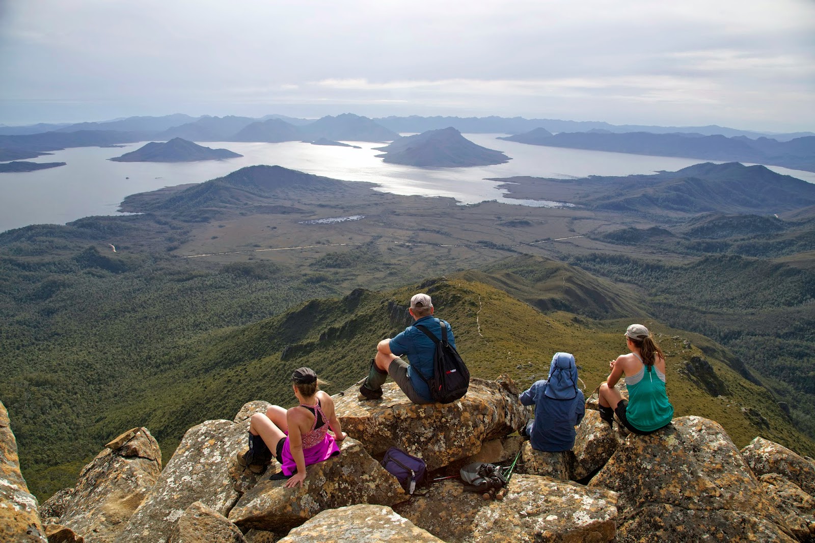
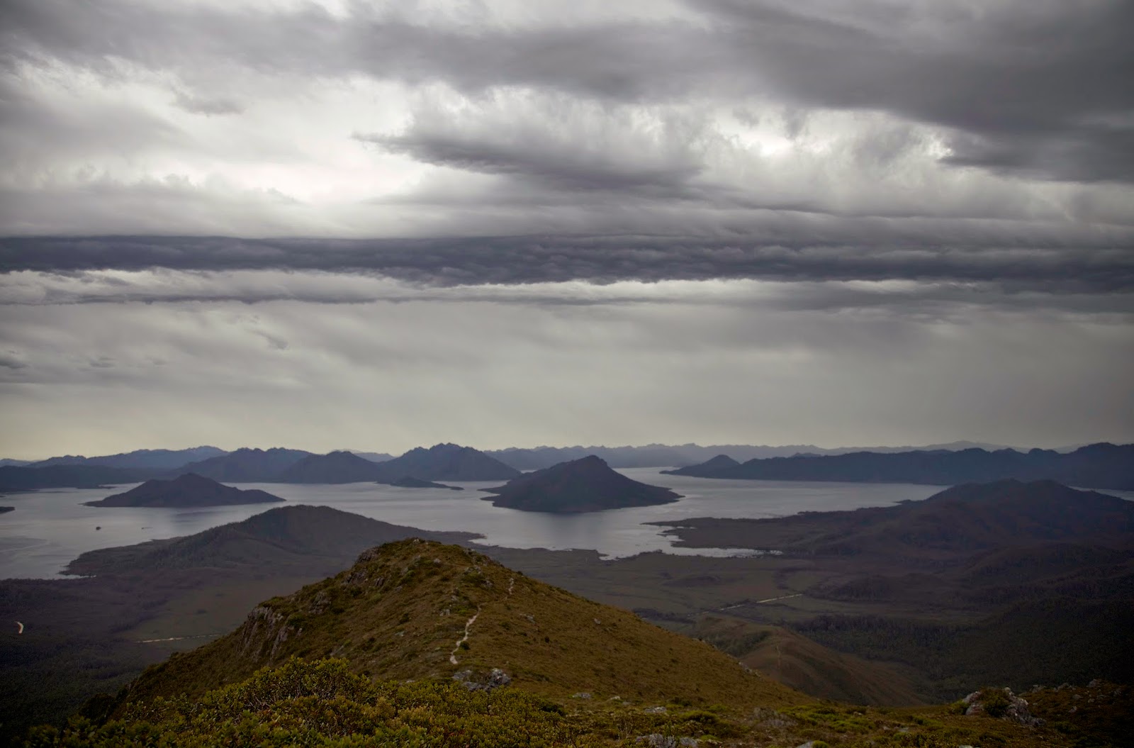
Our disparate mindsets soon reunite as we start to glimpse water through the trees. Libby momentarily mistakes it for more cloud, but the mini ripples on the otherwise still lake give it away. We dump our packs, then find some suitable tent-sites beneath the trees, before I suggest we check out the view from the water’s edge. I've told the others that it’s one of the most stunning views from any campsite in the state. The huge Eliza Plateau rises abruptly above the far shore of the large and stunning lake. But from the shore we see none of this. Cloud has settled low over the lake. It’s beautiful in its misty, tranquil way, but surely the others must think I’ve oversold it. 


Only time will tell, if the clouds decide to cooperate. Meanwhile aesthetic matters give way to practicality. We set our tents up, and get our food prep underway. It’s been a good day, a promising start to our walk. More than that: it's simply wonderful to be out here, clouds or not.


Sunday, 1 February 2015

A Mt Anne Epic 4: The Walking Wounded

At dawn the light is dull, sluggish. I’m the same, but make myself go out with my camera to check out the show. The valley is filled with slowly swirling cloud, but the tops are clear. It will be a fine, warm day once the sky shrugs off the valley’s blanket.


[Morning cloud burns off beneath Mt Lot & Lots Wife]
Tim and I wander across the shelf, looking for angles. I’m also testing my ankle, which feels walkable, ‘though the thought of carrying a full pack is daunting. We try not to linger over breakfast – there’s a long day ahead – but we rarely seem capable of breaking camp quickly. Apart from our desire to dry our tents before packing them, this place has a gravitational pull that makes it hard to escape.

It’s 9-30am before we wander up the slight incline towards the point where North-East Ridge meets Pandani Shelf. On the way we stop and chat with the only other people we’ve seen up here: two men with high-end photographic gear. We glean a couple of valuable tips, firstly how long they’ve taken to walk up from the road (6 hours) and secondly that they’ve taped their route with blue tape (which they intend to remove on their way back).


[Tim starts the descent. The road is just visible in the background. (Click to enlarge the image.)] 

We do a quick calculation of our return time, estimating 8 hours. That’s based on their fitness relative to ours, and how much injury and inexperience may slow us down. Just before plunging steeply through the forest we take a short detour to see if we can find Anne-A-Kananda, once the deepest known cave in Australia. (It has since been surpassed – only slightly – by Tachycardia and Niggly Caves, in the Junee Florentine system, a little further north of here.)  


[The Anne-A-Kananda sinkhole, with Lake Timk and Lots Wife]
The viewpoint gives only a hint of the huge hole beneath, and we don’t have the time to explore further. But we are still awestruck by the scale of the work done by mere H2O on this limestone ridge. We try – mostly in vain - to capture some of it photographically.

The “track” we’re aiming for – sometimes called the Bombardier Track – indirectly owes its existence to limestone. In the late 1960s a solo bushwalker went missing in this area. A caterpillar-tracked vehicle known as a bombardier, used by both the Hydro and mining companies for exploration, was co-opted to aid with the search. Unfortunately the walker was never found, and was presumed to have fallen into one of the numerous sinkholes in the area. However the track remains visible in some places, and the route is occasionally used by walkers like us.


[A 1960s bombardier, with HEC staff. (Ashton/National Library of Australia)]
The descent is long and steep, very steep. Trekking poles – just one for most of us - are extended. I’m using mine as an emergency brake, keeping some of the weight off my ankle. The rainforest is dense and deep green, with light filtering through myrtle beech and sassafras overtowered by old and gnarled King Billy pine. The pines have deposited a soft brown layer on the forest floor, and the undergrowth is mostly sparse, at least at first. We are making reasonable progress, although the downhill plunge is hot, hard and thirsty work. We welcome the shade, and take frequent drink stops. Outside this green haven the day is becoming warm and sunny.


[Tim finds shade on the descent through the forest] 

We stop for lunch somewhere towards the bottom half of the slope, ‘though not as far down as I’d hoped. After lunch the interminable downhill plunge continues, and the scrub thickens. The walk starts to become a tactical battle, a mental game for each of us as individuas, and as a group. Finding the route, now sparsely marked with blue – and pink and yellow – plastic tape, has become more of a task. Some of the tapes lead in contradictory directions. Lina is in the lead for a time, her first go at route finding. We’re pleased to be able to congratulate her on not getting lost.

But this victory is overshadowed by sounds of disgruntlement from elsewhere. Mick is having a hard time. Stumbling and grumbling, at one point he falls over outright, cursing loudly. We pause to help – once we’ve taken some photographs – and make “we’ll soon be at the bottom” type promises.


[Mick takes a tumble ... and we take photos!]
Eventually we do reach the toe of the slope, but it’s clear Mick is not well. He goes off to dig an emergency hole, returning a while later still not looking great. He’s clearly exhausted, as we all are, but we guess he’ll be okay. With that we plunge out of the forest and onto the buttongrass plain.

Five minutes into our 4km slog along the plain, Mick stops, drops his pack, and starts vomiting. There’s not much we can do but put a hand on his shoulder and mutter sympathies. After a few violent episodes, he manages to swig some water, take a few deep breaths, and gradually get to his feet. It’s the start of a long and almost impossibly hard return walk for him.

He is sick several more times. We pause often on a slow and seemingly endless march across the plain. Actually it’s anything but “plain”. At a few points there are creeks and scrub bands that interrupt the buttongrass. At these points the twin bombardier tracks, which were at times plainly visible, are suddenly unfindable; either overgrown or otherwise obfuscated.


[Paola on the Bombardier Track, with Anne Range behind]
Given that the tracks are at least 45 years old, we probably should be surprised that we can see any of them. The wider scene is quite stunning, even if we’re not in a position to really appreciate it. The whole north-western flank of the Anne Range rears up out of the surrounding plains and forest. She is imperious, majestic, this Queen Anne.

Tim and I talk about going ahead, finding the car, dropping our gear and returning to carry Mick’s gear. But each time he manages to rally enough to shrug the suggestion off, and to walk on for another few hundred metres. I’m wearing my GPS and can measure both our progress and the distance to the road. Our advance is agonizingly slow. Not for the first time I wonder whether it’s best not to know.

The afternoon heats up, and we beat on into the face of the sun. We keep trying to persuade Mick to just stop and let us come back for him and his pack in a short while. But he’s made of stern stuff – not to say somewhat stubborn – and he keeps finding a way to walk on.

When we finally agree that Paola and I will go ahead and come back once we’ve reached the road, we don’t manage to shake off Mick’s pursuit. As we enter the last little bit of scrub (of course there has to be something nasty before we finish!) we turn to see the rest of the group only 200m or so behind us. Mick’s going to do it all under his own steam.

Barely ten minutes after we reach the road, the rest stagger out of the bush and onto the road verge. If Mick is the crookest, no-one else is in great shape. Lina walks out, and lurches off to find a quiet spot. She is utterly spent, and not yet up to celebrating an incredible effort: her first excursion into some of the toughest country in a truly wild part of the world.


[Tim, Mick, Lina and Paola at the road]
It’s 7-30pm. We’ve been on our feet for 10 hours. We’re a long way from feeling elation. We’re just relieved that we’ve managed to hobble, stagger and persist our way out of the bush under our own steam. Next time we might try something straightforward.

Sunday, 25 January 2015

A Mt Anne Epic 3: The Still Point

At the still point of the turning world. Neither flesh nor fleshless;
Neither from nor towards; at the still point, there the dance is.
T.S. Eliot

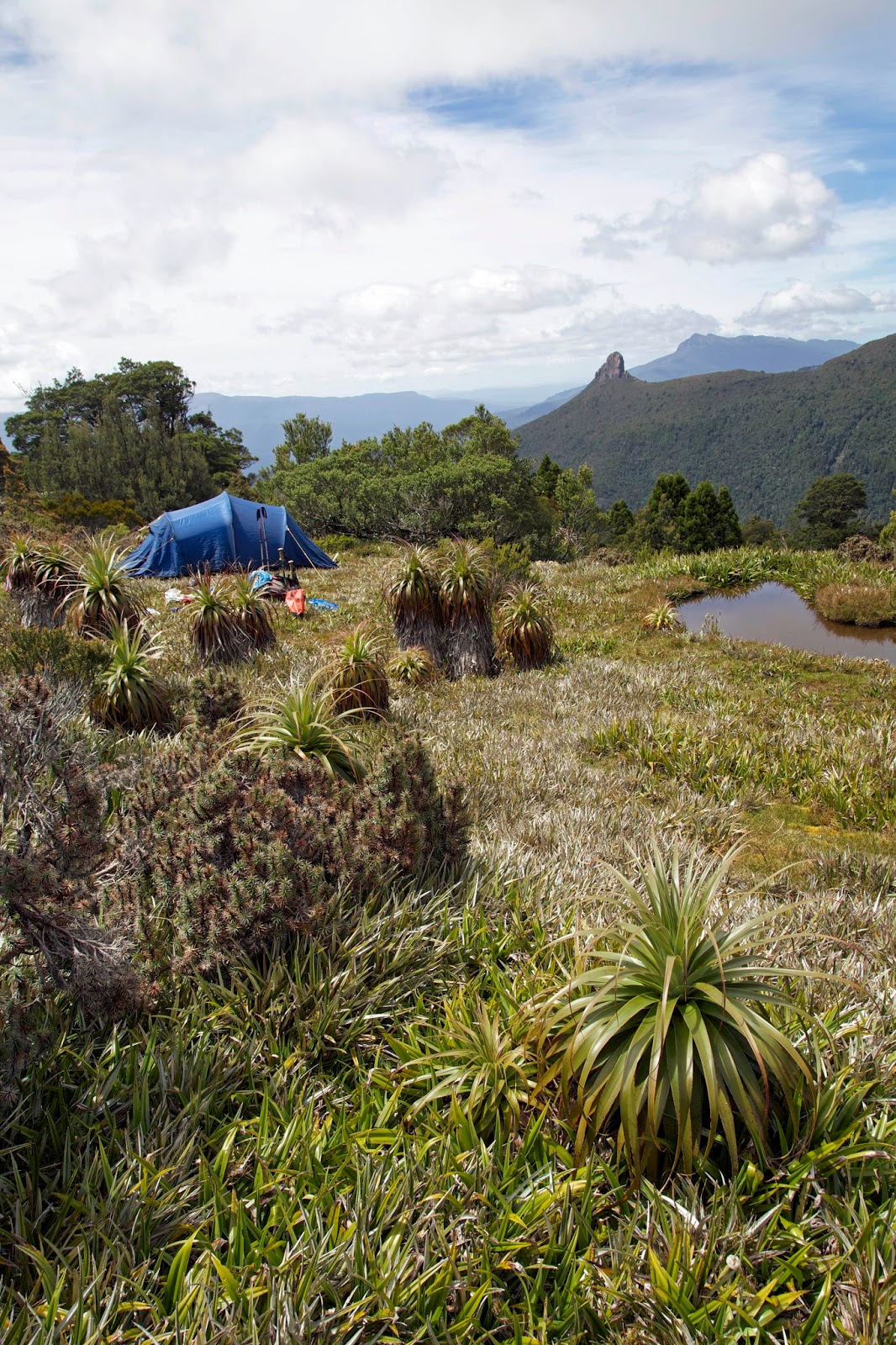
For more than 30 years I have wanted to be in this place. I don’t suppose I envisaged arriving in the manner I have. Like some penitent rascal just scraping into heaven, I have limped and slipped and staggered my way down to Pandani Shelf.


[Camping on Pandani Shelf, with Lots Wife behind] 
It is too late in the day to see what kind of smaller beauties it holds, but the shadows falling from the steepling bulk of Mt Anne and her sibling peaks, and the deep darkness in the valleys below, give us more than a hint of the grander scene.

On the soft pineapple grass beside a small pool, I sleep like the dead until around 4am. All is profoundly silent, except for my monkey-mind, which begins jumping from wonder to worry. How bad is my ankle? What if I can’t walk out? I unzip the tent to test it out, and to relieve myself.

Climbing out is awkward. I wince as I inch my injured foot into a Croc, and again as I stand up in the pre-dawn chill. I stumble a few metres from the tent, shivering in the cold. Yet as I stand there, the chill somehow eases the soreness of my ankle. Perhaps walking won’t be impossible, especially after the coming rest day. I slip back into the tent and eventually back into slumber.

In the full morning it’s only the sun striking our tents that brings us out. No-one is in a hurry to get going after the rigours of yesterday. But as we mingle over breakfast, it turns out the “rest day” might include some effort for some. Paola is very keen to try for the summit of Anne. Not wanting to do it on her own, she works on getting Tim to join her. She knows he’s already shown an interest, and that there’s no chance the rest of us will be in it.

Tim is undecided, so Paola plots a recce up the ridge. Lina joins her “just for that bit”. Eventually the women wander back. Paola is full of beans, even though they haven’t found an easy route. Despite our head shakes and talk of “worlds of pain”, Tim soon caves in and they hoist day packs and start climbing. It’s a long and steep climb, but they’ll be visible for parts of the route, and audible practically the whole time. They take the PLB just in case.

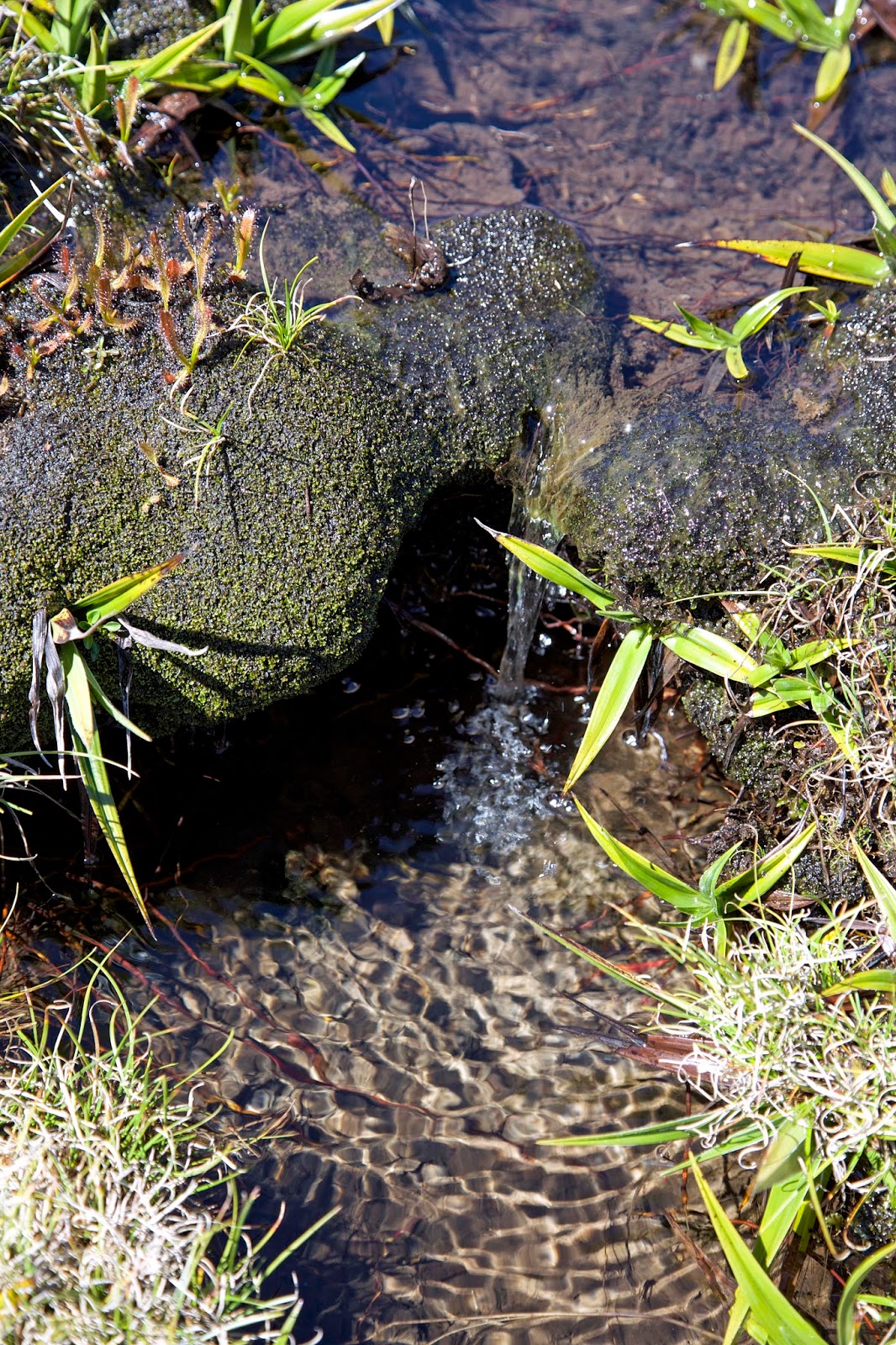
Mick, Lina and I go for a slow wander around the shelf, discovering that it’s actually multiple shelves, some of them split-level. They’re separated by bands of scoparia, pandani and other scrub species. I had expected to find prominent patches of cushion plants, but initially it’s mainly pineapple grass, rock slabs, bushy scrub … and a lot of water.


[Some of Pandani Shelf's plentiful water] 
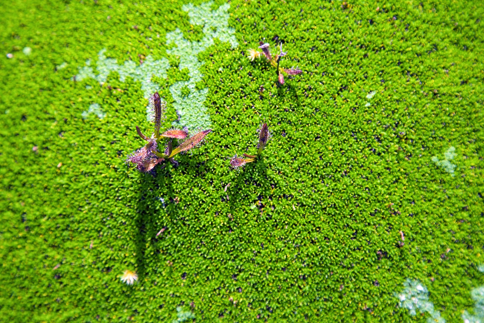
As we push through some bush on a lower level, we meet our first bright green expanses of the aptly-named cushion plants. Actually the name is only apt for their flattish, pillow-like appearance. As we touch them we find they’ve got the texture and ungiving resistance of coral. Bolster heaths, as they are also called, are usually made up of a number of different cushion plant species, often interspersed with other plants that variously piggy-back on, grow alongside, or compete with the “cushions”.


[Sundew on a cushion plant (Abrotanella forsteroides)] 
The surface of a cushion is made up of hundreds – perhaps thousands – of tiny, densely-packed, overlapping leaves. Their uniform growth enables them to form a tight barrier against the harsh conditions experienced in these highlands. This keeps the interior temperature and humidity of each “cushion” remarkably even, making them highly resistant to snow, wind, sun, lashing rain, hail and grazing animals. However prolonged drought and human footfall are both capable of harming these communities, breaking the surface and opening them up to the harsh weather conditions.


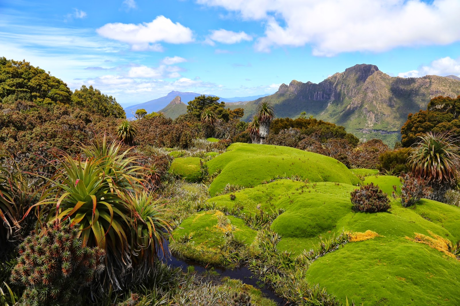
[A large cushion plant, with Mt Lot and Lots Wife behind] 
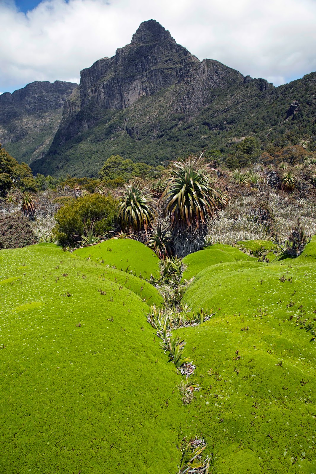
I have seen cushion plants many times, ‘though never in the profusion that we are soon finding. We turn a corner and find one continuous clump that is more than 20m wide. It wobbles and undulates like an enormous quilt hastily thrown over hiding giant-children. I half expect one to emerge with a sudden “boo!”

In and of itself this clump is stunning enough; the equivalent of a giant forest spread low and dense. But as we stand back to take it in, the magnificent backdrop of Mt Anne, Mt Lot and the deep clefts between us and them, has a transcendent effect. For a time we are literally speechless.


[Cushion plant, pandani and Mt Anne] 
The spell is broken when we suddenly hear voices from on high. It’s not a heavenly host, and there’s no hallelujah: it’s just Tim and Paola talking to each other from somewhere high on the mountain. We can’t see them; don’t know whether they’ve made the top or not. But at least they still have breath!

Towards sunset, just as we’re settling in to cook our dinners, we hear the climbers on the ridge nearest us. Nearly half an hour later they wander into the camp with a restrained “whoo hoo”. It turns out they haven’t quite summited; the last 20 metres proving just a little too intimidating.


[Paola and Tim celebrate their "almost!"] 
Still, we’re surprised - and a bit proud - that they’ve managed as much as they have. We make them a brew and hear all about their mammoth effort. They even show us photos of people they saw, and talked with, who were on the summit. So close!

We’re glad to hear that during their last half hour they’ve seen and photographed some of the cushion plants that have so thrilled us. For Mick, Lina and myself, what we’ve seen has been its own mammoth experience. Perhaps keeping (almost) still can be as big an adventure as (almost) making a summit.

Saturday, 17 January 2015

A Mt Anne Epic 2: Hands-in-Pockets

Overnight the storm rages. The nor-westerly trough that brought the storm over the mountain is replaced around two in the morning by a sou-westerly change. There’s more lightning, more thunder, and the winds stiffen from the forecast 30km/h to well over double that. My sturdy old Macpac Olympus tent isn’t bothered by the wind, but the uproar keeps Tim and me awake for a time.


[On the ascent above Eliza Hut] 
 Having been woken, I find I’m a little anxious about the unknowns of the day ahead. But our recce up Mt Eliza in the afternoon has been valuable on a couple of levels. First we’ve been able to introduce Lina to the new-to-her concept of boulder scrambling, and without having to carry a large pack. She is mildly disturbed by the experience, but lives to tell the tale. And at least she knows what to expect first thing tomorrow.

We’ve also been able to quiz a friend we met up there about our intended route around Mt Anne. We won’t use her real name – for reasons that will become apparent – although “Janet’s” words are inscribed in our memories. She breezily recalls that the section between Mt Anne and North-East Ridge is a “hands-in-pockets” walk. Those of us who know Janet best are a little wary, given her “glass-half-full” take on life, and her reputation as a strong walker. Still we can’t help but be a little reassured, especially since none of us has been that way before.

The disturbed night and low cloud combine to keep us in the tent late. We have no desire to climb Eliza in wet cloud. Instead we discuss our day’s tactics over a slow and convivial breakfast in the hut. Just as we’re cleaning up, as if on cue the cloud breaks up and the sun starts to peep through. Our minds are made up for us.

Considering yesterday’s dose of heat exhaustion, I’m feeling quite good, and am pleasantly surprised to reach the top of Eliza with ease. Lina surprises herself too, coping well with the large boulders. She pauses on top of her first Tasmanian “mountain” for a quick celebration.


[Lina on top of Mt Eliza] 
 The wind is still fresh, though nothing like the overnight blasts. It’s pleasantly cool: ideal walking weather. We come across a party we’d met the day before. They’re on their way down Eliza, ahead of schedule, after a terrible night at Shelf Camp. Two of their three tents have had poles snapped in the overnight wind. They’re cold, wet and not keen to stay and chat. We try to resist a dose of schadenfreude, knowing full well we had planned to camp in the same spot last night.

We wonder what has become of Janet and Geoff, but the returning group has no news. They certainly hadn’t seen them at Shelf Camp. As we wander across the alpine plateau, we come across a tent nestled among some low rocks. There’s no-one there but we’re pretty sure it belongs to Janet and Geoff. As we pause for lunch a little further on, the pair walks by.

They tell us of a scary night in the open, with gale force winds and lightning strikes not far from their tent. Given that experience and a tight schedule they too have decided to head down rather than continue their planned Mt Anne Circuit. “We might check out Schnells Ridge instead.” We freshly quiz Janet about the way around Mt Anne, and glean a few more details – including her pointing to our best route – before she and Geoff return to pack up their tent.

After lunch we have a few sublimely hands-in-pockets moments as we wander over to the edge of the plateau. We take in views over glacially-carved Lake Judd to Schnells Ridge and beyond. Then, our packs back on, we make our way towards the shoulder of Mt Anne, herself massively torn by the actions of ice over the last few million years.


[Looking over Lake Judd towards Schnells Ridge] 
 I recall taking my brother-in-law Mike up this mountain one cold and windy day back in the 1980s. In basic day-walk gear we boulder-hopped and scrambled our way up the intimidating peak. Mike wore a plastic poncho in lieu of a rain jacket. In the wind it acted like a crazy spinnaker, blowing him on a dangerously erratic course across the boulders.

More than 30 years later, as we negotiate our way across those same boulder fields, I wonder how we survived that day. This time there’s certainly no hopping involved. We pick our wary way across the rough rocky slopes that surround the mountain.


 [Traversing boulders beneath Mt Anne]
 We’re soon scrambling past the normal route to the summit. We’ve been told there’s a “back door” to the summit, further around. Some of our group are keen to try this out, though given the time we figure that might be tomorrow’s challenge.

Although the distance to N-E Ridge on the map is not great, it is a rough route, and we wait in vain for the hands-in-pockets section to begin. Instead I find a much less desirable foot-in-hole moment. As I’m leading a steep sidling section I put my left foot down on what appears to be a vegetation-covered boulder. Instead there’s a hole beneath it. My left foot goes down 40 or 50cm further than expected, leaving my right foot high above. The mechanics being all wrong, my right ankle wrenches sideways and backwards.

I shout out in pain and drop to the ground. Have I heard a crack, or was that just the wrench shooting up through my nerves? I’ve never broken a bone, so I’m not sure what it would feel like. But the phrases “personal locator beacon” and “helicopter rescue” definitely come to mind!


[Tim straps my ankle: photo by Mick Adams] 
 Tim is first on the scene, and he asks all the right questions. I take off my boot, and find I can wiggle my toes and move my foot without too much pain. Not broken, then … but can I walk? Tim binds the ankle firmly. I swig some water, eat some scroggin, then put the swollen foot back inside my boot. I try out a step or two, and it seems workable if painful.

The rest of that walk down to N-E Ridge is slow, rough and horrible. Each time I put my right ankle down it protests and I wince. But using a trekking pole as part walking stick/part brake, I am able to hobble slowly along the scrubby, rocky ridge.


[Hobbling along N-E Ridge: photo by Paola] 
 After some hours of slow and literally painstaking traversing, we find what might be a way down to Pandani Shelf where we plan to camp. Our descent route is steep and undignified, but where legs don’t work well I find a bottom does fine. Nothing in this part of Tasmania is easy or straightforward, but we finally reach the shelf as the last of the sun is setting over the far mountains.


[The shadow of Mt Anne creeps towards Lake Timk, with Lots Wife and Mt Lot] 
It’s probably a beautiful place; it’s certainly surrounded by magnificent peaks; it’s quite possibly the perfect place for a hands-in-pockets rest day. Tomorrow will answer all that. For now I’m just glad to be here more or less in one piece.


Sunday, 11 January 2015

A Mt Anne Epic 1: Some Like It Hot

Some like it hot. I’m not one of them. So when the forecast for our planned four day trip in the Mount Anne area suggests a hot first day, I push our start time as early as possible. That way we might avoid the worst of the heat on the steepest part of the climb.

I’m hoping the forecast cloud will delay the heat. But as we turn onto the pale gravel of the Scotts Peak Road, well over two hours after leaving Hobart, the sky is clear and blue. In south-west Tasmania that’s usually a cause for celebration. Nearby Strathgordon averages two and a half metres of rain a year, and Mount Anne considerably more. There are only 16 clear days a year, and this is one of them.


[Tim points out Mt Anne from the lower slopes] 
Considering a 680m climb carrying full packs, we’re not as excited as we might be to see the mighty pyramid of Mt Anne stark against the blue. After a car shuffle and the usual mucking around, we heave our packs on at around 9:30. It’s already over 30 degrees, and our plans of avoiding the heat have melted before us.

We have little time to settle into our packs before we hit the brutal climb up the shade-less buttongrass slope. We’re carrying plenty of water, are slick with sunscreen, and have hats tugged over our faces. Still, it’s inescapably hot. Between heaving breaths Tim and I fantasise about solar-powered air conditioned hats. “There’s a gap in the market” Tim reckons.

We trudge slowly upwards, stopping frequently for water and sometimes scroggin. Over the decades I’ve done this part of the walk many times in all kinds of conditions, but today feels the hardest. Is it Christmas/New Year over-indulgence on top of the heat, or am I just getting older?


[An early break on the way up Mt Eliza] 
At least the views out over the south-west are as good as ever. We tell Paola and Lina, the two German walkers who have joined us, the names of the various ranges. Tim and I linger over the saw-toothed profile of the Western Arthur Range, remembering separate epic trips there. We recount the story of the original Lake Pedder, and the impoundment that now covers it. They are gob-smacked by their surroundings, and teach us some German expressions of awe and wonder … or possibly they’re just expletives!

We’ve planned a lunch break at the Mt Eliza Hut. I remember it always taking quite a while to come into view, but today it is stubbornly tardy. Mick and the frauleins decide to walk on and wait for us at the hut. Tim stays with me, doing his best to jolly me along. I’m struggling, barely able to put more than 50 steps together before needing to stop again.

There is no respite from the heat, no trees to shade us and precious little breeze. I feel as though my brain is boiling inside my hat. We reach the top of a slope, or what turns out to be a false top. I slump to the ground again, turn my head as far away from the sun as possible, mutter apologetic words of exhaustion to Tim.

[Mick at High Camp Memorial Hut, aka Eliza Hut]
After a while I look up, as though to will the hut to appear. Instead I see Mick coming towards us, without his pack, carrying two bottles. He gives each of us a bottle of fresh cool water. The bad news, he says, is that the hut is still 40 minutes away. The good news is that he’s happy to carry my pack to the hut. I bless him, take a slug of water, and we set off.

I start to realise I’m not just tired when I find walking just as hard without the pack. Tim recounts his experience of heat stroke on a Frenchmans Cap trip. It included nausea and vomiting, but as I’m not feeling sick, I don’t think I’ve got that. But it could be heat exhaustion. Distracted by such speculations, we suddenly reach the hut. It’s only taken 20 minutes. Mick has a sly smile. “Thought it’d be better to overestimate.”


[Is this heat exhaustion? Resting outside the Eliza Hut. photo Mick Adams] 
I drop to the ground outside the hut, in the shade of a myrtle beech tree. I can’t even lift my head to drink, let alone think of eating. I lie there for 15 or 20 minutes before starting to feel human again. We have lunch and discuss the options for the rest of the day. I’m not the only one suffering in the heat, and given we’re only just over half-way to our destination at Shelf Camp, and that rain is forecast, we eventually choose to stay at the hut. We’ll re-assess our onward options in the morning.

Over lunch Paola gives me an orange-flavoured magnesium tablet to dissolve in a bottle of water. It’s supposed to help replace electrolytes after physical exertion, and seems to hit the spot. After an hour or so of rest and rehydration, I feel well enough to join the others on a recce of the track above.


[Stunning views over Lake Pedder from above Eliza Hut] 
The track is steeper and rockier than ever, but with tiny day packs and superb views, it’s surprisingly do-able. But any thoughts of staying up there for sunset views over Lake Pedder are overturned by a coming storm. We turn back and reach the hut just as a long line of bruised black cloud rolls towards us over the lake. Lightning flickers, a veil of rain is draped beneath the cloud, and thunder rumbles. We estimate its time of arrival, then Tim and I tighten our tent guys and retreat to the shelter of the hut for a spectacular show.


[The storm approaches Eliza Hut] 
The beat of the rain drowns out normal conversation, so we have to shout our gladness that we’re not caught out on Eliza Plateau during this! Perhaps my heat exhaustion was a blessing in disguise. As I share some wine with Mick – a small thank you for his kindness – I raise a glass to dry huts and fortuitous decisions.