Showing posts with label 1967 bushfires. Show all posts

Tuesday, 18 February 2025

Return December?

[This post was originally published in Forty South Tasmania, Issue 115, Summer 2025. I wrote it before the summer of 2024/25, but reproduce it here in response to the terrible wildfires that have ravaged Tasmania's West Coast for much of February 2025. I am deeply saddened that this is happening, and is likely to keep happening in future summers. One reality of climate change as we will experience it in Tasmania, will be the devastation of some of our irreplaceable fire-sensitive species.]


[A hazard reduction burn in nearby bushland]

Among Elvis Presley’s many gifts, the articulation of lyrics wasn’t foremost. That at least was my excuse for miss-hearing the title of his 1962 hit “Return To Sender”. I was sure he was singing “Return December”. And why wouldn’t anyone long for the return of the first month of summer, with its long days of sun, sand, cricket and, of course, Christmas? Back in my childhood it seemed impossible to be downbeat about summer. I gleefully anticipated the return of December.
 
How things have changed! Lately, I’ll confess, I’m close to dreading summer. It’s as though the very thing I’ve longed for has turned on me, like a beloved dog that suddenly bites. The source of much of this angst is bushfires. While summers in southern Tasmania have always come with the threat of bushfires, climate change has magnified that threat. Compared with late 20th century figures, Hobart can expect to nearly double its number of hot days (maximums >30 °C) by the mid-21st century. That’s an increase from 4 or 5 days per year to 8 days per year. At the same time our rainfall average is declining. 
 
Such conditions greatly increase the risk of lightning strike without rain, a phenomenon  more commonly associated with the drier, hotter parts of mainland Australia. Lightning has always been in Tasmania’s weather mix, but usually within rain-producing storms. Rain might continue to come with storms, but in warmer and drier conditions it will often evaporate before it reaches the ground. And lightning on dry bush is a recipe for disaster.


[Lightning strike photographed by me during a visit to Hokkaido, Japan]
This risk is not just a hypothetical future projection. Quite abruptly, since the year 2000, Tasmania has seen a sharp rise in the number of fires ignited by dry lightning. And these fires last longer and burn larger areas. Last century long-burn fires caused by lightning strike were a rarity. Now Tasmania has experienced such fires most summers so far this century.  

The summer bushfires of 2018/2019 serve as a startling example. They began in late December 2018, when dry lightning strikes ignited several fires in the Tasmanian highlands. Thousands more dry strikes occurred on January 16 and 29. I watched an animated simulation of the lightning storms as they crossed from north-west to south-east. It was as though a vast and merciless dragon was swooping and swerving across our island, breathing deadly fire, now to the left, now to the right. The fires continued burning for weeks, and by early February 2019, they had burnt around 200,000 ha, almost 3% of Tasmania.


Back in The Patch our local bushland - we watched anxiously as one particular fire, the Gell River fire in the south-west wilderness, grew into a monster. As it roared down the Vale of Rasselas, a vast smoke plume spread eastward, piling high into the sky behind Kunanyi/Mt Wellington. An eerily murky pall settled over the city of Hobart for days. Nobody could breathe easy in any sense. It was a potent reminder that, for better or worse, the patch of bush we live beside is connected to the wild.


[A "cool' burn in our local bushland]

All day long we had the radio on, listening for updates, wondering if the fires would reach Hobart. We hastily worked out our fire plan, with southern Tasmania’s disastrous 1967 fires firmly in mind. That calamity claimed 64 lives, including some in our neighbourhood. If fire struck here again our plan was simple: get out early. Twice that summer we packed overnight bags and precious items. We photographed parts of the house interior, in case we’d need to remember what was replaceable. The irreplaceable would be just that.
 
We’re not the only ones threatened by fire. Looking at The Patch, I wonder how its other inhabitants can respond to a severe fire. How might they “get out early”? And even if a bushfire doesn’t come, how will the trend to hotter and drier effect the plants and animals here? 


[Where would an echidna find refuge in a wildfire?]

Of course all of this change to our climate doesn’t mean we’ll suddenly have uniformly hot, dry summers. We will continue to enjoy the endearingly changeable summer weather we’ve come to expect, including the occasional December snow on Kunanyi. But weather is not climate. Climate refers to changes over longer periods of time, and looks at trends in our weather. And it’s the trend to hotter, drier, and more volatile that is most worrisome. I ask myself whether this is a situation I want to leave to my grandchildren’s generation?
 
In that context my own maternal grandmother comes to mind. She was a wonderful, somewhat eccentric presence throughout my childhood. One of her quirks was a morbid fear of thunderstorms. When lightning flashed and thunder rumbled, she would quickly take herself off to her room. And there she would hide in a dark wardrobe, sitting on a chair she had in there for just that purpose, hoping the sturm und drang would be muffled by her frocks and coats. 
 
I could never understand her phobia, as I found a “good thunderstorm” quite exhilarating. But all these years later, and for entirely different reasons, I seem to be inheriting my grandmother’s feelings about thunder and lightning. I won’t be heading for the wardrobe, but I certainly wish I could parcel up a coming storm, and label it “Return to Sender”. 

Sunday, 24 January 2016

First Impressions: The Patch, Part 2

Love at first sight? I’m not a firm believer. For me love often has a slow burn. Take kunanyi/Mt Wellington for instance. My first impression of it was probably no more favourable than that of Charles Darwin, who described it as “of no picturesque beauty” after his 1836 visit.

His view may have been coloured by his own gloom at the time: see my earlier post here. And my own less-than-favourable impression was doubtless related to first seeing it just 9 years after the catastrophic 1967 bushfires. Back then the mountain’s slopes were scarred by the grey ghosts of a vast burned forest.


[kunanyi/Mt Wellington at sunset] 
But now; how shall I count the ways in which I love this mountain? Allow me one. 

Shortly after first moving here, I am driving home at dusk. A sou’wester is easing after a cold, wet change. The sky is pale, drained of both light and dust. Against that sky the mountain is a decoupage in black, the line of it as crisp as the air, climbing uninterrupted to The Pinnacle. In the falling dark I am not seeing the actual mountain. But I am seeing its shape as a hint, a promise of altitude and wildness; of untamed cold; of uncounted future experiences.

When it comes to “my” patch of bush on the slopes of that mountain, I have more difficult accurately recalling my first impressions. I know that on moving to this place in 1986, I was all eyes for the mountain: that and the amazing garden I could scarcely believe had come with the house.

It was May, and the predominantly European and American trees were in their late autumn glory. As much as I loved Australian native plants, my head was still turned by that blushing northern deciduousness.


[The scarlet oak in its autumn glory] 
But it was a spacious garden – three quarters of an acre – and upslope, in the back garden, the native bush was dominant. Tall stringy barks and massive blue gums jostled with straggly wattle trees. A large, ramshackle chicken yard hogged the block’s best view. And beyond that, there was more bush, a lot of it.

Our children were young back then, and excursions into the patch of bush were only occasional. More often we were up there chasing our dog, a talented escapologist, able to leap tall fences in a single bound. Poor “Angus” contracted canine distemper on one early jaunt. He survived, but it left him with a nervous tick (chorea), which led us to mistakenly believe him mentally impaired. (He later demonstrated a quite startling intelligence: but that’s another story.)


[A blue gum at the edge of the patch] 
With Scottish Anglophile ancestry (now there’s a contradiction in terms!), I not only loved mountains, I also loved well-tended fields, hedges and other such English countryside staples. So when the drive/walk to and from the city took me past our local brewery’s small field, I responded much as I did to deciduousness.

As with those northern trees, the field would change dramatically with the seasons. Green in winter, it would grow lush and tall in spring, waving colourful seed-laden heads in the November winds, before turning golden in high summer. 


[Mowing the brewery field in summer] 
In a good year they might cut two loads of hay, leaving the field pale and stubbly until autumn’s cooler wet allowed new growth. That the field had a few poplars edging it added to that sense of gradual, perceptible seasonality. Much harder to notice, and far more complex, were the seasonal changes in our patch of bush. The field’s delights I quickly saw and enjoyed in those early years. Yet 'though it stood so close by, it took many more years, and a willingness to pay attention to detail, for me to learn a little of our native bush. But again, that’s another story.


[The Patch starts at the top of the field] 

Sunday, 11 May 2014

From City to Summit 4: The Unknown Neighbourhood


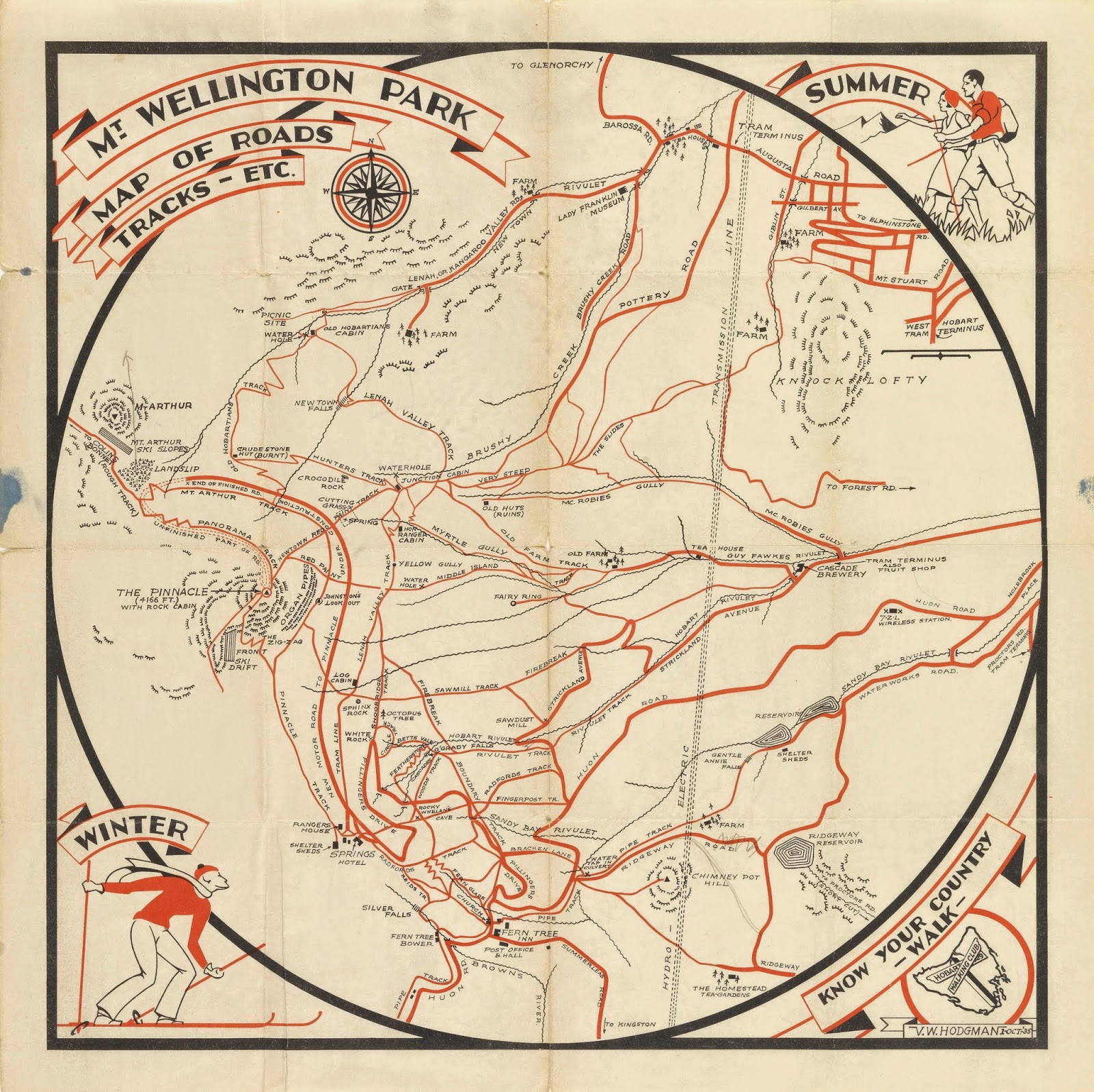
[Mt. Wellington Park Map by the Hobart Walking Club
(VW Hodgman), 1935, 
Tasmanian Archive and Heritage Office]
 
How well do we know our neighbourhoods? Perhaps we can rehearse the names of adjacent streets and nearest intersections; or give directions to the nearest shops or playgrounds. We might also be able to put names to the faces of some of our neighbours; even repeat a few stories about one or two notable – or notorious – neighbourhood characters.

But how far back does our knowledge go? Do we, for instance, know what the neighbourhood was like 20, 50, 100 years ago? Even further back, do we know how the land was used before it became city, town or suburb? And do we know anything of past Aboriginal life in our area?

The new Cascade Track had proved a pleasant, gently uphill morning’s walk. Our height gain was modest and our conversations barely disturbed by the mild exertions. Still, we were glad to reach the top of the track, near the end of Old Farm Rd, in time for some thermos coffee and Anzac biscuits. It was comforting, familiar.

So too was wandering back to the junction of Inglewood Rd and Strickland Avenue. There Tim and Sally would leave me, and Lynne would join me for the next section of the walk. We were just a few bends in the road away from home. Yet coming at my onward journey from this odd angle had me thinking about it differently.


[On the Inglewood Fire Trail]
Tim and Sally waved us away as we walked steeply up Inglewood Road and onto the Inglewood Fire Trail. The track’s name should have been enough to remind us of this area’s recent history. But it took coming across a deep fenced-off water hole to get us thinking about the bushfires that ravaged our neighbourhood during the massive 1967 fires. Bush dams like this are used as supply points for the kind of “hand-to-hand” fire fighting that can happen in such bush. It’s no mere nicety: 13 people died in our street alone in the ’67 fires.


[Near the start of the Lower Sawmill Track] 
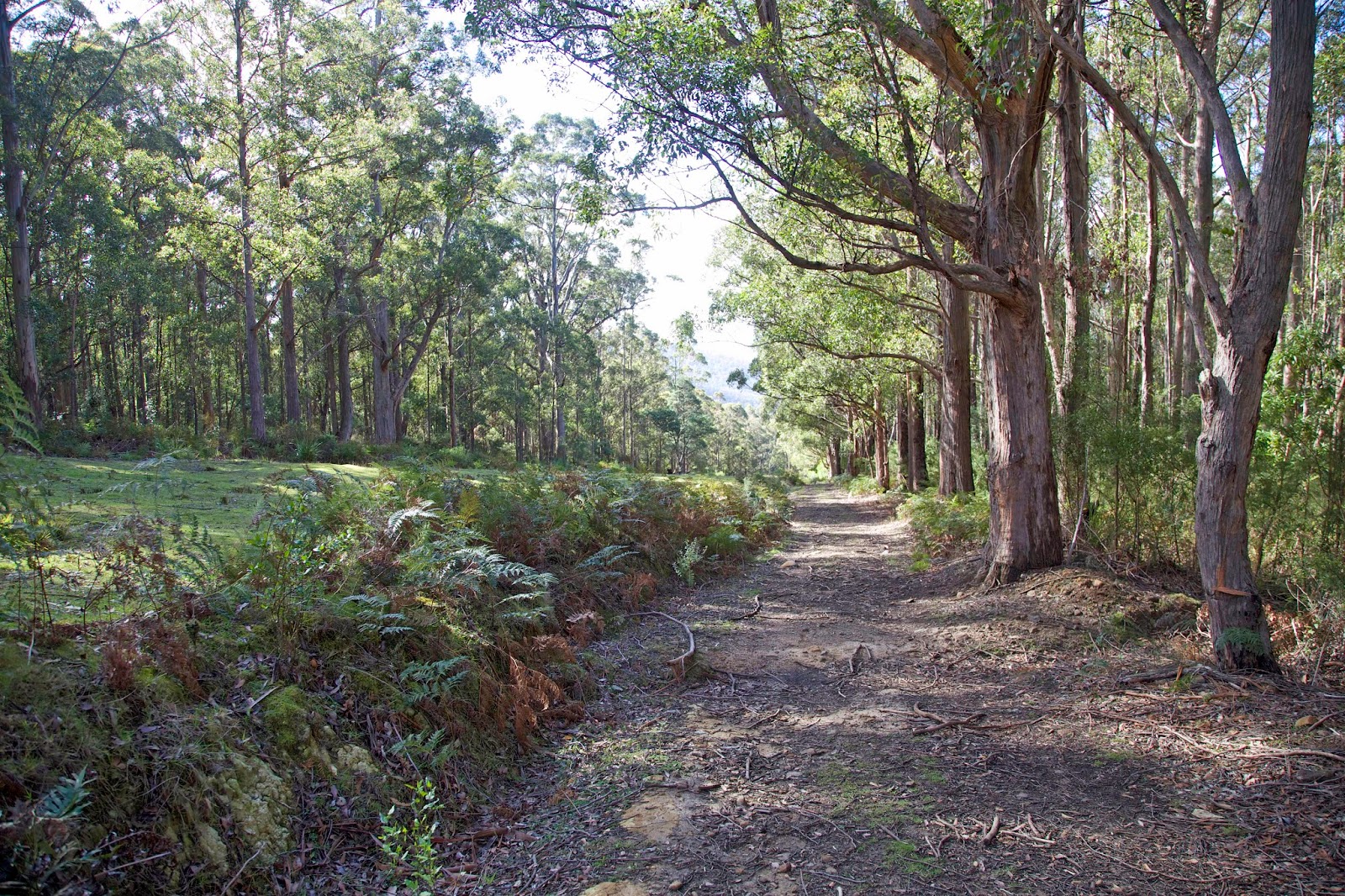
At the top of that fire trail we joined another fire trail. That led us in turn to the Lower Sawmill Track, and to another encounter with history. The Sawmill Track was probably constructed in the late 1910s/1920s as part of the Cascade Sawmill operation. Logs were dragged down the mountain to the mill and cut into boards, scantlings or fruit boxes. The mill may have been locally known as Woodleigh's Sawmill, but on the 1935 Hobart Walking Club map (shown above) it is simply marked as 'Sawdust Mill'.

Although it had stood only a few hundred metres up Strickland Avenue from where Lynne and I had just departed, we had previously known nothing about it. It had ceased operations by mid-century, and its remains were probably consumed in the ’67 fire.

Walking on the Sawmill Track, a legacy of a now gone logging industry, felt like a local encapsulation of Tasmanian history. Only the slight cupping of the track hinted at the thousands of dragged logs that must have helped shape it. The now thickly-forested bush has recovered well from both logging and bushfires. We found it pleasant and green, soft underfoot, quietly grand. That was just as well, because it was now clear that the real climbing had begun.


[One that got away? A fallen log on the Sawmill Track.] 
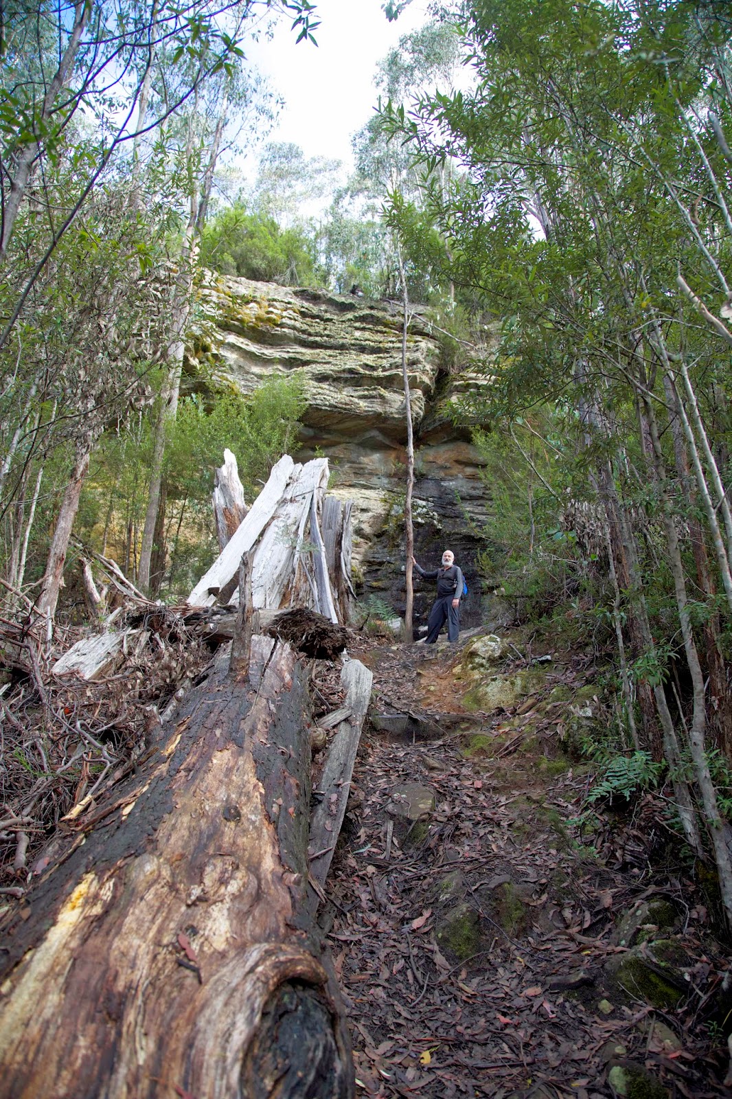
We stumbled ever more steeply upwards, and yet our lunchtime goal, Sphinx Rock, seemed unwilling to appear. The slope steepened, rock talus became more frequent. Surely, the earth scientist inside me reasoned, the prominent sandstone formation would loom out of the bush at any moment. It didn’t. Instead it was the cheerfully loud voices of our grandchildren atop Sphinx Rock that eventually told us we were (literally) within coo-ee of our lunchtime rendezvous with Sally, James and family.


[Approaching Sphinx Rock on the Sawmill Track] 
As we clambered up the very steep track – possibly an old snigging track – I recalled reading that Sphinx Rock itself may once have had a sawmill near the top of it. I know I far preferred finding my family picnicking at the lookout. Not all progress is bad.


Sunday, 10 February 2013

Where There's Smoke ...


[Bushfire smoke billows above Kunanyi/Mt Wellington]

The cloud was rising from a mountain -- at such a distance we couldn't tell which. I can best describe its shape by likening it to a pine tree. It rose into the sky on a very long "trunk" from which spread some "branches." I imagine it had been raised by a sudden blast, which then weakened, leaving the cloud unsupported so that its own weight caused it to spread sideways. Some of the cloud was white, in other parts there were dark patches of dirt and ash. The sight of it made the scientist in my uncle determined to see it from closer at hand. 

So wrote ancient Roman, Pliny the Younger. The event he evokes is the eruption of Mount Vesuvius in August 79AD. His uncle, Pliny the Elder, died that day while seeking his closer scientific view.

Today a large plume of smoke is rising from the mountain behind our place. The sky has an uncanny, jaundiced hue, and the citizens of Hobart are on edge. As much as I admire Pliny’s scientific curiosity – many of his contemporaries simply cowered in fear at this “wrath of the gods” – I will not be emulating it. Today, for the third day in a row, Hobart and surrounds are swathed in thick bushfire smoke. Satellites, helicopters and the internet tell me exactly where the fires are. And I have studied enough to know how they behave. I have no desire to see this fire close up. 

We have had a summer of savage bushfire all over our island State. On January 4, 2013 Hobart reached 41.8 degrees Celsius. That’s more than 107 degrees Fahrenheit. For a cool-temperate island, derided by mainland Australians as sub-Antarctic, that’s impossibly hot. And it’s the kind of weather which makes fire impossible to control. On that January day around 200 houses in south-eastern Tasmania were incinerated, along with countless livestock and wildlife. Incredibly, no-one was killed by the fire.

I was driving home from the north of the State that afternoon, dodging fires, listening to the car radio to find the safest route home. The heat was so intense that sections of bitumen on the Midland Highway were melting. Ash and smutty embers were drifting out of a hellish sky.


[Map of a SW Tasmanian fire, January 2013. The blue sections indicate burned areas. Its "dragon" shape, more than 50km long, appears ready to swallow the Western Arthur Range.]  

Smoke from those fires persisted for days. For me, as for many Australians, such smoke elicits two opposite, primal responses. Gum leaves, and the wood from gum trees, make the very best of fires, whether in the fireplace or at an overnight campsite. For me those are hugely nostalgic settings, home to some amazing memories. A whiff of that smoke transports me to a happy place. But the same wood’s combustible qualities make wild fires in eucalypt forests and woodlands some of the fiercest, most frightening fires on earth. That smell on a hot day is the antithesis of nostalgia, especially when combined with strong winds and the judder of helicopters overhead.


[Thick smoke all but obscures the mountain]
Older Hobartians only have to hear “1967” and they shudder. In February that year conditions similar to those of January 4 this year caused the State’s worst ever fires. 62 people lost their lives, nearly 1000 were injured, and around 300 dwellings and buildings were destroyed. If I wanted the horror brought home, I need only recall that thirteen people in our street died. Our local landmark, the Cascade Brewery, was gutted, and 163 South Hobart houses were lost.


[A Tas Fire Service image of South Hobart after the 1967 fires]
A few days after the January 2013 fires it rained. Not hard, not for long, but we got a medium soaking. I walked outside and caught a different eucalypt whiff, one with no downside. It was the scent of wet gum leaves, and there are few smells as heavenly: sharp-tanged, clean, spirit-lifting. With this latest Vesuvian cloud still hovering over us, that is the smell I am wanting more than any other.