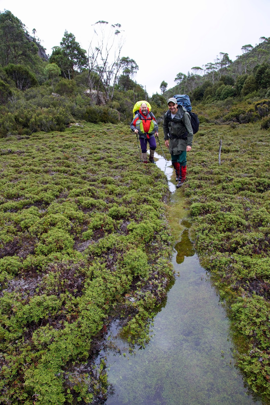
If the weather is
going to relent, we’re hoping it will be today. Today we plan to climb Mt
Rogoona on our way over to Lake Myrtle. It’s our only mountain for this
trip. And while we’re putting in weather requests, we’d quite like it to stay
fine for our night by the lake shore. It is a sublime place, but certainly at
its best when the weather is calm and kind.
We wake to an
overcast sky. At least it isn’t raining, and hasn’t since early evening. These
are hopeful signs. Then as we finish up breakfast, the grey clouds yawn and
stretch, and quite soon they’re taking their leave.
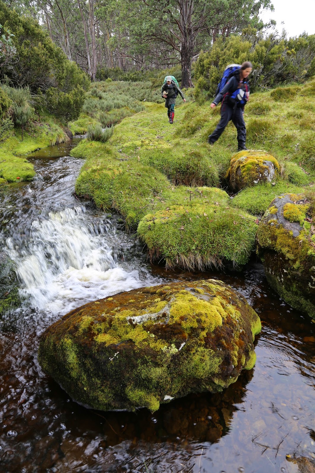
With new optimism
we slather on sunscreen, shoulder our packs and step outside to start the uphill
climb. The sun strikes the still-wet shingle roof of the hut and generates a
swirl of steam. By the time we reach the high point of the saddle we’re doing
the same. There we drop our full packs, swig some water, and put essentials
into day packs. From here it’s off-track and uphill to the summit of Mt
Rogoona.
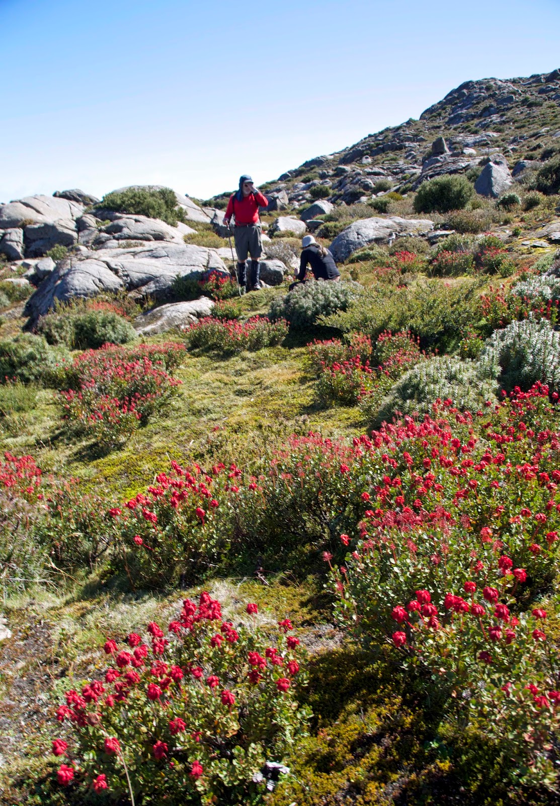
The contrast to our
previous days is stark. The rain has been routed, with just a few wisps of
cloud clinging to the mountain tops. The sky is an intense cerulean blue, and
there is barely a murmur of wind. It would be churlish to complain about the
hot climb, but we do have to work hard to gain the summit. If we needed
encouragement the intricate alpine gardens, miniature tarns and dappled slabs
of dolerite are an ever-varying delight.
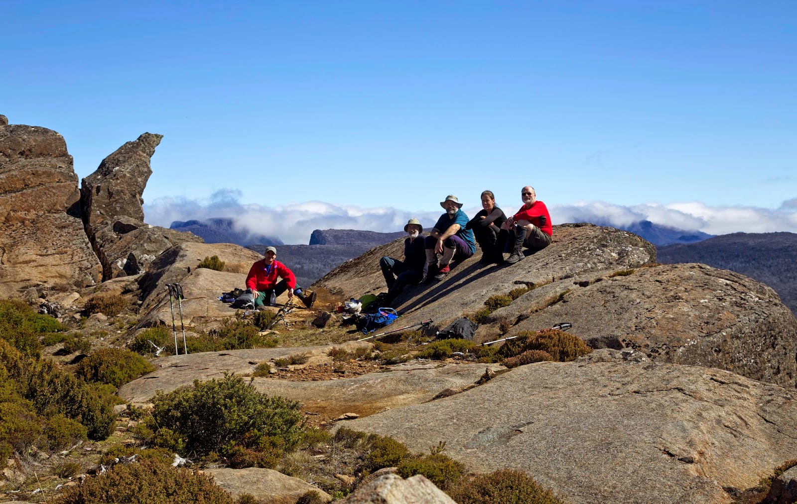
Rogoona’s is a
summit I will never tire of visiting. The views stretch from tonight’s lakeside
campsite far below us to the distant peaks of the Overland Track: the Pelions,
the DuCanes and even Mt Olympus. As we stand on the sharp-edged summit, Long
John and Libby, first time visitors here, are slack jawed, overawed.
Tim, Jim and I are
enjoying it afresh, and also reminiscing about earlier visits to the summit.
For the three of us a previous highlight was a close encounter with a young
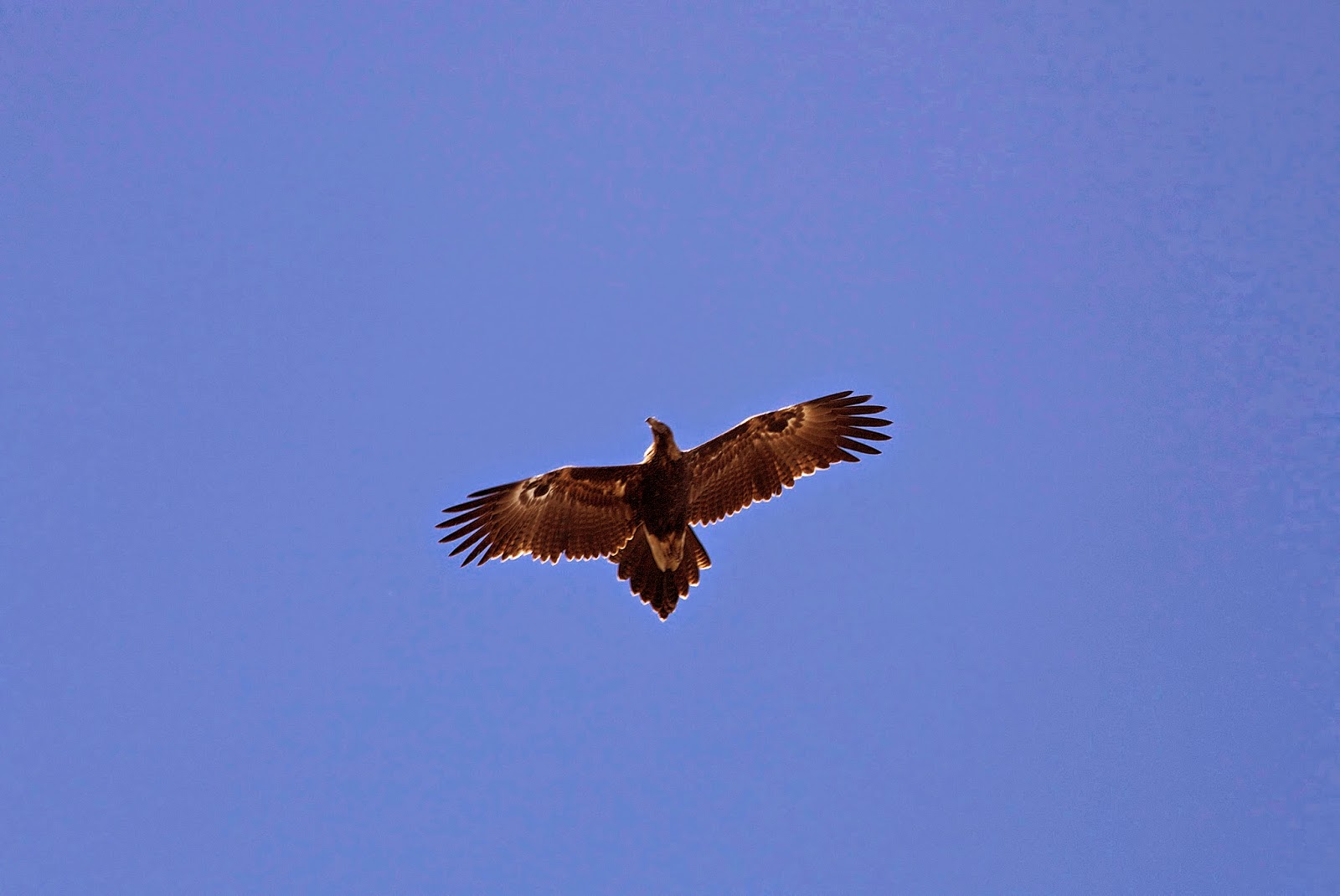
wedge-tailed eagle, which had “buzzed” us several times. As we settle down to
today’s mountain-top lunch, a shadow falls across our improvised table. The
eagle – or another eagle – is back!
Can there be such a
thing as calm panic? If there is we approximate it, letting out gasps of awe,
scrambling for our cameras, and doing our best to take in these brief moments
in whatever way we can. The eagle flies directly over us, less than 10 metres above
our heads, glides silently away, then circles back a few times. It has striking
eye-like markings on the underside of each wing. It’s as though there are four
eyes watching us.
Of course the eagle
is just doing what comes naturally to a top predator. It is checking to see
what is happening in its range. We could represent food, or possibly threat. For
us, seeing an eagle at close quarters is anything but business-as-usual. The
Tasmanian wedge-tailed eagle (Aquila
audax fleayii) is Australia’s largest bird of prey. It is a larger and heavier
sub-species of the mainland wedge-tailed eagle, and has a wing-span of more
than two metres. It is among the royalty of birds, world-wide, and we feel
deeply privileged to be allowed such an audience. We had merely asked for a
fine day on the summit. What kind of excess is this?!
After a few minutes
the raptor drifts off westward, and is soon just a dark crease in the blue sky
over the Du Cane Range. We return to the banalities of eating and taking group
photos, but can’t resist talking about this epiphany all the way back to our
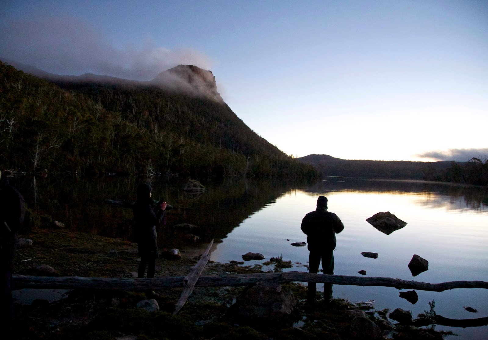
packs. Even as we set up beside the still waters of Lake Myrtle, cradled
beneath the now more distant peak of Rogoona, we’re reminded afresh of that visitation
on the mount.
If our hopes for a
perfect, calm evening at the lake are realised, the wee hours bring a return to
our earlier weather. In the morning we pack up slowly in persistent rain. It
may be inconvenient, uncomfortable even, but having just experienced
Rogoona/Myrtle perfection, it’s water off a duck’s back.
We follow a
lesser-known route down from the lake to our cars. It is steep and wet, and the
leeches make a spectacular comeback, keeping our stops to a minimum. But that’s
fine, as we’re on a mission to get the Christmas Hills Raspberry Farm in time
for lunch. Our bodies have worked hard, our souls have been filled to
overflowing. Now it’s time for some hot food!
|
Sunday, 26 April 2015
Four Lakes and a Mountain: Part 4
Sunday, 12 April 2015
Four Lakes and a Mountain: Part 3
Former Tasmanian
Premier, Robin Gray, famously referred to the Franklin River as a “brown
leech-ridden ditch”. This was rhetorical flourish on his part rather than
first-hand knowledge. He was not one for deep engagement with actual
wilderness.
We on the other
hand can personally attest to the flourishing of leeches here in the Mersey
River headwaters. Each time we venture outside the Junction Lake hut it takes
only seconds to discover one, two, ten leeches either on our legs or making
their way towards them. One or two even find our upper limbs and faces.
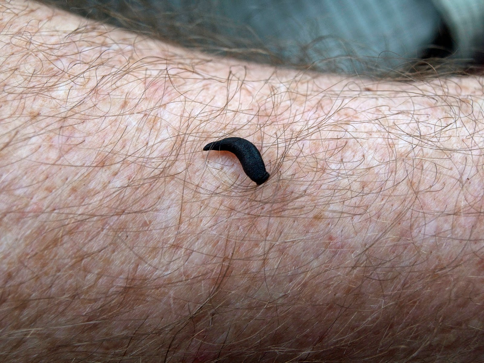 |
["I vant to suck your blood!" - a common leech] |
Leeches are
annelids, so are related to earthworms. But as worms go they’re rather
specialised in that they’re sanguivores – in plain English blood-suckers. Tasmania
scores well in the world of leeches, owing to our high rainfall and relatively dense
vegetation cover. Leeches require moisture on their bodies to assist
respiration, and vegetation cover provides both sun protection and prey.
There’s been plenty
of moisture everywhere we’ve been walking, and the warmth of our blood is a
constant attractant for these little suckers. The leeches getting attached to
us now are the most common species in Tasmania, Philaemon pungens. They reach about 20mm in length, and can grow as
fat as a child’s finger after a good feed.
Tasmanian
bushwalkers sometimes tease visitors with tales of enormous, striped leeches
called tiger leeches. Despite the exaggeration of the stories, tiger leeches actually
exist. Individuals of the species Philaemon
grandis can reach towards 60mm in length.
 |
[Tempting the leeches, Junction Lk Hut. Photo by Libby] |
I join the majority
of humanity in not being a big fan of sanguivores. While I’m happy to grant
leeches, mosquitoes and ticks their place in the ecosystem, I’d prefer that place
wasn’t on my actual person. That certainly turns out to be the opinion of one
of our hut companions when a large patch of blood is discovered inside their
sleeping bag. A stifled squeal is followed by a hurried shimmy out of the bag.
Mysteriously the
culprit is never found. As we’re wondering where it might have gone, I spy some
of the large cracks in the hut’s floorboards. The sated creature, I conjecture,
could easily have slipped through one of these and might now be happily
sleeping off its meal beneath the hut. We picture it creeping out one night in
the not-too-distant future to insanguinate itself afresh on some poor
unsuspecting sleeper.
Thankfully it’s now
morning, so we leave the hut and its crypt-dwelling blood-suckers to the next
party. It’s still raining, but we don’t have too far to walk. A couple of hours
up valley should get us to Lake Meston and its hut: another Dick Reed
four-bunker. Our original plan had been to walk to the far end of the long lake
to camp on the shore. It’s one of the loveliest campsites in the area. But in
weather like this it would be a lot less charming, and the lure of another hut
is strong.
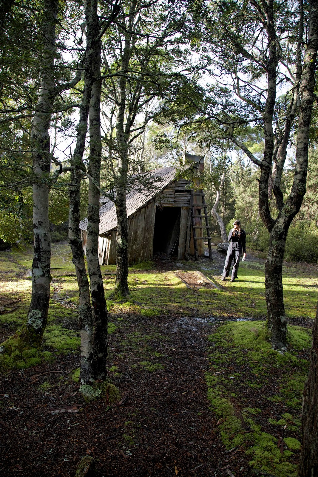 |
[Lake Meston Hut in its forest setting] |
The hut might bear
the name of the lake, but it’s high above the lake shore. And at best the lake
can only be glimpsed through trees. Still, it’s dry and very welcoming by the
time we get there. We’re all cold and wet, and though it’s mid-afternoon, we
are soon getting into our sleeping bags.
 |
[Views of Lake Meston 10 minutes above the hut ] |
The exception is
Tim, who has again volunteered to sleep in his tent. So instead of getting into
a bag, he dons his jacket, sits in the hut and picks up a book. Jim is
talking about having a nana-nap, but the rest of us are keen for Tim to read to
us. We’re soon laughing out loud, first as Tim reads some hilarious passages
from Bill Bryson’s “Neither Here Nor There”, and then as Jim breaks into
snoring.
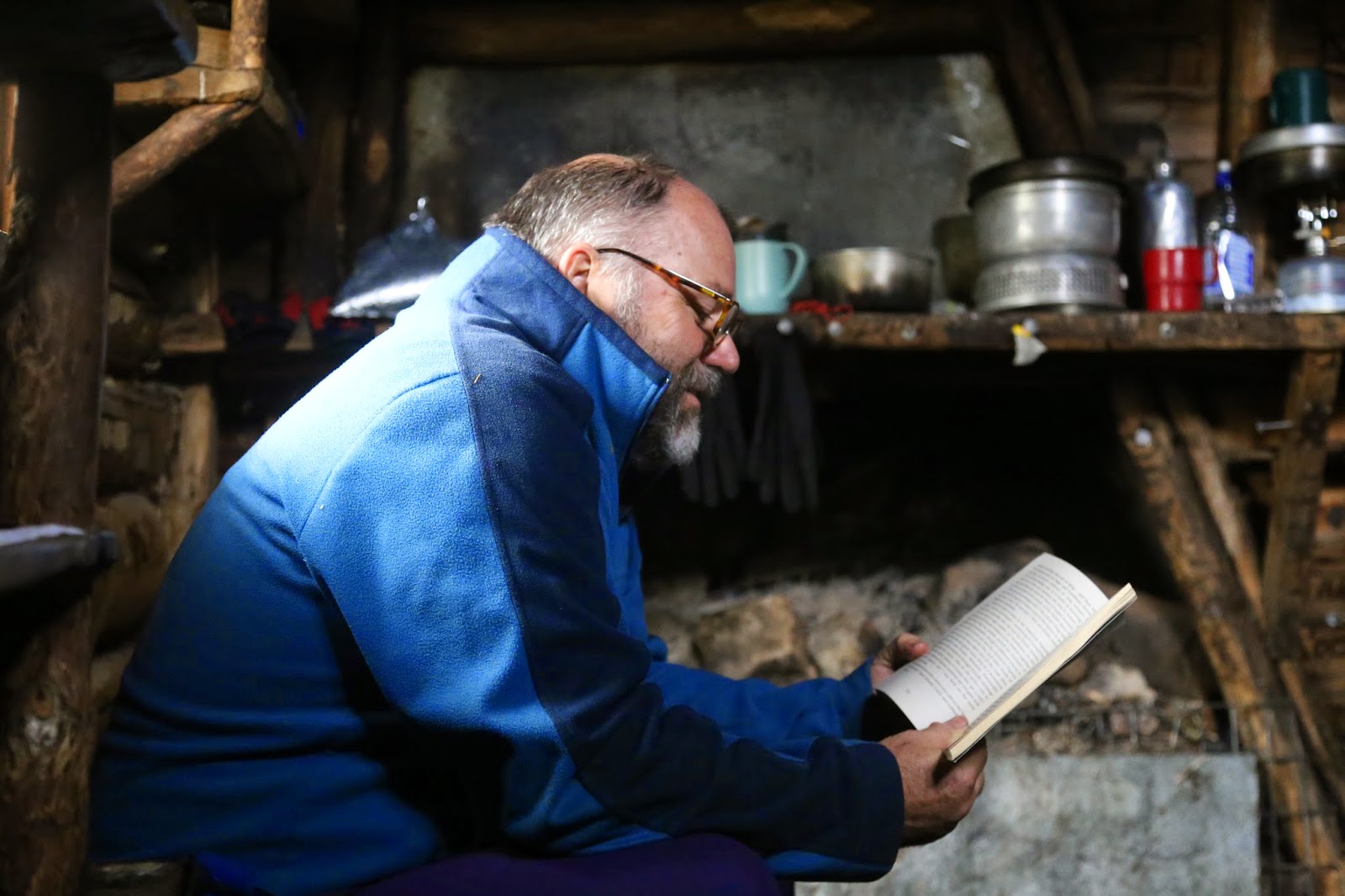 |
[Storytime with Tim: Lake Meston Hut] |
The grey afternoon has
eased gently towards a rainy evening before we clamber out of bed to make
dinner. We finish it off with a wee dram of port supplied by Tim. And then it’s
time for more Bill Bryson, with Jim taking up the reading duties. He’s puzzled
to find the bookmark further on than he remembered. So we fill him in on the
lost pages – and laugh afresh at his expense – before he continues the reading.
If it has to be a
wet walk, there are worse ways to spend it than lying and laughing; reading and
snoozing in a comfy, dry and (relatively) leech free wooden hut.
Tuesday, 7 April 2015
Four Lakes and a Mountain: Part 2
Camping beneath a
waterfall, in a dank forest, at the bottom of a deeply cleft, lake-filled basin,
proves good practice for the wet day ahead.
Lulled by the dull
roar of the waterfall, we have surfaced slowly. By the time we get over to the
“kitchen” we discover icicles dangling from the tarp. Tim tells us we’ve just
missed a brief snowfall. We dress warm and waterproof for breakfast, by which
time there’s just persistent slushy rain.
 |
[In the forest above Cloister Lagoon] |
In theory we won’t
have a long day. But only Tim has taken the route we’ll follow from Chapter
Lake down valley via Cloister Lagoon to Junction Lake. Like Tim, it sounds a
bit vague in places.
Counter-intuitively
we start by going back uphill (north) before heading south down the valley. But
we’re soon following a discernible route, well-enough trod and - for now - reasonably
well marked. You know you’re in the
land of a thousand lakes when there are decent sized lakes that haven’t yet
been named. We pause at a couple on our way to Cloister Lagoon.
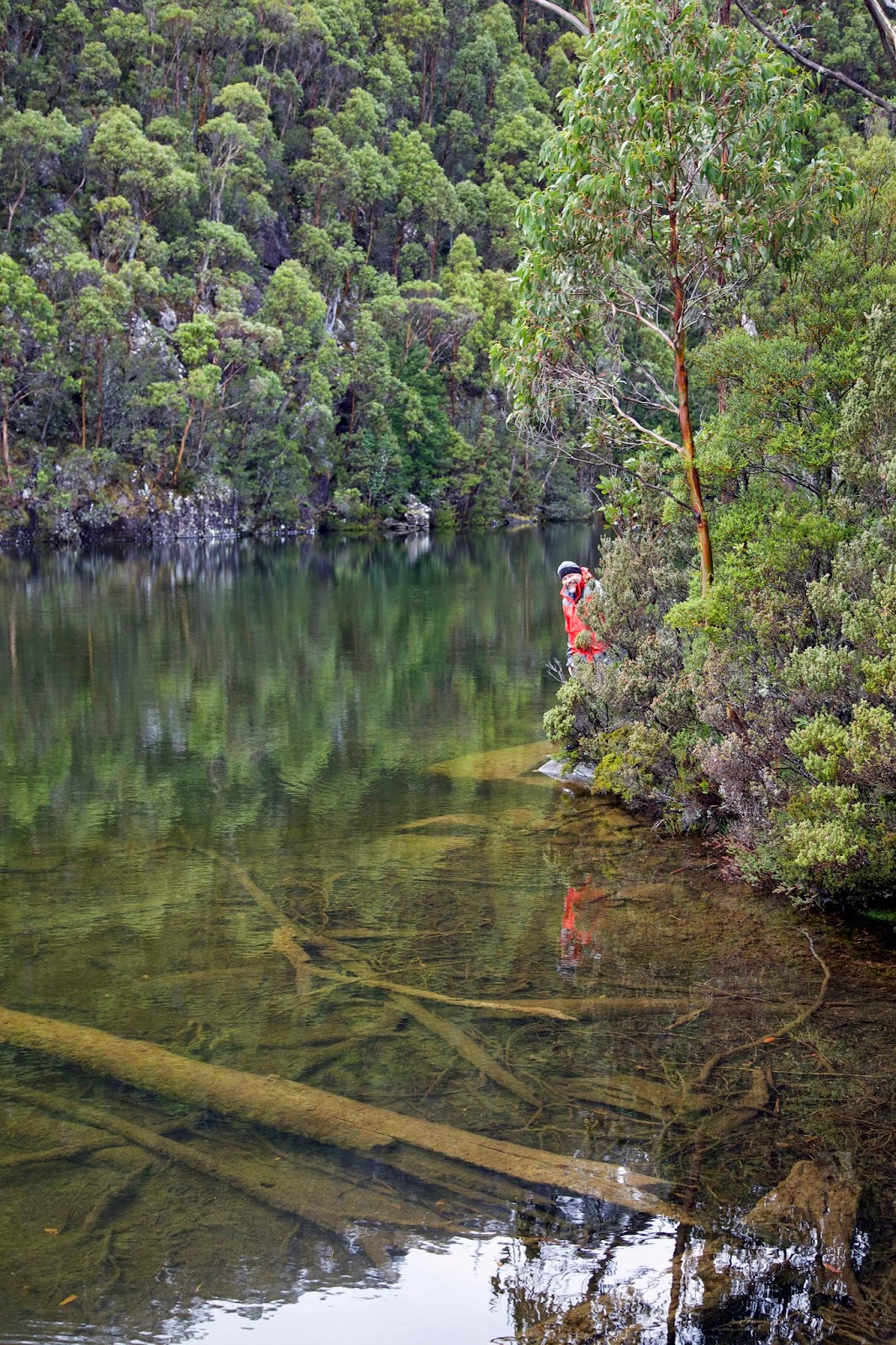 |
[Tim checks out an unnamed lake] |
The lagoon is
over 2km long, and fills the bottom half of a deep, glacier-gouged valley. That
valley peters out a few kilometres before Junction Lake, leaving us guessing
which way the water flows. It’s hypothetical anyway, since water is flowing every
which way after the persistent overnight rain.
Persistent too are
the leeches, which start latching on as soon as we stop anywhere. The worst
spots are the valley bottoms, especially amongst the soggy coral ferns and buttongrass.
It’s good motivation to keep moving, as is the rain, which is returning in fits
and starts.
 |
[A soggy walk through coral fern] |
The route
occasionally meanders up slope, through dripping wet forest. Towards the end of
Cloister Lagoon we descend through a thicket of fagus. A few leaves hint at
autumn colour, ‘though most are still their vivid summer green.
As we finally leave
the lagoon we climb a little; proof that the water runs north out of Cloister
and down to Chapter Lake. We struggle to get our head around the idea that
we’ve been walking up the valley. A
quick check of our maps confirms it, before rain sends us on our way again.
 |
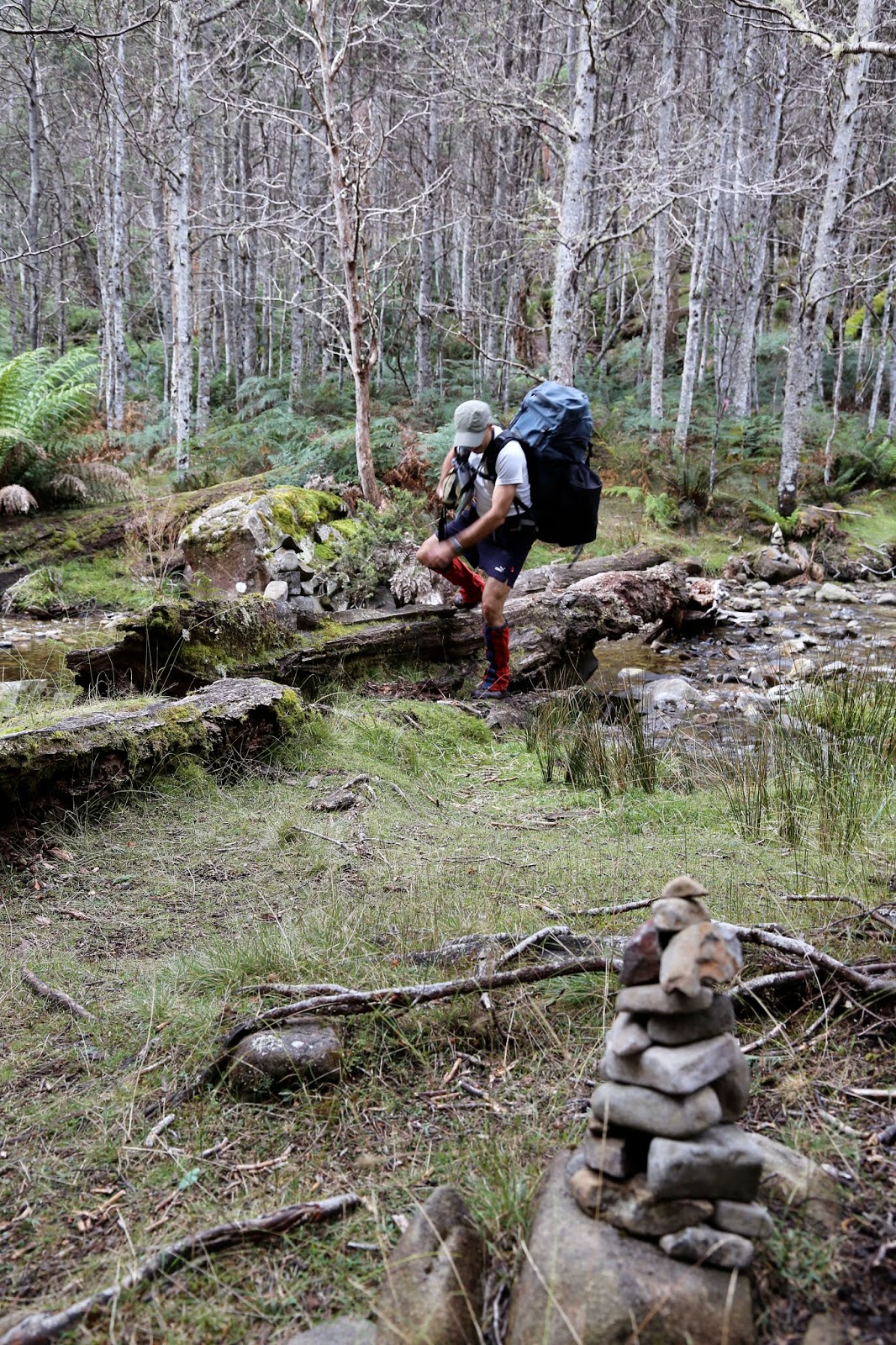
[Definitely going down valley] |
And now we are
definitely heading down valley, following an ill-defined path beside a flowing
creek: a creek that is part of the headwaters of the Mersey River. We may be
coming closer towards Junction Lake, but we’re having to slow down as we search
about for a clear way through the scrub-choked creek.
Eventually the
valley widens out onto Mayfield Flats, a large, intermittently marshy area.
Buttongrass flats are interspersed with forested patches. Ahead we can see an
upland area, which we take to be the Mountains of Jupiter. According to the map
they stand above our destination.
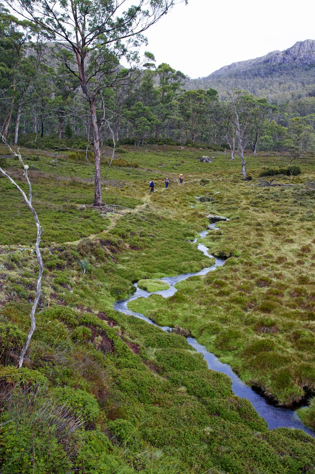 |
[near Mayfield Flats, with views of some mountains] |
Junction Lake is a
fair sized body of water, perhaps 500m across at its widest point. And the hut
we’re heading for is called Junction Lake Hut, which you would think would be
close by that body of water.
It’s perhaps my
fourth visit to the hut, but on every previous visit, there’s always been a
frustrating period of wandering about before the hut reveals itself. And so it
is this time too! It’s not actually on the lake, but is tucked into a bushy
bank above the upper reaches of a “young” Mersey River.
 |
[Junction Lake at sunset] |
The four-bunk
pencil pine hut was built by Tasmanian pastoralist/bushwalker H. R. (Dick) Reed
in 1969/70. He was a hardy bushwalker, frequently taking long distance walks
across the Tasmanian highlands. His view was that “if you don’t come alive at
1500 feet then you’ll never come alive”. His hut building was an expression of
that attitude, and he built several others, including the Lake Meston hut which
we’d reach tomorrow. Astonishingly he was in his 70s when he did this work.
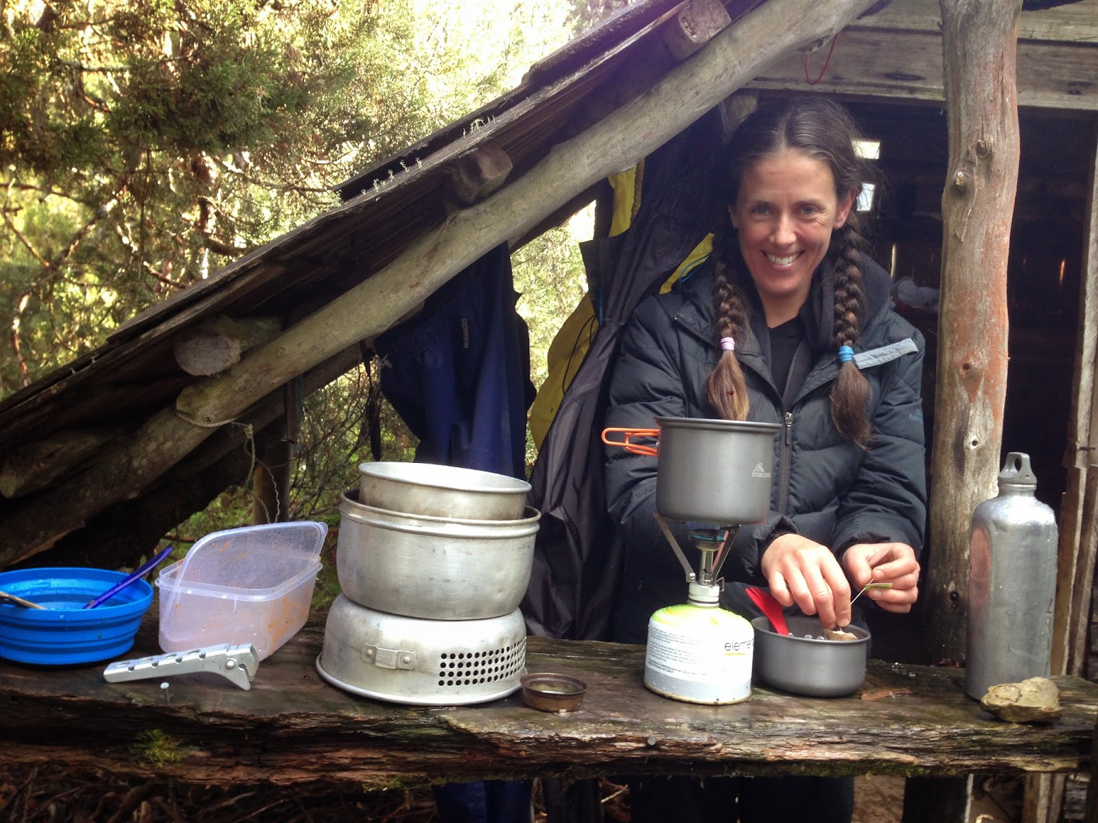 |
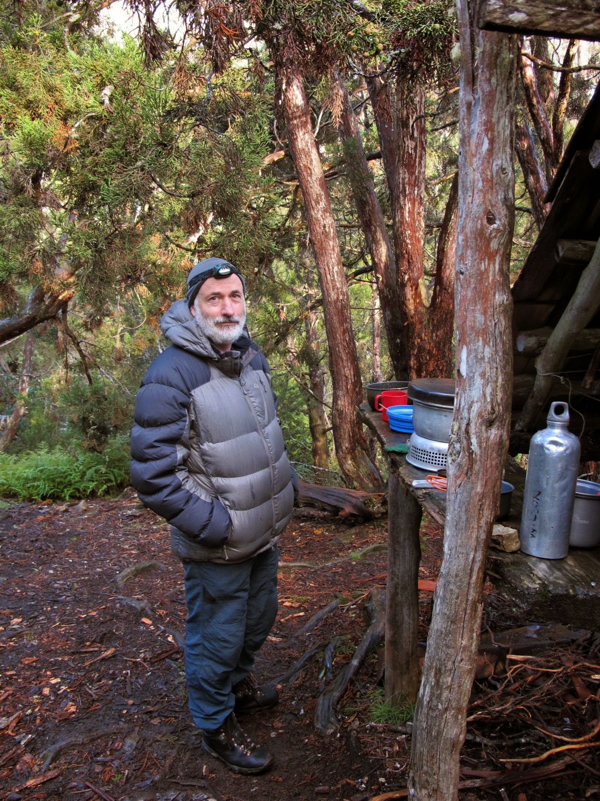
[Cooking al fresco at Junction Lake Hut. Photo by Jim Wilson] |
The hut is small
and humble. The wooden door creaks as we open it, revealing one simple room with
wooden floor boards, and two small glass windows. Two bunks face the door, and
there are two more on the wall to our left. Next to the door is a raised
fireplace with a rustic mantelpiece. There are some crude shelves beneath one window, and a
couple of basic chairs.
It may be humble,
but it’s a very welcome shelter from the rain. Four of us have chosen to try
the bunks out for the night, while Tim is content to pitch his tent and tarp
nearby. Once we’re settled in we boil some brews, which soon lead on to dinner.
It’s not even 5pm, but we’re cold, wet and hungry, and we go with the flow.
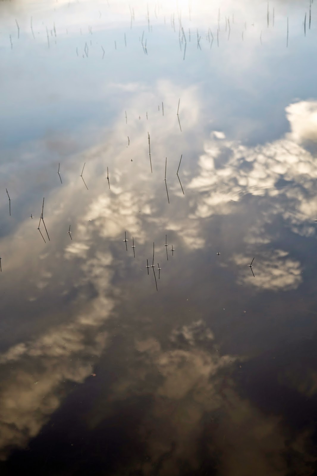 |
[Reflections in the shallows: Junction Lake] |
After dinner there’s
still a lot of daylight left, and we’re enticed out to the lake by an
improvement in the weather. A few of us wander down for a closer look at
Junction Lake, catching some wonderful reflections and a hint of colour as the
sun sets. We’re above Dick Reed’s 1500 feet. And yes, we’re feeling very much
alive.
 |
[Junction Lake - click pic for full panorama] |
Saturday, 4 April 2015
Four Lakes and a Mountain: Part 1
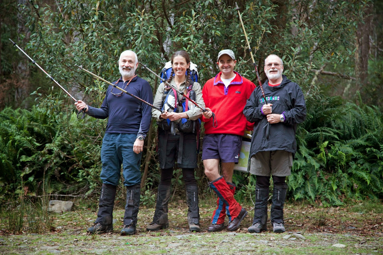 |
[Ready at the start of the track] |
Five days, four
lakes, one mountain: it’s a neat equation. It’s also an equation that might
hint at a certain proportion of wet to dry; of sloppy to solid.
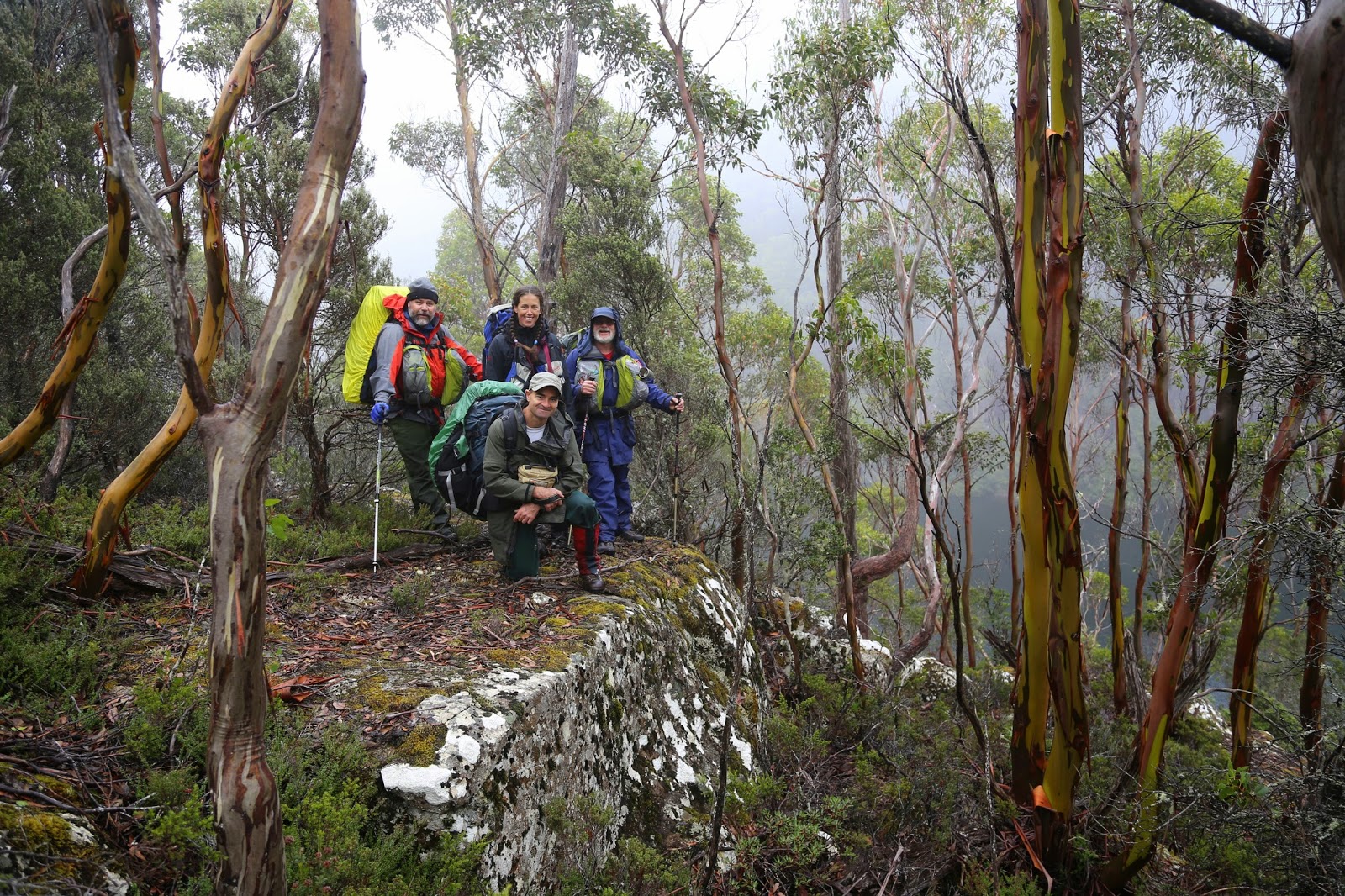
On day 1 that
discovery is still ahead of us. For now the overcast, dry, cool weather looks
perfect for walking. For me, after a summer largely spent recovering from
injury, the prospect of being out walking again is bliss.
Four of us have left
Hobart at a civilized hour, travelled up the Midland Highway, then on through
Mole Creek, making for the end of the Mersey Forest Rd. Ahead of is “a bit of a
climb” for a few hours. We’ll be taking the Moses Creek track to our first
lake, Chapter Lake.
There we expect to
find Tim D, who has promised to walk ahead to claim the campsite and “repel all
other comers” in piratical fashion. But it’s a Wednesday during school and uni
term, and Chapter Lake is not the most sought-after campsite in the state, so
we’re thinking Tim won’t have much swashbuckling to do.
Our group is mostly
old hands, the only newbie being a Victorian named Jonathan. He’s a friend of
Tim O, and comes as his surrogate. Tim O had long planned to be on this walk, but
sadly a severely frozen shoulder means he can’t even raise his arm let alone a
pack.
 |
["Long John" gets into his stride] |
We quickly dub
Jonathan “Long John”, not because he’s especially tall, but because it fits in
with the pirate nonsense we carry on with on these walks. Jonathan has done
some walking in Tasmania before, but never in this area.
Our walk starts on
an old logging track, wide and easy, though choked in a few places by regrowth
and tree falls. It’s almost an hour before we are clear of the regrown forest
and climbing steeply into the Walls of Jerusalem National Park. I keep finding
bits of track that remind me of the more popular routes in that park. At one
point I even say “this is just like the Walls” before realising it technically IS the Walls, albeit a
less-walked part of that park.
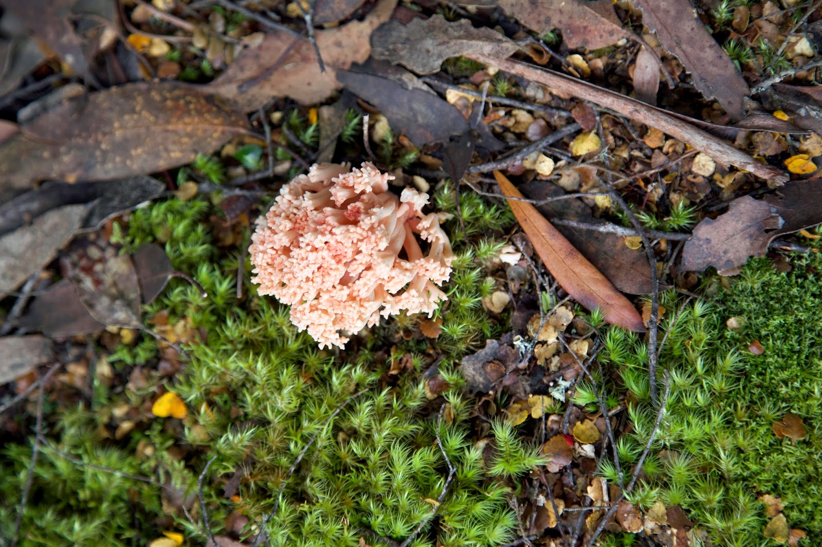 |
[Pink coral fungi (Ramaria sp) along the track] |
The steepness tests
my recovering ankle and knee, and I am soon travelling slowly. I resort to
distractions. Apart from the usual scroggin and water stops, there’s always
botanising. And here “Long John” helps, being full of questions, as he’s
unfamiliar with the area’s natural history. Flora aside, it’s almost peak fungi
season too, and when you add some geomorphological oddities (glacial erratics
and a disappearing tarn), our progress slows admirably.
 |
[Fruit of the mountain blue berry (Billardiera longiflora)] |
Jim has been the
main planner of this trip, and he’s happy to be reminded it’s supposed to be a
“hands-in-pockets” walk. That’s partly in compensation for the epic Mt Anne
trip that saw my early-January injury, and partly because Jim prefers this kind
of walk. Keep the walk times short, throw in a hut or two, and Jim’s a happy
man.
Suitably distracted
by our surrounds, we top out surprisingly quickly. I’m always amazed that no
matter how many times I walk a track – and this is at least my third time on
this one – I can never accurately predict when such points will come. But I
welcome it, and start the descent to Chapter Lake. The growing sound of Grail
Falls, which flanks the campsite, tells us we’re close.
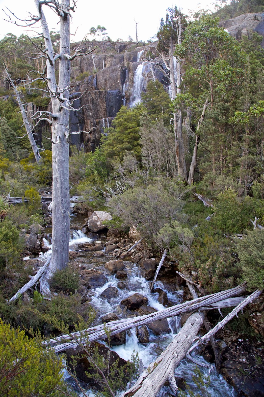 |
[A glimpse of Grail Falls near Chapter Lake camp] |
We are soon
greeting Tim D in the forested campsite near the lake. He has set up camp, and
repelled boarders, as promised. We set up our tents then gather at Tim’s
kitchen set-up. It has good log seats with a sheltering tarp above. There is rain
forecast, and a couple of us recall the word snow getting a mention, so we’re
glad of a tarp to gather beneath.
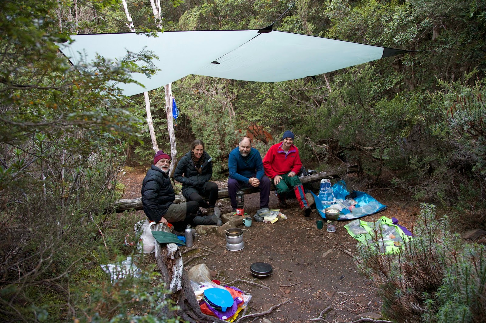 |
[Together under the tarp at Chapter Lake] |
After dinner we
retire to our tents and slip into sleep to the accompanying roar of the
waterfall. That may make it hard to know when or if the rain has come – which may
be no bad thing. Let tomorrow take care of itself.
Subscribe to:
Comments (Atom)